ChiricahuaLogistics
Chiricahua logistics
Compiled by National Park News from National Park Service data
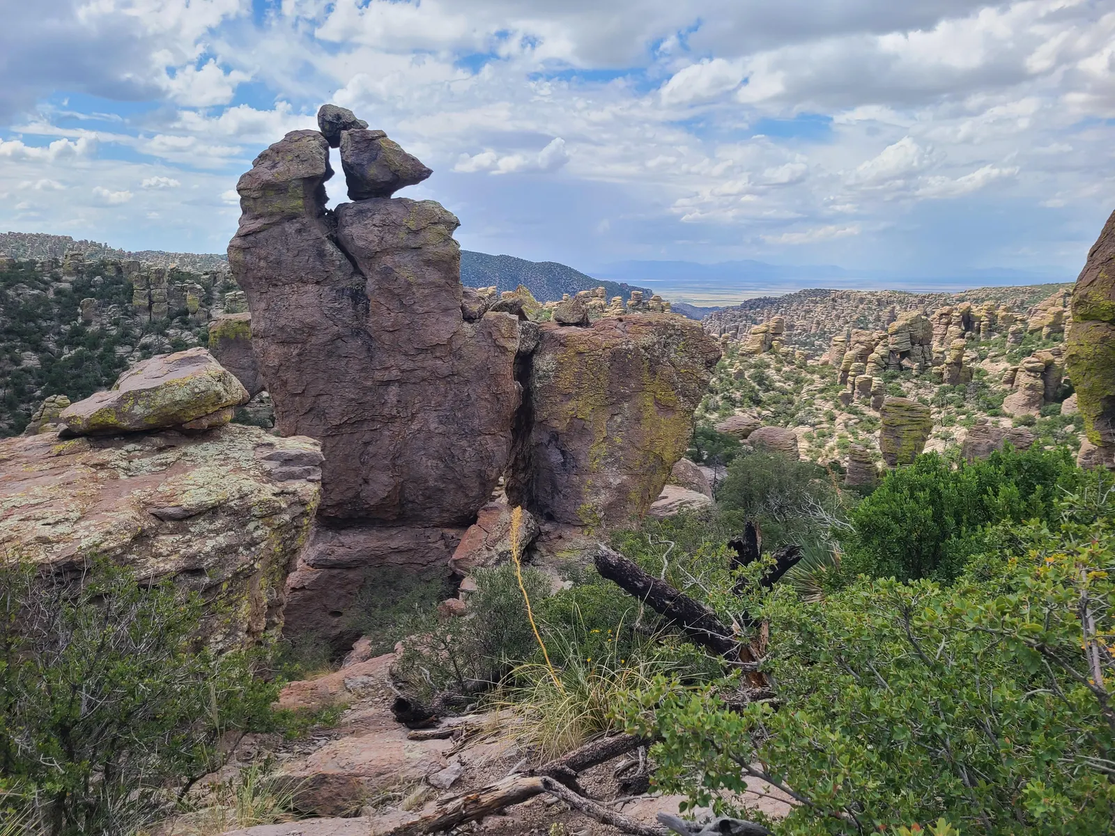
Chiricahua · Photo: NPS Photo
Live conditions and planning tools
Is Chiricahua open right now?
Open, 1 alert Last updated Nov 20, 2026 (from NPS alerts)
Data from the National Park Serviceupdated daily
These alerts may be out of date. Source retrieval: Nov 20, 2026, 6:03 AM ET; no verified retrieval within the last day and a half. Check nps.gov current conditions before you go.
- InformationVehicle Length & Trailer Restrictions No large vehicle turnaround after Faraway Ranch Parking (1 mile after entrance). Vehicles over 29 feet park at Faraway. Disconnect trailers at Faraway. Trailers with campground reservations proceed to camp. Scenic dri… details
No active NPS alerts right now.
This is our reading of the official NPS alerts, not an official status. When this page loads it fetches the latest NPS alerts; if that fails, you see the last saved ones, with the time above. Confirm on nps.gov current conditions before you drive.
Right now
Go. This is from the last saved check, so confirm current conditions before you go.
Updated Nov 19, 5:56 AM ET (NPS alerts, National Weather Service, AirNow and NIFC).
Weather alerts: None returned for the park coordinate. National Weather Service, Nov 19, 5:56 AM ET.
Wildfires within 80 km: 0. NIFC, Nov 19, 5:56 AM ET. A nearby fire doesn’t by itself mean anything in the park is closed.
Air quality: 28 AQI. AirNow, Nov 19, 5:00 AM ET. Preliminary data, subject to change.
Not covered by this check: Road status (unlisted roads unknown); current crowds. Check NPS conditions.
Crowd timing & sources
Current crowd levels: unknown; excluded from the verdict. Historical guidance does not predict today’s queues.
- NPS says parking “can fill up quickly” in February–April and on holiday weekends. Use Massai Point or Sugarloaf parking when full. NPS timing source
- NPS directs overflow parking to the right side of gravel Rhyolite Creek Road, leaving room to pass. A dip and limited turnaround may prevent oversized vehicles or trailers from using it. NPS timing source
- NPS says parking “can be challenging on weekends and holidays from October through April.” NPS timing source
Research update time unknown. Confirm current operations with NPS.
NPS webcams
Updated from the NPS webcam list. A listed camera may not be showing a current image.
Road status
Updated · saved NPS alerts
- Vehicle Length & Trailer Restrictions
No large vehicle turnaround after Faraway Ranch Parking (1 mile after entrance). Vehicles over 29 feet park at Faraway. Disconnect trailers at Faraway. Trailers with campground reservations proceed to camp. Scenic drive = 24 ft limit and no trailers.
Official NPS conditions and road links. Disruption feeds are incomplete inventories; confirm access before travel.
Is Chiricahua open today?
Open NPS alerts list no closures. Park hours: The road, campground and facilities stay open overnight, and trails are open for sunrise, sunset and night-sky viewing. Last updated Nov 20, 2026 (from NPS alerts).
What’s closed, road status and today’s hours →
- Today
- Tonight
- Air quality
- Wildfires within 50 mi
- NPS alerts
Seasonal nature: flowers, fall colors & wildlife
Nature follows weather and elevation. These NPS notes are for planning, including any peak times the NPS gives. Recent sightings below don’t mean flowers or fall color are at their peak.
Seasonal calendar
NPS notes checked Nov 3, 2026. We don’t guess peak times from sightings.
Wildflowers
The NPS doesn’t publish a reliable season for this. Check the linked park sources before planning around a peak.
Fall colors
The NPS doesn’t publish a reliable season for this. Check the linked park sources before planning around a peak.
Wildlife activity
The Turkey Vulture ( Cathartes aura ) is fairly common in Chiricahua during the summer.
NPS timing source
What’s happening now
Research-grade iNaturalist observations from the last 30 days within the park’s mapped iNaturalist place. A small sample of recent distinct taxa, not a census or a promise of a sighting. Observer coverage and identification delays affect this list. No photos or locations are displayed; sensitive and obscured records are excluded.
Open this section to check the live sources.
iNaturalist · CC BY 4.0 / CC0 terms · USA National Phenology Network Spring Indices (dataset citation) · Official park website
Park at a glance
- Area
- 12,025 acres
- Elevation
- 5,124 ft (Park entrance) – 7,310 ft (Sugarloaf Mountain)
- Established
- Oct 20, 2026 as national park
- Earlier designation
- National monument, 1924. The approved law gives October 20, 2026 for redesignation; the NPS FAQ gives a conflicting September 30 date.
- Annual visits
- 70,406 (2025)
- Passport stamps
- Visitor Center
Know the place
- Landscape
- Erosion carved rhyolite tuff into pinnacles after a volcanic eruption about 27 million years ago. This sky island supports a mix of desert, grassland, scrubland, and forest.
- History
- Faraway Ranch began as the Erickson family homestead and later became a guest ranch under Lillian and Ed Riggs. The Civilian Conservation Corps named many rock formations in the 1930s.
- People
- This is Chiricahua Apache homeland. NPS maintains relationships with connected tribal nations, including the Fort Sill Apache Tribe and Mescalero Apache Tribe.
Pack for Chiricahua
- Water capacity and electrolytes (recommended)
- NPS advises one liter per hour; high elevation and dry winter air increase water needs. Last verified · nps.gov
- Warm layers (recommended)
- Upper elevations can be 5–10°F cooler and windier than the entrance; winter lows often reach freezing. Last verified · developer.nps.gov
- Traction devices in icy weather (recommended)
- NPS says microspikes may help in some winters; snow and ice can affect roads and trails December–March. Last verified · nps.gov
- Paper map and downloaded driving directions (recommended)
- Cell service is limited; NPS says to carry a paper map and download directions before arrival. Last verified · nps.gov
- Spare car key and checked spare tire (recommended)
- NPS warns roadside assistance may take a full day or more on this remote approach. Last verified · nps.gov
Filling a gap in your kit? Compare these packing essentials on Amazon. Choose gear for your route, conditions and the park’s guidance.
As an Amazon Associate we earn from qualifying purchases. How this works
Crowds
Busiest: Mar, Apr, Feb. Quietest: Aug, Jul, Jun. Average monthly NPS recreation visits, 2021–2025. Last verified · irma.nps.gov
- Echo Canyon
- NPS says parking “can fill up quickly” in February–April and on holiday weekends. Use Massai Point or Sugarloaf parking when full. Last verified · nps.gov
- Visitor center overflow
- NPS directs overflow parking to the right side of gravel Rhyolite Creek Road, leaving room to pass. A dip and limited turnaround may prevent oversized vehicles or trailers from using it. Last verified · nps.gov
- Park-wide
- NPS says parking “can be challenging on weekends and holidays from October through April.” Last verified · nps.gov
Where to stay: bases compared
Bonita Canyon Campground
In the park ·
Bands use advertised rates: $ under $150; $$ $150–249; $$$ $250–399; $$$$ $400+. NPS lists this campground as the only place to stay inside the park; there is no in-park lodge. The options below are site categories within the same campground. A campground-to-Massai Point driving distance or time is not published in the reviewed sources.
- Bonita Canyon Campground — standard campsite
- Campsite without hookups · $ · $25 per night · Rate season and advance reservation release window are not published in the reviewed listing. Reservations are required through Recreation.gov. Last verified · developer.nps.gov
- Bonita Canyon Campground — group site 26
- Group tent campsite · $ · $50 per night · For 9–24 people; unsuitable for a two-person booking. Rate season and advance reservation release window are not published in the reviewed listing. Last verified · developer.nps.gov
Willcox, Arizona
Outside the park · NPS lists Willcox lodging about 45 minutes from the park; the entrance-to-Massai Point drive adds eight miles, about 30 minutes without stops.
- Arizona Sunset Inn & Suites
- Inn and suites · Verified public nightly rate and booking window not published; price band not assigned. Last verified · arizonasunsetinn.com
- Holiday Inn Express & Suites Willcox
- Hotel · $ · $117.80–$136.80 per night; IHG Willcox overview range · The overview lists one Willcox hotel. Applicable stay dates and advance booking window are not published; the range is not a dated room quote. Last verified · ihg.com
Sunizona / Sunsites (Pearce), Arizona
Outside the park · NPS groups Sunizona and Sunsites with nearby communities 30–60 minutes from the park; individual property drive times are not published. The entrance-to-Massai Point drive adds eight miles, about 30 minutes without stops.
- DreamCatcher Inn at Chiricahua
- Bed and breakfast · $$ · Hummingbird Room: $169 per night; two-night minimum; breakfast included · Applicable season and advance booking window are not published. Room accommodates up to two guests. Last verified · dreamcatcherbnb.com
- The Inn at Sunsites
- Hotel · Verified public nightly rate and booking window not published; price band not assigned. Last verified · innatsunsites.com
Prices change.
What a trip costs
Assumptions: party: 2 · nights: 2 · season: Rates posted when checked November 1, 2026; neither the campground API nor the Hummingbird Room page publishes an applicable rate season. Low uses one standard campsite; high uses one Hummingbird Room instead. Zero entries in the alternative lodging lines indicate that option is omitted from that scenario. No pass discount. · from: Willcox
$50–$338
- Park entrance and parking: no fee
- $0 Last verified · nps.gov
- Lodging, 2 nights: one Bonita Canyon standard campsite at $25/night (low) to one DreamCatcher Inn Hummingbird Room at $169/night (high)
- $50–$338 Last verified · developer.nps.govLast verified · dreamcatcherbnb.com
- Timed entry or ordinary sightseeing permits: none required; camping reservation covered by the campsite alternative
- $0 Last verified · nps.gov
- Required paid park transport: none; access is by private vehicle
- $0 Last verified · nps.gov
Excludes: Travel to Willcox, vehicle rental, fuel, food beyond the inn breakfast, camping gear, optional activities, and taxes or fees not stated as included. A separate campground booking surcharge is not published in the reviewed campground listing and is not included. These are alternative camping and room subtotals, not complete trip costs.
Checked Nov 1, 2026. Prices change.
Getting there, hours & seasons
Getting there, hours & seasons
Official data, not firsthand- From I-10 (north, west or east)
- Leave I-10 in Willcox (exit 336, 340 or 344) and follow the brown signs to Hwy 186 south. Last verified · nps.gov
- From the south
- Hwy 191 meets Hwy 181 at Sunizona (Pearce). Last verified · nps.gov
- Park
- The road, campground and facilities stay open overnight, and trails are open for sunrise, sunset and night-sky viewing. Overnight parking, sleeping in vehicles and camping outside the campground are prohibited. Last verified · nps.gov
- Visitor center
- Open daily, 8:30 am-4:30 pm Mountain Standard Time (most of Arizona doesn’t observe daylight saving time). Last verified · nps.gov
All 6 ways in, airports, drive times from major cities, gas and EV charging →
When to go, month by month
- January: 3 of 5, Fine
- February: 3 of 5, Fine
- March: 4 of 5, Great
- April: 5 of 5, Best
- May: 4 of 5, Great
- June: 2 of 5, Not ideal
- July: 3 of 5, Fine
- August: 3 of 5, Fine
- September: 4 of 5, Great
- October: 5 of 5, Best
- November: 4 of 5, Great
- December: 3 of 5, Fine
Best time to visit Chiricahua: monthly crowds, weather and seasonal access
- Spring
- March is the park’s busiest month. Spring is the driest time of year, and fire restrictions often apply from April to June. Average highs at the visitor center are 65°F in March and 73°F in April. Last verified · nps.gov
- Summer
- Summer has the fewest visitors. Average June highs are about 91°F at the 5,400-ft visitor center, and the top of the park (7,310 ft) runs 5 to 10 degrees cooler. Last verified · nps.gov
- Summer
- Monsoon season runs June 15 to September 30 and brings severe thunderstorms, flash flooding, and lightning. July and August each average about 4 inches of rain. Hwy 186 can briefly flood, and washes on Hwy 181 may flood for days or months. Last verified · nps.gov
- Fall
- Average highs are 83°F in September and 75°F in October. Traffic peaks during October school breaks, and parking is difficult on weekends and holidays from October through April. Last verified · nps.gov
- Winter
- Snow, ice, or rain is possible from November through April, and trails are likely icy or snow-packed from January through March. Average January highs are 56°F and lows are 30°F. Last verified · nps.gov
- Overall
- The park has no restaurants or vending machines, and the nearest gas is 27 miles away in Sunizona or 37 miles away in Willcox. Bonita Canyon Campground often fills, especially during spring break (March–April) and on holidays. Last verified · nps.gov
Lodging, food & services
Lodging, food, gas & services
Official data, not firsthand- Nearest hotels
- Bonita Canyon Campground is in the park. The closest hotels and motels are in Willcox, AZ, about 45 minutes away, which also has restaurants, a full grocery store and gas. Last verified · nps.gov
- Camping outside the park
- Coronado National Forest offers dispersed camping on Pinery Canyon Road, 6 miles along a gravel road. Cave Creek / Portal campgrounds are about a 90-minute drive across the mountains. Contact the Douglas Ranger District at 520-364-3468 for conditions. Private campgrounds in Willcox, Sunizona and Bowie offer alternatives for larger rigs. Last verified · nps.gov
- Food
- Bring your own food and drinks. The visitor center bookstore sells a few snacks, but there are no restaurants or vending machines. Last verified · nps.gov
- Gas and supplies
- Gas, EV charging, groceries and ice are 30-40 miles away; Willcox and Sunizona are the last towns with gas and basic supplies. Last verified · nps.gov
- Cell service
- Reception is limited near the park; download maps and directions before you go. Last verified · nps.gov
Rig fit: RVs and trailers
Rig fit: RVs and travel trailers
Official data, not firsthand- Bonita Canyon scenic drive beyond the campground
- Standard-size vehicles only, with a 24-ft maximum and no trailers. The campground is the last stop for vehicles over 24 ft. The road is narrow and steep, with low-hanging trees. Last verified · nps.gov
- Beyond Faraway Ranch
- No vehicles over 29 ft and no day-use trailers. Day users must disconnect trailers at Faraway Ranch, and there is no turnaround for trailers or large RVs past that point. Last verified · nps.gov
- Bonita Canyon Campground length limit
- All vehicles and trailers must be under 29 ft including racks. Campers with reservations may drive vehicles up to 29 ft to their site starting at noon on the reservation day. Last verified · nps.gov
- Campground entry creek crossing
- A dip in the entry road limits larger vehicles. Rigs over 29 ft, or with more than about 9 ft of rear overhang, may bottom out. Last verified · recreation.gov
- Natural Bridge Trailhead parking
- Three small parking spaces. Last verified · nps.gov
- Group campsite 26
- Tent-only, with no trailers or RVs and a maximum of 5 small vehicles. Last verified · recreation.gov
Check your rig against every Chiricahua road and campground limit
Where to stay & what to do in town
Willcox, AZ
37 miles northwest (about 45 minutes)
The closest town with hotels and motels, a full grocery store, several gas stations, and restaurants, plus several campgrounds.
Sunizona / Sunsites (Pearce), AZ
27 miles southwest (30–60 minutes)
Gas station, small independent restaurants, inns, and an RV park.
Portal, AZ
More than 1 hour; Cave Creek-area campgrounds are about 90 minutes across the range
Small community on the east side of the Chiricahua Mountains, with Coronado National Forest campgrounds nearby in Cave Creek Canyon.
Popular guided tours nearby
- Birding tours in southeast Arizona’s sky islands (Cave Creek Canyon / Portal)
- Historic town tours in Tombstone and Bisbee
- Ranger-led programs and tours of the Faraway Ranch Historic District
- Visits to Fort Bowie National Historic Site (Apache Pass), managed with Chiricahua
- Southeast Arizona wine-trail tours around Willcox
Places to stay near Willcox, AZ
Map by Stay22.
Affiliate link: we may earn a commission, at no extra cost to you. How this works
Where to stay in Chiricahua: in-park lodges vs gateway towns
Affiliate link: we may earn a commission, at no extra cost to you. How this works
Safety, wildlife & crowds
Safety, wildlife & crowds
Official data, not firsthand- Elevation and water
- The park runs from 5,400 to 7,300 ft. Carry about 1 liter of water per hour of hiking, plus electrolytes. Last verified · nps.gov
- Weather
- Snow and ice are possible December through March and can close roads. Summer highs often reach 80-90°F from May to September, and July-September monsoon storms bring lightning and flooded road crossings. Last verified · nps.gov
- Wildlife
- Don’t feed or approach animals (rabies is a risk). Watch your step for rattlesnakes. If you see a bear or mountain lion, don’t run; make yourself big and yell. Last verified · nps.gov
- Vehicles
- There are no gas stations between I-10 and the park, and roadside assistance can take a day or more. Bring a spare key and check your spare tire. Last verified · nps.gov
- Busy season
- March is the busiest month, and school breaks in October, December and March are busy too. Parking is hard on weekends and holidays from October through April; Echo Canyon’s 19-space lot fills fast in February-April. Summer has the fewest visitors. Last verified · nps.gov
Nearby parks & trip planning
Nearby parks & trip planning
- Saguaro camping & park guide about 84 miles away in a straight line
- White Sands camping & park guide about 183 miles away in a straight line
- Petrified Forest camping & park guide about 207 miles away in a straight line
- Guadalupe Mountains camping & park guide about 261 miles away in a straight line
- Carlsbad Caverns camping & park guide about 280 miles away in a straight line
- Grand Canyon camping & park guide about 318 miles away in a straight line
- National parks near Tucson Chiricahua is about 2 hr away by car
- National parks near Phoenix Chiricahua is about 3 hr away by car
- National parks near El Paso Chiricahua is about 4 hr away by car
- Saguaro vs Chiricahua which to visit, or how to see both
- White Sands vs Chiricahua which to visit, or how to see both
- Other parks at their best in April Chiricahua scores highest in April and October
- Today’s Chiricahua alerts and closures
- Plan my trip: free itinerary builder
- Browse park itinerary bundles
- The best national parks to visit, month by month
- All 64 national parks: guides and snapshots