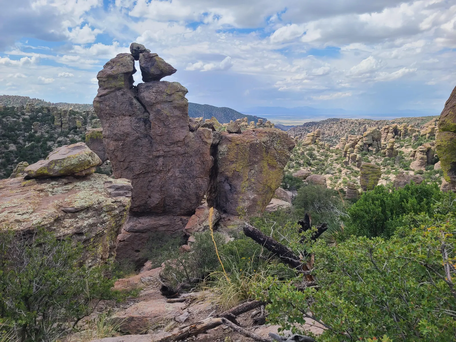
Echo Canyon Loop
The named loop combines Echo Canyon, Hailstone and Ed Riggs trails. NPS recommends a counterclockwise direction: descend through the formations, cross the more level Hailstone section and climb back on Ed Riggs.
Chiricahua · Photo: NPS Photo
- 3.3 miDistance
- 560 ftElevation gain
- 2–4 hrTime
- ModerateDifficulty
The numbers, with sources
Distance: NPS conflicts: 3.3 miles in summary; 3.4 miles in narrative. Source
Gain: NPS states total elevation 560 feet; separately describes 400-foot descent and climb. Source
Time: 2–4 hours (NPS activity). Source
Difficulty: Moderate; rocky uneven terrain and steep drop-offs. Source
Trailhead: The trailhead has a parking area and pit toilets. No water is available. Parking area can fill up on weekends during the winter. Consider alternative hikes in the busy month of March and on holiday weeks/weekends. Source
Route type: Loop Source
Built from official sources (checked Nov 3, 2026). Confirm current conditions with the park.
Recreation.gov permits, entrances & campgrounds
Recreation.gov (RIDB). Booking records date not published. NPS guidance above takes precedence. A listing doesn’t mean you need a permit or that there’s space on your dates.
Park campground options (1)
These records belong to the park’s NPS recreation area. We haven’t checked how close these are to the trail, when they open or whether sites are free; check the map and the booking page.
Bonita Canyon Campground — Campground; RIDB reservable: yes. Season: not published in structured RIDB data. Recreation.gov (RIDB) source · Booking details
NPS reservation guidance: All campsites are on the reservation system, recreation.gov. We recommend making reservations a few weeks in advance and as much as three months in advance during holidays and from January to April. Larger campsites often fill up early so tent campers may find last minute availability more frequently. The park does not offer any walk-in or first come first serve camping. If you arrive without a reservation you may be able to make a reservation using wi-fi at the visitor center. Dispersed camping without a reservation is available on Pinery Canyon Road (Forest Road 42) 6 miles outside the park. NPS source
Route, junction by junction
Route selection → Described destination
The named loop combines Echo Canyon, Hailstone and Ed Riggs trails. NPS recommends a counterclockwise direction: descend through the formations, cross the more level Hailstone section and climb back on Ed Riggs. Source
No elevation profile yet:
No elevation profile yet: we haven’t verified a complete line for this route. No partial line, invented connector, scaled mileage or flat profile is substituted. Source
In-depth guide
Compiled from linked sources, checked Nov 3, 2026. Each paragraph links to its source.
Is this hike for you?
This is a triangular loop through some of the best rocks in the park, made of the Echo Canyon, Hailstone and Ed Riggs trails. The NPS calls it moderate and gives two lengths: 3.3 miles in its summary and 3.4 miles in its description. It lists a total elevation of 560 feet. You can do it in 2 hours, but most people give it 3 or 4 hours (the NPS lists 2–4 hours). Source
Expect steep drop-offs and loose, rocky, uneven ground the whole way, with grades of 1-25% and cross-slopes up to 50%. Watch for rocks, boulders, roots and runoff channels underfoot. Some spots may be unpleasant if you’re afraid of heights. Source
The trail
The NPS recommends going counterclockwise (go right) for the views and the elevation. Echo Canyon Trail descends 400 feet through rock formations; the Civilian Conservation Corps built it, and it’s a feat of engineering. Hailstone Trail is almost level, with wide views of the Wonderland of Rocks; look for unusual stones that look like hail, and yucca, agave and cactus on its sunny south-facing slope. Ed Riggs Trail climbs 400 feet back to Echo Canyon parking, or a bit farther if you started from Massai Point. Source
Getting to the trailhead
The trailhead has a parking area and pit toilets but no water. The lot can fill on winter weekends. In busy March and on holiday weeks and weekends, consider another hike. Source
Kids, strollers, wheelchairs and pets
It’s not suitable for wheelchairs or strollers: the trail is steep and rocky, with over 500 feet of elevation change. Pets aren’t allowed on any of the upper trails through the rocks. Narrow paths and cliffs can scare animals and people, and sensitive plants and animals live in this wilderness area. Source
When to go
You can hike it year-round. Summer can bring high heat and dangerous sun, or monsoon rain and lightning. In winter the trail may be icy for days after snow. Source
Map and elevation profile
The NPS trail map includes Echo Canyon and the Massai-Echo Canyon Spur, and OpenStreetMap shows an “Echo Canyon Trail” and an “Upper Rhyolite Canyon Trail” nearby. We haven’t verified a complete line for the whole loop, so there’s no elevation profile yet. Source · Source 2 · Source 3 · Source 4
Sources & planning limits
Reviewed 2026-11-03. Check current conditions for your trip dates.
- The NPS gives the loop as 3.3 miles in one place and 3.4 miles in another, and lists 560 feet of total elevation alongside a 400-foot descent and climb. Source
- The NPS doesn’t give times for each leg, when parking fills, or services beyond what’s described above. Source
- No elevation profile yet: we haven’t verified a complete line for this route. Source
Getting there and back
The trailhead has a parking area and pit toilets. No water is available. Parking area can fill up on weekends during the winter. Consider alternative hikes in the busy month of March and on holiday weeks/weekends. Source
Return: Use the return described in the official route account. Don’t count on a shuttle, boat, flight or pickup unless you have confirmed it yourself. Source
Water
The NPS doesn’t publish a full list of water and restrooms along this route. Use only the facilities explicitly identified in the NPS account; confirm current operations. Source
Hazards
The short description says 3.3 miles and the narrative says 3.4 miles. Those figures remain a source conflict. We don’t turn the descent and climb descriptions into a measured total climb. The NPS location description says the trailhead has pit toilets but no water. Source
Season
This trail is spectacular year-round. Summer may bring high temperatures and dangerous sun exposure OR monsoon rain and lightning. Winter may be icy for days after snow events. Source
This trail is spectacular year-round. Summer may bring high temperatures and dangerous sun exposure OR monsoon rain and lightning. Winter may be icy for days after snow events. Source
Gear & rules
Respect current closures, signs and barriers. A mapped path is not proof that travel is permitted. Source
Filling a gap in your kit? Compare these packing essentials on Amazon. Choose gear for your route, conditions and the park’s guidance.
As an Amazon Associate we earn from qualifying purchases. How this works
Pets are not allowed on any of the upper trails through the rocks. Narrow paths and cliffs can scare animals and humans. Sensitive flora and fauna live in this wilderness area. Source
Questions
Which hike is this?
The named loop combines Echo Canyon, Hailstone and Ed Riggs trails. NPS recommends a counterclockwise direction: descend through the formations, cross the more level Hailstone section and climb back on Ed Riggs. NPS conflicts: 3.3 miles in summary; 3.4 miles in narrative. Source
Is a measured elevation profile available?
No elevation profile yet: we haven’t verified a complete line for this route. No partial line, invented connector, scaled mileage or flat profile is substituted. Source
Alternatives
Alternative-route distances and durations are unavailable unless separately described in the source. Side trails aren’t included. Source