Glacier
Going-to-the-Sun Road
Live report requires JavaScript. Check the official NPS road report.
Nearby snow station: Flattop Mtn. · 482:MT:SNTL · 6,280 ft. USDA NRCS AWDB metadata, checked 2026-11-03.
Seasonal roads
The high roads close for snow every winter. Here’s when each has typically opened, from the parks’ own records, and what the snow and road reports say today.
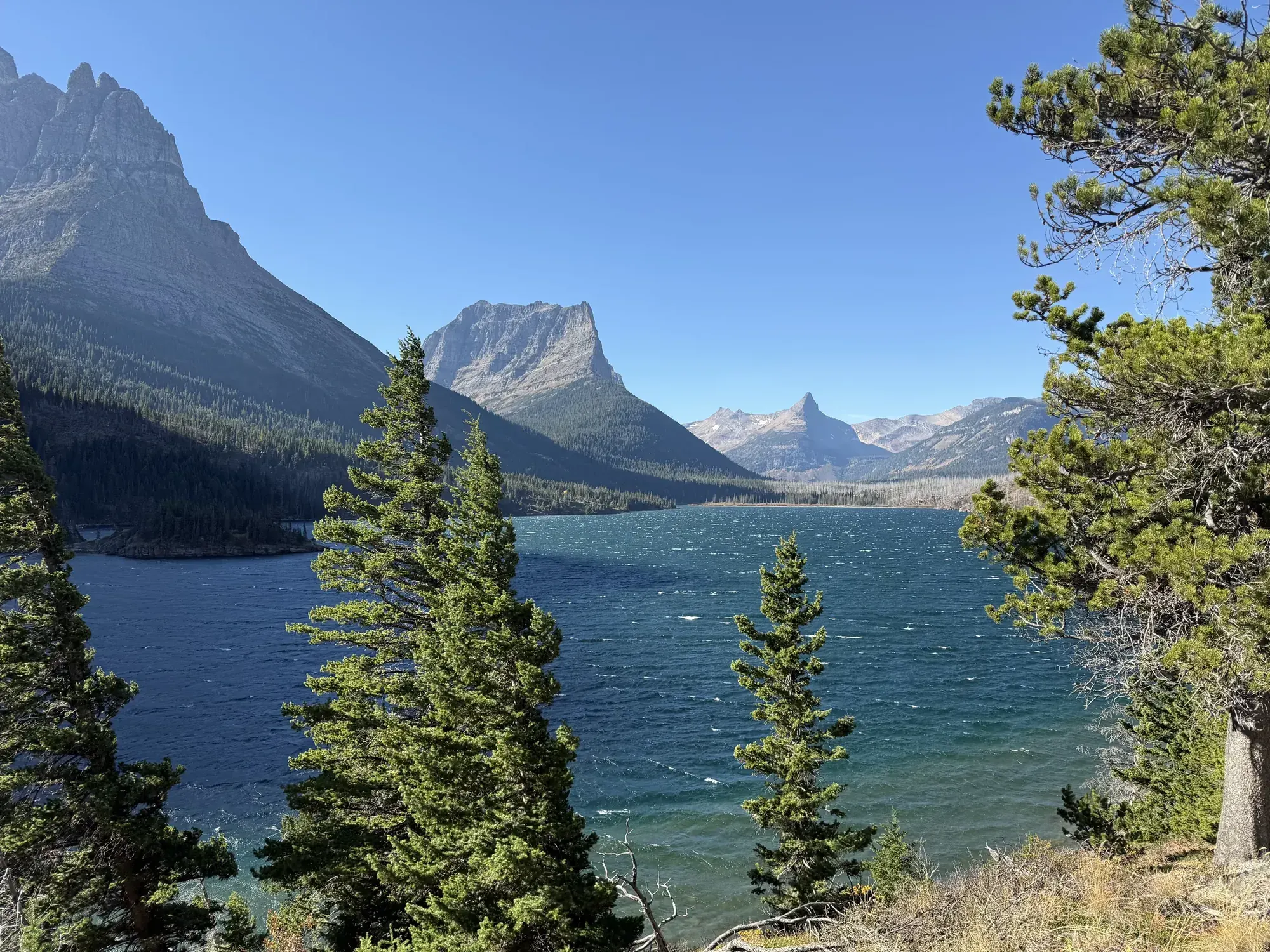
Glacier · Photo: David & Keri New
Past dates, not a forecast
The middle opening date of the years each park has published, with the earliest and latest. Snow, construction and storms move it every year.
Usually opensMay 14
Earliest Mar 28, 2015 · latest Jul 15, 2023
30 years of NPS records · full road (Chinquapin to Glacier Point)
Usually opensMay 15
Earliest May 15, 2026 · latest Jun 2, 2023
4 years of NPS records · spring access to the North Rim
Usually opensMay 22
Earliest May 22, 2026 · latest Jun 1, 2024
2 years of NPS records · US-212 from Red Lodge to Cooke City
Usually opensMay 22
Earliest Apr 8, 1977 · latest Jul 22, 2023
68 years of NPS records · full road (Crane Flat to Tioga Pass)
Usually opensJun 2
Earliest Apr 28, 1990 · latest Jul 26, 2017
47 years of NPS records · full park highway
Usually opensJun 9
Earliest May 14, 2015 · latest Jun 30, 2023
20 years of NPS records · North Entrance Road and West Rim Drive
Usually opensJun 11
Earliest May 16, 1987 · latest Jul 13, 2022
94 years of NPS records · over Logan Pass (full road, West Glacier to St. Mary)
Usually opensJul 9
Earliest Jun 11, 2015 · latest Jul 22, 2011
19 years of NPS records · East Rim Drive
NPS road disruptions and alerts refresh on request (up to one hour of shared caching). Snow readings are daily USDA NRCS observations fetched directly; a server fallback caches them for an hour. No listed disruption does not mean a road is open. Check the official road report before driving.
Nearby stations describe local snowpack, not snow on the pavement or the whole park. SWE is the water contained in snow. Percent of normal compares SWE with the same day’s AWDB 30-year median; a missing or zero median has no percentage. Snowpack does not predict an opening date.
Going-to-the-Sun Road
Live report requires JavaScript. Check the official NPS road report.
Nearby snow station: Flattop Mtn. · 482:MT:SNTL · 6,280 ft. USDA NRCS AWDB metadata, checked 2026-11-03.
Tioga Road and Glacier Point Road
Live report requires JavaScript. Check the official NPS road report.
Nearby snow station: Virginia Lakes Ridge · 846:CA:SNTL · 9,400 ft. USDA NRCS AWDB metadata, checked 2026-11-03.
Trail Ridge Road and Old Fall River Road
Live report requires JavaScript. Check the official NPS road report.
Nearby snow station: Bear Lake · 322:CO:SNTL · 9,490 ft. USDA NRCS AWDB metadata, checked 2026-11-03.
Rim Drive and North Entrance Road
Live report requires JavaScript. Check the official NPS road report.
Nearby snow station: Annie Springs · 1000:OR:SNTL · 6,020 ft. USDA NRCS AWDB metadata, checked 2026-11-03.
Lassen Volcanic National Park Highway
Live report requires JavaScript. Check the official NPS road report.
Nearby snow station: Lower Lassen Peak · LLP:CA:MSNT · 8,220 ft. USDA NRCS AWDB metadata, checked 2026-11-03.
Sunrise, Stevens Canyon and seasonal pass roads
Live report requires JavaScript. Check the official NPS road report.
Nearby snow station: Paradise · 679:WA:SNTL · 5,150 ft. USDA NRCS AWDB metadata, checked 2026-11-03.
Seasonal park roads, including Sylvan Pass
Live report requires JavaScript. Check the official NPS road report.
Nearby snow station: Sylvan Road · 807:WY:SNTL · 7,140 ft. USDA NRCS AWDB metadata, checked 2026-11-03.
North Cascades Highway (SR 20)
Live report requires JavaScript. Check the official NPS road report.
Official road report ↗ · WSDOT SR 20 report ↗
Nearby snow station: Rainy Pass · 711:WA:SNTL · 4,880 ft. USDA NRCS AWDB metadata, checked 2026-11-03.
Hurricane Ridge Road
Live report requires JavaScript. Check the official NPS road report.
Nearby snow station: Waterhole · 974:WA:SNTL · 5,010 ft. USDA NRCS AWDB metadata, checked 2026-11-03.
North Rim access (AZ 67)
Live report requires JavaScript. Check the official NPS road report.
No nearby daily snow station has been verified for this panel. Snowpack versus normal is unavailable here.
Kuwohi Road (formerly Clingmans Dome Road)
Live report requires JavaScript. Check the official NPS road report.
No nearby daily snow station has been verified for this panel. Snowpack versus normal is unavailable here.
Generals Highway, Mineral King Road and Cedar Grove access
Live report requires JavaScript. Check the official NPS road report.
No nearby daily snow station has been verified for this panel. Snowpack versus normal is unavailable here.
Year by year
Past dates, not a forecast
Opening · spring access to the North Rim · 4 years with dates Last verified · nps.gov
Closing history not published in this dataset.
Dates compare month and day. Median uses the lower middle observed date when the count is even. Medians show month and day only. Missing dates are excluded. Tied extremes show the most recent year.
Past dates, not a forecast
Opening · US-212 from Red Lodge to Cooke City · 2 years with dates Last verified · mdt.mt.gov
Closing history not published in this dataset.
Dates compare month and day. Median uses the lower middle observed date when the count is even. Medians show month and day only. Missing dates are excluded. Tied extremes show the most recent year.
Past dates, not a forecast
Opening · over Logan Pass (full road, West Glacier to St. Mary) · 94 years with dates Last verified · nps.gov
1933 is the dedication date, not a plowing-driven opening.
1943 late opening due to reduced WWII staffing.
2020: road open West Entrance to Rising Sun only (COVID-19); Logan Pass date listed is July 13.
Table page has no 2023+ rows; later years come from per-year news releases (source_url on each row).
Closing · over Logan Pass · 71 years with dates Last verified · nps.gov
Since 1992 the pass has a pre-set closing date: third Monday in October, weather permitting.
2011-2017 and 2022: several September/early-October dates reflect side closures for road rehabilitation, fire (2017 Sprague Fire) or the 2013 government shutdown, not snow.
No closing dates published before 1952.
The 1933 dedication is excluded from the latest opening statistic.
Dates compare month and day. Median uses the lower middle observed date when the count is even. Medians show month and day only. Missing dates are excluded. Tied extremes show the most recent year.
Past dates, not a forecast
Opening · full road (Crane Flat to Tioga Pass) · 68 years with dates Last verified · nps.gov
Pre-1980 rows (1957-1979) list only an opening date; 1959 is blank in the source.
2019: restricted entry from June 21, unrestricted July 1 (date listed).
2020: park entry reservation required.
Source average 2004-2023: May 31; median: May 23.
Closing · full road (Crane Flat to Tioga Pass) · 45 years with dates Last verified · nps.gov
2010 closing listed as “Jan 17″ with no year; excluded from the date statistics.
Source notes temporary winter re-openings Dec 16, 2011-Jan 17, 2012 and Dec 23, 1999-Jan 1, 2000.
Source average 2004-2023: Nov 17; median: Nov 14.
Dates compare month and day. Median uses the lower middle observed date when the count is even. Medians show month and day only. Missing dates are excluded. Tied extremes show the most recent year.
Past dates, not a forecast
Opening · full road (Chinquapin to Glacier Point) · 30 years with dates Last verified · nps.gov
2022: did not open (rehabilitation project).
2023: opened later due to construction.
No dates published before 1995; 1994 and earlier listed as “?”.
Source average 2004-2023: May 17; median: May 15.
Closing · full road (Chinquapin to Glacier Point) · 27 years with dates Last verified · nps.gov
2022: did not open.
2001, 2004, 2005 closing dates listed as “?” (omitted).
Source average 2004-2023: Nov 17; median: Nov 14.
Dates compare month and day. Median uses the lower middle observed date when the count is even. Medians show month and day only. Missing dates are excluded. Tied extremes show the most recent year.
Past dates, not a forecast
Opening · full park highway · 47 years with dates Last verified · nps.gov
Park has no established full-opening date; source says openings may occur as late as early July.
Closing · full park highway · 46 years with dates Last verified · nps.gov
Closing date = date the park highway officially closed for the year; the road may temporarily close earlier for lighter snowfalls.
2026 closing not yet listed.
Dates compare month and day. Median uses the lower middle observed date when the count is even. Medians show month and day only. Missing dates are excluded. Tied extremes show the most recent year.
Past dates, not a forecast
Opening · North Entrance Road and West Rim Drive · 20 years with dates Last verified · nps.gov
No set reopening dates; source says plowing typically begins mid-April and all roads are ready by mid-July.
Source pairs each year with winter snow total (16-56 feet, 2004-2023).
Closing · North Entrance Road and West Rim Drive · 10 years with dates Last verified · nps.gov
Roads close with the first big snowstorm or on November 1, whichever comes first.
Page text says closing table covers “since 2009″ but rows shown are 2012-2021.
Dates compare month and day. Median uses the lower middle observed date when the count is even. Medians show month and day only. Missing dates are excluded. Tied extremes show the most recent year.
Past dates, not a forecast
Opening · East Rim Drive · 19 years with dates Last verified · nps.gov
2023 East Rim Drive opening blank in source (page last updated July 9, 2023).
Closing · East Rim Drive · 10 years with dates Last verified · nps.gov
Roads close with the first big snowstorm or on November 1, whichever comes first.
Dates compare month and day. Median uses the lower middle observed date when the count is even. Medians show month and day only. Missing dates are excluded. Tied extremes show the most recent year.
Trail Ridge Road · No multi-year table on park pages; only single-season news releases (search results). Not compiled. Last verified · nps.gov
SR 410 Chinook Pass / SR 123 Cayuse Pass / Stevens Canyon Road / Sunrise Road · Road status page links WSDOT real-time pass pages only; no historical dates. Sunrise page (https://www.nps.gov/mora/planyourvisit/sunrise.htm) gives only “usually opens late June or early July”. Last verified · nps.gov
State Route 20 (North Cascades Highway) · WSDOT-managed; NPS page links WSDOT real-time map only. Hours page (https://www.nps.gov/noca/planyourvisit/hours.htm) also has no history. Last verified · nps.gov
Park roads (spring opening schedule) · Publishes a fixed projected schedule for the current year only (2026: West Entrance-Madison-Old Faithful/Norris-Canyon Apr 17; Sylvan Pass and Canyon-Bridge Bay May 1; South Entrance/Craig Pass/Tower Fall May 8; Dunraven Pass May 22-Oct 12). This is a schedule, not observed dates, and no past years are listed. Last verified · nps.gov
Hurricane Ridge Road · Current status only; no historical dates. Also checked https://www.nps.gov/olym/planyourvisit/current-road-conditions.htm. Last verified · nps.gov
Clingmans Dome Road · No historical dates found; also checked https://www.nps.gov/grsm/planyourvisit/temproadclose.htm. Last verified · nps.gov
Generals Highway / Mineral King Road / Cedar Grove (Hwy 180) · Current conditions only (e.g., Cedar Grove road “typically open from May through early to mid-November”); no historical dates. Also checked https://www.nps.gov/seki/planyourvisit/mineral-king.htm. Last verified · nps.gov
Road history checked Nov 1, 2026. Live disruptions come from NPS road events and alerts; no listed disruption does not mean a road is open. Always check the park’s road report before driving.