Draft guide. The official facts below are researched and sourced. Our firsthand sections (campground verdicts, scores, tips) are still being written from our trip notes. Firsthand words so far: 0/150, scores pending.
Our visit
- When did you visit Yosemite (month/year), how many nights, and was it tent, trailer or no camping?
- One or two sentences: what kind of trip was it, and who is this park perfect for?
Status
Is Yosemite open right now?
Open, 1 closure inside the park as of Oct 29, 2026 (from active NPS alerts; updated daily)
- Park ClosureGlacier Point Road is temporarily closed due to the Dome Fire The Dome Fire is burning in the wilderness northeast of Wawona. Glacier Point Road is temporarily closed because of reduced visibility along the road due to smoke and to safely allow firefighting operations. Additiona… details
This is our daily read of the official alerts, not an official status. Confirm on nps.gov current conditions before you drive.
What changed for 2026
Entry: No. The NPS says Yosemite 'will no longer use a timed reservation system in 2026'. Traffic and parking are managed in real time instead, with 'targeted management' on the busiest days. The page does not say whether that could include day-specific reservations (page last updated Feb 18, 2026). Last verified 2026-10-28 · nps.gov
Fees: Private vehicle $35 (valid 7 days). Motorcycle $30 (7 days). Individual on foot, bike or horse $20 (7 days; ages 15 and under free). Yosemite Annual Pass $70. America the Beautiful passes: resident annual $80, nonresident annual $250, senior annual $20, senior lifetime $80. Nonresidents age 16+ pay a $100 per-person fee on top of the entrance fee unless they hold an Annual or America the Beautiful pass. 2026 fee-free days for US citizens and residents: Feb 16, May 25, Jun 14, Jul 3-5, Aug 25, Sep 17, Oct 27, Nov 11.
- No timed-entry reservation in 2026. Yosemite dropped its season-wide entrance reservation system for 2026. On the busiest days the park manages traffic and parking in real time and adds staff at busy intersections. Last verified 2026-10-28 · Entrance Reservations - Yosemite National Park (U.S. National Park Service)
- Nonresident fee. Nonresidents age 16 and older pay a $100 per-person fee on top of the entrance fee unless they hold an Annual or America the Beautiful pass. The nonresident America the Beautiful annual pass costs $250. Last verified 2026-10-28 · Fees & Passes - Yosemite National Park (U.S. National Park Service)
- Generator hours and no hookups. Generators may run only 7-9 am, noon-2 pm and 5-7 pm. No campsites have electric, water or sewer hookups, and RVs must stay in a designated site. Last verified 2026-10-28 · Campgrounds - Yosemite National Park (U.S. National Park Service)
- No sleeping in vehicles outside campsites; no overnight parking on Tioga and Glacier Point roads. Sleeping in a vehicle is allowed only in a campsite you have registered for. Overnight parking is not allowed along Tioga Road or Glacier Point Road or in their parking lots, and on Tioga Road this applies from October 15 until the spring opening. Last verified 2026-10-28 · Current Conditions - Yosemite National Park (U.S. National Park Service)
- Pet restrictions. Pets must be on a leash no longer than 6 ft. They are allowed on paved roads, sidewalks and bike paths and in most campgrounds, but not on trails (Wawona Meadow Loop excepted), in the wilderness, on shuttles, or in walk-in campgrounds such as Camp 4. Last verified 2026-10-28 · Pets - Yosemite National Park (U.S. National Park Service)
- Food storage in RVs. Food may be stored in hard-sided RVs and trailers only if it is out of sight and all windows, doors and vents are closed when unattended. It may not be stored in pop-up, tent or soft-sided campers. Last verified 2026-10-28 · Campgrounds - Yosemite National Park (U.S. National Park Service)
- Commercial trucking prohibited. Commercial trucking through Yosemite is prohibited. Last verified 2026-10-28 · Road Restrictions - Yosemite National Park (U.S. National Park Service)
- Campfire hours. Campfires are allowed only from 5 to 10 pm in Yosemite Valley campgrounds and at Hodgdon Meadow. Last verified 2026-10-28 · Campgrounds - Yosemite National Park (U.S. National Park Service)
When to go
Best months: May, June (draft score, David & Keri reviewing) · Best parks by month
Official data, not firsthand- Overall: About 95% of the park's precipitation falls between October and May, and snow typically covers most of the park from about November through May. No entrance reservation is required in 2026; the NPS suggests weekday visits and planning early for weekends and holidays. Last verified 2026-10-28 · nps.gov
- Spring: Average Yosemite Valley highs run 57-71°F from March to May, with precipitation dropping from 5.5 in (March) to 1.9 in (May). Tioga Road plowing typically begins around April 15; in 2026 the road opened to all vehicles on May 15 at 8 am. Last verified 2026-10-28 · nps.gov
- Summer: Average Valley highs are 81-89°F and the season is very dry (0.2-0.5 in per month); Tuolumne Meadows highs are 65-72°F. RV parking can fill by late morning in summer, especially on weekends. Last verified 2026-10-28 · nps.gov
- Fall: Average Valley highs drop from 83°F in September to 56°F in November, and rain and snow return in October and November. Tioga Road usually closes sometime in November, Glacier Point Road closes around October or November, and Half Dome cables normally come down after the second Monday in October. Last verified 2026-10-28 · nps.gov
- Winter: Winter is the wettest season, with average Valley highs of 46-51°F and most of the park under snow. Tioga, Glacier Point and Mariposa Grove roads are closed (about November through May, or April for Mariposa Grove), and chains may be required on the year-round roads. Last verified 2026-10-28 · nps.gov
- Winter: When Badger Pass Ski Area is open (mid to late December through March), Glacier Point Road is groomed beyond the ski area and cross-country skiers can follow it 10.5 miles to Glacier Point. Wilderness permits are available the day before or the day of a trip from late October to mid-April. Last verified 2026-10-28 · nps.gov
- Fall: As of Oct 23, 2026, Tioga, Glacier Point, Mariposa Grove (disability placard vehicles only; free shuttle) and Hetch Hetchy (sunrise to sunset) roads were open. Open campgrounds were Upper Pines, North Pines (closing Oct 26), Camp 4, Wawona and Hodgdon Meadow, and the Half Dome cables were down for the season. Last verified 2026-10-28 · nps.gov
- What month would you go back to Yosemite, and why?
Is one extra day worth it?
- How many days did you spend in Yosemite? What would one extra day buy you (a hike, a sunrise, an area), or would you spend that night at another park instead?
Camping in Yosemite
Each campground shows the official details (Official data, not firsthand) and, where we stayed, our “We Camped Here” verdict.
Upper Pines
Yosemite Valley
Official data, not firsthandTap water; 10 accessible sites; campfires 5-10 pm; generators 7-9 am, noon-2 pm, 5-7 pm.
Last verified 2026-10-28 · nps.govWe Camped Here: our verdict
Awaiting David & Keri’s notes: did we camp here? If yes: best loops/sites, what rig really fits, our two scores (1–10), and “skip it if…”. If not, this will say “We hiked it, didn’t camp.”
Lower Pines
Yosemite Valley
Official data, not firsthandTap water; 5 accessible sites; campfires 5-10 pm.
Last verified 2026-10-28 · nps.govWe Camped Here: our verdict
Awaiting David & Keri’s notes: did we camp here? If yes: best loops/sites, what rig really fits, our two scores (1–10), and “skip it if…”. If not, this will say “We hiked it, didn’t camp.”
North Pines
Yosemite Valley
Official data, not firsthandTap water; 5 accessible sites; campfires 5-10 pm.
Last verified 2026-10-28 · nps.govWe Camped Here: our verdict
Awaiting David & Keri’s notes: did we camp here? If yes: best loops/sites, what rig really fits, our two scores (1–10), and “skip it if…”. If not, this will say “We hiked it, didn’t camp.”
Camp 4
Yosemite Valley
Official data, not firsthandNo pets; reservation period extended through Nov 29; 2 accessible sites.
Last verified 2026-10-28 · nps.govWe Camped Here: our verdict
Awaiting David & Keri’s notes: did we camp here? If yes: best loops/sites, what rig really fits, our two scores (1–10), and “skip it if…”. If not, this will say “We hiked it, didn’t camp.”
Wawona
South of Yosemite Valley (Wawona)
Official data, not firsthandLoops B and C close Oct 26; Loop A reservations extended to Nov 29; 4 accessible sites.
Last verified 2026-10-28 · nps.govWe Camped Here: our verdict
Awaiting David & Keri’s notes: did we camp here? If yes: best loops/sites, what rig really fits, our two scores (1–10), and “skip it if…”. If not, this will say “We hiked it, didn’t camp.”
Bridalveil Creek
South of Yosemite Valley (Glacier Point Road)
Official data, not firsthandClosed early for the 2026 season after a lightning strike damaged water and restroom systems; elevation 7,200 ft.
Last verified 2026-10-28 · nps.govWe Camped Here: our verdict
Awaiting David & Keri’s notes: did we camp here? If yes: best loops/sites, what rig really fits, our two scores (1–10), and “skip it if…”. If not, this will say “We hiked it, didn’t camp.”
Hodgdon Meadow
North of Yosemite Valley (Big Oak Flat entrance)
Official data, not firsthandCampfires 5-10 pm only; elevation 4,900 ft.
Last verified 2026-10-28 · nps.govWe Camped Here: our verdict
Awaiting David & Keri’s notes: did we camp here? If yes: best loops/sites, what rig really fits, our two scores (1–10), and “skip it if…”. If not, this will say “We hiked it, didn’t camp.”
Crane Flat
North of Yosemite Valley
Official data, not firsthandTap water; 7 accessible sites; elevation 6,200 ft.
Last verified 2026-10-28 · nps.govWe Camped Here: our verdict
Awaiting David & Keri’s notes: did we camp here? If yes: best loops/sites, what rig really fits, our two scores (1–10), and “skip it if…”. If not, this will say “We hiked it, didn’t camp.”
Tamarack Flat
North of Yosemite Valley (Tioga Road)
Official data, not firsthandCreek water only (boil before use); elevation 6,300 ft.
Last verified 2026-10-28 · nps.govWe Camped Here: our verdict
Awaiting David & Keri’s notes: did we camp here? If yes: best loops/sites, what rig really fits, our two scores (1–10), and “skip it if…”. If not, this will say “We hiked it, didn’t camp.”
White Wolf
North of Yosemite Valley (Tioga Road)
Official data, not firsthandNo water in 2026; elevation 8,000 ft.
Last verified 2026-10-28 · nps.govWe Camped Here: our verdict
Awaiting David & Keri’s notes: did we camp here? If yes: best loops/sites, what rig really fits, our two scores (1–10), and “skip it if…”. If not, this will say “We hiked it, didn’t camp.”
Yosemite Creek
North of Yosemite Valley (Tioga Road)
Official data, not firsthandCreek water only (boil before use); elevation 7,700 ft.
Last verified 2026-10-28 · nps.govWe Camped Here: our verdict
Awaiting David & Keri’s notes: did we camp here? If yes: best loops/sites, what rig really fits, our two scores (1–10), and “skip it if…”. If not, this will say “We hiked it, didn’t camp.”
Porcupine Flat
North of Yosemite Valley (Tioga Road)
Official data, not firsthandOnly 4 sites fit RVs; creek water only (boil before use); elevation 8,100 ft.
Last verified 2026-10-28 · nps.govWe Camped Here: our verdict
Awaiting David & Keri’s notes: did we camp here? If yes: best loops/sites, what rig really fits, our two scores (1–10), and “skip it if…”. If not, this will say “We hiked it, didn’t camp.”
Tuolumne Meadows
High country (Tioga Road)
Official data, not firsthandDump station closed for wastewater treatment plant work; elevation 8,600 ft; 13 accessible sites.
Last verified 2026-10-28 · nps.govWe Camped Here: our verdict
Awaiting David & Keri’s notes: did we camp here? If yes: best loops/sites, what rig really fits, our two scores (1–10), and “skip it if…”. If not, this will say “We hiked it, didn’t camp.”
Rig fit: RVs and travel trailers
Official data, not firsthand- Wawona Road (Hwy 41) and Wawona Tunnel: 45 ft maximum for a single vehicle. Wawona Tunnel clearance at the curb is 10 ft 2 in entering the Valley and 13 ft 6 in leaving it; clearance is higher at the white fogline. Last verified 2026-10-28 · nps.gov
- Big Oak Flat Road (Hwy 120 west) and El Portal Road (Hwy 140): Big Oak Flat Road: 45 ft single vehicle, tunnel clearance 10 ft 3 in leaving the Valley and 13 ft 8 in entering it. El Portal Road: 45 ft single vehicle, 60 ft combination, 35 ft towed vehicle (hitch to rear bumper), 13 ft height. Last verified 2026-10-28 · nps.gov
- Glacier Point Road: 30 ft maximum single vehicle beyond the Sentinel Dome/Taft Point trailhead, and no trailers beyond it. Buses over 30 ft or carrying 26+ passengers are barred beyond Badger Pass. Last verified 2026-10-28 · nps.gov
- Hetch Hetchy Road: 25 ft maximum length and 8 ft maximum width mirror to mirror; many RVs under 25 ft are wider than 8 ft. Open sunrise to sunset only. Last verified 2026-10-28 · nps.gov
- Mariposa Grove Road: 21 ft maximum and no trailers. Only vehicles with a disability placard may drive it; other visitors take the free shuttle from the Welcome Plaza (about late April through November). Last verified 2026-10-28 · nps.gov
- Tioga Road and Yosemite Valley RV parking: Tioga Road has grades up to 8% and no published length limit. In Yosemite Valley, class A and B RVs park at Curry Village or Yosemite Falls, and class C RVs at the Yosemite Village day-use lot or west of Yosemite Valley Lodge. Last verified 2026-10-28 · nps.gov
- What did you tow or drive here (trailer length + tow vehicle)? Any tight turns, grades, tunnels or lots to warn people about? Where did you leave the trailer while sightseeing?
Hike permits & lotteries
| Permit | How | When | Fee |
|---|---|---|---|
| Half Dome day-hike permit Last verified 2026-10-28 · nps.gov | Preseason lottery on Recreation.gov or at 877/444-6777, up to 6 permits per application for specific dates or a date range; also a daily lottery two days before the hike for permits left by expected under-use and cancellations. | Preseason lottery: March 1-31, results mid-April. Daily lottery: apply from midnight to 4 pm PT two days before the hike date. Permits are required 7 days a week while the cables are up (normally the Friday before Memorial Day through the day after the second Monday in October). | $10 per application (non-refundable) plus $10 per person when a permit is issued |
| Wilderness (backpacking) permit Last verified 2026-10-28 · home.nps.gov | About 60% of permits go through a weekly lottery on Recreation.gov 24 weeks ahead. Leftover space opens first-come on a Friday at 9 am PT, and the remaining ~40% opens at 7 am PT seven days before the start date. The trip leader must pick up the physical permit at a wilderness center. | Required year-round for overnight stays. Reservations cover trips from May through October, with lottery windows running mid-November to early May. From late October to mid-April, permits are issued in person the day before or the day of the trip. | $10 processing fee per application plus $5 per person if a permit is issued (non-refundable) |
| Campground reservations (North Pines lottery and standard releases) Last verified 2026-10-28 · nps.gov | Book on Recreation.gov or at 877/444-6777. Releases open at 7 am PT and usually sell out within minutes; each website visit or phone call allows two reservations. | 5 months ahead on the 15th (Valley, Wawona, Hodgdon Meadow); 2 months ahead plus a 14-day rolling window (Tuolumne Meadows); 2 weeks rolling (Tioga Road and Glacier Point Road campgrounds); 1 week rolling (Camp 4) | See campground fees ($24-$36 per night; Camp 4 $10 per person) |
- Did you apply for any permits/lotteries here? What worked, and what would you tell a first-timer?
Where to stay & what to do in town
El Portal
14 mi / about 30 min from Yosemite Valley (NPS)
Gateway community on Highway 140 just outside the Arch Rock Entrance.
Mariposa
44 mi / about 1 h 15 m from Yosemite Valley (NPS)
County seat on Highway 140 with lodging, restaurants and grocery services.
Groveland
49 mi / about 1 h 15 m from Yosemite Valley (NPS)
Highway 120 gateway town toward the Big Oak Flat Entrance with lodging and dining.
Oakhurst
55 mi / about 1 h 30 m from Yosemite Valley via Hwy 41 (NPS)
Highway 41 town near the South Entrance with lodging, groceries and fuel.
Popular guided tours nearby
- Yosemite Valley floor guided tours
- Seasonal Glacier Point bus tours
- Day tours to Yosemite from San Francisco
- Guided rock-climbing lessons in Yosemite Valley
- Guided hiking and photography tours
- Merced River whitewater rafting near El Portal and Mariposa (seasonal)
- Where did you stay or eat outside the park that you would recommend (or avoid)? Any must-do in town?
David & Keri’s hot tips
- 5–10 quick tips only someone who has been there would know (parking, timing, a trail, a mistake to avoid).
What we’d do differently
Wrong entrance, wrong month, a missed shuttle, too few nights: the honest list.
- 1. …
- 2. …
- 3. …
Sources & corrections
All official facts on this page were last verified 2026-10-28 against the linked National Park Service and Recreation.gov pages. Park rules change; confirm before you go.
Where sources disagree
- Camp 4: camping.htm (updated Sep 11, 2026) still lists reservations as required Apr 18-Oct 31, 2025, while campgrounds.htm gives a 2026 reservation period of Apr 15-Nov 29.
- Wawona: camping.htm says it is reservable April-October, while campgrounds.htm says Loop A reservations are extended to Nov 29 and Loops B and C close Oct 26.
- Wilderness permit timing: wildpermits.htm (updated Dec 31, 2025) says reservations are required late April through October and its 40% release wording is contradictory ('seven days in advance (up to three days in advance)'); wpres.htm (updated Jun 22, 2026) says reservations are offered for trips May through October, with the 40% released at 7 am seven days before the start date.
- Tuolumne Meadows: wpres.htm mentions a 'Tuolumne Meadows Campground closure' that reduced backpacker capacity, while campgrounds.htm lists a 2026 season of Jul 1-Sep 27 with only the dump station closed.
- Wilderness permit fees for walk-up or winter permits: secondary sources disagree on whether first-come permits carry the same fees; wpres.htm lists the $10 plus $5 per person fees for reservations only.
- Nonresident fee: the NPS fees page lists $100 per person (age 16+) on top of the entrance fee; at least one news article describes it as $100 per day, which the NPS page does not say.
- Arch Rock Entrance driving time: driving.htm gives about 25 minutes in its text and 20 minutes in its table.
- Half Dome permit page was last updated Jun 3, 2025 and gives no 2026-specific lottery or cable dates.
- 2026 opening and closing dates for Glacier Point Road are not published on the Glacier Point page, and no 2026 closing date for Tioga Road is published.
- Current conditions
- Road restrictions (vehicle limits)
- Campgrounds (2026 dates)
- Tioga Road status
- Entrance reservations (2026 policy)
- Fees & passes
- Official NPS site
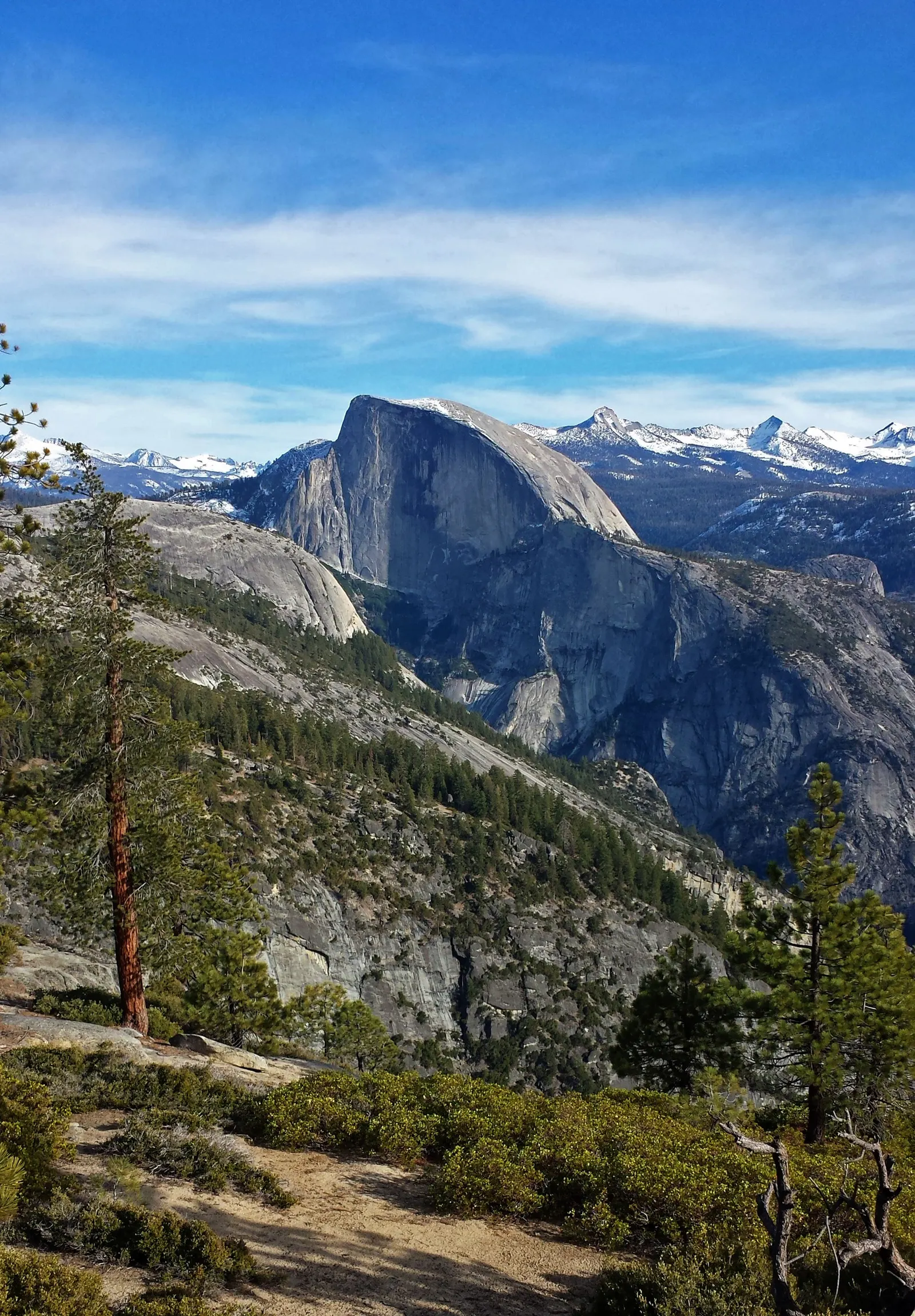
Spot something out of date? Tell us and we’ll fix it and log the correction. Photos: NPS / Cindy Jacoby; NPS Photo; NPS / Cindy Jacoby (NPS, public domain).