ChiricahuaItinerary
Chiricahua itinerary
One Chiricahua scenic-drive day or two with a dedicated Heart of Rocks hike, plus parking limits, camping bookings and a lower-canyon backup.
By David & Keri New, who have visited 63 of the 64 U.S. national parks
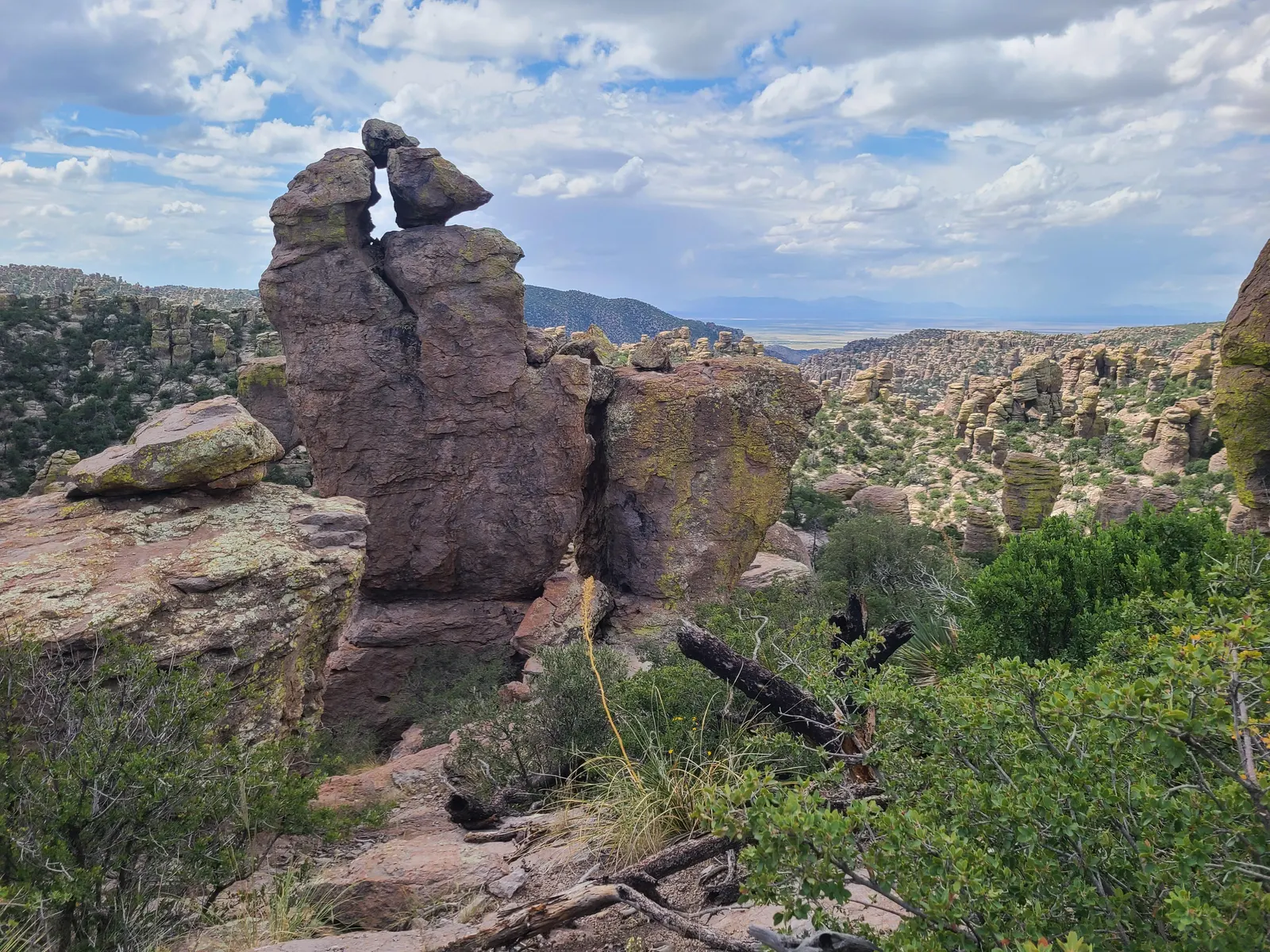
Chiricahua · Photo: NPS Photo
Choose your days
One day fits the scenic drive, a short walk and the lower canyon. Two is worthwhile for fit hikers who want Heart of Rocks as a separate trip. Do not add more days unless you are planning additional hikes independently.
Check road, trail, monsoon and winter conditions. Follow posted upper-road and parking limits. Plan your hike from your own vehicle and check NPS transport information before relying on a shuttle. Suggested starts use local Arizona time. Check NPS Chiricahua conditions
Check Bonita Canyon camping reservations
Times are suggested local starts. Closure flags update from the NPS alert feed when available. Check conditions again before your visit. Check park alerts
Open the free one-page planner
1 day
Make time for Echo Canyon Grottoes
Add your dates and save a copy.
Day 1 · Bonita Canyon Drive, Massai Point and the grottoes
NPS allows about 30 minutes each way without stops on the eight-mile drive from the entrance to Massai Point. Budget extra for overlooks, parking and the return. The upper drive and small trailhead lots are not for trailers or vehicles over 24 feet; confirm current restrictions before driving up. Drive time source · Vehicle and parking rules
Check the road and trails before leaving Willcox or your base. Snow, ice, monsoon storms or lightning can close the upper route. If the upper road is shut, use the lower-canyon backup only when lower access is open and safe. Access source
Booking and access details
Day visitors can use the public roads and trails when open; camping is a separate reservation. Check the specific site and rig limits before booking. Overnight campsite fit does not make a vehicle eligible for the upper scenic drive. Check Bonita Canyon camping reservations
2 stops in order; not on the map: Chiricahua Visitor Center, Echo Canyon Grottoes (not one fixed place, or no reliable position). Positions from OpenStreetMap; map data loads from OpenStreetMap when you tap. Not for navigation.
-
Chiricahua Visitor Center
Get current road and trail information and confirm vehicle restrictions before climbing. If using a large rig, follow NPS parking guidance instead of turning around in a small lot.
Facts for Chiricahua Visitor Center
The visitor center is on the right 2 miles after the entrance. Open from 8:30 am to 4:30 pm, it has an information desk, museum, park film, and gift shop. It provides free maps, junior ranger booklets, and information. The museum includes geology, biodiversity, and human history exhibits. Its architecture showcases Civilian Conservation Corps rock work and… 0
-
Massai Point
Start with the high overlook and the short nature trail if the weather permits. Leave time to stop at pullouts on the descent.
-
Echo Canyon Grottoes
Walk the short out-and-back from Echo Canyon toward the grottoes. If the small lot is full, keep the Massai Point walk rather than parking illegally or making up a shuttle connection.
Facts for Echo Canyon Grottoes
See tunnel-like rock formations among pinnacles and balanced rocks. 1
- Where
- Echo Canyon 1
- Walking
- 0.5 mi each way from Echo Canyon parking; loose rock 1
- Season
- Year-round; winter ice is possible 1
- Time
- 30-60 Minutes 1
- Dogs
- Not allowed 1
- Accessibility
- Not suitable for wheelchairs or strollers. This trail is steep and rocky. Some areas may be unpleasant for those with acrophobia (intense fear of heights). 1
-
Faraway Ranch
See the signed exterior areas on the return through the lower canyon. Do not assume the buildings or an interior tour are open.
2 days · Add Heart of Rocks
Make time for Heart of Rocks Loop
Add this after the 1-day plan.
Add your dates and save a copy.
Day 2 · A separate Heart of Rocks hiking day
NPS allows about 30 minutes each way without stops on the eight-mile drive from the entrance to Massai Point. Budget extra for overlooks, parking and the return. The upper drive and small trailhead lots are not for trailers or vehicles over 24 feet; confirm current restrictions before driving up. Drive time source · Vehicle and parking rules
Use the Echo Canyon trailhead round trip only when the road and trail network are open and the group can handle roughly seven-plus miles at elevation. Check heat and lightning risk. The occasional hiker transport is not required or assumed. Access source
-
Echo Canyon Trailhead
Confirm your route and carry a map, water and layers. Use a permitted vehicle and legal parking. If you cannot park, consult rangers rather than improvising a different length or return route.
Facts for Echo Canyon Trailhead
The named loop combines Echo Canyon, Hailstone and Ed Riggs trails. NPS recommends a counterclockwise direction: descend through the formations, cross the more level Hailstone section and climb back on Ed Riggs. These are three parts of one trip. 1
- Distance
- NPS conflicts: 3.3 miles in summary; 3.4 miles in narrative. 1
- Elevation
- NPS states total elevation 560 feet; separately describes 400-foot descent and climb. 1
- Time
- 2–4 hours (NPS activity). 1
- Difficulty
- Moderate; rocky uneven terrain and steep drop-offs. 1
- Route
- loop 1
- Trailhead
- Echo Canyon trailhead at Echo Canyon parking; Massai Point is an alternative start. 1
- Season
- Year-round 1
- Dogs
- Not allowed 1
- Accessibility
- Not suitable for wheelchairs or strollers. This trail is steep and rocky with over 500 feet in elevation change. Some areas may be unpleasant for those with acrophobia (intense fear of heights). No… 1
-
Heart of Rocks Loop
Follow the NPS route from Echo Canyon through the connecting trails and back to the same lot. This is a strenuous hike, with steep sections and uneven ground. Turn back early if conditions change.
Facts for Heart of Rocks Loop
See unusual formations, including Pinnacle Balanced Rock and Big Balanced Rock. 1
- Time
- 4-6 hours 1
- Route
- lollipop 1
- Trailhead
- Echo Canyon trailhead; follow Ed Riggs, Mushroom Rock, and Big Balanced Rock trails to the loop. 1
- Where
- Wilderness trail network 1
- Walking
- 7.3 mi round trip; many rock steps 1
- Season
- Year-round 1
- Dogs
- Not allowed 1
- Accessibility
- This is a strenuous trail with rock steps and rocky areas. Pets are not permitted. 1
-
Echo Canyon Trailhead
Return to your vehicle and drive down while access remains safe. Keep the remainder of the day flexible rather than adding another long summit hike.
Facts for Echo Canyon Trailhead
The named loop combines Echo Canyon, Hailstone and Ed Riggs trails. NPS recommends a counterclockwise direction: descend through the formations, cross the more level Hailstone section and climb back on Ed Riggs. These are three parts of one trip. 1
- Distance
- NPS conflicts: 3.3 miles in summary; 3.4 miles in narrative. 1
- Elevation
- NPS states total elevation 560 feet; separately describes 400-foot descent and climb. 1
- Time
- 2–4 hours (NPS activity). 1
- Difficulty
- Moderate; rocky uneven terrain and steep drop-offs. 1
- Route
- loop 1
- Trailhead
- Echo Canyon trailhead at Echo Canyon parking; Massai Point is an alternative start. 1
- Season
- Year-round 1
- Dogs
- Not allowed 1
- Accessibility
- Not suitable for wheelchairs or strollers. This trail is steep and rocky with over 500 feet in elevation change. Some areas may be unpleasant for those with acrophobia (intense fear of heights). No… 1
Upper road closed · Lower canyon only
Add your dates and save a copy.
Day 1 · A shorter Faraway Ranch and Silver Spur Meadow day
Use only if the park entrance, lower road and chosen paths remain safe and open. Creek crossings can flood; never cross a flooded wash or walk past a closure. If the lower canyon is also unavailable, postpone. Access source
2 stops in order. Positions from OpenStreetMap; map data loads from OpenStreetMap when you tap. Not for navigation.
-
Faraway Ranch
Use the public exterior areas and signs near the ranch. Do not drive toward the upper road or expect an interior tour.
-
Silver Spur Meadow Trail
Take a short signed out-and-back in the lower canyon, turning around before any unsafe creek crossing. Return to the same parking area.
Facts for Silver Spur Meadow Trail
Beginning from the Visitor Center, Campground, or Faraway Ranch picnic area, this 1.2 mile/1.9 kilometer leisurely walk goes by the Faraway Ranch Historic District, Stafford Cabin, and Silver Spur Meadow. This is a dog-friendly trail. 1
Good to know
For your days in Chiricahua
Wildlife and where to look (7)
- Coues’ white-tailed deer. Scenic drive and Silver Spur Meadow Trail. Watch for deer while driving. nps.gov
- White-nosed coati (coatimundi). Silver Spur Meadow and Bonita Canyon Campground at lower elevations; daytime; bands are often seen in fall and winter. Look for groups of females and young foraging. nps.gov
- Hooded and striped skunks. Bonita Canyon Campground; primarily at night. Keep a clean campsite. nps.gov
- Javelina. Lower elevations; forests and grasslands. Keep a safe distance from wild animals. nps.gov
- Acorn woodpecker. Silver Spur Meadow Trail and Lower Rhyolite Trail. Look along creeks; NPS identifies these trails as common viewing locations. nps.gov
- Mexican jay. Parking areas; year-round. NPS says these birds often beg for food; feeding is prohibited. nps.gov
- Turkey vulture. Cliffs above Bonita Canyon Campground amphitheater; summer evenings. Watch birds returning to roost. nps.gov
Night sky and light (3)
- Faraway Ranch (Faraway Ranch parking lot). Road and restrooms remain open at night; overnight parking is prohibited. International Dark Sky Park. NPS recommends this open-sky location and avoiding a full moon. nps.gov
- Echo Canyon (Echo Canyon parking lot). Road and restrooms remain open at night; overnight parking is prohibited. International Dark Sky Park. NPS recommends this open-sky location and avoiding a full moon. nps.gov
- Massai Point sunset (Massai Point). NPS describes the park as open 24 hours for sunrise, sunset and stars. NPS publishes a sunset view here; exact seasonal sunrise and sunset times are not published on this page. nps.gov
Longer drives between areas (1)
- Park entrance to Massai Point: 8 miles miles, about 30 minutes without stops. NPS allows 60–90 minutes for the scenic-drive activity with stops. nps.gov
Add a guided tour to your Chiricahua days
Affiliate link: we may earn a commission, at no extra cost to you. How this works
Before you go
- Best time to visit Chiricahua: crowds, weather and seasonal access by month.
- Plan Chiricahua in the trip planner: your dates, booking deadlines and a conditions check before you leave.
- Is Chiricahua open today? Live NPS alerts and closures.
Plans checked against official NPS pages Nov 10, 2026.