ChiricahuaPrintable packet
Chiricahua, on paper
Entry, hours, permits, rules, maps and safety from our sourced guide, in one file to print or save before you lose signal.
Compiled by National Park News from National Park Service data
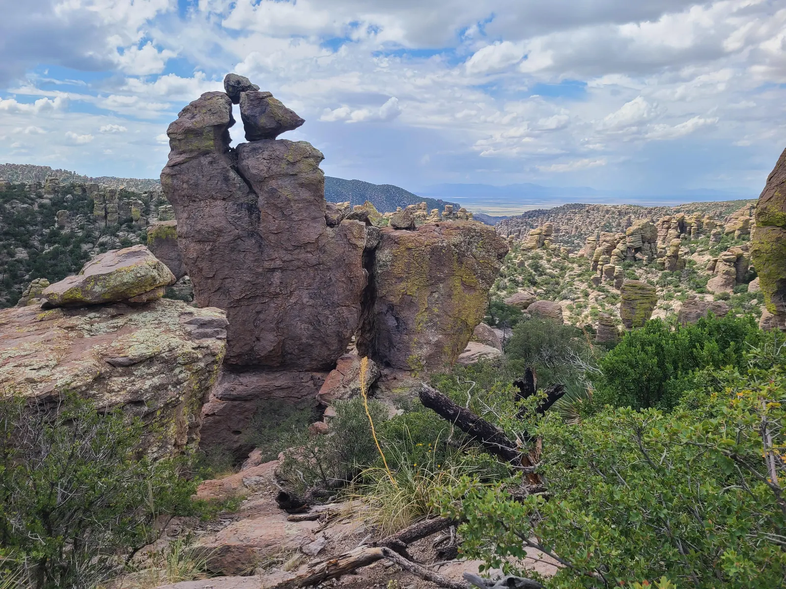
Chiricahua · Photo: NPS Photo
Offline packet · Arizona
Chiricahua National Park
Checked: Guide facts Nov 20, 2026 · Maps & sights Nov 1, 2026 · Camping details Nov 1, 2026. Rules and conditions change; confirm on nps.gov before you go. Printed from thenationalparknews.com/parks/chiricahua/.
For offline maps, download the park in the free official NPS App.
Emergency
- Emergency: call 911.
- Park website: https://www.nps.gov/chir/
Emergency card
- Emergency number
- Dial 911 Source
- Cell coverage
- Cell phone service is limited near the park; if calling while driving nearby, pull over as reception will likely cut out. Source
- Compass
- Magnetic declination at park center, mid-2027: 8.5° E (NOAA WMM2025) Source
What to tell dispatch (NPS) Source
- GPS coordinates from your phone, if available
- Name of the trail or area of the park where you started your activity
- Your last known location before you became lost
- Description of your surroundings including visible landmarks
- Types and colors of clothing you are wearing
- Equipment you are carrying
- Any medical conditions you may have
Time zone
- No daylight saving time: clocks here do not change in March/November, so the offset to mainland DST-observing states changes by an hour seasonally. Source
Entry & fees
- Entry
- No entry reservation required. NPS lists no timed-entry or parking reservations for 2026. Camping requires a reservation. No 2027 entry-reservation program is announced on the checked permits page.
- Fees
- No entrance fee. No parking fee. The park does not sell passes.
Hours
- Park
- The road, campground and facilities stay open overnight, and trails are open for sunrise, sunset and night-sky viewing. Overnight parking, sleeping in vehicles and camping outside the campground are prohibited.
- Visitor center
- Open daily, 8:30 am-4:30 pm Mountain Standard Time (most of Arizona doesn’t observe daylight saving time).
Getting there
- From I-10 (north, west or east)
- Leave I-10 in Willcox (exit 336, 340 or 344) and follow the brown signs to Hwy 186 south. Drive 32 miles, turn left on Hwy 181, and the park is 4 miles ahead.
- From the south
- Hwy 191 meets Hwy 181 at Sunizona (Pearce). Follow Hwy 181 about 26 miles, staying on the pavement through several sharp turns.
- One way in
- There is only one entrance, and the paved road ends at Massai Point; it does not go through to the other side. Pinery Canyon (FR 42) and Apache Pass from Portal or Bowie are winding, rocky dirt roads; NPS recommends high clearance or 4WD on Pinery Canyon.
- Fuel, cars and airports
- A private car is the only practical way in; rideshare and taxis don’t operate here. Gas, EV charging and groceries are 30-40 miles away, so fill up in Willcox or Sunizona. Nearest airport: Tucson (TUS).
- Large vehicles
- Trailers and vehicles over 29 ft must park at Faraway Ranch; vehicles over 24 ft can’t go past the campground on the scenic drive. NPS suggests leaving big rigs in Willcox or Sunizona.
- Hiker shuttle
- The hiker shuttle is not running. The NPS basic information page, updated October 21, 2026, says service stopped in fall 2025 and is not running now. No restart date is posted; recheck this page monthly before planning transport.
Official maps
- Park Map (PDF)
- Park Guide & Map (PDF)
Download these before you lose signal.
Permits & reservations checklist
- Campground reservation (Bonita Canyon). When: Current advance booking window not visible in the checked pages; consult the Recreation.gov calendar.. Fee: Not published · Apply
- Day hiking. When: No application window.. Fee: Free · Details
- Backcountry camping. When: Not available.. Fee: Not published · Details
- Administrative / special use permit. When: Apply well in advance; no fixed deadline is published.. Fee: $100 application; possible additional costs · Apply
- First Amendment activities. When: No fixed deadline is published.. Fee: Free application · Apply
- Commercial tour authorization (2026). When: Obtain authorization before operating.. Fee: Free · Apply
- Filming, photography and audio recording. When: Discuss the project before the activity.. Fee: $100 application + location fees · Apply
- Research permit. When: Required before research begins; no fixed deadline is published.. Fee: Not published · Apply
- Drone (unmanned aircraft) authorization. When: Written approval required before operation.. Fee: Not published · Details
Sample 1-day plan
Our rule of thumb from this guide’s data (8 walks / trails, 1 scenic drive, 6 areas or entrances listed in this guide), not a firsthand recommendation.
- Day 1: Bonita Canyon Drive: Bonita Canyon Drive + Echo Canyon Loop
- Season: Park and Bonita Canyon Drive open 24 hours, year-round; the drive past the campground can close briefly for snow, ice or rockfall.
- Start: Visitor center: Open daily, 8:30 am-4:30 pm Mountain Standard Time (most of Arizona doesn’t observe daylight saving time).
- Drive: Bonita Canyon Drive: An 8-mile paved drive up through rock formations and oak, cypress and pine forest to Massai Point’s 360-degree view of the Wonderland of Rocks, passing Faraway Ranch, the visitor center and the campground.
- Hike: Echo Canyon Loop: 3.4 mi loop · About 400 ft gain · Moderate
- See: Heart of Rocks: 7.3 mi round trip; many rock steps
- Hike: Massai Point Nature Trail: 0.5 mi · Easy, with stairs and uneven footing
- Running late? Drop: Echo Canyon Loop
- Overnight base: Bonita Canyon Campground (the only place to stay in the park) or Willcox, AZ (about 45 minutes)
Key rules for 2026
- Redesignated as a national park. H.R. 6380 became Public Law 119-133 on October 20, 2026, redesignating Chiricahua National Monument as Chiricahua National Park without changing its boundaries. The published law gives October 20 as the approval date; September 30 was Senate passage, despite the signing date given in the NPS FAQ.
- 2026 Superintendent’s Compendium. The compendium for Chiricahua and Fort Bowie took effect 01/09/2026. It states that references to the Monument now refer to the Park.
- Vehicle length and trailer limits. Vehicles over 24 ft and trailers are prohibited on Bonita Canyon Road beyond the campground. Vehicles over 29 ft and day-use trailers are prohibited beyond Faraway Ranch.
- No camping outside the campground. Camping and overnight parking are allowed only at Bonita Canyon Campground. Backcountry camping is prohibited, and no backcountry permits are issued.
- Pets limited on trails. Pets must be on a leash no longer than 6 ft and are prohibited on most trails. Exceptions are Bonita Creek, Faraway Ranch, Silver Spur Meadow, and the connector trail between the campground and visitor center.
- Drones prohibited. Launching, landing, or operating unmanned aircraft is prohibited without the superintendent’s written approval.
- Fire rules. Fires are allowed only in the provided stand-up grills at the campground, and wood collecting is prohibited. Stage 2 restrictions ban open flames. Since 2025, burning flammable liquids, garbage, plastics, or synthetic materials has been prohibited.
- No bikes or e-bikes on trails. Bicycles and e-bikes are allowed only on paved park roads open to vehicles. They are not allowed on trails or in Wilderness, and climbing the rock pinnacles is prohibited.
Pets
- Where pets can go
- Leashed or carried pets may use the campground, paved parking lots and lower trails between the campground and entrance: Bonita Creek, Silver Spur Meadow and the Faraway Ranch area.
- Where pets cannot go
- Pets, including carried pets, are prohibited in buildings and on trails above 5,500 feet, including Massai Point Nature, Echo Canyon, Heart of the Rocks, Natural Bridge and Sugarloaf.
- Leash and care rules
- Use a leash no longer than 6 feet. Do not tie pets to objects or leave them unattended. Remove pet waste.
- BARK Ranger
- NPS documented a free Silver Spur Meadow BARK Ranger walk on October 20, 2026, with a certificate for completing the adventure. That event has passed. Current self-guided enrollment and tag or badge availability are not published on the checked pages.
Safety
- Elevation and water
- The park runs from 5,400 to 7,300 ft. Carry about 1 liter of water per hour of hiking, plus electrolytes.
- Weather
- Snow and ice are possible December through March and can close roads. Summer highs often reach 80-90°F from May to September, and July-September monsoon storms bring lightning and flooded road crossings.
- Wildlife
- Don’t feed or approach animals (rabies is a risk). Watch your step for rattlesnakes. If you see a bear or mountain lion, don’t run; make yourself big and yell.
- Vehicles
- There are no gas stations between I-10 and the park, and roadside assistance can take a day or more. Bring a spare key and check your spare tire.
Compiled from the sourced Chiricahua guide on thenationalparknews.com. Follow the guide for official sources and current updates. Track the parks you’ve visited on the 64-park checklist.