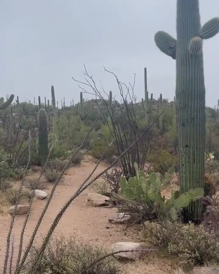
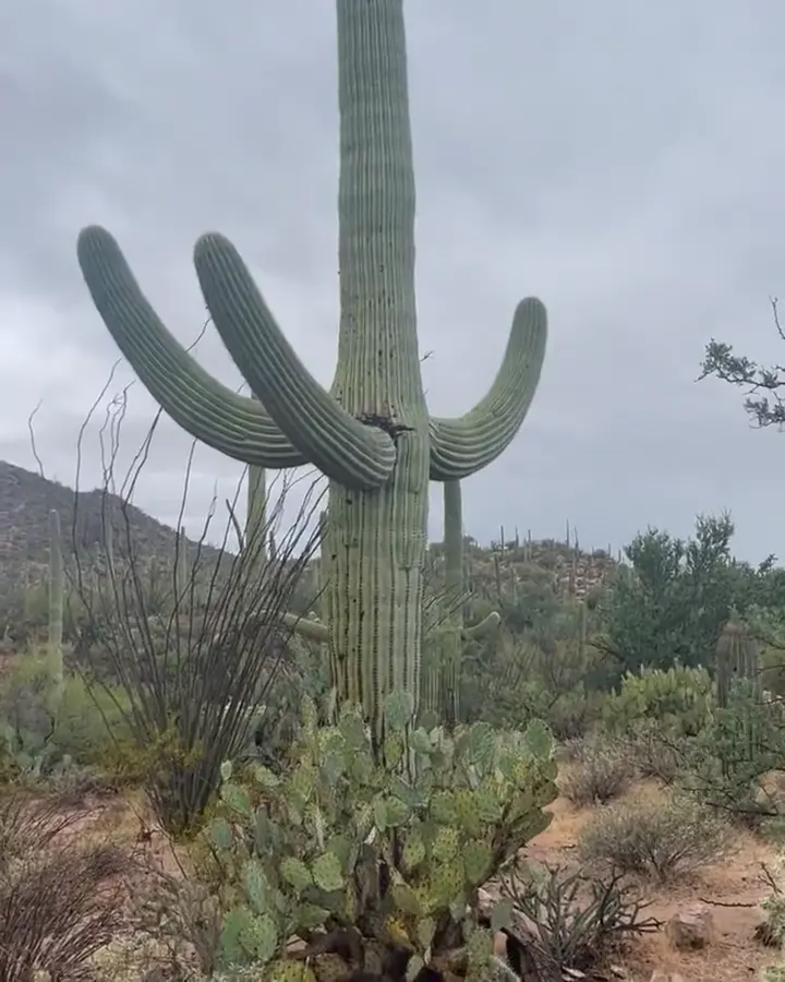
A forest of saguaro cacti below rocky hills in Saguaro National Park

Arizona

Saguaro National Park Guide

Two districts on either side of Tucson protect forests of giant saguaro cactus. The Tucson Mountain District (West) has denser, younger stands and sunset views. The Rincon Mountain District (East) has older saguaros and climbs to pine forest at 8,666-ft Mica Mountain.

By David & Keri New, who have visited 63 of the 64 U.S. national parksUpdated

Park 51 of our 63Visited Dec 2022

Your trip planner

Add Saguaro to a trip

Choose a saved trip or start a new draft for this park.

Saves this park and its trail guides on this device. Alerts and conditions are as of when you save; live maps and bookings need a connection.

Photo: David & Keri New

NPS alertsAs of 6:03 AM ET, Nov 20

Bajada Loop Drive Closure in West District

  • Vehicle Break-Ins
  • RV and trailer precautions: be aware of vehicle restrictions before visit.

Plan your first trip to Saguaro

1 day is our starting point.

Follow our one-day plan. Start at Red Hills Visitor Center in the west district and drive the open part of Bajada Loop Drive. After lunch, cross Tucson to the east district for Cactus Forest Loop Drive.

Open the 1-day itinerary

Before choosing 2 days · Standard vehicle hours. In the Rincon Mountain District (East), the Cactus Forest Loop Drive is open from 5:00am - 8:30pm. Temporary closures override these hours.

Starts a new draft and keeps your saved trips. Set a custom duration in the full planner.

How many days?

1 day · our pick
  1. Saguaro West in the morning, Saguaro East in the afternoon
Open this day plan
2 days · conditional
  1. Saguaro West in the morning, Saguaro East in the afternoon
  2. Saguaro East · Tanque Verde Ridge
Open this day plan
Compare all trip lengths
Shorter visit

With only a few hours, pick one district. In the east, drive the paved 8-mile Cactus Forest Loop Drive and stop at the pullouts. Crossing to the other district adds 45 to 60 minutes each way.

National Park Service guidanceNational Park Service guidance

Optional add-on

Hike to Wasson Peak, the high point of the west district. The King Canyon Trail from the King Canyon trailhead is 3.5 miles each way. Our west-only option gives the whole day to this hike.

Open the backup itineraryNational Park Service guidanceNational Park Service guidance

If plans change

If parts of Bajada Loop Drive are closed, stay on paved Kinney Road and walk the Desert Discovery Nature Trail if it is open, or spend the day in the east district. In summer heat, NPS advises outdoor activity before 10 am or after 4 pm.

Open the 1-day itineraryNPS park conditions

Check what’s open

Where to base yourself

Tucson

Stay in Tucson, on the side of town nearest the district you visit first. The park has no lodging and no drive-in or RV camping. Its only campsites are backcountry sites in the Rincon Mountains.

NPS camping rules and reservationsLodging and gateway towns

Compare stays and access

Before you book

For a day visit, buy an entrance pass. It covers both districts, and the park does not accept cash. Book ahead only if you plan to backpack: backcountry campsites need a permit from Recreation.gov.

National Park Service guidanceNPS camping rules and reservationsNational Park Service guidance

Getting there and getting around

You need a car. The two districts sit on opposite sides of Tucson, and NPS says to enter each district's street address in your map app because apps confuse them. David and Keri suggest giving each district its own half day.

National Park Service guidanceDavid & Keri’s trip notes

Our visit

Park 51 of our 63

Where Saguaro ranks in our 63

December 2022

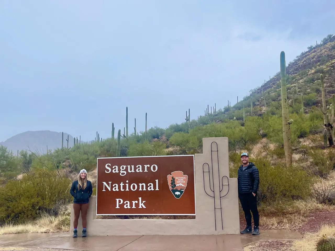
David and Keri at the Saguaro entrance sign
We were hereDec 4, 2022
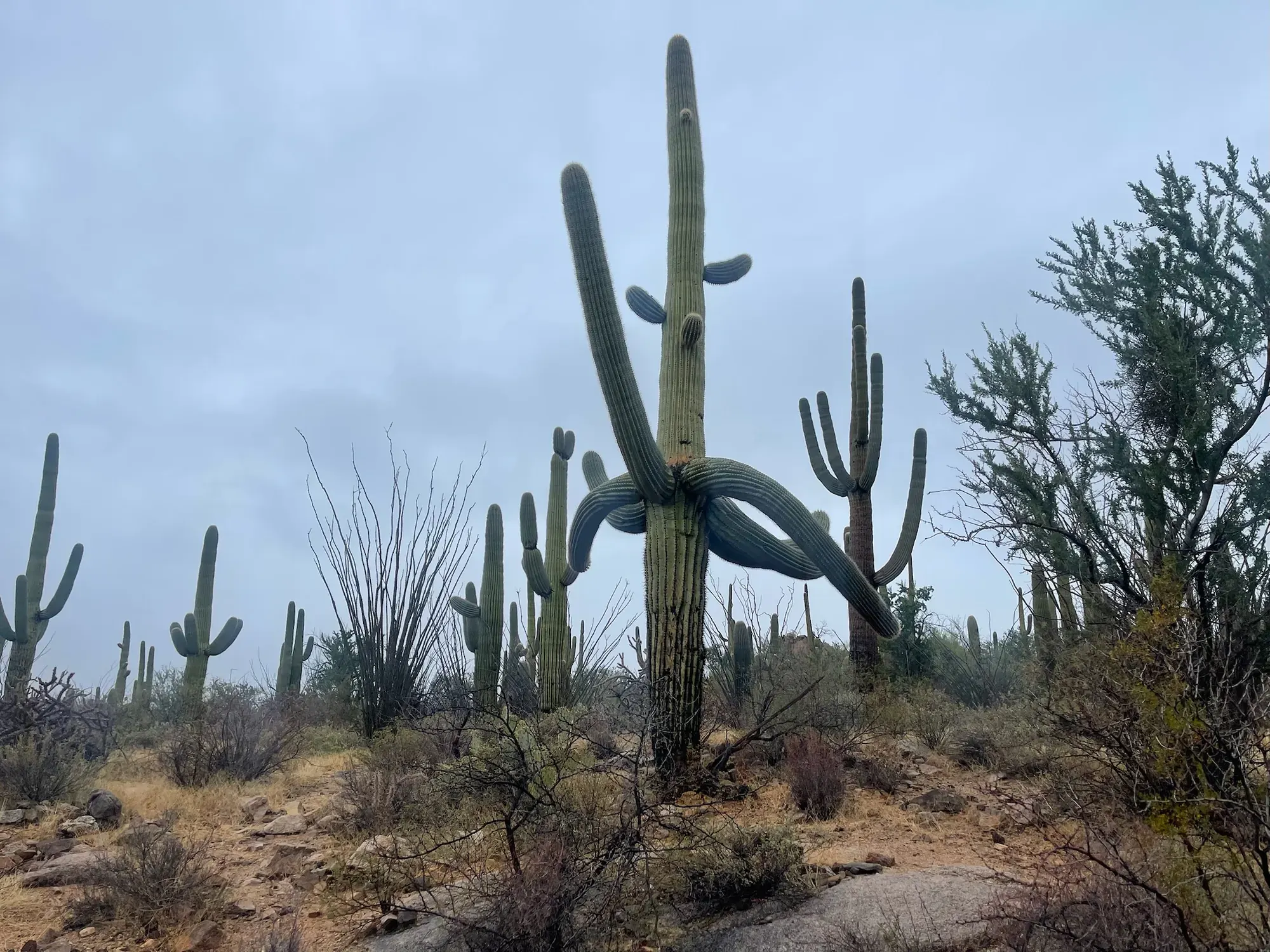
A tall saguaro cactus with curving arms among desert scrub under a cloudy sky in Saguaro National Park
A big saguaro with arms that curl down before turning back up. · Dec 4, 2022
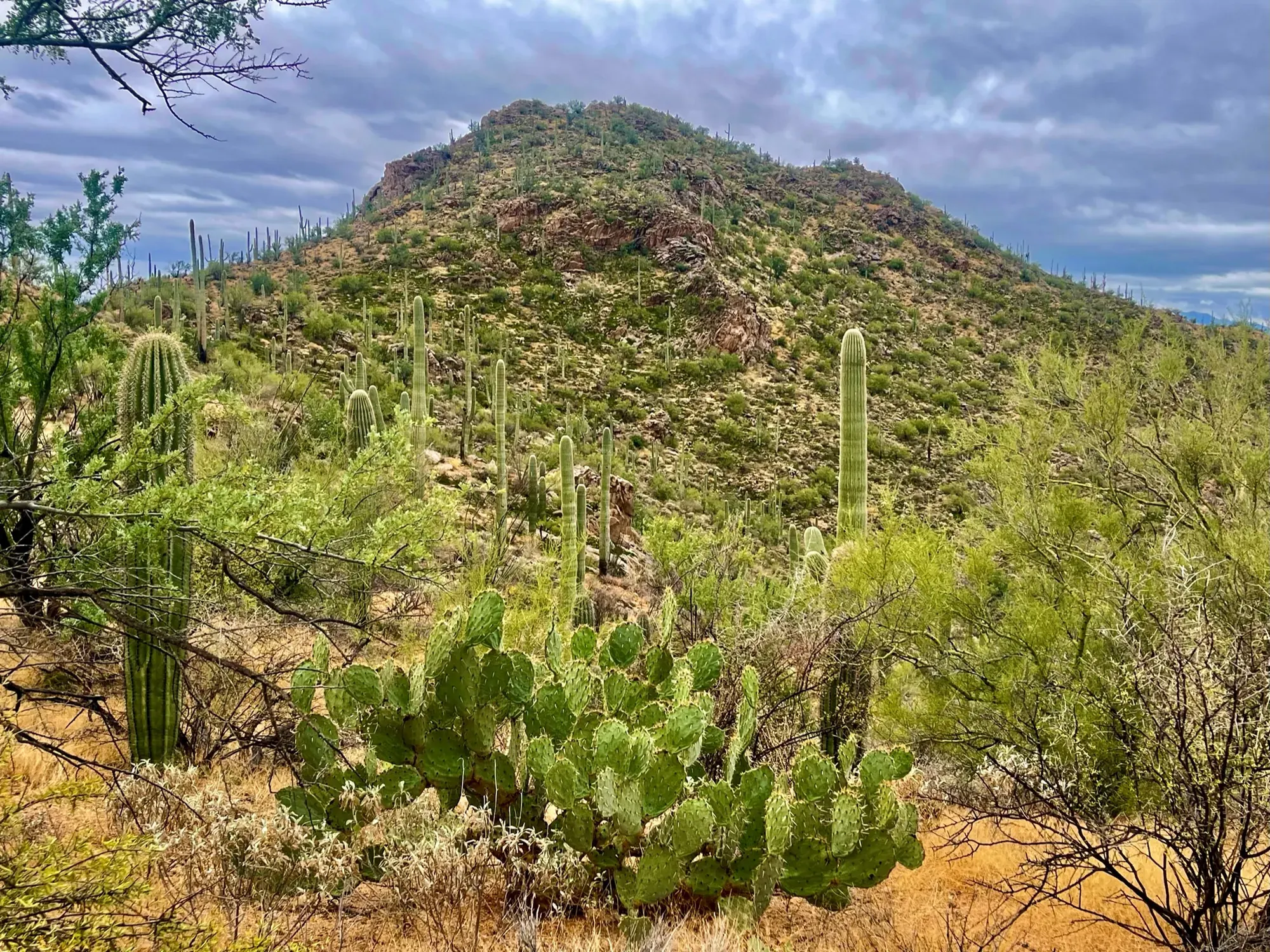
A green desert hillside with prickly pear and saguaros in Saguaro National Park
Prickly pear in front, saguaros all the way up the hillside. · Dec 4, 2022
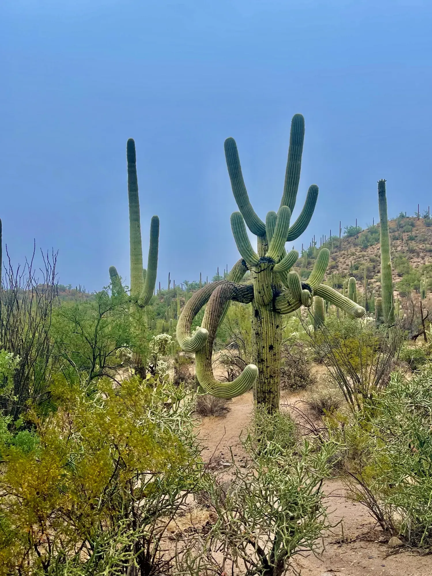
Saguaros rising over green desert shrubs against a blue sky in Saguaro National Park
A little blue sky over the saguaros on an otherwise gray December day. · Dec 4, 2022
Sharp leftover saguaro desert in Saguaro
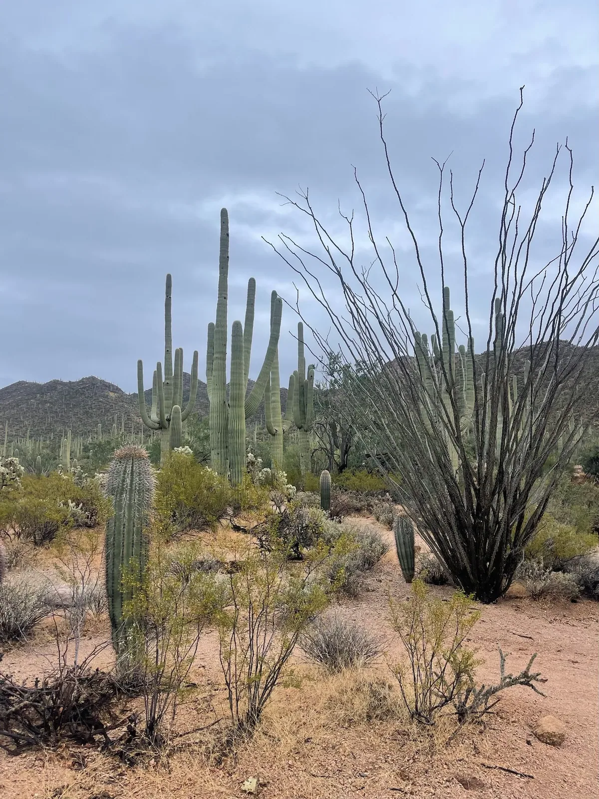
Ocotillo stems and saguaros against a cloudy Arizona sky. · Dec 4, 2022
Two large saguaro cacti beside a sandy path under clouds in Saguaro National Park
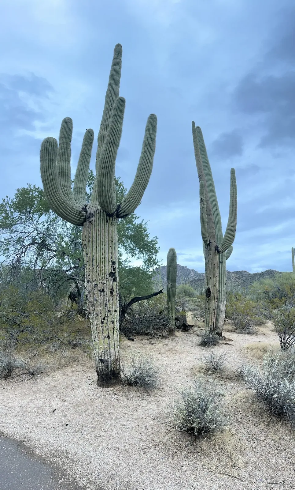
Two big saguaros beside the path. · Dec 4, 2022
A person hugging a saguaro in Saguaro
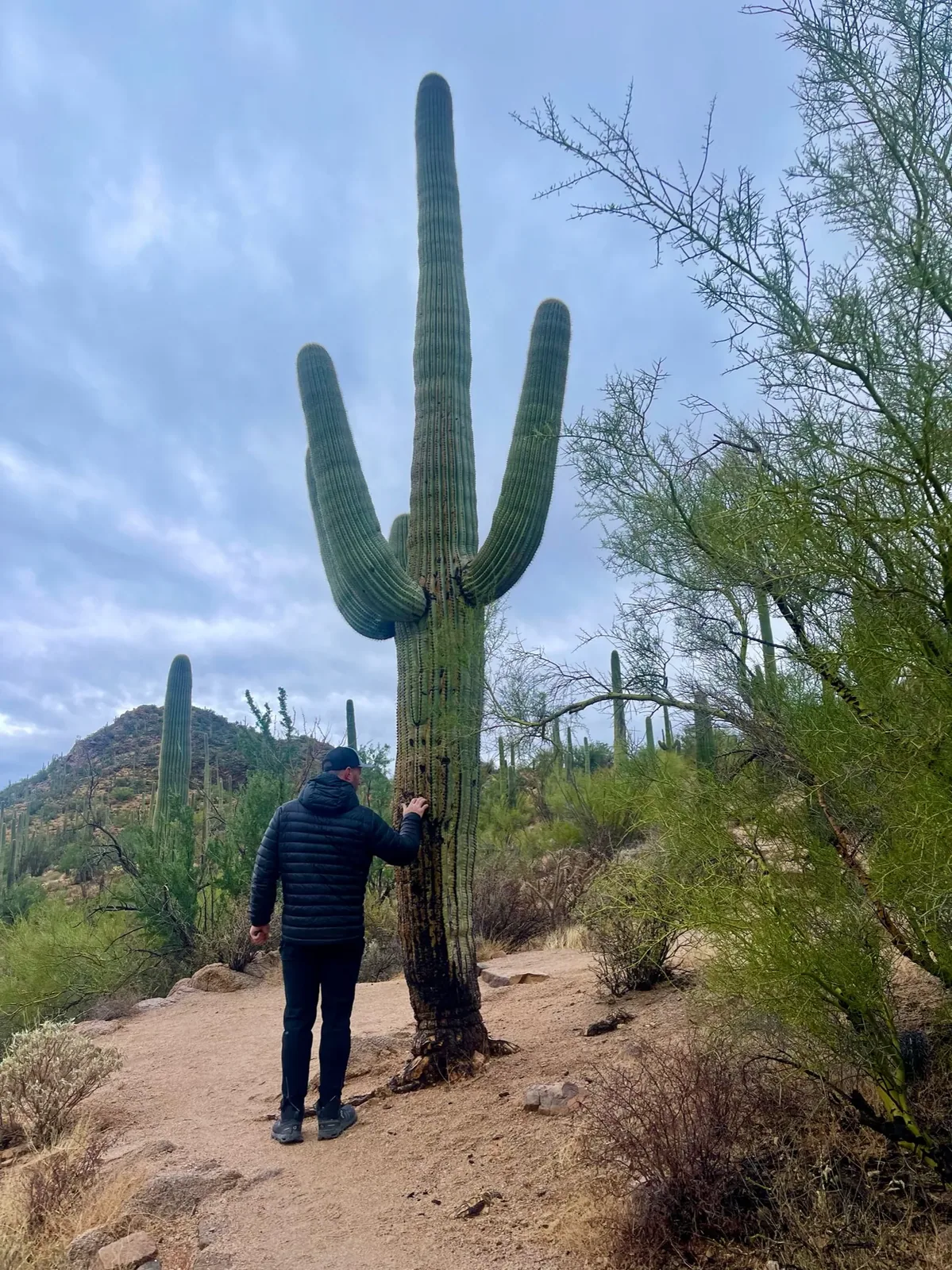
Standing beside a saguaro puts its size in perspective. · Dec 4, 2022

Why it’s on our list

Saguaro is a celebration of the unique beauty of the Sonoran Desert. The enormous saguaro cacti, rugged desert mountains, and spectacular sunsets create a landscape unlike anywhere else in the national park system. While the scenery is beautiful, the park doesn’t offer quite the same variety of major attractions as many of our higher-ranked destinations.

Our favorite moment

Watching the sunset surrounded by giant saguaros, hiking through the cactus forest, and exploring Signal Hill’s petroglyphs.

Dark boulders overlook a wide desert valley from the Signal Hill area of Saguaro National Park
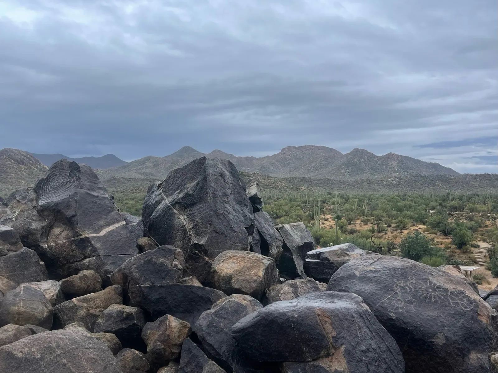
Looking out over the saguaro forest from the rocks near Signal Hill. · Dec 4, 2022
See all 19 photos and videos
When we went
December 2022

Photos by David & Keri New.

Firsthand · David & Keri New

What we’d tell a friend about Saguaro

Saguaro is a forest of giant cactus right at the edge of Tucson, and they stand as far as you can see. It’s an easy park to visit and a nice change from the big canyon parks. We were there on a gray, rainy December day, and the desert was greener than usual.

  • Dec 4, 2022 · Day trip
Tall saguaro cactus stand across a desert hillside under blue sky
Saguaro forest · our video
A tall saguaro cactus against the desert sky
Saguaro up close · our video
See all 19 photos and videos

Our favorite hike

Sendero Esperanza Trail to Wasson Peak

Wasson Peak is the highest point in the Tucson Mountains. The climb goes through thick saguaro forest and ends with wide views over Tucson and the desert, and it’s the best workout in the park.

Our one tip

The park has two districts on opposite sides of Tucson, about an hour apart, so pick one per half day. Do the Cactus Forest Loop Drive in the East and the Bajada Loop Drive in the West.

What we’d do differently

A clear day would change this park for us.

With one more day

Saguaro was a one-day park for us, and one day was enough.

Was it a good time to go?

Early December is a good time for the weather, with cool temperatures and light crowds before the holidays. Our day was overcast and the pavement was wet, so we got the rare rainy desert.

In town

Gates Pass, by the West district, is the go-to sunset drive. In Tucson, El Charro Café is among the oldest family-run Mexican restaurants in the country.

Where we stayed

Day trip

Dec 4, 2022 · Day trip

Just a day visit for us.

Entry and best time to visit

Entry

No entry reservation required

You still need an entrance pass: $25 per vehicle.

Fees and permits

Best time

February, March, November

February–March and November excel. October–April generally pleasant. Saguaro blooms peak late May–early June. June–August heat limits hiking.

Month by month

Live conditions and planning tools →

Itineraries

How many days in Saguaro?

Saguaro itinerary: every day stop by stop, with sources

Compare the 1-day plans, day by day →

Map

Where things are in Saguaro

2 visitor centers and 1 of the 2 campgrounds on a map you can zoom and drag. Map data loads from OpenStreetMap when you tap.

Saguaro’s two districts on either side of Tucson: schematic, not to scale Sandario RdRed Hills VCKing CanyonGates PassAjo WayTucsonDouglas SpringRincon Mtn VCJavelina RocksLoma AltaBackcountry
Schematic, not to scale

2 visitor centers

Locations from the NPS visitor-center listing, checked Nov 13, 2026. Hours and what each one has

1 of 2 campgrounds mapped

Locations from Recreation.gov, checked Nov 7, 2026. Not on this map: Backcountry campgrounds (no Recreation.gov location in our data). Compare all 2 campgrounds

Official NPS maps for Saguaro (opens in a new tab) ↗

Trails

10 hikes, shortest first

  1. Desert Ecology Trail (East)0.25 mi · Paved gain · Easy

    0.25 mi

    Details for Desert Ecology Trail (East)

    Paved, with exhibits and benches. Dogs allowed.

    Loop · About 20 minutes
    Start: Desert Ecology parking pullout on Cactus Forest Loop Drive.

    Last verified · nps.gov
  2. Desert Discovery Trail (West)0.5 mi · Paved gain · Easy

    0.5 mi

    Details for Desert Discovery Trail (West)

    Paved, with exhibits, shade ramadas and benches. Great at sunset.

    Loop · About 15 minutes (estimated)
    Start: Desert Discovery Trail parking area on Kinney Road.

    Last verified · nps.gov
  3. Freeman Homestead Trail (East)1 mi · Not listed gain · Easy

    1 mi

    Details for Freeman Homestead Trail (East)

    Homestead ruins, large saguaros and a wash where great horned owls roost.

    Loop · About 1 hour
    Start: Freeman Homestead Trailhead.

    Last verified · nps.gov
  4. Wild Dog Trail (West)1.8 mi · Not listed gain · Easy

    1.8 mi

    Details for Wild Dog Trail (West)

    Valley View to Golden Gate Rd / Signal Hill. Works well as a point-to-point shuttle. The Golden Gate Rd end is on the Bajada Loop, closed to all traffic as of Nov 1, 2026 (NPS alert).

    One way (point to point)
    Start: Valley View Trail; connect to Wild Dog Trail toward Golden Gate Road.

    Last verified · nps.gov
  5. Hope Camp & Ridge View (East)2 mi · 400 ft gain · Moderate

    2 mi

    Details for Hope Camp & Ridge View (East)

    From the Loma Alta trailhead, with Rincon Peak views.

    Out and back · About 45 minutes (estimated)
    Start: Loma Alta trailhead; follow Hope Camp Trail 0.1 mile to Ridge View Trail.

    Last verified · nps.gov
  6. King Canyon / Gould Mine Loop (West)2.4 mi · 380 ft gain · Moderate

    2.4 mi

    Details for King Canyon / Gould Mine Loop (West)

    Sandy wash with stair-step rocks; bees possible. There have been recent car break-ins at this trailhead.

    Loop · About 1 hour (estimated)
    Start: King Canyon trailhead, just outside the park in Tucson Mountain Park.

    Last verified · nps.gov
  7. Sendero Esperanza to the ridge / Wasson Peak (West)3.4-8 mi · 220-1,600 ft gain · Moderate to strenuous

    3.4–8 mi

    Details for Sendero Esperanza to the ridge / Wasson Peak (West)

    Wasson Peak (4,687 ft) is the high point of the Tucson Mountains.

    Out and back · About 1.25–3.5 hours (estimated)
    Start: Sendero Esperanza trailhead on Golden Gate Road.

    Last verified · nps.gov
  8. Loma Verde Loop (East)3.8 mi · 60 ft gain · Easy

    3.8 mi

    Details for Loma Verde Loop (East)

    Loops through mesquite and the bajada, past the Loma Verde Mine. The FAQ recommends it for tall saguaros.

    Loop · About 2 hours
    Start: Loma Verde trailhead; start north on Loma Verde Trail.

    Last verified · nps.gov
  9. Garwood Dam & Wildhorse Tank (East)6.4 mi · Not listed gain · Moderate

    6.4 mi

    Details for Garwood Dam & Wildhorse Tank (East)

    From the Douglas Spring trailhead, through classic cactus forest.

    Lollipop loop
    Start: Douglas Spring trailhead; follow Douglas Spring Trail to Garwood Trail.

    Last verified · nps.gov
  10. Tanque Verde Ridge (East)Varies (6.9 mi one way to Juniper Basin) · About 3,000 ft to Juniper Basin gain · Strenuous

    Varies

    Details for Tanque Verde Ridge (East)

    From Javelina Picnic Area. Ridge views start at 0.75 mi.

    Out and back · About 6 hours (estimated)
    Start: Tanque Verde Ridge Trail at Javelina Picnic Area.

    Last verified · nps.gov

Distances, gains and difficulty as NPS publishes them; the bar shows the published distance, dashed where a longer option exists.

Camping

Camping in Saguaro

  • Backcountry campgroundsOpen all year

Camping in and near Saguaro: the campground, every site, nearby campgrounds and open sites for your dates

Fees, permits & rules

Saguaro entrance fee: $25 per vehicle, plus permits and when to book

Last verified · nps.gov All Saguaro fees, permits and booking deadlines →

Rules and changes for 2026

  1. West loop drive closed (Nov 2026)

    A flash flood warning is in effect for both districts. The west district loop drive (Bajada Loop: Hohokam Rd and Golden Gate Rd) is fully closed to all traffic, which also cuts off Signal Hill Picnic Area and the Golden Gate Rd end of the Wild Dog Trail. Roads from Tucson to the west district may be blocked by flooding. The east district’s Cactus Forest Loop Drive is open, but the NPS advises against hiking and driving while rain continues. Never drive or walk through a flooded road.

    Last verified · NPS alert (Nov 1, 2026)
  2. Kinney Rd closed to Nov 24, 2026

    Pima County has closed Kinney Rd from the eastern McCain Loop intersection to the Desert Museum entrance from Oct 1 to Nov 24, 2026 for water line work. McCain Loop is the detour. From I-10 you can also reach Red Hills Visitor Center via Exit 242, Avra Valley Rd and Sandario Rd (see Getting there).

    Last verified · Pima County notice
  3. Vehicle break-ins

    Break-ins have happened at King Canyon Trailhead and other trailheads. Hide or take your valuables. Pima County Sheriff non-emergency: 520-351-4900.

    Last verified · NPS alert
3 more rules and changes
  1. Oversize vehicles on the loop drives

    On both loop drives, vehicles wider than 102 in (8.5 ft) or a combined length of 40 ft or more when towing are prohibited. Gates Pass (Speedway) has a 12,000-lb weight limit, and vehicles over 25 ft aren’t recommended there.

    Last verified · Getting around (NPS)
  2. Rideshare warning (West)

    Rideshares will drop you off at the Tucson Mountain District but usually won’t pick you up. Arrange a round trip first. No major trails start at the visitor center.

    Last verified · NPS alert
  3. Prohibited

    Drones, ATVs and firearms are prohibited inside park boundaries. No livestock on trails for 24 hours after heavy rain.

    Last verified · Rules & regulations (NPS)

Crowds by month

Historical recreation visits · 2021–2025 · as of Nov 3, 2026. Visits count entries, not unique people, parking spaces or trail crowding.

Average monthly recreation visits, 2021–2025
Jan119,624
Feb127,304
Mar156,077
Apr112,570
May64,510
Jun41,026
Jul36,225
Aug35,577
Sep39,325
Oct54,673
Nov77,571
Dec94,119

Busiest by average count: Mar. Quietest: Aug. Each bar is that month’s average visits across 5 years; unusual years and reported zeros are included. Past visits can’t tell you the best time of day to arrive.

Every month’s visits and NOAA weather, with the counts for each year →

NPS Visitor Use Statistics: monthly report · NPS monthly data · checked Nov 3, 2026; latest included year 2025.

How this page is made. The section “What we’d tell a friend” is ours. Our recorded visits to Saguaro include December 2022.Planning information, including any fees, permits, closures, weather and crowd figures shown here, is compiled from the National Park Service, Recreation.gov and other public sources, and each fact shows the date we last checked it. If something is wrong, tell us and we’ll log the fix on our corrections page.

Sources & corrections

The core guide research was last verified Nov 20, 2026 against the linked National Park Service and Recreation.gov pages. Live conditions and separately sourced facts show their own dates. Park rules change; confirm before you go.

Report a correction · Corrections log

Photos: David & Keri New.

Where sources disagree (1)
  • Closed days: the NPS hours data says the park is always open. The visitor-center page says it’s open every day except Thanksgiving and Christmas Day. Neither says whether roads or only visitor centers close; confirm with the park at (520) 733-5153.