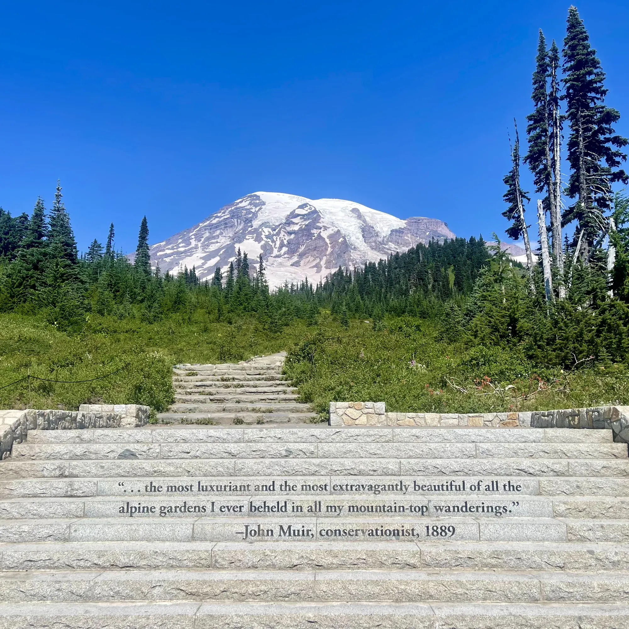
Naches Peak Loop
The loop starts at Tipsoo Lake. From the main parking area, walk toward the lake; the Naches Peak Loop Trail starts on your left going uphill, which puts you on the loop clockwise, the direction NPS says gives the most views of the mountain. The route crosses an arch bridge at the park boundary, and part of the loop is outside the park on the Pacific Crest Trail. NPS gives 3.4 miles, 500 feet of elevation gain and an average hiking time of 2 hours.
Mount Rainier · Photo: David & Keri New
- 3.4 miDistance
- 500 ftElevation gain
- 2 hrTime
- EasyDifficulty
The numbers, with sources
Distance: 3.4-mile (5.5 km) loop. Source
Gain: 500 feet. Source
Time: 2 hours (NPS average hiking time). Source
Difficulty: The NPS doesn’t rate the difficulty. Source
Trailhead: Tipsoo Lake main parking area, just off State Route 410, 0.5 mile west of Chinook Pass. Source
Route type: Loop; NPS recommends clockwise Source
Built from official sources (checked Nov 15, 2026). Confirm current conditions with the park.
Recreation.gov permits, entrances & campgrounds
Recreation.gov (RIDB). Booking records date not published. NPS guidance above takes precedence. A listing doesn’t mean you need a permit or that there’s space on your dates.
Park campground options (5)
These records belong to the park’s NPS recreation area. We haven’t checked how close these are to the trail, when they open or whether sites are free; check the map and the booking page.
White River Campground — Campground; RIDB reservable: yes. Season: not published in structured RIDB data. Recreation.gov (RIDB) source · Booking details
NPS reservation guidance: When open for the summer, all sites are first-come, first-serve. The campground does not take reservations. NPS source
OHANAPECOSH GROUP CAMPGROUND — Campground; RIDB reservable: yes. Season: not published in structured RIDB data. Recreation.gov (RIDB) source · Booking details
OHANAPECOSH CAMPGROUND — Campground; RIDB reservable: yes. Season: not published in structured RIDB data. Recreation.gov (RIDB) source · Booking details
NPS reservation guidance: Reservations can be made online or by telephone 1-877-444-6777. Ohanapecosh campsites tend to open in mid to late May as weather allows. From opening until the end of June, all open sites are first-come, first-serve. For summer dates June 23, 2016, through early September reservations can be made up to 6 months in advance. Reservations are highly recommended as this campground is very popular. NPS source
COUGAR ROCK CAMPGROUND — Campground; RIDB reservable: yes. Season: not published in structured RIDB data. Recreation.gov (RIDB) source · Booking details
NPS reservation guidance: Reservations can be made online or by telephone 1-877-444-6777. Cougar Rock campsites tend to open in mid to late May as weather allows. From opening until the end of June, all open sites are first-come, first-serve. Reservations are accepted up to 6 months in advance. NPS source
COUGAR ROCK GROUP CAMPGROUND — Campground; RIDB reservable: yes. Season: not published in structured RIDB data. Recreation.gov (RIDB) source · Booking details
Route, junction by junction
Route selection → Described destination
The loop starts at Tipsoo Lake. From the main parking area, walk toward the lake; the Naches Peak Loop Trail starts on your left going uphill, which puts you on the loop clockwise, the direction NPS says gives the most views of the mountain. The route crosses an arch bridge at the park boundary, and part of the loop is outside the park on the Pacific Crest Trail. NPS gives 3.4 miles, 500 feet of elevation gain and an average hiking time of 2 hours. Source
No elevation profile yet:
No elevation profile yet: we haven’t verified a complete line for this route. No partial line, invented connector, scaled mileage or flat profile is substituted. Source
In-depth guide
Compiled from linked sources, checked Nov 15, 2026. Each paragraph links to its source.
Is this hike for you?
Naches Peak Loop is a 3.4-mile (5.5 km) loop with 500 feet of elevation gain, and the NPS puts the average hiking time at 2 hours. It starts at Tipsoo Lake on the east side of Mount Rainier National Park. Part of the loop is inside the park and part is outside it on the Pacific Crest Trail. Source
The trail
From the main parking area, walk toward the lake. The trail starts on your left going uphill, which puts you on the loop clockwise, the direction the NPS says gives you the most views of the mountain. Along the way you cross an arch bridge at the park boundary. Trails here are typically dirt, broken up by rock or log steps. Source
Getting to the trailhead
Tipsoo Lake is just off State Route 410, 0.5 mile (0.8 km) west of Chinook Pass. There’s a parking lot with a vault toilet and some parking along the road. The lake is open to vehicles only June to October. Source
When to go
The area is closed from fall through late spring and is under snow for much of the year. Snow can linger into June and sometimes July, so check trail conditions before you head out. Source
Kids, strollers and wheelchairs
The parking lot is paved but sloped, and the vault toilet is accessible with a paved ramp. The picnic tables by the lot sit on gravel or dirt that can be uneven. The trail itself has rock or log steps and some climbing. The NPS doesn’t give a minimum age. Source
Dogs, permits and fees
Pets aren’t allowed on the part of the loop inside the park. Tipsoo Lake is fragile, protected amphibian habitat: stay on the maintained trail, don’t pick flowers, leave any amphibians in the water alone, and don’t fish, wade or swim. A park entrance fee is required. Source
Before you go
The NPS doesn’t give leg times, parking-fill times, shuttle times or services beyond the vault toilet, so bring the water and food you need. Source
NPS trail maps list it as Naches Loop Trail, and OpenStreetMap labels it Naches Peak Loop Trail. Neither gives us a verified complete route line, so there’s no elevation profile yet. Source · Source 2
Getting there and back
Tipsoo Lake main parking area, just off State Route 410, 0.5 mile west of Chinook Pass. Source
Return: Use the return described in the official route account. Don’t count on a shuttle, boat, flight or pickup unless you have confirmed it yourself. Source
Water
The NPS doesn’t publish a full list of water and restrooms along this route. Use only the facilities explicitly identified in the NPS account; confirm current operations. Source
Hazards
Plan around snow and the road season. NPS says the area is closed from fall through late spring and is under snow for much of the year, snow may linger into June and sometimes July, and Tipsoo Lake is open to vehicles only from June to October. Pets are not permitted on the section of the loop inside the park. Stay on the maintained trail, do not pick flowers, and do not fish, wade or swim: the lake is protected amphibian habitat. The parking lot has a vault toilet, and a park entrance fee is required. Source
Season
Snow may still linger in early summer, impacting what activities at Tipsoo Lake can be done. Source
Snow may still linger in early summer, impacting what activities at Tipsoo Lake can be done. Source
Gear & rules
Respect current closures, signs and barriers. A mapped path is not proof that travel is permitted. Source
Filling a gap in your kit? Compare these packing essentials on Amazon. Choose gear for your route, conditions and the park’s guidance.
As an Amazon Associate we earn from qualifying purchases. How this works
Pets are not allowed on trails. Source
Questions
Which hike is this?
The loop starts at Tipsoo Lake. From the main parking area, walk toward the lake; the Naches Peak Loop Trail starts on your left going uphill, which puts you on the loop clockwise, the direction NPS says gives the most views of the mountain. The route crosses an arch bridge at the park boundary, and part of the loop is outside the park on the Pacific Crest Trail. NPS gives 3.4 miles, 500 feet of elevation gain and an average hiking time of 2 hours. 3.4-mile (5.5 km) loop. Source
Is a measured elevation profile available?
No elevation profile yet: we haven’t verified a complete line for this route. No partial line, invented connector, scaled mileage or flat profile is substituted. Source
Alternatives
Alternative-route distances and durations are unavailable unless separately described in the source. Side trails aren’t included. Source
Camp near Naches Peak Loop
Closest campgrounds by drive time to Naches Loop Trailhead:
- 13 min Lodgepole Campground (Washington) ↗ (8 mi, USDA Forest Service)
- 19 min Pleasant Valley Campground ↗ (11.6 mi, USDA Forest Service)
- 23 min Silver Springs Campground ↗ (12.3 mi, USDA Forest Service)
- 23 min Hells Crossing Campground ↗ (14.7 mi, USDA Forest Service)
- 29 min Ohanapecosh (15.9 mi, in the park)
Driving time with no traffic (OSRM, OpenStreetMap roads). Some park roads are shuttle-only in season. All camping near Mount Rainier
More Mount Rainier trail guides
- Burroughs Mountain Trail4.7 mi · Strenuous
- Rampart Ridge Loop4.6 mi · Moderate
- Skyline Trail Loop5.5 mi · Strenuous