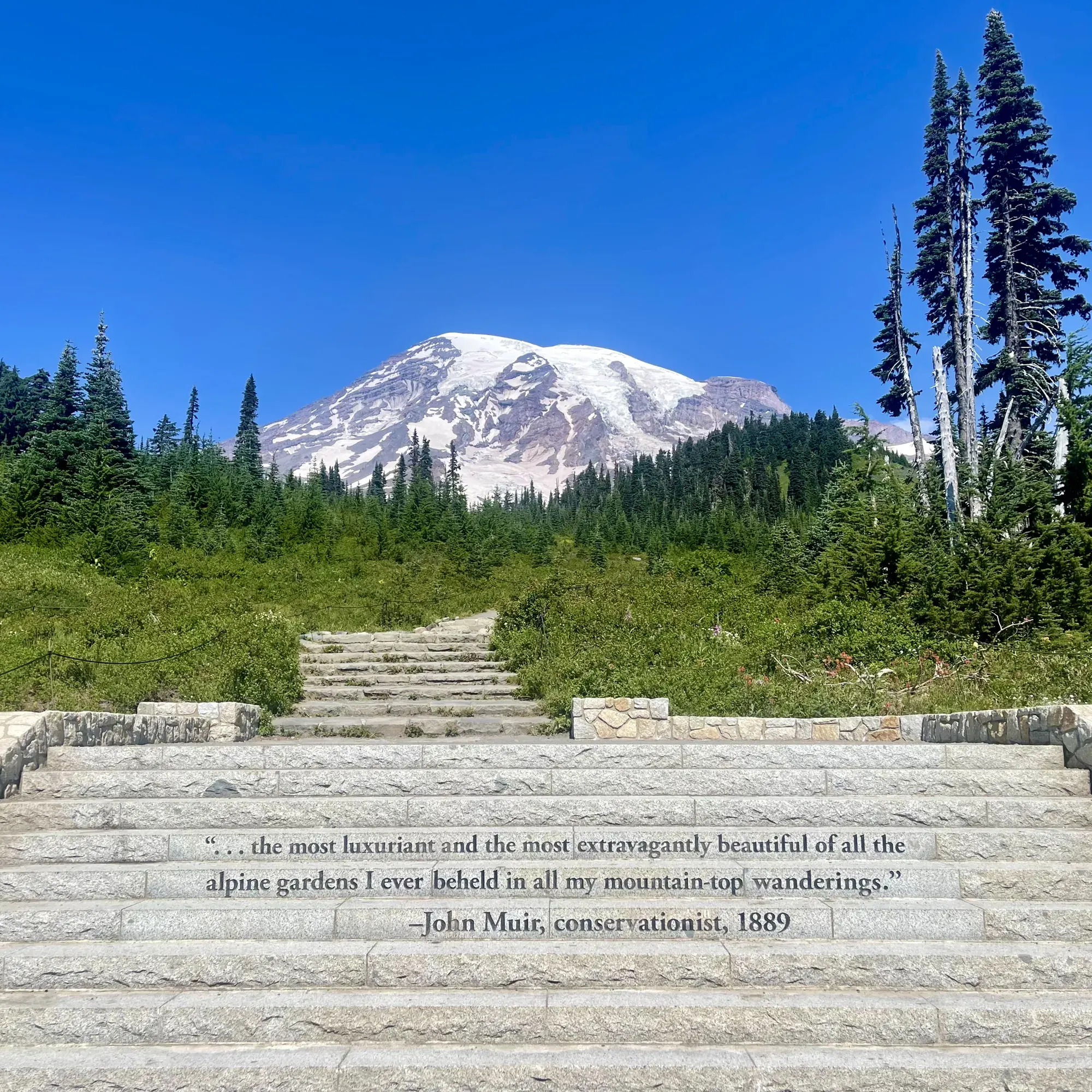
Burroughs Mountain Trail
Hike the Burroughs Mountain Trail for outstanding mountain views and to visit the most accessible tundra in the Cascade Range.
Mount Rainier · Photo: David & Keri New
- 4.7 miDistance
- 900 ftElevation gain
- 3–6 hrTime
- StrenuousDifficulty
The numbers, with sources
Distance: 4.7 miles round trip to First Burroughs; 7 miles to Second Burroughs. Source
Gain: 900 feet to First Burroughs; 1,150 feet to Second Burroughs. Source
Time: 3–6 hours for published route options Source
Difficulty: Narrow, rocky uphill trail with steep drop-offs Source
Trailhead: The Burroughs Mountains can be reached from either the Sourdough Ridge or the Sunrise Rim trails, accessible from the Sunrise Visitor Center parking lot. Source
Route type: out-and-back Source
Built from official sources (checked Nov 3, 2026). Confirm current conditions with the park.
Recreation.gov permits, entrances & campgrounds
Recreation.gov (RIDB). Booking records date not published. NPS guidance above takes precedence. A listing doesn’t mean you need a permit or that there’s space on your dates.
Park campground options (5)
These records belong to the park’s NPS recreation area. We haven’t checked how close these are to the trail, when they open or whether sites are free; check the map and the booking page.
White River Campground — Campground; RIDB reservable: yes. Season: not published in structured RIDB data. Recreation.gov (RIDB) source · Booking details
NPS reservation guidance: When open for the summer, all sites are first-come, first-serve. The campground does not take reservations. NPS source
OHANAPECOSH GROUP CAMPGROUND — Campground; RIDB reservable: yes. Season: not published in structured RIDB data. Recreation.gov (RIDB) source · Booking details
OHANAPECOSH CAMPGROUND — Campground; RIDB reservable: yes. Season: not published in structured RIDB data. Recreation.gov (RIDB) source · Booking details
NPS reservation guidance: Reservations can be made online or by telephone 1-877-444-6777. Ohanapecosh campsites tend to open in mid to late May as weather allows. From opening until the end of June, all open sites are first-come, first-serve. For summer dates June 23, 2016, through early September reservations can be made up to 6 months in advance. Reservations are highly recommended as this campground is very popular. NPS source
COUGAR ROCK CAMPGROUND — Campground; RIDB reservable: yes. Season: not published in structured RIDB data. Recreation.gov (RIDB) source · Booking details
NPS reservation guidance: Reservations can be made online or by telephone 1-877-444-6777. Cougar Rock campsites tend to open in mid to late May as weather allows. From opening until the end of June, all open sites are first-come, first-serve. Reservations are accepted up to 6 months in advance. NPS source
COUGAR ROCK GROUP CAMPGROUND — Campground; RIDB reservable: yes. Season: not published in structured RIDB data. Recreation.gov (RIDB) source · Booking details
Route, junction by junction
Trailhead → Selected destination or loop
The mountains can be reached by Sourdough Ridge or Sunrise Rim. NPS describes a loop through Shadow Lake, an Emmons Glacier overlook, First Burroughs and the Frozen Lake junction. Continuing to Second Burroughs adds a separate westward section. Decide on the combination before treating a single mileage as the whole day. Source
No elevation profile yet:
No elevation profile yet: we haven’t verified complete measurements for this route. Source
In-depth guide
Compiled from linked sources, checked Nov 2, 2026. Each paragraph links to its source.
Is this hike for you?
Burroughs Mountain is a series of three peaks on Mount Rainier’s northeast slope, and the trail is the most accessible way onto alpine tundra in the Cascade Range. You pick how far to go. First Burroughs is 4.7 miles round trip with 900 feet of gain; Second Burroughs is 7 miles round trip with 1,150 feet. The NPS gives 3-6 hours for the round trip. Expect a narrow, rocky uphill trail with steep drop-offs. The NPS doesn’t give a distance to Third Burroughs, so we don’t either. Source
The trail
You can reach the Burroughs from the Sourdough Ridge Trail or the Sunrise Rim Trail, both from the Sunrise Visitor Center parking lot, and you can loop from First Burroughs using both. Taking Sunrise Rim up or down adds only 0.4 miles over Sourdough Ridge. The Sunrise Rim trailhead is on the south side of the Sunrise parking area. The mountain is a rocky, rounded lava flow that formed 500-420 thousand years ago, and it’s named for naturalist and essayist John Burroughs. Source
Going clockwise, you pass Shadow Lake at 1.2 miles on level ground, then climb sharply to an overlook of the White River and Emmons Glacier at 1.6 miles. From there it’s 0.9 miles up onto the wide, flat plateau of First Burroughs. To close the loop, turn right and go 0.75 miles east to the Frozen Lake junction, then 1.4 miles east on the Sourdough Ridge Trail back to the Sunrise parking lot. Or turn left and climb another 0.7 miles west to Second Burroughs, with big views of Mount Rainier and the Emmons Glacier. That adds 250 feet of gain. For closer views still, you can drop 0.4 miles from Second Burroughs to a junction with a trail that descends to White River Campground. Source
Getting to First Burroughs means an uphill climb on a narrow, rocky trail with steep drop-offs in places. The NPS doesn’t give a minimum age. The shorter First Burroughs option is there if part of your group wants less. Source
Snow, season and closures
Sunrise Road usually opens in late June or early July and closes in late September to early October; the NPS lists the trail’s season as summer (July–September). Because it’s so high, the trail can stay under snow after the road opens, and snow on the steep drop-offs makes it more dangerous. Check trail conditions before an early-season hike, and don’t push on to a higher peak across snow you aren’t sure of. Source
An NPS alert from November 3, 2026 said White River and Sunrise Roads had closed for the winter, along with Paradise Valley, Ricksecker Point and Stevens Canyon Roads. Closed roads may be open to bicycling when no work is going on; check the signs on the gates. A second alert closed Grand Park and its trails, the Northern Loop Trail, the Wonderland Trail from Carbon River Suspension Bridge to Frozen Lake, and nearby backcountry campgrounds until further notice because of active fires on the north side of the park. Check current alerts before you go. Source · Source 2 · Source 3
Distance and elevation
The NPS figures are 900 feet of gain to First Burroughs and 1,150 feet to Second Burroughs. Keep each distance tied to its destination: the loop total isn’t the distance to any one viewpoint. Source · Source 2
There’s no elevation profile yet: we haven’t verified complete measurements for this route. Source · Source 2
Water and food
The NPS doesn’t list water or restrooms along the trail. Bring all the water you’ll need for the round trip, plus food, layers and any medication. Source
Dogs, permits and fees
Pets aren’t allowed on the trails. Stay on the trail: the tundra is fragile even where it looks like bare soil, and mats of mountain heather can be hundreds of years old. Look for dwarf plants like dwarf lupine. No campfires (backcountry stoves are okay), no bicycles on trails, pack out trash, and don’t feed or disturb wildlife or disturb natural, cultural or archeological features. Source
No reservation is needed for a day hike. You need a wilderness permit to camp at Sunrise Camp, and permits are required for all overnight wilderness use and for travel on glaciers above 10,000 feet. Check the park’s entrance fee for your date. Source · Source 2
Before you go
Before you start, pick First or Second Burroughs and decide if you’ll loop or come back the same way. If the group is slower than you expected, turn back early and stay together. Source
Sources & planning limits
Reviewed 2026-11-03. Check current conditions for your trip dates.
- The NPS gives separate distances for each destination. Keep each one tied to its start and end point. Source
- NPS alert, November 3, 2026: regular winter road closures are in place for Paradise Valley, Ricksecker Point, Stevens Canyon, White River and Sunrise Roads. Closed roads may be open to bicycling when no work is going on. Check the signs on the gates and current alerts before travel. Source
- NPS alert, November 3, 2026: because of several active fires on the north side of the park, Grand Park and its trails, the Northern Loop Trail, the Wonderland Trail from Carbon River Suspension Bridge to Frozen Lake, and nearby backcountry campgrounds are closed until further notice. White River and Sunrise Roads have closed for the winter. Check current alerts before travel. Source
- No elevation profile yet: we haven’t verified complete measurements for this route. Source
- NPS details are as of the date shown. Confirm access, services and reservations for your travel date. Source
Getting there and back
The NPS alerts we last checked show Sunrise Road closed for winter. The Burroughs Mountains can be reached from either the Sourdough Ridge or the Sunrise Rim trails, accessible from the Sunrise Visitor Center parking lot. Source
Return: Come back the way described above. Return along the same trail unless a separate transport plan has been confirmed. Source
Water
No complete route-specific drinking-water or restroom schedule confirmed. Carry water for the whole hike. Source
Hazards
Burroughs Mountain Trail allows hikers to choose a shorter or longer hike depending on their fitness and preference. Getting to First Burroughs requires hiking uphill on a narrow, rocky trail with areas of steep drop offs. Continuing to Second Burroughs adds 250 feet elevation gain. Due to its high elevation, portions of the Burroughs Mountain trail can remain snow-covered after the road to Sunrise opens. Given the trail’s steep drop offs the presence of snow can make it more hazardous. Check trail conditions before hiking early in the season. Source
Season
The Sunrise Road usually opens in late June or early July and closes in late September to early October. Due to its high elevation, the Burroughs Mountain trail can remain snow-covered after the road to Sunrise opens. Check trail conditions before hiking early in the summer season. Source
The Sunrise Road usually opens in late June or early July and closes in late September to early October. Due to its high elevation, the Burroughs Mountain trail can remain snow-covered after the road to Sunrise opens. Check trail conditions before hiking early in the summer season. Source
Gear & rules
Follow current signs and closures, and treat any side trip as a separate decision. Source
Filling a gap in your kit? Compare these packing essentials on Amazon. Choose gear for your route, conditions and the park’s guidance.
As an Amazon Associate we earn from qualifying purchases. How this works
The NPS doesn’t publish a pet rule for this exact route. Confirm the applicable rule before bringing an animal. Source
Questions
Which route do these figures describe?
4.7 miles round trip to First Burroughs; 7 miles to Second Burroughs. Burroughs has several destination and route choices from Sunrise. This page treats First and Second Burroughs as separate destinations. NPS gives 4.7 miles round trip with nine hundred feet of gain for First, and seven miles with 1,150 feet for Second. The NPS doesn’t give a Third Burroughs distance, and we don’t guess one. Source
Is the trail open right now?
No. NPS details as of Nov 3, 2026. Confirm current conditions and closures with NPS. Source
Is there a measured elevation profile?
No elevation profile yet: we haven’t verified a complete line for this route. Source
Alternatives
Sunrise Road opening doesn’t confirm a snow-free trail. NPS warns that snow can remain on steep, exposed sections after vehicles can reach Sunrise. The tundra is fragile even where it looks bare, so stay on the trail. An optional higher destination is not a reason to continue across hazardous snow. Source
More Mount Rainier trail guides
- Naches Peak Loop3.4 mi · Easy
- Rampart Ridge Loop4.6 mi · Moderate
- Skyline Trail Loop5.5 mi · Strenuous