Rampart Ridge Loop
Rampart Ridge is a loop above Longmire on the remnant of an ancient lava flow from Mount Rainier’s summit. Start at the west end of the Trail of the Shadows, across the road from the National Park Inn; the Rampart Ridge Trail begins about 0.2 mile in. NPS recommends going clockwise to keep Mount Rainier in front more of the time. A viewpoint up the Nisqually River Valley comes at 1.8 miles, and at 2.9 miles you join the Wonderland Trail for the return to Longmire. NPS gives 4.6 miles, 1,339 feet of elevation gain and 2.5 hours.
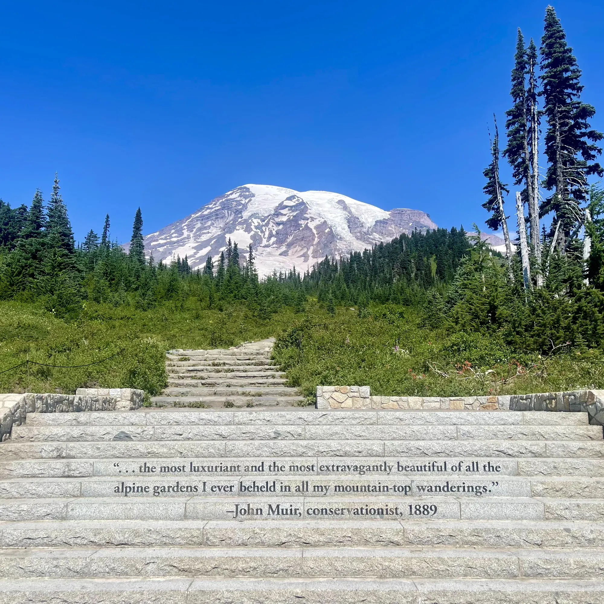
Mount Rainier · Photo: David & Keri New
- 4.6 miDistance
- 1,339 ftElevation gain
- 2.5 hrTime
- ModerateDifficulty
The numbers, with sources
Distance: 4.6-mile loop. Source
Gain: 1,339 feet. Source
Time: 2.5 hours round trip. Source
Difficulty: Moderate (NPS calls it a moderate loop trail). Source
Trailhead: West end of the Trail of the Shadows, across the road from the National Park Inn in Longmire; the Rampart Ridge Trail begins about 0.2 mile in. Source
Route type: Loop; NPS recommends clockwise Source
Built from official sources (checked Nov 15, 2026). Confirm current conditions with the park.
Recreation.gov permits, entrances & campgrounds
Recreation.gov (RIDB). Booking records date not published. NPS guidance above takes precedence. A listing doesn’t mean you need a permit or that there’s space on your dates.
Park campground options (5)
These records belong to the park’s NPS recreation area. We haven’t checked how close these are to the trail, when they open or whether sites are free; check the map and the booking page.
White River Campground — Campground; RIDB reservable: yes. Season: not published in structured RIDB data. Recreation.gov (RIDB) source · Booking details
NPS reservation guidance: When open for the summer, all sites are first-come, first-serve. The campground does not take reservations. NPS source
OHANAPECOSH GROUP CAMPGROUND — Campground; RIDB reservable: yes. Season: not published in structured RIDB data. Recreation.gov (RIDB) source · Booking details
OHANAPECOSH CAMPGROUND — Campground; RIDB reservable: yes. Season: not published in structured RIDB data. Recreation.gov (RIDB) source · Booking details
NPS reservation guidance: Reservations can be made online or by telephone 1-877-444-6777. Ohanapecosh campsites tend to open in mid to late May as weather allows. From opening until the end of June, all open sites are first-come, first-serve. For summer dates June 23, 2016, through early September reservations can be made up to 6 months in advance. Reservations are highly recommended as this campground is very popular. NPS source
COUGAR ROCK CAMPGROUND — Campground; RIDB reservable: yes. Season: not published in structured RIDB data. Recreation.gov (RIDB) source · Booking details
NPS reservation guidance: Reservations can be made online or by telephone 1-877-444-6777. Cougar Rock campsites tend to open in mid to late May as weather allows. From opening until the end of June, all open sites are first-come, first-serve. Reservations are accepted up to 6 months in advance. NPS source
COUGAR ROCK GROUP CAMPGROUND — Campground; RIDB reservable: yes. Season: not published in structured RIDB data. Recreation.gov (RIDB) source · Booking details
Route, junction by junction
Route selection → Described destination
Rampart Ridge is a loop above Longmire on the remnant of an ancient lava flow from Mount Rainier’s summit. Start at the west end of the Trail of the Shadows, across the road from the National Park Inn; the Rampart Ridge Trail begins about 0.2 mile in. NPS recommends going clockwise to keep Mount Rainier in front more of the time. A viewpoint up the Nisqually River Valley comes at 1.8 miles, and at 2.9 miles you join the Wonderland Trail for the return to Longmire. NPS gives 4.6 miles, 1,339 feet of elevation gain and 2.5 hours. Source
No elevation profile yet:
No elevation profile yet: we haven’t verified a complete line for this route. No partial line, invented connector, scaled mileage or flat profile is substituted. Source
In-depth guide
Compiled from linked sources, checked Nov 15, 2026. Each paragraph links to its source.
Is this hike for you?
Rampart Ridge is a moderate 4.6-mile loop above Longmire with 1,339 feet of elevation gain. The NPS gives 2.5 hours round trip. The ridge, also called “The Ramparts,” is what’s left of an ancient lava flow from the summit of Mount Rainier, and the trail runs through forest with glimpses of the mountains around it. Source
The trail
Start at the west end of the Trail of the Shadows, across the road from the National Park Inn in Longmire. That stretch is a fairly flat, wide path with a boardwalk. About 0.2 mile in, the Rampart Ridge Trail starts and climbs steep switchbacks through dense forest to the top of the ridge. You can go either way, but the NPS recommends clockwise because it keeps Mount Rainier in front of you more of the time. Source
At 1.8 miles there’s a viewpoint up the Nisqually River Valley. The ridge itself is fairly level, with two viewpoints that look out at Mount Rainier and the valley on a clear day. Listen for woodpeckers and grouse and watch for deer. At 2.9 miles you join the Wonderland Trail for the return to Longmire, which has boardwalk sections and steep stairs, some up to a foot tall. The trail is rocky and rooted throughout. Source
When to go
Longmire is open year-round, but snow can make this trail hazardous in winter, and winter hikers and snowshoers need navigation experience. There are no wilderness camps on the trail. Source
Before you go
The NPS doesn’t give leg times, parking-fill times, shuttle times or services for this hike, so bring the water and food you need. Source
NPS trail maps and OpenStreetMap both list a Rampart Ridge Trail, but neither gives us a verified complete loop, so there’s no elevation profile yet. Source · Source 2
Getting there and back
West end of the Trail of the Shadows, across the road from the National Park Inn in Longmire; the Rampart Ridge Trail begins about 0.2 mile in. Source
Return: Use the return described in the official route account. Don’t count on a shuttle, boat, flight or pickup unless you have confirmed it yourself. Source
Water
The NPS doesn’t publish a full list of water and restrooms along this route. Use only the facilities explicitly identified in the NPS account; confirm current operations. Source
Hazards
The climb comes first: NPS says the hike begins steeply, with switchbacks to the top of the ridge, and the trail is rocky and rooted throughout. The descent on the Wonderland Trail has boardwalk sections and steep stairs, some up to a foot tall. Longmire is open year-round, but snow can make the trail hazardous in winter, and winter hikers and snowshoers must have navigation experience. There are no wilderness camps on this trail. Source
Season
While Longmire is open year-round, snow can make this trail hazardous in winter. Winter hikers and snowshoers must have experience with navigation. Source
While Longmire is open year-round, snow can make this trail hazardous in winter. Winter hikers and snowshoers must have experience with navigation. Source
Gear & rules
Respect current closures, signs and barriers. A mapped path is not proof that travel is permitted. Source
Filling a gap in your kit? Compare these packing essentials on Amazon. Choose gear for your route, conditions and the park’s guidance.
As an Amazon Associate we earn from qualifying purchases. How this works
The NPS doesn’t publish a pet rule for this exact route; confirm with the park before bringing an animal. Source
Questions
Which hike is this?
Rampart Ridge is a loop above Longmire on the remnant of an ancient lava flow from Mount Rainier’s summit. Start at the west end of the Trail of the Shadows, across the road from the National Park Inn; the Rampart Ridge Trail begins about 0.2 mile in. NPS recommends going clockwise to keep Mount Rainier in front more of the time. A viewpoint up the Nisqually River Valley comes at 1.8 miles, and at 2.9 miles you join the Wonderland Trail for the return to Longmire. NPS gives 4.6 miles, 1,339 feet of elevation gain and 2.5 hours. 4.6-mile loop. Source
Is a measured elevation profile available?
No elevation profile yet: we haven’t verified a complete line for this route. No partial line, invented connector, scaled mileage or flat profile is substituted. Source
Alternatives
Alternative-route distances and durations are unavailable unless separately described in the source. Side trails aren’t included. Source
More Mount Rainier trail guides
- Burroughs Mountain Trail4.7 mi · Strenuous
- Naches Peak Loop3.4 mi · Easy
- Skyline Trail Loop5.5 mi · Strenuous