South Kaibab Trail: Day-Hike Turnarounds
Select a South Kaibab day-hike turnaround before descending. This page doesn’t suggest going to the river and back in a day or hiking rim to rim.
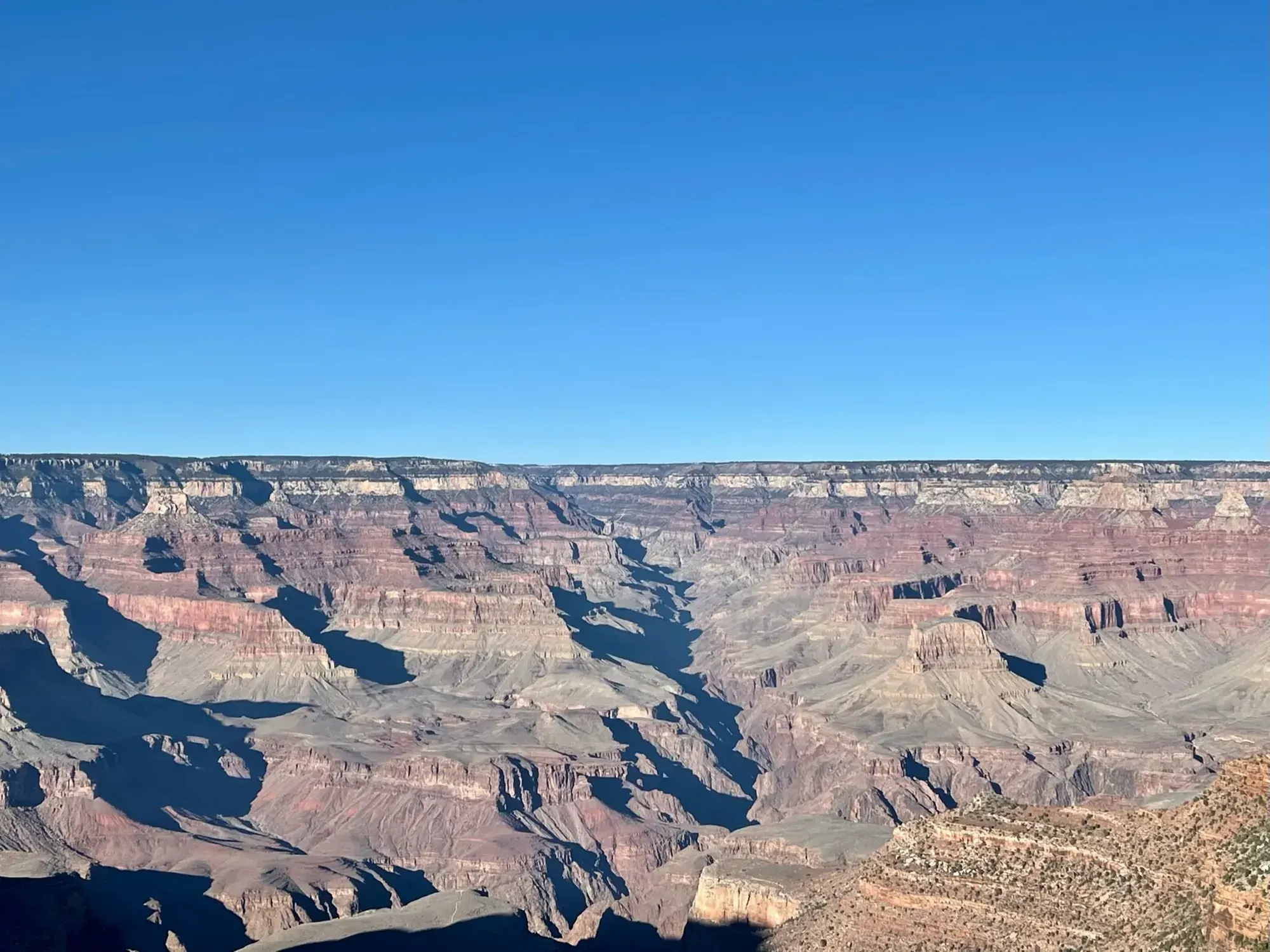
Grand Canyon · Photo: David & Keri New
- 1–2 hrTime
- StrenuousDifficulty
The numbers, with sources
Distance: Choose a named turnaround; do not use the full river descent as a casual day-hike plan Source
Gain: Descent must be regained on return; see official turnaround figures Source
Time: Ooh Aah Point: 1–2 hours; Cedar Ridge: 2–4 hours; longer turnarounds require a separate decision Source
Difficulty: *Note: all trails into the canyon are steep and difficult; consider contacting a park ranger before starting your hike. Source
Trailhead: No public parking at the South Kaibab Trailhead. The NPS listing directs day visitors to park at Grand Canyon Visitor Center and use the Kaibab Orange Route shuttle; verify current service. Source
Route type: out-and-back Source
Built from official sources (checked Nov 3, 2026). Confirm current conditions with the park.
Recreation.gov permits, entrances & campgrounds
Recreation.gov (RIDB). Booking records date not published. NPS guidance above takes precedence. A listing doesn’t mean you need a permit or that there’s space on your dates.
Park campground options (4)
These records belong to the park’s NPS recreation area. We haven’t checked how close these are to the trail, when they open or whether sites are free; check the map and the booking page.
North Rim Campground (AZ) — Campground; RIDB reservable: yes. Season: not published in structured RIDB data. Recreation.gov (RIDB) source · Booking details
Trailer Village RV Park - South Rim — Campground; RIDB reservable: no. Season: not published in structured RIDB data. Recreation.gov (RIDB) source · Booking details
NPS reservation guidance: Reservations can be made up to 13 months in advance. If visiting during the busy season (May through October) making reservations 1 year in advance is recommended. NPS source
MATHER CAMPGROUND — Campground; RIDB reservable: yes. Season: not published in structured RIDB data. Recreation.gov (RIDB) source · Booking details
NPS reservation guidance: From March 1, through November 30 (Peak Season) most campsites are by reservation only through recreation.gov. Mather campground offers 15 first-come, first-served sites that go on sale at 8 am. None of Mather Campground’s sites have hook-ups or electricity. Full hook-ups are available at adjacent Trailer Village RV Campground, operated by Delaware North. NPS source
Desert View Campground — Campground; RIDB reservable: yes. Season: not published in structured RIDB data. Recreation.gov (RIDB) source · Booking details
NPS reservation guidance: Campsites for the 2026 season are by reservation only, through www.recreation.gov. Reservations can be made with them online, by clicking the reservation button below, or by phone (877-444-6777). Reservations can be made 6 months in advance for the 2026 season that runs from Saturday, April 11 through Sunday, October 18, 2025, with the campground closing for the season on Monday, October 19, 2026. Due to high demand, Desert View Campground now requires advanced reservations. You may book reservations up to 6 months in advance. Desert View Campground does not hold back any campsites for first-come, first-served camping during peak season and does not have a wait list or call back system. Same Day Reservations can be made online (www.recreation.gov) or by phone (877-444-6777). NPS source
Route, junction by junction
South Kaibab Trailhead → Ooh Aah Point
Get to the trailhead by shuttle, on foot or by bike; there’s no public parking. Ooh Aah Point is the first turnaround, 1.8 miles round trip. Source
Ooh Aah Point → Cedar Ridge
Keep going only if you have plenty left for the climb back. Cedar Ridge is 3 miles round trip. There’s no drinking water on the trail. Source
Cedar Ridge → Skeleton Point or return
Skeleton Point is 6 miles round trip, and the NPS says to check with a ranger before trying it as a day hike. Come back up the same trail; don’t go below it on a day hike. Source
No elevation profile yet:
No elevation profile yet: we haven’t verified complete measurements for this route. Source
In-depth guide
Compiled from linked sources, checked Nov 3, 2026. Each paragraph links to its source.
Decisions & preparation
We only show distances between points where the NPS publishes them. We don’t split the total into made-up segments. Source
Turnaround & return planning
Turn around at the closer point before the group runs low on energy, water or daylight. Remember the climb out is the hard part. Planning basis
Parking & transport timing
No public parking at the South Kaibab Trailhead. The NPS tells day visitors to park at Grand Canyon Visitor Center and take the Kaibab Orange Route shuttle. Check that it’s running; the NPS doesn’t list pickup times here. Source
What to bring by season
Any season: the NPS Ten Essentials (navigation, sun protection, extra clothing, a light, first aid, fire supplies where allowed, repair tools, extra food, water and emergency shelter). Tell someone your route and when you’ll be back. Source
Warm weather: sun protection, plenty of water and extra food. Cold or wet weather: warm layers and rain gear, plus an extra layer in case you’re out longer than planned. Source
Children & mobility
The NPS doesn’t publish accessibility details for this trail. Source
Is this hike for you?
The South Kaibab Trail is a well-maintained dirt trail down into the Grand Canyon with wide-open views. It makes a good half-day hike or less if you pick a named turnaround and come back up the same way. Every step down has to be climbed back out, and the NPS says all trails into the canyon are steep and difficult, so consider talking to a ranger before you start. Source
Where to turn around
The NPS lists three day-hike turnarounds, all round trip from the rim. Ooh Aah Point is 1.8 miles (2.9 km), 1-2 hours, with 790 feet (230 m) of elevation change. Cedar Ridge is 3 miles (4.8 km), 2-4 hours, with 1,120 feet (340 m). Skeleton Point is 6 miles (9.6 km), 4-6 hours, with 2,040 feet (620 m), and the NPS says to check with a ranger before trying it as a day hike. Source
Don’t go below Skeleton Point on a day hike. The NPS advises against it because of the long distance, extreme temperature changes and an elevation change of about 5,000 feet (1,500 m) each way. Talk to a ranger about safety and overnight permits if you want to go farther. Source
Heat, shade and water
The trail is very exposed. It gets extremely hot in summer, and there’s little to no shelter from passing storms. What shade there is comes from the canyon walls near the top, early in the day. There’s no water on the trail. In summer there’s a spring-fed water filling station at the trailhead, so fill up there and carry enough for the climb out. Source
Getting to the trailhead
You can’t drive to the South Kaibab Trailhead: no private vehicles, no public parking. Get there on foot, by bicycle or by shuttle. The NPS tells day visitors to park at Grand Canyon Visitor Center and take the Kaibab Orange Route shuttle. Check that the shuttle is running before you rely on it. Source
Permits and fees
The NPS doesn’t say whether you need a reservation for a day hike here. Source
The park entrance fee is $35.00 for a private, non-commercial vehicle and everyone in it, up to a 15 person passenger van. Organized non-commercial groups over 16 passengers pay different fees, and commercial groups can’t use the vehicle permit. Source
Kids, strollers and wheelchairs
The NPS doesn’t publish accessibility details or an age guide for this trail. It’s a steep dirt trail into the canyon, so plan on a short turnaround like Ooh Aah Point with kids. Source
Before you go
When we checked, the park had inner canyon trail closures: the entire North Kaibab Trail (including Cottonwood Campground), Phantom Ranch, Bright Angel Campground, Silver Bridge and the Black Bridge. Those are all below the day-hike turnarounds, but check the park’s current alerts before you go and stay out of closed areas. Source
The NPS doesn’t publish a season or pet rules for this trail, so check the park’s pet rules before you bring a dog. Bring the park map, agree on your turnaround before you start, and turn back early if the group is slower than expected. Source
Elevation profile
There’s no elevation profile yet: we haven’t verified complete measurements for this route. Source
Sources & planning limits
Reviewed 2026-11-03. Check current conditions for your trip dates.
- The NPS elevation figures for this trail don’t all line up, and we haven’t worked out a total climb from them. Source
- NPS details are as of the date shown. Confirm access, services and reservations for your travel date. Source
- We don’t rate this trail for kids or mobility needs. Check the NPS accessibility details before you go. Source
- We haven’t confirmed access, transport or services for your date. Check with the NPS and the shuttle before you rely on them. Source
- No elevation profile yet: we haven’t verified complete measurements for this route. Source
Getting there and back
No public parking at the South Kaibab Trailhead. The NPS listing directs day visitors to park at Grand Canyon Visitor Center and use the Kaibab Orange Route shuttle; verify current service. Source
Return: Complete the return arrangement described for this route. Distances and elevations in the source describe several destinations. Keep each number tied to its named point, and pick a turnaround your group can climb back from. A fast descent doesn’t confirm the time or effort needed to climb back to the rim. Source
Water
There is no water along the trail, though there is a spring-fed water filling station at the trailhead during the summer. Source
Hazards
This can be a great trail for short trips into the canyon of half a day or less, but the openness of this trail lends itself to extreme heat during the summer months and little to no protection from passing storms. Source
*Note: all trails into the canyon are steep and difficult; consider contacting a park ranger before starting your hike. Source
Season
The NPS does not publish a seasonal opening window for this route. Source
The NPS does not publish a seasonal opening window for this route. Source
Gear & rules
The NPS does not publish pet rules for this exact route. Source
Filling a gap in your kit? Compare these packing essentials on Amazon. Choose gear for your route, conditions and the park’s guidance.
As an Amazon Associate we earn from qualifying purchases. How this works
Questions
Which hike is this?
Select a South Kaibab day-hike turnaround before descending. This page doesn’t suggest going to the river and back in a day or hiking rim to rim. Source
Are the published figures fully consistent?
Distances and elevations in the source describe several destinations. Keep each number tied to its named point, and pick a turnaround your group can climb back from. A fast descent doesn’t confirm the time or effort needed to climb back to the rim. Source
Is there an elevation profile?
No elevation profile: the NPS map line keeps going to the river, and this page covers named short turnarounds. No sourced coordinate for those turnarounds was verified, so a full river-descent profile is not substituted. Source
Alternatives
Camp near South Kaibab Trail: Day-Hike Turnarounds
Closest campgrounds by drive time to South Kaibab Trailhead:
- 16 min Mather (4.2 mi, in the park)
- 28 min Tusayan - Montane ↗ (11.2 mi, USDA Forest Service)
- 42 min Desert View (21.5 mi, in the park)
- 4 hr 21 min Demotte ↗ (191.3 mi, USDA Forest Service)
- 4 hr 49 min North Rim (208.1 mi, in the park)
Driving time with no traffic (OSRM, OpenStreetMap roads). Some park roads are shuttle-only in season. All camping near Grand Canyon
More Grand Canyon trail guides
- Bright Angel Trail (day hikes)3 mi · Strenuous
- Grand Canyon Rim-to-Rim13.7 mi one way
- Grandview Trail to Coconino Saddle2.2 mi · Strenuous
- Hermit Trail to Santa Maria Spring5 mi
- Rim Trail at Mather Point0.7 mi one way