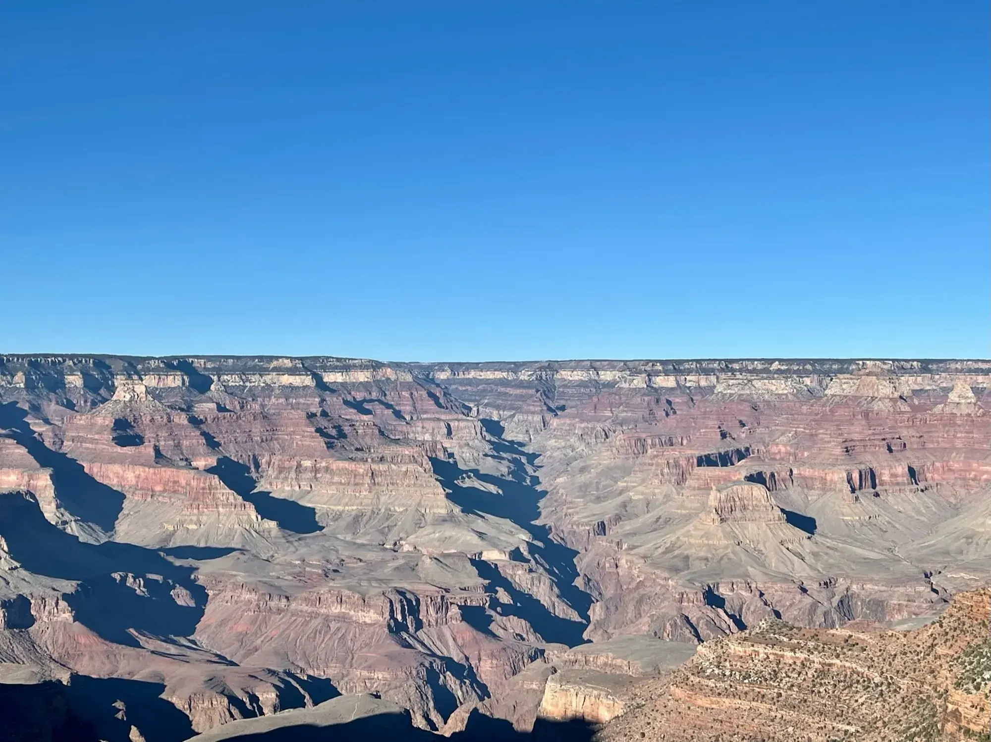
Grand Canyon Rim-to-Rim
The corridor crossing links the North Kaibab Trail with Bright Angel or South Kaibab on the South Rim. It is currently unavailable because the North Kaibab Trail, river bridges and Phantom Ranch area are closed after flash flooding.
Permit required
Grand Canyon · Photo: David & Keri New
- 13.7 mi one wayDistance
The numbers, with sources
Distance: NPS publishes component distances to Bright Angel Campground: North Kaibab 13.7 mi one way, Bright Angel 9.5 mi, South Kaibab 7.0 mi. A single crossing total is not published in this source. Source
Difficulty: A North Kaibab day hike beyond Roaring Springs is not recommended; do not attempt rim-to-river-and-back in a day. Source
Trailhead: North Kaibab Trailhead on North Rim; Bright Angel or South Kaibab Trailhead on South Rim. Source
Route type: point-to-point Source
Built from official sources (checked Nov 3, 2026). Confirm current conditions with the park.
Recreation.gov permits, entrances & campgrounds
Recreation.gov (RIDB). Booking records date not published. NPS guidance above takes precedence. A listing doesn’t mean you need a permit or that there’s space on your dates.
Nearby campground records
Within 10 straight-line miles of the trailhead. Distances are straight-line from map coordinates, not driving distances.
- North Rim Campground (AZ): approximately 0.5 miles straight line. RIDB coordinates · Mapped route source
Matched permits & entrances (1)
Grand Canyon National Park Backcountry Permits — Permit; RIDB reservable: yes. Season: not published in structured RIDB data. Recreation.gov (RIDB) source · Booking details
Park campground options (4)
These records belong to the park’s NPS recreation area. We haven’t checked how close these are to the trail, when they open or whether sites are free; check the map and the booking page.
North Rim Campground (AZ) — Campground; RIDB reservable: yes. Season: not published in structured RIDB data. Recreation.gov (RIDB) source · Booking details
Trailer Village RV Park - South Rim — Campground; RIDB reservable: no. Season: not published in structured RIDB data. Recreation.gov (RIDB) source · Booking details
NPS reservation guidance: Reservations can be made up to 13 months in advance. If visiting during the busy season (May through October) making reservations 1 year in advance is recommended. NPS source
MATHER CAMPGROUND — Campground; RIDB reservable: yes. Season: not published in structured RIDB data. Recreation.gov (RIDB) source · Booking details
NPS reservation guidance: From March 1, through November 30 (Peak Season) most campsites are by reservation only through recreation.gov. Mather campground offers 15 first-come, first-served sites that go on sale at 8 am. None of Mather Campground’s sites have hook-ups or electricity. Full hook-ups are available at adjacent Trailer Village RV Campground, operated by Delaware North. NPS source
Desert View Campground — Campground; RIDB reservable: yes. Season: not published in structured RIDB data. Recreation.gov (RIDB) source · Booking details
NPS reservation guidance: Campsites for the 2026 season are by reservation only, through www.recreation.gov. Reservations can be made with them online, by clicking the reservation button below, or by phone (877-444-6777). Reservations can be made 6 months in advance for the 2026 season that runs from Saturday, April 11 through Sunday, October 18, 2025, with the campground closing for the season on Monday, October 19, 2026. Due to high demand, Desert View Campground now requires advanced reservations. You may book reservations up to 6 months in advance. Desert View Campground does not hold back any campsites for first-come, first-served camping during peak season and does not have a wait list or call back system. Same Day Reservations can be made online (www.recreation.gov) or by phone (877-444-6777). NPS source
Route, junction by junction
North Kaibab Trailhead → Supai Tunnel
This is a route description for future planning only: the entire North Kaibab Trail is currently closed. In the NPS trail sheet, the route begins with a steep descent down the head of a valley through numerous switchbacks, with lush vegetation and views below the trailhead. The trail reaches Supai Tunnel; the usual toilets and seasonal water described here do not make the closed trail accessible. Source
Distance: Supai Tunnel is 1.7 miles from North Kaibab Trailhead in this trail sheet; the introductory hiking handout instead lists 2.0 miles. Source
Elevation: North Kaibab trailhead 8,241 ft; Supai Tunnel 6,800 ft. Source
Supai Tunnel → Roaring Springs area
Switchbacks continue into the Redwall Limestone cliffs. For long stretches the path is blasted into the cliff as a half tunnel, with considerable exposure and broad views. Where the steep descent reaches the flatter bottom of Bright Angel Canyon, Roaring Springs gushes from the cliffs over moss and fern to form Bright Angel Creek. Source
Distance: Roaring Springs is listed 4.7 miles from the North Kaibab trailhead. Source
Elevation: Roaring Springs elevation: 5,220 ft. Source
Junction: Roaring Springs side trip: NPS identifies Roaring Springs as a side-trip destination along North Kaibab; this is not a reason to enter the currently closed trail. Source
Roaring Springs area → Manzanita Rest Area
Continue down-canyon toward the former Pumphouse or Aiken Residence, now a ranger station. The nearby Manzanita Rest Area provides access to Bright Angel Creek, a toilet and shaded benches in the normal route description. Its usual drinking-water service is currently off, and access is prohibited by the North Kaibab closure. Source
Distance: Manzanita is 5.4 miles from the trailhead in the March 2024 trail sheet; the introductory handout instead gives 5.1 miles. Source
Elevation: Manzanita Rest Area elevation: 4,600 ft. Source
Manzanita Rest Area → Cottonwood Campground
Passing the former Aiken Residence signals the approach to Cottonwood Campground. NPS describes Cottonwood as the designated campground near the halfway point of North Kaibab. At-large camping is prohibited on this trail; a normal overnight itinerary must use designated campgrounds and have the required backcountry permit. Source
Distance: Cottonwood is listed 6.8 miles from North Kaibab Trailhead in this sheet, versus 6.5 in the introductory handout. Source
Elevation: Cottonwood Campground elevation: 4,080 ft. Source
Cottonwood Campground → Ribbon Falls side-trip area
Ribbon Falls is described as a waterfall in a grotto on the west side of Bright Angel Creek, downstream from Cottonwood. The NPS sheet says the bridge to the falls no longer exists and reaching the falls requires finding a place to ford. Spring snowmelt can make the crossing high, fast and dangerous; the falls are an optional side trip, not an obligatory river crossing on the main route. Source
Distance: Cottonwood to Ribbon Falls side destination: 1.6 miles. This is not a mileage for the main-trail junction. Source
Elevation: Ribbon Falls side destination elevation: 3,720 ft; not a main-trail junction elevation. Source
Junction: Ribbon Falls side trip: The waterfall is across Bright Angel Creek west of the main trail. The former bridge is gone; the official sheet warns that spring crossings can be dangerous. Source
Cottonwood / Ribbon Falls area on main trail → Bright Angel Campground and Phantom Ranch
Between Cottonwood and Bright Angel campgrounds the main trail enters the Inner Gorge. Vishnu Schist walls enclose the trail on both sides, creating the narrow section NPS describes as an oven in summer. Although the elevation profile is less demanding here, the entire low-elevation stretch becomes extremely hot from early morning through late afternoon; the normal trail sheet advises reaching Bright Angel Campground before 10 am. Source
Distance: Cottonwood to Bright Angel Campground: 7.2 miles on the main trail; Bright Angel Campground is 14 miles from North Kaibab Trailhead in this sheet. Source
Elevation: Bright Angel Campground elevation: 2,480 ft. Source
Bright Angel Campground / north bank → River Resthouse via Silver Bridge
The normal Bright Angel corridor connection crosses the Colorado River on Silver Bridge and follows exposed sand dunes toward the River Resthouse. The NPS trail sheet warns that the dune section exceeds a mile and becomes a dangerous slog in hot weather. Both Silver Bridge and Black Bridge are currently closed, so no crossing described here is presently available. Source
River Resthouse → Havasupai Gardens
In the north-to-south direction, the climb toward Havasupai Gardens uses the Pipe Creek drainage and the steep Devil’s Corkscrew. The NPS sheet calls the Corkscrew brutally hot in summer and recommends early-morning or late-evening travel. Above this section, the route follows Garden Creek through a winding, water-sculpted gully with cottonwoods. Source
Elevation: Havasupai Gardens elevation: 3,800 ft. Source
Havasupai Gardens → Bright Angel Trailhead, South Rim
Leave the flatter Tonto Platform near Havasupai Gardens and climb the long series of upper Bright Angel switchbacks. Most of this trail’s elevation change lies in its upper four miles. Resthouses provide places to pause on the climb, while canyon walls frame the views and supply shade; current water-off notices still supersede the trail sheet’s normal tap descriptions. Source
Distance: Havasupai Gardens to Bright Angel Trailhead: 4.5 miles. Source
Elevation: Bright Angel trailhead elevation: 6,860 ft. Source
1: North Kaibab Trailhead · 2: Cottonwood Campground · 3: South Kaibab Trailhead
Traced line: 20.89 mi point to point, about 5,799 ft of climbing and 6,826 ft of descent. North Kaibab to South Kaibab trailhead.
North Kaibab to South Kaibab variant: the 20.7 mi comparison adds the published 13.7 mi and 7.0 mi campground distances. Check the current NPS closure notice before planning this crossing. NPS closure notice
Elevations: USGS 3DEP (public domain). Route: National Park Service GIS. Named waypoints: © OpenStreetMap contributors (ODbL 1.0). Terrain sampling and smoothing can miss short climbs and steep steps.
Elevation waypoint table
| Waypoint | Mile | Elevation (ft) |
|---|---|---|
| 1. North Kaibab Trailhead | 0.00 | 8,240 |
| 2. Cottonwood Campground | 6.74 | 4,034 |
| 3. South Kaibab Trailhead | 20.89 | 7,213 |
Method: Centered 50 m moving average (5 m trapezoidal integration; clamped endpoints); 3 m hysteresis. Elevations and distances are estimates along the mapped route. Published route figures.
In-depth guide
Compiled from linked sources, checked Nov 3, 2026. Each paragraph links to its source.
Decisions & preparation
We only show a leg’s distance when the NPS publishes it. We don’t split the total into made-up pieces. Source
Turnaround & return planning
Turn back before the group runs low on energy, water or daylight. Don’t count on a rescue, a road pickup or an easy way out. Planning basis
Parking & transport timing
South Kaibab trailhead is reached by shuttle bus; Bright Angel starts west of Bright Angel Lodge. Check current closure notices before hiking. The NPS doesn’t say when parking fills. Source
For South Kaibab, take the Kaibab Trail Route shuttle. Bright Angel starts west of Bright Angel Lodge. The NPS page doesn’t give a shuttle between the rims or a last departure time, so don’t mix up South Rim shuttles with getting from rim to rim. Shuttle source
What to bring by season
All seasons: the NPS Ten Essentials (navigation, sun protection, extra clothing, a light, first aid, fire supplies where allowed, repair tools, extra food, water and emergency shelter). Leave your plan and return time with someone. Source
Hot weather: sun protection, plenty of water and extra food. Cold or wet weather: warm layers and rain gear, plus extra clothing in case you’re out longer than planned. Source
The North Rim status page lists day use through November 30, 2026 or the first major snowstorm. That’s about North Rim access, not North Kaibab or the bridges reopening. The tentative May 15, 2027 campground reopening isn’t a trail reopening date. Source
May and September are hot and mostly dry, June is extremely hot and dry, and July–August are hot with monsoon thunderstorms. In summer the NPS says not to hike from 10 am to 4 pm and warns about lightning, falling rocks and flash floods in storms. Source
Winter brings short days, long cold nights, possible snow and ice on the rims and rain in the canyon. Spring and fall weather swings a lot, with frequent high winds and both snow and intense heat possible. The handout recommends traction devices for leftover spring ice or early fall snow. Source
Children & mobility
The NPS doesn’t give a minimum age or mobility rating. Think about the steps, exposure and distance back when you decide. (Unconfirmed: No rating from the NPS.) Source
Is the crossing open?
Not when we checked. The entire North Kaibab Trail was closed, and so were both river bridges (Silver Bridge and Black Bridge), so there was no way to cross the canyon on foot. The route below is for planning a future trip. Check the park’s current notices before you book anything. Source
Parts of the South Rim corridor were open: the flood-recovery notice allowed the Bright Angel Trail to River Resthouse and the South Kaibab Trail to Black Bridge, with the bridge itself closed. Each of those is an out-and-back hike with its own return. Stop at barriers even if the trail past them looks fine. Source
The route
The NPS publishes distances to Bright Angel Campground by trail: North Kaibab 13.7 miles one way, Bright Angel 9.5 miles and South Kaibab 7.0 miles. It doesn’t publish a single total for the crossing. The leg-by-leg description, with the places where NPS handouts disagree on mileage, is in the plan below. Source
Getting between the rims
The drive between the South and North rims is about 212 road miles, roughly four and a half hours each way. That’s separate from the hike and from South Rim shuttles. Arrange the car and the transfer first, and have a plan for anyone who finishes late. Source · Source 2 · Source 3
The North Rim entrance is 30 miles south of Jacob Lake on Highway 67, and the rim is another 14 miles past the entrance. Source
North Rim roads and seasons
The North Rim road normally closes December 1 through May 14, with no vehicle access (snowmobiles included) and no visitor services. The park’s 2026 fall notice said it could close earlier after a major snowstorm. Cape Royal Road and Point Imperial Road were also closed for repairs from sunset October 15 through sunrise November 3, 2026. An open road doesn’t mean the trails and bridges are open. Source
Permits and camping
Any overnight in the canyon needs a backcountry permit. The early-access lottery gives up to 750 applicants a set time to log in, see availability and reserve an itinerary; it doesn’t award a specific campsite. Have backup itineraries ready. Permits are good only for the named leader, itinerary, group size and dates. Carry the printed permit and display it on your gear once you’ve set up camp. Source
Camping groups can’t be larger than eleven people in one campground or use area, and the park voids permits when one group uses several permits for the same place on the same night. More permits are available for small groups (1-6 people) than large ones (7-11). Source
You can stay up to two nights per campground per hike, consecutive or not. From November 15 through February 28 the corridor campgrounds allow up to four nights per campground per trip. Phantom Ranch dorms and cabins need a lodging reservation instead of a backcountry permit. Check that the lodging is operating and that you can reach it. Source
Water
Don’t rely on old lists of where the taps are; read the park’s current water status. Silt keeps disinfection from working, so muddy water may need to settle for several hours before you pour off the clear part to treat. Source
Filtering alone doesn’t make water safe. The park says to filter and then disinfect, or to boil cleared water for one full minute (three minutes above 6,500 feet), and to use clean containers afterward. Source
Ordinary backpacking filters, boiling, bleach and iodine don’t remove cyanotoxins. Don’t collect water from or next to visible cyanobacterial mats, and don’t disturb them. Source
Heat and illness
The inner canyon gets about 5.5°F warmer for every 1,000 feet you descend, and summer highs at Phantom Ranch average roughly 30°F warmer than the rims. Check forecasts for both the rim and the inner canyon. Source
If anyone feels nauseated, dizzy or exhausted, stop and rest. Start drinking and eating slowly until they feel better, which can take an hour or longer. Leave room in the plan for that. Source
Sources & planning limits
Reviewed 2026-11-03. Check current conditions for your trip dates.
- Check closures, transport and services with the NPS for your travel dates. Source
Getting there and back
South Kaibab trailhead access is by shuttle bus; Bright Angel begins west of Bright Angel Lodge. See the current closure notices before hiking. Source
Shuttle: For the South Kaibab alternative, NPS identifies access to the trailhead by the Kaibab Trail Route shuttle. Bright Angel starts west of Bright Angel Lodge. This source does not provide a current inter-rim shuttle schedule or a last departure time; South Rim trailhead access must not be confused with transportation between rims. Source
Return: NPS notes that rim-to-rim hikers with one vehicle often use commercial shuttles between the North and South rims. The trail sheet does not publish an operator, current schedule, fare or guaranteed seat. That general transport description does not make a crossing possible now: North Kaibab and both river bridges remain closed. Arrange any future rim-to-rim transportation only after checking reopening and road access. Source
Water
All inner-canyon water is currently off. Carry sufficient water or collect and properly treat natural water; all hikers should carry a reliable treatment method. Source
All North Rim and inner-canyon water is currently OFF, including North Kaibab Trailhead, Supai Tunnel, Manzanita, Cottonwood, Phantom Ranch, Bright Angel Campground, and Havasupai Gardens. The North Kaibab sites are also inaccessible under the closure. Normal tap locations in route handouts are not current refill promises. Source
The normal North Kaibab sheet says potable-water stations can fail because erosion breaks the pipeline. It directs hikers to check trailhead signs before descending and always carry treatment such as a filter or chemical purification. It identifies creeks between Roaring Springs and the Colorado River as possible treated-water sources under normal access. Source
The Bright Angel trail sheet states that no potable-water sources exist between Havasupai Gardens and Bright Angel Campground, even under ordinary operating conditions. It also says River Resthouse never has drinking water. Carry water and treatment rather than assuming a river-side rest stop provides a tap. Source
Hazards
Closed crossing and flood damage
Both Colorado River bridges, the entire Phantom Ranch area and all of North Kaibab are closed because of hazardous flash-flood damage. NPS says the closures protect visitors and give crews time to check the damage, repair and stabilize. There is no estimated reopening; a route description or overnight permit does not override this restriction. Source
The Inner Gorge in summer
NPS warns that the low-elevation 7.2 miles between Cottonwood and Bright Angel campgrounds become extremely hot from early morning through late afternoon. The dark-rock gorge acts like an oven. Its normal planning guidance is to arrive at Bright Angel Campground before 10 am and soak clothing in creek water to help stay cool. Source
Upper-trail winter hazards
Snow, ice, rockfall and downed trees can affect upper North Kaibab, typically above Supai Tunnel. The upper trail can remain ice covered and snowbound during deep winter. NPS says to prepare for extreme winter conditions on the North Rim. Source
Ribbon Falls ford
The former bridge from the main trail to Ribbon Falls is gone. The NPS sheet warns that snowmelt can make Bright Angel Creek high and fast in spring; it calls any ford a proceed-at-your-own-risk decision. This warning concerns an optional side trip, not a required step in the main crossing. Source
Rescue delays
NPS makes hikers responsible for their safety and the safety of their companions. Rescue is not guaranteed, and weather or other emergencies can delay help for hours or days. Stay together, follow the itinerary, and know where an emergency call can be made. Source
Season
North Rim day use is listed through November 30, 2026 or the first major snowstorm. North Kaibab and the river bridges are closed. A 2027 trail reopening is not published; May 15, 2027 is only the campground’s tentative reopening. Source
The current North Rim status page lists day use through November 30, 2026 or the season’s first major snowstorm. This concerns North Rim access, not reopening North Kaibab or the river crossings. An older NPS page lists a tentative May 15, 2027 campground reopening. That’s not a trail reopening date. Source
NPS describes May and September as hot and mostly dry, June as extremely hot and dry, and July–August as hot with monsoon thunderstorms. Summer guidance says not to travel from 10 am to 4 pm and warns about lightning, falling rocks and flash floods during storms. Source
Winter means short days, long cold nights, potential rim snow and ice, and rain in the canyon. Spring and autumn have highly variable weather and common high winds; both snow and intense heat are possible. The handout recommends traction devices for lingering spring ice or early autumn snow. Source
Gear & rules
Organized non-commercial groups of 12–30 participants, or not-for-profit groups, conducting rim-to-rim, rim-to-rim-to-rim, rim-to-river-to-rim, or extended inner-canyon day hikes must obtain a Special Use Permit. Source
Mules and uphill hikers have right of way; pack out trash. Source
Filling a gap in your kit? Compare these packing essentials on Amazon. Choose gear for your route, conditions and the park’s guidance.
As an Amazon Associate we earn from qualifying purchases. How this works
A backcountry permit is required for overnight backcountry camping. NPS distinguishes overnight permits from ordinary day hikes, for which a backcountry permit is not required. A permit does not authorize entering the currently closed North Kaibab, Phantom Ranch or bridge areas. Source
North Kaibab does not allow at-large camping. Overnight hikers must use the designated Cottonwood or Bright Angel campgrounds when open. NPS requires use of the lockable campsite food-storage boxes for all scented or smellable items, including food, toothpaste, lip balm and plastic bags. Source
The NPS essentials include extra water and treatment, salty food and meals, first aid, a map, a headlamp with spare batteries, sun protection, signaling supplies, emergency shelter, broken-in hiking shoes, poles and clothing layers. Overnight guidance adds sleeping equipment and a stove with fuel and matches as appropriate. Source
Corridor backpackers must obtain the permit before starting and attach it visibly to the pack. Camp only in campgrounds rather than beside the trail, and do not build campfires. Store food, toiletries and plastic bags in the provided cans and secure the lids. Source
Pace
NPS does not recommend hiking the entire North Kaibab Trail in one day, particularly in summer, because avoiding the heat of the day is nearly impossible. The normal trail sheet says to plan to reach Bright Angel Campground before 10 am. It does not publish stretch-by-stretch hiking times or a recommended single-day crossing time. Source
Questions
Can a rim-to-rim hike be made now?
No. The entire North Kaibab Trail, both Colorado River bridges, Phantom Ranch and Bright Angel Campground are closed. NPS gives no reopening estimate. North Rim day-use access is not permission to enter those areas. Source
Why do NPS documents give different North Kaibab distances?
The March 2024 North Kaibab trail sheet gives 14 miles from the trailhead to Bright Angel Campground. An older NPS introductory handout gives 13.7 miles. This page credits both and uses the trail sheet for the North Kaibab profile. Source
Is Ribbon Falls part of the required crossing?
No. NPS describes Ribbon Falls as a side trip west of Bright Angel Creek. Its published 1.6-mile distance is from Cottonwood to the falls, not an exact mileage to a main-trail junction. The former bridge is gone and spring fording can be dangerous. Source
Can one car be used for a future crossing?
The NPS trail sheet notes that hikers with one vehicle often use commercial shuttle services between the rims. It does not supply current operator schedules, booking details or fares. Current trail and bridge closures must be resolved before a crossing can be planned as available. Source
Are the usual water taps dependable?
No. NPS warns that pipeline breaks occur and says to carry treatment even under normal operations. The present critical-update page goes further: all inner-canyon water is off. Tap locations in older handouts are not an assurance of supply. Source
Is a permit enough to camp anywhere along North Kaibab?
No. NPS prohibits at-large camping on North Kaibab and directs visitors to designated Cottonwood or Bright Angel campgrounds. Both are within currently closed areas, so the ordinary camping rules don’t confirm present access. Source
Alternatives
South Rim Trail: An easy rim walk; begin at village viewpoints or along Hermit Road and use shuttle buses to customize the distance. Source
Camp near Grand Canyon Rim-to-Rim
Closest campgrounds by drive time to North Kaibab Trailhead:
- 4 min North Rim (1.2 mi, in the park)
- 26 min Demotte ↗ (16 mi, USDA Forest Service)
- 4 hr 13 min Desert View (186.7 mi, in the park)
- 4 hr 53 min Mather (209.8 mi, in the park)
- 5 hr 5 min Tusayan - Montane ↗ (216.8 mi, USDA Forest Service)
Driving time with no traffic (OSRM, OpenStreetMap roads). Some park roads are shuttle-only in season. All camping near Grand Canyon
More Grand Canyon trail guides
- Bright Angel Trail (day hikes)3 mi · Strenuous
- Grandview Trail to Coconino Saddle2.2 mi · Strenuous
- Hermit Trail to Santa Maria Spring5 mi
- Rim Trail at Mather Point0.7 mi one way
- South Kaibab Trail: Day-Hike TurnaroundsStrenuous