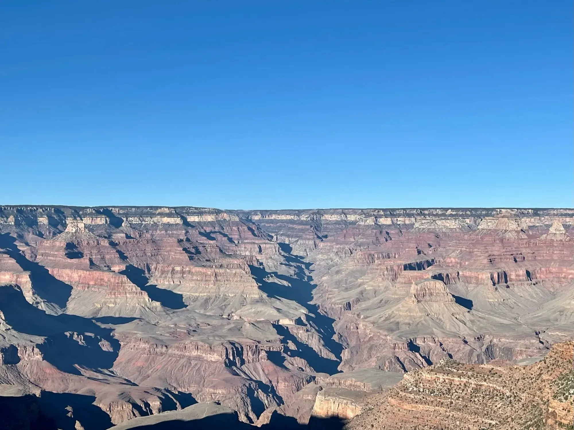
Grandview Trail to Coconino Saddle
This hike goes to Coconino Saddle, not Horseshoe Mesa, Page Spring or the farther viewpoint. NPS assigns the saddle 2.2 miles round trip and 1,000 feet of elevation change, and says it has no sign. Mileage is not a substitute for navigation and a detailed plan.
Grand Canyon · Photo: David & Keri New
- 2.2 miDistance
- 1,000 ftElevation gain
- 2–4 hrTime
- StrenuousDifficulty
The numbers, with sources
Distance: Selected Coconino Saddle destination: 2.2 miles round trip (NPS). Source
Gain: 1,000 feet elevation change. Total climb isn’t available. Source
Time: 2–4 hours (NPS selected destination). Source
Difficulty: Strenuous and exposed; experienced desert walkers only. Source
Trailhead: The NPS doesn’t publish this for the whole route. Consult the official route description and park map for the start. Source
Route type: Out-and-back to Coconino Saddle Source
Built from official sources (checked Nov 3, 2026). Confirm current conditions with the park.
Recreation.gov permits, entrances & campgrounds
Recreation.gov (RIDB). Booking records date not published. NPS guidance above takes precedence. A listing doesn’t mean you need a permit or that there’s space on your dates.
Park campground options (4)
These records belong to the park’s NPS recreation area. We haven’t checked how close these are to the trail, when they open or whether sites are free; check the map and the booking page.
North Rim Campground (AZ) — Campground; RIDB reservable: yes. Season: not published in structured RIDB data. Recreation.gov (RIDB) source · Booking details
Trailer Village RV Park - South Rim — Campground; RIDB reservable: no. Season: not published in structured RIDB data. Recreation.gov (RIDB) source · Booking details
NPS reservation guidance: Reservations can be made up to 13 months in advance. If visiting during the busy season (May through October) making reservations 1 year in advance is recommended. NPS source
MATHER CAMPGROUND — Campground; RIDB reservable: yes. Season: not published in structured RIDB data. Recreation.gov (RIDB) source · Booking details
NPS reservation guidance: From March 1, through November 30 (Peak Season) most campsites are by reservation only through recreation.gov. Mather campground offers 15 first-come, first-served sites that go on sale at 8 am. None of Mather Campground’s sites have hook-ups or electricity. Full hook-ups are available at adjacent Trailer Village RV Campground, operated by Delaware North. NPS source
Desert View Campground — Campground; RIDB reservable: yes. Season: not published in structured RIDB data. Recreation.gov (RIDB) source · Booking details
NPS reservation guidance: Campsites for the 2026 season are by reservation only, through www.recreation.gov. Reservations can be made with them online, by clicking the reservation button below, or by phone (877-444-6777). Reservations can be made 6 months in advance for the 2026 season that runs from Saturday, April 11 through Sunday, October 18, 2025, with the campground closing for the season on Monday, October 19, 2026. Due to high demand, Desert View Campground now requires advanced reservations. You may book reservations up to 6 months in advance. Desert View Campground does not hold back any campsites for first-come, first-served camping during peak season and does not have a wait list or call back system. Same Day Reservations can be made online (www.recreation.gov) or by phone (877-444-6777). NPS source
Route, junction by junction
Route selection → Described destination
This hike goes to Coconino Saddle, not Horseshoe Mesa, Page Spring or the farther viewpoint. NPS assigns the saddle 2.2 miles round trip and 1,000 feet of elevation change, and says it has no sign. Mileage is not a substitute for navigation and a detailed plan. Source
No elevation profile yet:
No elevation profile yet: we haven’t verified a complete line for this route. No partial line, invented connector, scaled mileage or flat profile is substituted. Source
In-depth guide
Compiled from linked sources, checked Nov 3, 2026. Each paragraph links to its source.
Is this hike for you?
Here we cover the hike to Coconino Saddle, not the longer trips to Horseshoe Mesa, Page Spring or the farther viewpoint. The NPS gives the saddle as 2.2 miles round trip with 1,000 feet of elevation change and 2–4 hours. It doesn’t give a total climb, and there’s no sign at the saddle. Source
Short doesn’t mean easy. The NPS calls Grandview a rocky, exposed, strenuous trail for experienced desert hikers only, with big steps and extreme pitches, and harder going than the Bright Angel, South Kaibab and Hermit Trails, so allow extra time. A fall in the upper sections could be catastrophic. Stop at the Backcountry Information Center to talk to rangers first, carry a map, have a detailed plan, and save energy for the climb back out. Source
The trail
Native Americans first used the route to gather mineral paints on Horseshoe Mesa, and copper miners later built the trail to link the rim with their mines. It ended up carrying more tourists than miners, since Grandview Point was one of the best ways into the canyon at the time. Fairly intact stretches of the original miners’ trail survive in the upper part. Source
The trail drops to the right of the Grandview Point overlook. The Kaibab/Toroweap section crosses steep slopes, and the old trail is eroded in places. Miners built vertical steps on log “cribs” chained or pinned to the cliff face, and some hikers find the exposure there hazardous. Several of the historic cribs were swept away by landslides in the winter of 2005; crews rebuilt the trail but not the old logs. Sloping ledges at the top of the Coconino Sandstone cliff need care, especially when icy or wet. Source
Through most of the Coconino section you walk on the original cobblestone “riprap”, big sandstone slabs set on edge. The trail reaches the top of an east-facing gully where the Coconino Sandstone meets the Hermit Shale. That’s Coconino Saddle, with views into the upper valley of Hance Creek, and the place to turn around. Below it, steep cobblestone switchbacks drop through the Hermit Shale to the Supai Formation, where the trail eases into a long traverse down to Horseshoe Mesa. Source
You may see rusty cans, nails, tools and structures that look like trash. They’re left from mining and protected as archaeological resources, so leave them where they are. Source
Water
There’s no drinking water on the trail to Horseshoe Mesa, and the springs below the mesa aren’t reliable. Carry all you need, and ask rangers at the Backcountry Information Center about water below the rim. Source
What we don’t know
The NPS page doesn’t give times between points, when the parking fills, shuttle times or other services. Source
The NPS trail map lists a Grandview trail, and OpenStreetMap labels a mapped path “Grandview Trail”, but neither confirms the whole route. There’s no elevation profile yet: we haven’t verified a continuous line with the right endpoints. Source · Source 2
Sources & planning limits
Reviewed 2026-11-03. Check current conditions for your trip dates.
Getting there and back
The NPS doesn’t publish this for the whole route. Consult the official route description and park map for the start. Source
Return: Use the return described in the official route account. Don’t count on a shuttle, boat, flight or pickup unless you have confirmed it yourself. Source
Water
The NPS doesn’t publish a full list of water and restrooms along this route. Use only the facilities explicitly identified in the NPS account; confirm current operations. Source
Hazards
Grandview is rocky, exposed and rarely maintained, with potentially catastrophic fall consequences. NPS says there is no maintained drinking-water source on the trail to Horseshoe Mesa and springs below are unreliable. Talk to backcountry rangers before you go down, and save energy for the climb back. Being short doesn’t make this a beginner hike. Source
Season
This page can’t tell you current access. Check NPS conditions before departure. Source
Check current conditions and seasonal access with the park before you go. Check the park before departure. Source
Gear & rules
Respect current closures, signs and barriers. A mapped path is not proof that travel is permitted. Source
Filling a gap in your kit? Compare these packing essentials on Amazon. Choose gear for your route, conditions and the park’s guidance.
As an Amazon Associate we earn from qualifying purchases. How this works
The NPS doesn’t publish a pet rule for this exact route; confirm with the park before bringing an animal. Source
Questions
Which hike is this?
This hike goes to Coconino Saddle, not Horseshoe Mesa, Page Spring or the farther viewpoint. NPS assigns the saddle 2.2 miles round trip and 1,000 feet of elevation change, and says it has no sign. Mileage is not a substitute for navigation and a detailed plan. Selected Coconino Saddle destination: 2.2 miles round trip (NPS). Source
Is a measured elevation profile available?
No elevation profile yet: we haven’t verified a complete line for this route. No partial line, invented connector, scaled mileage or flat profile is substituted. Source
Alternatives
Alternative-route distances and durations are unavailable unless separately described in the source. Side trails aren’t included. Source
Camp near Grandview Trail to Coconino Saddle
Closest campgrounds by drive time to Grandview Trailhead:
- 26 min Mather (11.8 mi, in the park)
- 28 min Desert View (14 mi, in the park)
- 38 min Tusayan - Montane ↗ (18.8 mi, USDA Forest Service)
- 4 hr 6 min Demotte ↗ (183.7 mi, USDA Forest Service)
- 4 hr 34 min North Rim (200.5 mi, in the park)
Driving time with no traffic (OSRM, OpenStreetMap roads). Some park roads are shuttle-only in season. All camping near Grand Canyon
More Grand Canyon trail guides
- Bright Angel Trail (day hikes)3 mi · Strenuous
- Grand Canyon Rim-to-Rim13.7 mi one way
- Hermit Trail to Santa Maria Spring5 mi
- Rim Trail at Mather Point0.7 mi one way
- South Kaibab Trail: Day-Hike TurnaroundsStrenuous