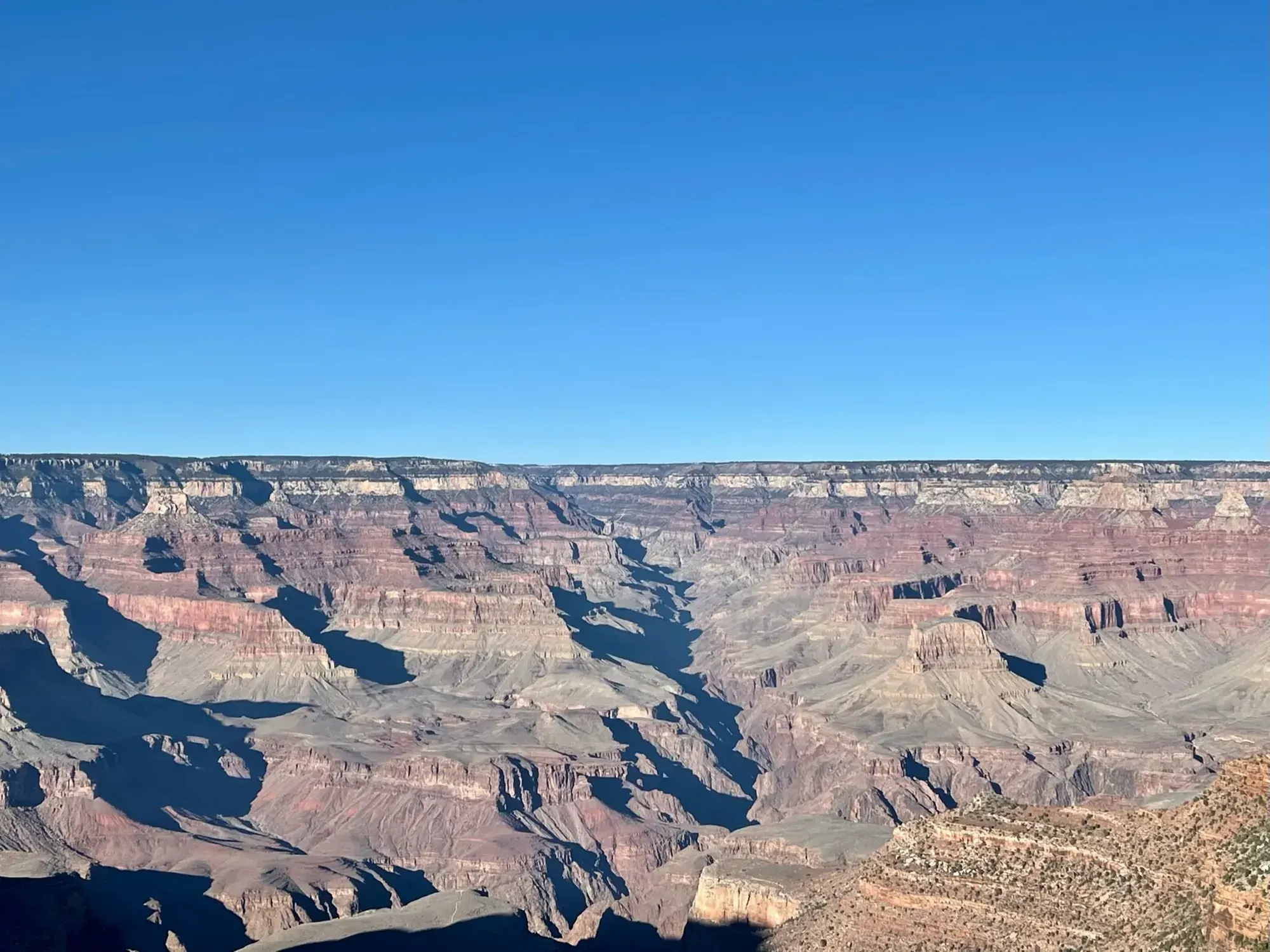
Bright Angel Trail (day hikes)
Bright Angel descends from west of Bright Angel Lodge into Grand Canyon. NPS identifies resthouses and Havasupai Gardens as day-hike turnaround destinations.
Grand Canyon · Photo: David & Keri New
- 3 miDistance
- 1,120 ftElevation gain
- 2–4 hrTime
- StrenuousDifficulty
The numbers, with sources
Distance: 3 mi round trip to 1.5 Mile Resthouse; 6 mi to 3 Mile Resthouse; 9 mi to Havasupai Gardens. Source
Gain: Elevation change from rim: 1,120 ft to 1½-Mile Resthouse; 2,120 ft to 3-Mile Resthouse; 3,040 ft to Havasupai Gardens. Source
Time: Round trip: 2–4 hours to 1½-Mile Resthouse; 4–6 to 3-Mile Resthouse; 6–9 to Havasupai Gardens. Source
Difficulty: Steep, maintained dirt trail with some shade. Source
Trailhead: Just west of Bright Angel Lodge; follow the rim path to the mule corral. Source
Route type: out-and-back Source
Built from official sources (checked Nov 3, 2026). Confirm current conditions with the park.
Recreation.gov permits, entrances & campgrounds
Recreation.gov (RIDB). Booking records date not published. NPS guidance above takes precedence. A listing doesn’t mean you need a permit or that there’s space on your dates.
Nearby campground records
Within 10 straight-line miles of the trailhead. Distances are straight-line from map coordinates, not driving distances.
- Trailer Village RV Park - South Rim: approximately 1.6 miles straight line. RIDB coordinates · Mapped route source
- MATHER CAMPGROUND: approximately 1.4 miles straight line. RIDB coordinates · Mapped route source
Park campground options (4)
These records belong to the park’s NPS recreation area. We haven’t checked how close these are to the trail, when they open or whether sites are free; check the map and the booking page.
North Rim Campground (AZ) — Campground; RIDB reservable: yes. Season: not published in structured RIDB data. Recreation.gov (RIDB) source · Booking details
Trailer Village RV Park - South Rim — Campground; RIDB reservable: no. Season: not published in structured RIDB data. Recreation.gov (RIDB) source · Booking details
NPS reservation guidance: Reservations can be made up to 13 months in advance. If visiting during the busy season (May through October) making reservations 1 year in advance is recommended. NPS source
MATHER CAMPGROUND — Campground; RIDB reservable: yes. Season: not published in structured RIDB data. Recreation.gov (RIDB) source · Booking details
NPS reservation guidance: From March 1, through November 30 (Peak Season) most campsites are by reservation only through recreation.gov. Mather campground offers 15 first-come, first-served sites that go on sale at 8 am. None of Mather Campground’s sites have hook-ups or electricity. Full hook-ups are available at adjacent Trailer Village RV Campground, operated by Delaware North. NPS source
Desert View Campground — Campground; RIDB reservable: yes. Season: not published in structured RIDB data. Recreation.gov (RIDB) source · Booking details
NPS reservation guidance: Campsites for the 2026 season are by reservation only, through www.recreation.gov. Reservations can be made with them online, by clicking the reservation button below, or by phone (877-444-6777). Reservations can be made 6 months in advance for the 2026 season that runs from Saturday, April 11 through Sunday, October 18, 2025, with the campground closing for the season on Monday, October 19, 2026. Due to high demand, Desert View Campground now requires advanced reservations. You may book reservations up to 6 months in advance. Desert View Campground does not hold back any campsites for first-come, first-served camping during peak season and does not have a wait list or call back system. Same Day Reservations can be made online (www.recreation.gov) or by phone (877-444-6777). NPS source
Route, junction by junction
Bright Angel Trailhead → First Tunnel
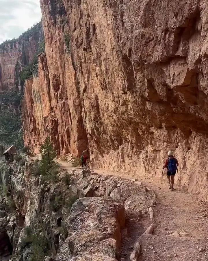
Begin on the South Rim just west of Bright Angel Lodge, following the rim path to the mule corral. The maintained dirt trail is well defined and steep, with shade supplied mainly by the canyon walls at particular times of day. NPS describes the first tunnel as a relatively gentle opportunity to experience a view from inside the canyon. Source
Distance: First Tunnel: 0.18 mile one way from the trailhead. Source
Elevation: Trailhead elevation: 6,860 ft; first-tunnel elevation not published. Source
First Tunnel → First Switchback
Continue to the first switchback. NPS identifies this as a good turnaround point for small children and warns that the trail starts getting steeper. This is a shorter option than either resthouse; the descent should not determine whether the return climb is manageable. Source
Distance: First Switchback: 0.45 mile one way from the trailhead. Source
First Switchback → Second Tunnel
Continue toward the second tunnel on the same Bright Angel route. Steep switchbacks follow the tunnel. The trail guide warns that the steepness is misleading on the descent and that the climb out takes much longer. Source
Distance: Second Tunnel: 0.75 mile one way from the trailhead. Source
Second Tunnel → Mile-and-a-Half Resthouse
Descend the switchbacks to the first resthouse. The NPS guide identifies this as a turnaround for first-time canyon hikers, casual hikers, and late starters. Toilets and an emergency phone are listed here, but the usual seasonal-water listing must be read alongside the current water-off notice. Source
Distance: Resthouse: 1.5 miles one way; 3 miles round trip from the rim. Source
Elevation: Mile-and-a-Half Resthouse elevation: 5,729 ft. Source
Mile-and-a-Half Resthouse → Two Mile Switchback/Corner
Continue to the signed Two Mile Switchback/Corner if the planned turnaround and the condition of the group permit. NPS notes that the trail gets steeper from this sign. Give uphill hikers the right of way and take regular breaks rather than treating the resthouses as the only places to stop. Source
Two Mile Switchback/Corner → Three-Mile Resthouse
Continue down Bright Angel to the next resthouse. NPS calls Three-Mile Resthouse a great turnaround point and lists a toilet and emergency phone there. Its seasonal tap is not a dependable supply; the current critical-updates page reports the water off. Source
Distance: Three-Mile Resthouse: 3 miles one way; 6 miles round trip from the rim. Source
Elevation: Three-Mile Resthouse elevation: 4,748 ft. Source
Three-Mile Resthouse → Havasupai Gardens
Most of Bright Angel’s elevation change occurs within the upper four miles, through a long series of switchbacks. Approaching Havasupai Gardens, the trail becomes considerably flatter as it crosses the shale-dominated Tonto Platform. The NPS day-hike guide requires an early start and good condition for this destination, and says not to continue beyond it on a summer day hike. Source
Distance: Havasupai Gardens: 4.5 miles from the trailhead. Source
Elevation: Havasupai Gardens elevation: 3,800 ft. Source
Junction: Plateau Point continuation: Plateau Point is a separate, extremely strenuous extension with no shade. The day-hike guide says not to go beyond Havasupai Gardens as a summer day hike. Source
No elevation profile: we only draw one from a mapped route we can verify. Route source
In-depth guide
Compiled from linked sources, checked Nov 3, 2026. Each paragraph links to its source.
Decisions & preparation
Distances are shown only where the NPS gives them. Source
Turnaround & return planning
Any of the stops above. Turn back before the group runs low on energy, water or daylight; the climb out takes much longer than the way down. Planning basis
Parking & transport timing
Take the rim path just west of Bright Angel Lodge; the trail starts by the mule corral. The NPS doesn’t say when parking fills. Source
The NPS suggests parking at the Backcountry Information Center in Lot D and walking past Maswik Lodge to the trailhead, a paved walk of about seven minutes for most people. Or park at Grand Canyon Visitor Center and take the Village Loop Blue Route shuttle, about a 20-minute ride. The trailhead is to the right of the Hermit-Interchange Red Route station. The NPS sheet doesn’t give bus frequency or the last bus. Shuttle source
What to bring by season
All seasons: the NPS Ten Essentials (navigation, sun protection, extra clothing, a light, first aid, fire supplies where allowed, repair tools, extra food, water and emergency shelter). Tell someone your route and when you’ll be back. Source
Warm weather: sun protection, plenty of water and extra food. Cold or wet weather: warm layers, rain gear and extra clothing in case you’re out longer than planned. Source
May and September are generally hot and mostly dry; June is extremely hot and dry. July and August are hot with monsoon thunderstorms. In summer, start before dawn, in the evening or at night, and avoid hiking 10 am–4 pm. Source
Winter brings short days, cold nights, possible snow and ice near the rim, and rain in the canyon. Spring and autumn can be cool, snowy or very hot, often windy. Carry traction for spring ice or early autumn snow, and a windproof layer. Source
Children & mobility
Wheeled devices, including baby buggies and bicycles, and pets aren’t allowed on trails below the rim. Source
Is this hike for you?
There are no easy trails into or out of Grand Canyon, and Bright Angel is no exception, even with its maintenance and resthouses. The way down is deceptively easy; the climb back is the hard part. The park reports more than 300 canyon rescues each year (across the whole canyon, not just this trail). Pick a turnaround the least prepared person in your group can climb back from. The trail stops and distances are listed below. Source
Parking and the shuttle
When the village is crowded, try Lot D at the Backcountry Information Center; it often has spaces when other lots are full, and you can walk from it to Bright Angel Trailhead, the historic district and the Hermit Road shuttle. The southern part of Lot D has pull-through spaces for RVs and trailers. The visitor-center complex also has them in Lot 1, but Lots 2, 3, and 4 don’t; don’t take up several ordinary spaces with a big vehicle. In the busy season, arriving at the visitor-center plaza by 10 am usually gets you a space, since those lots often fill by late morning. For the hike itself, you may need to start much earlier because of the heat. Source
The fall 2026 Village shuttle timetable listed a 50-minute full loop, with buses every twelve to fifteen minutes depending on the time of day. Check the timetable for your season, and don’t plan a climb that depends on catching the last bus. Source · Source 2 · Source 3
Closures and repairs
Flood-repair notices listed stock restrictions between Mile-and-a-Half Resthouse and Havasupai Gardens while crews fixed trail damage. Walking and stock access can differ, so check current notices, and ask the Backcountry Information Center if your trip needs more than ordinary walking access. Source · Source 2
Camping permits
Camping is a separate trip with its own permit. If you join the last-minute campground waitlist, you have to return to the South Rim Backcountry Information Center at 8 am each morning to keep your place. The office is open 8 am to noon and 1–5 pm Mountain Standard Time. A spot on the waitlist isn’t a permit. Source · Source 2 · Source 3
Winter
For winter the park recommends waterproof boots, gaiters, over-shoe traction and hiking poles, plus warm waterproof clothing and a spare set of dry clothes. Keep the traction where you can reach it. Watch for signs of hypothermia: uncontrolled shivering, stumbling, fumbling, confusion and exhaustion. If you see them, stop, get out of the weather, change wet clothes, and get help if rewarming doesn’t work. Source · Source 2 · Source 3 · Source 4
Water
Carry the water you need. If you collect natural water, filter it and then disinfect it, or boil it; muddy water may need to settle first. Ordinary filters, boiling and chemical treatment don’t make water with dissolved cyanotoxins safe, so stay away from visible cyanobacterial mats and check water advisories. Source
Rules and trail manners
Wheeled devices, including baby buggies and bicycles, and pets aren’t allowed on trails below the rim, so a family trip has to work on foot for everyone. Don’t use soap in creeks (even biodegradable), don’t feed, touch or disturb wildlife, and don’t throw or roll rocks into the canyon. Don’t leave clothes, gear, food or trash beside the trail to pick up later. Source · Source 2
If you’re faster, slow down and ask to pass, and speak quietly. If your group hikes at different speeds, agree on where and when to meet. Source
A rim alternative
The South Rim Trail gives you canyon views without the climb. You can start from village viewpoints or along Hermit Road and use the shuttle to shorten it. Parts are paved and accessible. There’s no water west of Bright Angel Lodge. Source
Before you go
Check the latest closures and water status, and compare the inner-canyon and rim forecasts. Carry enough water, food and layers, and pick a turnaround that leaves energy for the climb. If anyone gets nauseated, dizzy or exhausted, stop and rest; you can turn around anywhere, not just at a resthouse. Source
Getting there and back
Follow the rim path just west of Bright Angel Lodge; the trail starts by the mule corral. Source
Shuttle: The NPS trail sheet recommends parking at the Backcountry Information Center in Lot D and walking past Maswik Lodge to the trailhead, a paved walk taking most visitors about seven minutes. Alternatively, park at Grand Canyon Visitor Center and take the Village Loop Blue Route shuttle, listed as about a 20-minute ride. The trailhead is to the right of the Hermit-Interchange Red Route station. This sheet does not give a last bus or service frequency. Source
Return: Turn around at the destination selected for the day and climb Bright Angel back to the South Rim. NPS says to allow twice as long for the ascent as for the descent. Go slowly, rest often, stay cool, and let the weakest member of the group set the pace; a quick downhill start doesn’t confirm a safe pace for the return. Source
Water
As of the October 27, 2026 update, water is OFF at both resthouses and Havasupai Gardens. Potable water is in a tank beside trailhead restrooms. Carry water and treatment options. Source
Current conditions supersede the normal seasonal-water description in the PDF: Mile-and-a-Half Resthouse, Three-Mile Resthouse, and Havasupai Gardens all have water OFF to conserve water. Do not plan a refill at any of these locations. The critical-updates page was updated October 27, 2026. Source
Potable water at the trailhead is supplied from a large black tank next to the restrooms. With all inner-canyon water turned off, NPS says to carry sufficient water for the trip or collect and properly treat natural water. All hikers should carry a reliable treatment method. Source
Each person in a hiking group should carry water. NPS warns that hikers commonly carry too little, even on this normally supplied trail, and reminds visitors to eat as well as drink because canyon hiking uses considerable energy. Source
Hazards
A descent followed by a strenuous climb
The views can make it easy to lose track of how far down the trail the group has gone. NPS warns that the steepness can be misleading on the way down. Plan the turnaround before starting, and do not attempt a rim-to-river-and-back day hike, especially from May through September. Source
Persistent winter ice
The upper two miles are often icy during winter, especially December through February. Because winter sun does not reach the trail, slick conditions can persist for weeks or months after a snowstorm. NPS recommends over-shoe traction and hiking poles. Source
Heat and midday exposure
The lower canyon is most likely to reach at least 100°F from early May through late September. The trail sheet says to depart before dawn or wait until late afternoon in scorching weather and advises against hiking during the midday hours from 10 am to 4 pm. Source
Rockfall and flash flooding
Rockfalls are common during or after rain and during freeze/thaw events; they can happen without warning. Move quickly away if rockfall is heard or seen. Flash floods can also occur without warning: know upstream weather, face upstream near creeks, and have a fast exit plan. Source
Over-hydration
NPS says not to force fluids: drink when thirsty and stop when thirst is quenched. Excess water can produce a life-threatening salt-balance disorder called hyponatremia. Balance hiking food and water, and take breaks for rest and digestion. Source
Season
The upper trail may be extremely icy in winter or early spring. Seasonal water normally runs May–September but current closures and water notices take precedence. Source
May and September are generally hot and mostly dry; June is extremely hot and dry. July and August bring heat with monsoon thunderstorms. The NPS seasonal handout advises starting before dawn, in the evening, or at night and avoiding 10 am–4 pm summer hiking. Source
Winter brings short days, long cold nights, possible snow and ice near the rim, and rain inside the canyon. Spring and autumn can be cool, snowy, or intensely hot, with high winds common. Carry traction for lingering spring ice or early autumn snow and use windproof layers when needed. Source
Gear & rules
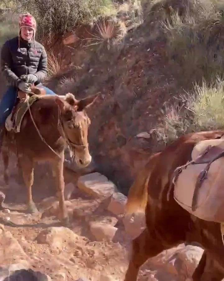
When mules pass, step to the uphill side away from the edge, follow the wrangler and remain still and quiet. Source
Do not return to the trail until the last mule is 50 feet past. Source
Organized non-commercial groups of 12–30 participants, or not-for-profit groups, conducting rim-to-rim, rim-to-rim-to-rim, rim-to-river-to-rim, or extended inner-canyon day hikes must obtain a Special Use Permit. Source
Filling a gap in your kit? Compare these packing essentials on Amazon. Choose gear for your route, conditions and the park’s guidance.
As an Amazon Associate we earn from qualifying purchases. How this works
NPS lists sufficient water plus emergency extra and a treatment method; salty snacks and high-calorie meals; first-aid supplies, prescriptions and blister care; a map or trail guide; and a flashlight or headlamp with spare batteries among the day-pack essentials. Source
Other listed essentials include sunscreen, a wide-brimmed hat and sunglasses; a whistle, signal mirror and cell phone; an emergency shelter; broken-in hiking shoes with good soles; hiking poles; and clothing layers. Rescue is not guaranteed, and assistance can take hours or days. Source
For a passing mule train, step off on the uphill side away from the edge. Follow the wrangler, stay quiet and completely still, and wait until the last mule is 50 feet past before returning to the trail. Uphill hikers also have right of way. Source
Pace
Allow twice the downhill time for the climb out. Walk slowly, rest often, stay cool, and allow the weakest hiker to set the pace. The NPS guide does not publish separate times for the short stretches between tunnels, corners, and resthouses; those segment times remain unpublished. Source
Questions
Which turnaround is appropriate for a first canyon hike?
The NPS day-hike sheet identifies Mile-and-a-Half Resthouse as a turnaround for first-time canyon hikers, casual hikers and late starters. The first switchback is a shorter turnaround identified for small children. Match the plan to the group’s abilities and the return climb. Source
Is water available at the resthouses today?
No. Both resthouses and Havasupai Gardens are listed water OFF in the current critical update. A potable-water tank is available beside the trailhead restrooms. Carry sufficient water and a treatment method rather than relying on the normal seasonal schedule. Source
Can this day hike continue across the river?
The current open trail extends from Bright Angel Trailhead to River Resthouse. Both river bridges, Phantom Ranch, Bright Angel Campground, and the entire North Kaibab Trail are closed after flash flooding. NPS publishes no estimated reopening. Source
Where are toilets along the route?
The Bright Angel trail sheet lists toilets at Mile-and-a-Half Resthouse, Three-Mile Resthouse, and Havasupai Gardens. Its longer-route list also includes the River Resthouse area and Bright Angel Campground/Phantom Ranch, but the latter area is currently closed. Source
Should the trip be timed from the downhill leg?
No. NPS specifically warns that the steepness is misleading on descent and says to plan twice as long to climb up as to descend. Frequent rests and the weakest hiker’s pace should guide the group. Source
Alternatives
Rim Trail: Easy walking along the South Rim with shuttle connections; part of the trail is paved and accessible. Source
Camp near Bright Angel Trail (day hikes)
Closest campgrounds by drive time to Bright Angel Trailhead:
- 7 min Mather (2 mi, in the park)
- 24 min Tusayan - Montane ↗ (10.4 mi, USDA Forest Service)
- 49 min Desert View (24.9 mi, in the park)
- 4 hr 28 min Demotte ↗ (194.7 mi, USDA Forest Service)
- 4 hr 56 min North Rim (211.5 mi, in the park)
Driving time with no traffic (OSRM, OpenStreetMap roads). Some park roads are shuttle-only in season. All camping near Grand Canyon
More Grand Canyon trail guides
- Grand Canyon Rim-to-Rim13.7 mi one way
- Grandview Trail to Coconino Saddle2.2 mi · Strenuous
- Hermit Trail to Santa Maria Spring5 mi
- Rim Trail at Mather Point0.7 mi one way
- South Kaibab Trail: Day-Hike TurnaroundsStrenuous