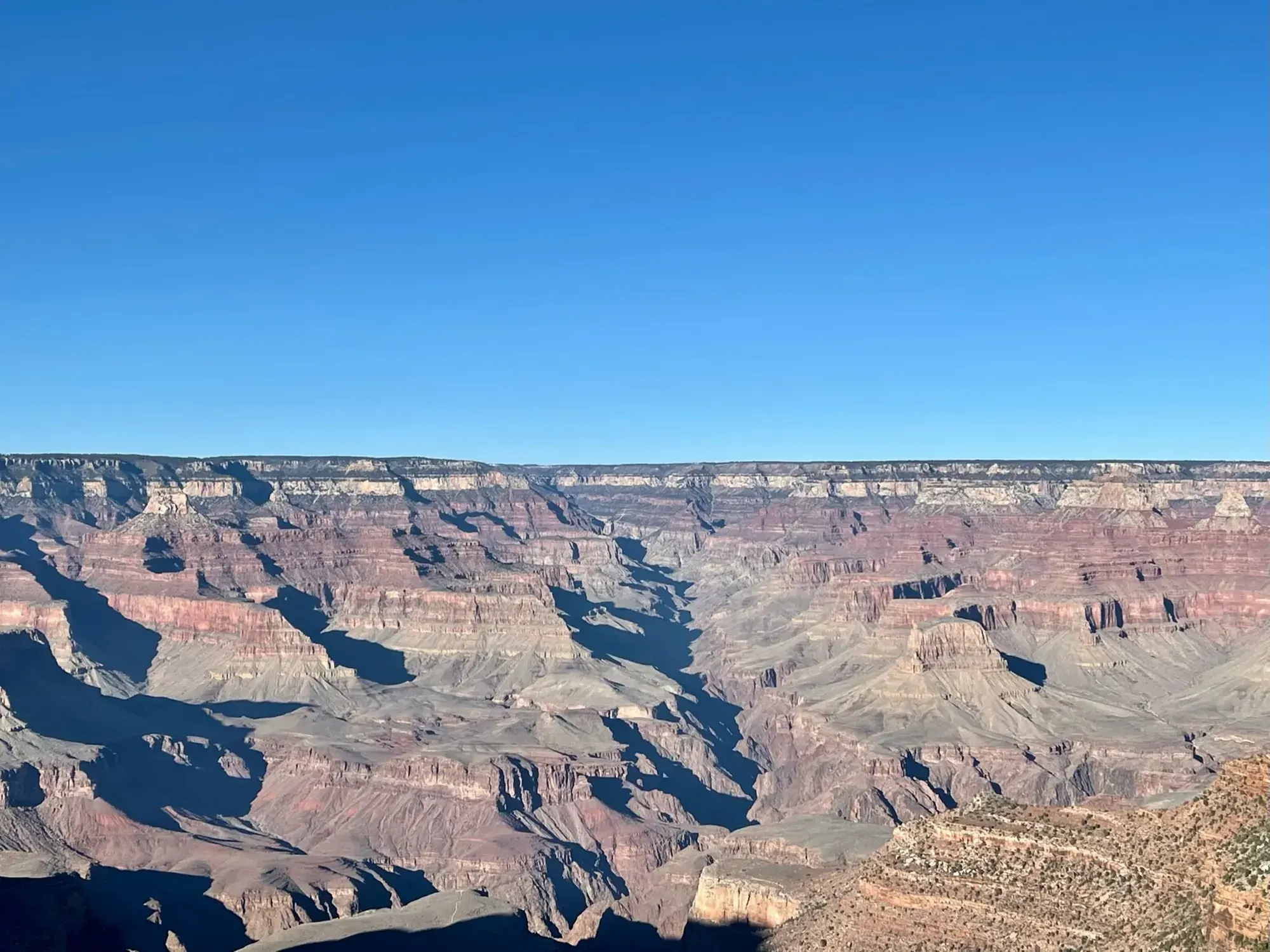
Hermit Trail to Santa Maria Spring
This hike ends at Santa Maria Spring on the Hermit Trail and goes back up to the rim. It does not descend to the Tonto Trail, Hermit Creek or the Colorado River.
Grand Canyon · Photo: David & Keri New
- 5 miDistance
- 1,680 ftElevation gain
- 4–6 hrTime
The numbers, with sources
Distance: 5 miles round trip to Santa Maria Spring Source
Gain: 1,680 feet of elevation change in the destination table Source
Time: 4–6 hours round trip to Santa Maria Spring Source
Difficulty: See the official route and surface descriptions; no separate rating added. Source
Trailhead: Trailhead west of Hermits Rest, reached along the dirt road from the restrooms. Day hikers must use the Hermit Red Route shuttle when it is operating. Source
Route type: out-and-back Source
Built from official sources (checked Nov 3, 2026). Confirm current conditions with the park.
Recreation.gov permits, entrances & campgrounds
Recreation.gov (RIDB). Booking records date not published. NPS guidance above takes precedence. A listing doesn’t mean you need a permit or that there’s space on your dates.
Park campground options (4)
These records belong to the park’s NPS recreation area. We haven’t checked how close these are to the trail, when they open or whether sites are free; check the map and the booking page.
North Rim Campground (AZ) — Campground; RIDB reservable: yes. Season: not published in structured RIDB data. Recreation.gov (RIDB) source · Booking details
Trailer Village RV Park - South Rim — Campground; RIDB reservable: no. Season: not published in structured RIDB data. Recreation.gov (RIDB) source · Booking details
NPS reservation guidance: Reservations can be made up to 13 months in advance. If visiting during the busy season (May through October) making reservations 1 year in advance is recommended. NPS source
MATHER CAMPGROUND — Campground; RIDB reservable: yes. Season: not published in structured RIDB data. Recreation.gov (RIDB) source · Booking details
NPS reservation guidance: From March 1, through November 30 (Peak Season) most campsites are by reservation only through recreation.gov. Mather campground offers 15 first-come, first-served sites that go on sale at 8 am. None of Mather Campground’s sites have hook-ups or electricity. Full hook-ups are available at adjacent Trailer Village RV Campground, operated by Delaware North. NPS source
Desert View Campground — Campground; RIDB reservable: yes. Season: not published in structured RIDB data. Recreation.gov (RIDB) source · Booking details
NPS reservation guidance: Campsites for the 2026 season are by reservation only, through www.recreation.gov. Reservations can be made with them online, by clicking the reservation button below, or by phone (877-444-6777). Reservations can be made 6 months in advance for the 2026 season that runs from Saturday, April 11 through Sunday, October 18, 2025, with the campground closing for the season on Monday, October 19, 2026. Due to high demand, Desert View Campground now requires advanced reservations. You may book reservations up to 6 months in advance. Desert View Campground does not hold back any campsites for first-come, first-served camping during peak season and does not have a wait list or call back system. Same Day Reservations can be made online (www.recreation.gov) or by phone (877-444-6777). NPS source
Route, junction by junction
Hermit Trailhead → Waldron Trail junction
Switchbacks down into Waldron Basin at 1.2 miles, then the Waldron junction at 1.5 miles. Stay right on the Hermit Trail. Source
Waldron junction → Dripping Springs junction
Stay right again at the Dripping Springs junction at 1.75 miles. Source
Dripping Springs junction → Santa Maria Spring
Continue to Santa Maria Spring at 2.5 miles and come back the same way, 5 miles in all. Treat the spring water. The NPS generally discourages going farther on a summer day hike. Source
No elevation profile yet:
No elevation profile yet: we haven’t verified complete measurements for this route. Source
In-depth guide
Compiled from linked sources, checked Nov 3, 2026. Each paragraph links to its source.
Decisions & preparation
Distances are shown only where the NPS gives them. Source
Turnaround & return planning
Dripping Springs junction or anywhere before the spring. Turn back before the group runs low on energy, water or daylight; the climb out is the hard part. Planning basis
Parking & transport timing
Trailhead just west of Hermits Rest, along the dirt road from the restrooms. Day hikers must ride the Hermit (Red) Route shuttle when it’s running. The NPS page doesn’t give shuttle times, so check them before you go. Source
What to bring by season
All seasons: the NPS Ten Essentials (navigation, sun protection, extra clothing, a light, first aid, fire supplies where allowed, repair tools, extra food, water and emergency shelter). Tell someone your route and when you’ll be back. Source
Warm weather: sun protection, plenty of water and extra food. Cold or wet weather: warm layers, rain gear and extra clothing in case you’re out longer than planned. Source
Children & mobility
The NPS doesn’t publish accessibility details for this trail. Source
Is this hike for you?
Santa Maria Spring is 2.5 miles (4 km) down the Hermit Trail, 5 miles round trip, with 1,680 feet of elevation change. The NPS allows 4–6 hours round trip and says this trail is for experienced desert hikers only. Conditions are harder than on the Bright Angel and South Kaibab Trails, so give yourself extra time. Source · Source 2
The trail
The upper Hermit Trail is steep, dropping almost 2,000 vertical feet (610 m) in the first 2.5 miles (4.0 km) on well-defined switchbacks through the Kaibab Formation and Coconino Sandstone. Bits of the old hand-fitted rock paving survive, mostly in the Coconino Sandstone, and you can spot a few fossilized lizard-like tracks in its lower half. The trail enters Waldron Basin, a quiet pocket in the Hermit side canyon, at 1.2 miles (1.9 km). Source
You pass the Waldron Trail junction at 1.5 miles (2.4 km) and the Dripping Springs Trail junction at 1.75 miles (2.8 km). Stay right at both. (Dripping Springs makes a good day hike destination on its own.) After that the trail drops along the east side of Hermit Creek gorge to Santa Maria Spring, where there’s a trickle of water and a historic masonry rest house with shade in summer. Carry the current park map; we don’t add turns the NPS doesn’t describe. Source
The trail is named for Louis D. Boucher, the “hermit” of Hermit Creek basin, who lived here alone for 20 years and built the Boucher Trail and seasonal camps at Dripping Springs and near Boucher Creek. Source
Getting to the trailhead
The trailhead is just west of Hermits Rest; follow the dirt road from the restrooms. There’s no day-hiker parking here while the Hermit (Red) Route shuttle runs, so you have to ride the free shuttle bus. The NPS page doesn’t give shuttle pickup times, so check the park’s transport information and plan your ride back before you start. Source
Permits and fees
The NPS doesn’t say whether this hike needs a reservation. Check current permit and reservation rules for your date, and check separately if you plan to camp or stay overnight. Source · Source 2 · Source 3
The private-vehicle entrance fee is $35.00. It covers one non-commercial vehicle and everyone in it, up to a 15-person passenger van. Non-commercial groups over 16 pay different charges, and commercial groups can’t use the vehicle permit. Source
Water and the season
Spring water must be purified before you drink it. The NPS doesn’t give a season for this trail, so check the forecast and current conditions for your date. Source
Kids, strollers and wheelchairs
The NPS doesn’t publish accessibility details for this trail. With the steep switchbacks and the climb back out, think hard before bringing young kids. Source · Source 2
Before you go
When we checked, a park alert listed inner canyon trail closures: the entire North Kaibab Trail (including Cottonwood Campground), Phantom Ranch, Bright Angel Campground, Silver Bridge and the Black Bridge. That alert isn’t about the Hermit Trail, but check current alerts before you go and follow posted signs. Source
Pick your turnaround before you start. Dripping Springs and Santa Maria Spring are both good places to stop, and you can turn back early if the group is slower than you expected. The NPS doesn’t publish pet rules for this trail, so check the park’s pet rules before you bring a dog. Source
There’s no elevation profile yet: we haven’t verified complete measurements for this route. Source
Sources & planning limits
Reviewed 2026-11-03. Check current conditions for your trip dates.
- The NPS doesn’t list permit, reservation or fee rules for this hike. Check them for your travel date. Source
- NPS details are as of the date shown. Confirm access, services and reservations for your travel date. Source
- The NPS doesn’t say whether this trail suits kids or people with limited mobility. Source
- Check shuttle and other services with the NPS for your travel date. Source
- No elevation profile yet: we haven’t verified complete measurements for this route. Source
Getting there and back
Trailhead west of Hermits Rest, reached along the dirt road from the restrooms. Day hikers must use the Hermit Red Route shuttle when it is operating. Source
Return: Complete the return arrangement described for this route. NPS reserves this trail for experienced desert hikers and warns that it is harder than Bright Angel or South Kaibab. Its narrative describes almost 2,000 vertical feet in the first 2.5 miles, while the destination table gives 1,680 feet at Santa Maria Spring. The differing descriptions remain unresolved. Source
Water
Follow the dirt road from the restrooms to make your way to the trailhead. Source
Water from springs must be purified. Source
Santa Maria Spring is reached at 2.5 miles (4 km) along the trail, offering a trickle of water and a historic masonry rest house which provides welcome shade during the summer. Source
Hazards
Though socially active in the South Rim community, residents labeled Boucher a hermit because he lived alone. Source
There is no parking for day hikers at this trailhead when the Hermit (Red) Route shuttle is active; day hikers must ride the free shuttle bus to reach the trailhead. Source
Trail Desciption The upper section of the Hermit Trail is quite steep, dropping almost 2,000 vertical feet (610 m) in the first 2.5 miles (4.0 km). Source
Season
The NPS does not publish a seasonal opening window for this route. Source
The NPS does not publish a seasonal opening window for this route. Source
Gear & rules
The NPS does not publish pet rules for this exact route. Source
Filling a gap in your kit? Compare these packing essentials on Amazon. Choose gear for your route, conditions and the park’s guidance.
As an Amazon Associate we earn from qualifying purchases. How this works
Questions
Which hike is this?
This hike ends at Santa Maria Spring on the Hermit Trail and goes back up to the rim. It does not descend to the Tonto Trail, Hermit Creek or the Colorado River. Source
Are the published figures fully consistent?
NPS reserves this trail for experienced desert hikers and warns that it is harder than Bright Angel or South Kaibab. Its narrative describes almost 2,000 vertical feet in the first 2.5 miles, while the destination table gives 1,680 feet at Santa Maria Spring. The differing descriptions remain unresolved. Source
Is there an elevation profile?
Elevation profile omitted: The official Hermit corridor continues far below Santa Maria Spring. We don’t have a confirmed location for the spring, so we don’t draw the profile, and we don’t swap in the longer river route. Source
Alternatives
Camp near Hermit Trail to Santa Maria Spring
Closest campgrounds by drive time to Hermit Trailhead:
- 39 min Mather (7 mi, in the park)
- 54 min Tusayan - Montane ↗ (12.7 mi, USDA Forest Service)
- 1 hr 20 min Desert View (30.2 mi, in the park)
- 4 hr 59 min Demotte ↗ (199.9 mi, USDA Forest Service)
- 5 hr 27 min North Rim (216.8 mi, in the park)
Driving time with no traffic (OSRM, OpenStreetMap roads). Some park roads are shuttle-only in season. All camping near Grand Canyon
More Grand Canyon trail guides
- Bright Angel Trail (day hikes)3 mi · Strenuous
- Grand Canyon Rim-to-Rim13.7 mi one way
- Grandview Trail to Coconino Saddle2.2 mi · Strenuous
- Rim Trail at Mather Point0.7 mi one way
- South Kaibab Trail: Day-Hike TurnaroundsStrenuous