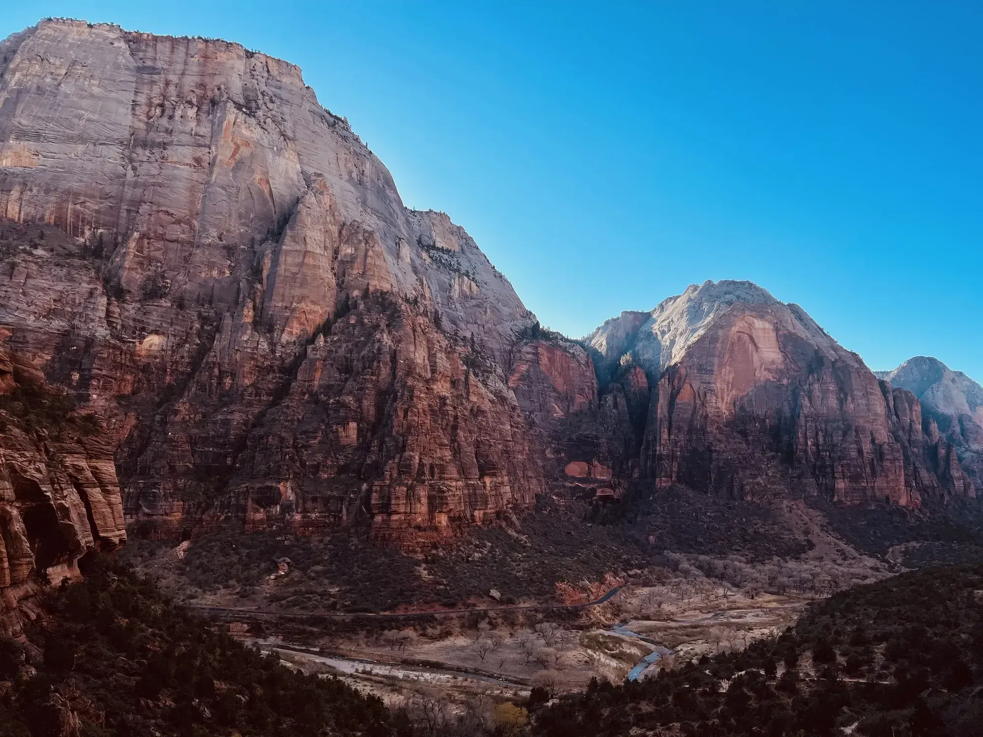
Pa’rus Trail
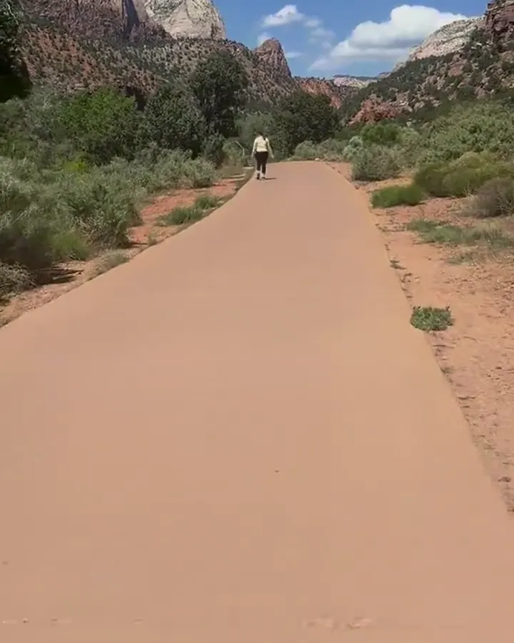
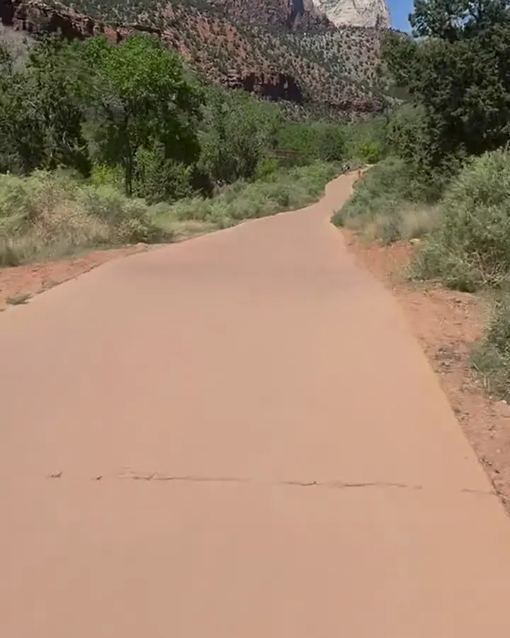
Pa’rus is Paiute for “bubbling water.” The Pa’rus Trail follows the Virgin River and has some of the best views of the Watchman. The paved trail connects the Zion Canyon Visitor Center and Canyon Junction. It is accessible for wheelchairs, pets on leashes, and bicycles. Trailside exhibits cover a variety of subjects, including plant and animal life along the river, geology, and human history.
Zion · Photo: David & Keri New
- 1.6 mi one wayDistance
- 7 ftElevation gain
- 30–120 minTime
- EasyDifficulty
The numbers, with sources
Distance: NPS trail survey: 1.6 miles one way. The NPS time estimate says 3.5 miles end to end. Source
Gain: NPS trail survey: 151.7 feet of gain and 62.7 feet of loss in the direction measured. Source
Time: 30–120 minutes for the activity Source
Difficulty: Paved shared-use trail; measured steep sections and obstacles Source
Trailhead: Start from either the Zion Canyon Visitor Center (shuttle stop #1) or from Canyon Junction (shuttle stop #3). Zion Canyon Visitor Center To reach the trailhead, follow the sidewalk through the Visitor Center plaza and past the shuttle stop to the bridge. Once you cross the bridge, follow the crosswalk to the trailhead adjacent to South Campground. Canyon Junction From the Canyon Junction shuttle stop, follow the sidewalk south (in the direction of the Watchman) under the roadway bridge. Source
Route type: point-to-point Source
Built from official sources (checked Nov 3, 2026). Confirm current conditions with the park.
Recreation.gov permits, entrances & campgrounds
Recreation.gov (RIDB). Booking records date not published. NPS guidance above takes precedence. A listing doesn’t mean you need a permit or that there’s space on your dates.
Park campground options (3)
These records belong to the park’s NPS recreation area. We haven’t checked how close these are to the trail, when they open or whether sites are free; check the map and the booking page.
Lava Point Campground — Campground; RIDB reservable: yes. Season: not published in structured RIDB data. Recreation.gov (RIDB) source · Booking details
NPS reservation guidance: Lava Point Campground is open as weather allows, typically May through September. Reservations are required and can be made up to 14 days in advance. First-come, first-served sites are not available. Be sure to make reservations before beginning your trip - cell service is limited in the park. NPS source
WATCHMAN CAMPGROUND — Campground; RIDB reservable: yes. Season: not published in structured RIDB data. Recreation.gov (RIDB) source · Booking details
NPS reservation guidance: Reservations for campsites at Watchman Campground can be made up to six months before your arrival date. Reserve sites online at www.recreation.gov or by calling 877-444-6777. The campground is full nearly every night during the peak season; early reservations are strongly encouraged. NPS source
SOUTH CAMPGROUND (UT) — Campground; RIDB reservable: yes. Season: not published in structured RIDB data. Recreation.gov (RIDB) source · Booking details
NPS reservation guidance: Reservations for campsites at South Campground can be made online at www.recreation.gov or by calling 877-444-6777. Reservations are available up to 14 days in advance. Park campgrounds are full nearly every night during the peak season; early reservations are strongly encouraged. NPS source
Route, junction by junction
South Campground to the river path →
Start near the visitor center on the paved Pa’rus Trail. Watch for bikes at crossings. Source
River path to Canyon Junction →
Follow the bridges and signs to Canyon Junction. The NPS activity description gives 3.5 miles. Source
Back to the start →
Walk back the way you came, or turn around sooner. The two NPS distances don’t match, so neither is a sure total. Source
No elevation profile yet:
No elevation profile yet: we haven’t verified complete measurements for this route. Source
In-depth guide
Compiled from linked sources, checked Nov 3, 2026. Each paragraph links to its source.
Decisions & preparation
We show distances for parts of the trail only where the NPS gives them. Source
Turnaround & return planning
Turn back before your group runs low on energy, water or daylight. Planning basis
Parking & transport timing
Start at the Zion Canyon Visitor Center (shuttle stop #1) or Canyon Junction (shuttle stop #3). From the visitor center, walk through the plaza past the shuttle stop, cross the bridge and take the crosswalk to the trailhead beside South Campground. From Canyon Junction, follow the sidewalk south (toward the Watchman) under the road bridge. The NPS doesn’t say when parking fills or give shuttle times for this trail. Source
What to bring by season
Any season: the NPS Ten Essentials are navigation, sun protection, extra clothing, illumination, first aid, fire supplies where allowed, repair tools, extra food, water and emergency shelter. Tell someone your plan. Source
Warm weather: sun protection, plenty of water and extra food. Cold or wet weather: warm layers, rain gear and extra clothing. Source
Children & mobility
1.6 mi (2.5 km) one way. Gain 151.7 ft (46.3 m), loss 62.7 ft (19.12 m). Grade typically 2.6%, maximum 11.4%; 1.2% of the trail is 8.3% or steeper. Cross slope typically 2.1%, maximum 8.8%. Tread typically 120 in (304.7 cm), minimum 96 in (243.8 cm). Surface 93.6% paved, 6.4% hard wood decking. Obstacles: 5 bridges 120 in (304.8 cm) wide and 416 to 1744 in (1056.6 to 4429.8 cm) long, decking gaps up to 3 in (2.5 cm); a post leaving 60 in (152.4 cm) of tread; tripping hazards 1 to 2 in (2.5 to 5 cm) tall with 0 in of tread left. Measured January 13, 2025. Obstacles under 0.5 in tall, or outside a 120 in (304.8 cm) by 96 in (243.8 cm) tread area, weren’t reported. Source
Is this hike for you?
Pa’rus (Paiute for “bubbling water”) is a paved path along the Virgin River between the Zion Canyon Visitor Center and Canyon Junction, with some of the best views of the Watchman. It’s open to walkers, bikes, leashed pets and wheelchairs. The NPS gives 30–120 minutes. Source
The distance depends on which NPS number you read. The accessibility details say 1.6 miles one way; the activity description says 3.5 miles end to end. We don’t know which endpoints each one measures, so pick a turnaround that suits your group. Trailside exhibits cover river plants and animals, geology and human history, and it’s a good spot for sunset, stargazing and astrophotography. (Unconfirmed: The NPS gives 1.6 miles one way in one place and 3.5 miles end to end in another, and doesn’t say which endpoints each one uses.) Source
Getting to the trailhead
Start at the Zion Canyon Visitor Center (shuttle stop #1) or at Canyon Junction (shuttle stop #3). From the visitor center, follow the sidewalk through the plaza and past the shuttle stop to the bridge, cross it, and take the crosswalk to the trailhead beside South Campground. From the Canyon Junction stop, follow the sidewalk south, toward the Watchman, under the road bridge. Source
You can also join from the Museum (shuttle stop #2) on a short, unpaved connector. It isn’t built for wheelchairs, and bikes and pets aren’t allowed on it. Read the posted trail map when you arrive and check that your start, finish and ride back all line up. Source
Wheelchairs, strollers and bikes
The NPS measured the trail on January 13, 2025. It’s mostly gentle (typical grade 2.6%), but a few short stretches reach 11.4%. It’s 93.6% paved, with the rest wood decking on 5 bridges that have gaps up to 3 in (2.5 cm) wide. A post narrows the path to 60 in (152.4 cm), and there are tripping hazards 1 to 2 in (2.5 to 5 cm) tall. Some NPS metric conversions don’t match the inches, so trust what you see and ask staff. (Unconfirmed: Some NPS metric conversions for obstacles don’t match the inches.) Source
Pets
Pa’rus is the only trail in Zion that allows pets. They aren’t allowed on any other trail, in wilderness areas, on shuttle buses or in public buildings. They’re welcome along public roads and parking areas, in the developed campgrounds and picnic areas, and on the grounds of Zion Lodge. Keep your pet on a leash no longer than 6 feet, bag its poop everywhere in the park, and don’t let it harass wildlife. Source
Zion is hot, and a car can warm to dangerous levels most months of the year, so leaving a pet in a vehicle when it’s unsafe is prohibited. Pets can be left alone in developed campgrounds only when conditions are safe and they aren’t making unreasonable noise. Service animals (dogs individually trained to do work or tasks for people with disabilities, under the ADA) can go anywhere; emotional support dogs don’t qualify. Pet rules are in 36 CFR 2.15 and the Superintendent’s Compendium, and the minimum fine is $100. There are boarding kennels in Rockville, Hurricane, St. George, Kanab and Cedar City. Source
Water, restrooms and fees
Restrooms and water filling stations are at the visitor center. Don’t drink from the river or put your head under (see the cyanobacteria alert below). Source
The NPS says you don’t need a reservation for this walk. You still pay the park entrance fee; check the NPS fees page for current prices and passes. Source · Source 2
Before you go
NPS alerts as of November 3, 2026: vehicles over the length, width, height or weight limits can’t drive the Zion-Mt. Carmel Highway between Canyon Junction and the East Entrance. Toxic cyanobacteria are in rivers, streams and pools, so don’t drink the water or submerge your head. Parking is limited; once it’s full, park in Springdale, and park only in designated spaces or risk a ticket and a tow. Check current alerts and closures before you go. Source · Source 2 · Source 3
The NPS lists the walk for every season, but that doesn’t promise good footing or weather on your day. If you’re slower than planned, just turn around sooner. Source
Map and elevation profile
We haven’t verified a complete line for this route, so there’s no elevation profile yet. Source · Source 2
Sources & planning limits
Reviewed 2026-11-03. Check current conditions for your trip dates.
- The NPS gives 1.6 miles one way in its accessibility details and 3.5 miles end to end in the activity description, and doesn’t say which endpoints each uses. Source
- Some NPS metric conversions for obstacles don’t match the inches; go by what you see and ask staff. Source
- NPS alert as of November 3, 2026: Large vehicle restrictions on Zion-Mt. Carmel Highway. Vehicles over the length, width, height or weight limits can’t travel between Canyon Junction and the East Entrance. Check current alerts before you go. Source
- NPS alert as of November 3, 2026: Toxic cyanobacteria in rivers, streams and pools. Don’t submerge your head in or drink river water in Zion. Check current alerts before you go. Source
- NPS alert as of November 3, 2026: Zion has limited parking. When it’s full, park in Springdale, and only in designated spaces; vehicles parked elsewhere can be ticketed and towed. Check current alerts before you go. Source
- No elevation profile yet: we haven’t verified a complete line for this route. Source
- Confirm access, services and reservations for your travel date. Source
Getting there and back
Start from either the Zion Canyon Visitor Center (shuttle stop #1) or from Canyon Junction (shuttle stop #3). Zion Canyon Visitor Center To reach the trailhead, follow the sidewalk through the Visitor Center plaza and past the shuttle stop to the bridge. Once you cross the bridge, follow the crosswalk to the trailhead adjacent to South Campground. Canyon Junction From the Canyon Junction shuttle stop, follow the sidewalk south (in the direction of the Watchman) under the roadway bridge. Source
Return: Come back the way described above. Return along the same trail unless a separate transport plan has been confirmed. Source
Water
Restrooms and water filling stations are available at the Visitor Center. Source
Hazards
Length (one way) | 1.6 mi (2.5 km) Elevation | Gain: 151.7 ft (46.3 m) | Loss: 62.7 ft (19.12 m) Grade | Typical: 2.6% | Maximum: 11.4% | 1.2% of the trail is at an 8.3% or higher grade. Cross Slope | Typical: 2.1% | Maximum: 8.8% Tread Width | Typical: 120 in (304.7 cm) | Minimum: 96 in (243.8 cm) Surface | 93.6% of the trail is paved and 6.4% is hard wood decking. Obstructions | Bridges (5) 120 in (304.8 cm) wide and 416 - 1744 in (1056.6 - 4429.8 cm) long, with gaps in decking up to 3 in (2.5 cm) wide | Post in trail leaving 60 in (152.4 cm) of remaining tread | Tripping hazards 1 - 2 in (2.5 - 5 cm) tall, with 0 in of remaining tread Last assessed on January 13, 2025. Obstructions less than 0.5 in tall, or outside the tread area of 120 in (304.8 cm) wide by 96 in (243.8 cm), high were not reported. Source
Season
Use current official conditions; activity season labels are not a guarantee of access. Source
Current trail conditions require a trip-date check. Source
Gear & rules
Follow current signs and closures, and treat any side trip as a separate decision. Source
Filling a gap in your kit? Compare these packing essentials on Amazon. Choose gear for your route, conditions and the park’s guidance.
As an Amazon Associate we earn from qualifying purchases. How this works
Please follow the rules of BARK! B ag your pet’s poop Pet owners are responsible for removing pet waste from all areas in the park including campgrounds, picnic areas, parking lots, roads, pet-friendly trails, and other developed areas. A lways wear a leash Pets must be restrained on a leash no longer than 6 feet. R espect wildlife Pets can harass or harm wildlife by making noise or scaring wildlife away. K now where you can go The only trail that allows pets is the Pa’rus Trail, which begins at the Zion Canyon Visitor Center. Pets are not permitted - on any other trails, wilderness areas, on shuttle buses, or in public buildings in Zion. Additionally, properly restrained pets are welcome along public roads and parking areas, in the developed campgrounds and picnic areas, and on the grounds of the Zion Lodge. Pets should not be left unattended. Zion is hot! The interior temperature of a vehicle can quickly warm to dangerous levels, during most months of the year. Leaving a pet unattended in a vehicle with environmental conditions that pose a health risk to the animal is prohibited. Properly restrained pets may be left unattended in developed campgrounds only when environmental conditions are safe for the animal, and the animal is not making unreasonable noise (barking, etc.). Service Animals may accompany their owner to all park locations. Under the Americans with Disabilities Act (ADA), Service animals are defined as dogs that are individually trained to do work or perform tasks for people with disabilities. Dogs whose sole function is to provide comfort or emotional support do not qualify as service animals under the ADA. 36 CFR 2.15 (Code of Federal Regulations) provides more details concerning pets within National Park Service areas. Pet owners not adhering to regulations may be cited (minimum fine is $100). Read the complete Superintendent’s Compendium for more details. Boarding kennels are available in the nearby towns of Rockville, Hurricane, St. George, Kanab, and Cedar City. Source
Questions
Which route do these figures describe?
NPS trail survey: 1.6 miles one way. The NPS time estimate says 3.5 miles end to end. Pa’rus follows the Virgin River between the visitor center and Canyon Junction. It is a shared-use route for walkers, bicycles and leashed pets, with wheelchair access explicitly described by NPS. The 2025 NPS survey gives grades, widths and obstacles, which tell you more about mobility than the word paved does. Source
Is the trail open right now?
No. NPS details as of Nov 3, 2026. Confirm current conditions and closures with NPS. Source
Is there a measured elevation profile?
Elevation profile omitted: Official named line measures 0.03 miles versus 1.6 miles for selected variant; completeness/endpoints unresolved. Source
Alternatives
The NPS figures don’t agree: the trail survey says 1.6 miles one way, while the time estimate says 3.5 miles end to end. No average is used here. Choose a turnaround or confirm the intended endpoints with NPS, and keep the optional museum connector separate from the main trail. Source
More Zion trail guides
- Angels Landing5.4 mi · Strenuous
- Canyon Overlook Trail1 mi · Moderate
- Riverside Walk1 mi one way · Easy
- Taylor Creek2.6 mi one way · Moderate
- The Narrows (bottom-up)9.4 mi · Strenuous
- Timber Creek Overlook0.6 mi one way · Easy
- Upper Emerald Pools1 mi · Moderate
- Watchman Trail3.3 mi · Moderate