Upper Emerald Pools
Choose an approach before interpreting mileage. NPS describes getting there by the Kayenta, Lower Emerald Pool or Middle Emerald Pools trails, but its detailed survey measures only the upper section. It does not supply a complete distance or gain from Zion Lodge or The Grotto.
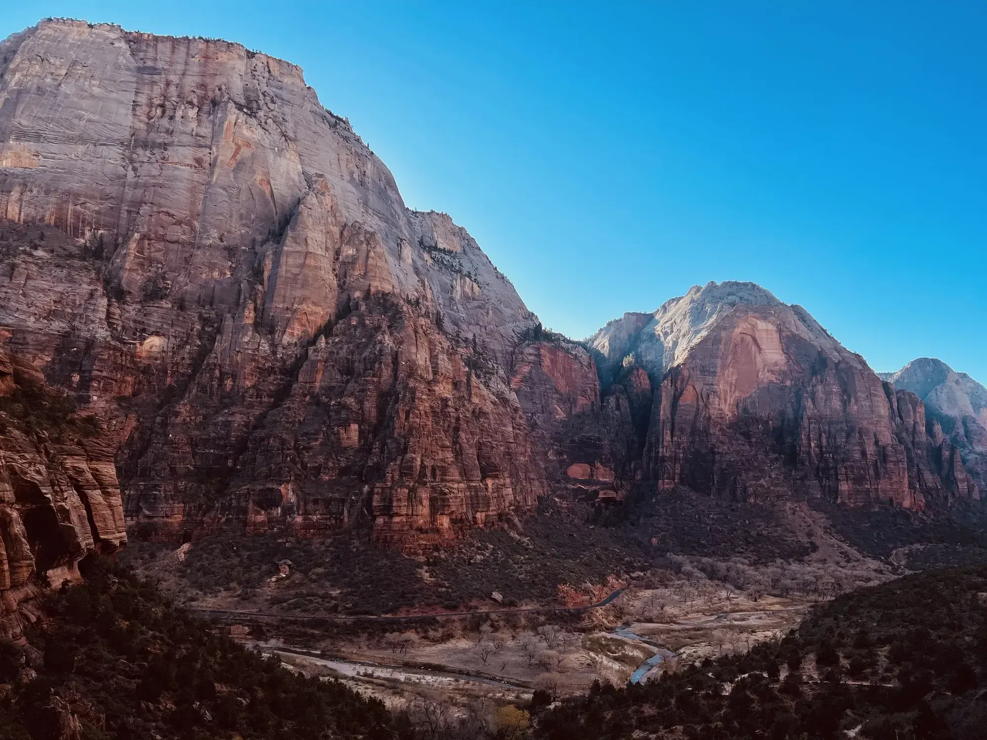
Zion · Photo: David & Keri New
- 1 miDistance
- 8 ftElevation gain
- 1–2 hrTime
- ModerateDifficulty
The numbers, with sources
Distance: Summary: 1 mile; assessed upper segment: 0.3 mile one way. Complete approach varies. Source
Gain: Assessed segment only: gain 75.8 ft, loss 28.9 ft. Total climb for the full hike isn’t available. Source
Time: 1–2 hours (NPS activity; approach-dependent). Source
Difficulty: Moderate; steps, sand and narrow sections. Source
Trailhead: Upper Emerald Pools Trail can be accessed from the Emerald Pools Trailhead at Zion Lodge (shuttle stop #5) or from The Grotto (shuttle stop #6). Zion Lodge Follow the sidewalk past the lodge lawn to the crosswalk. Cross the road then continue over the bridge to begin. From that point, hikers can either take the easier Lower Emerald Pool Trail on the right, or take the moderate Middle Emerald Pools Trail on the left. The Grotto To get to Upper Emerald Pools Trail from The Grotto, hike the moderate 2 mi (3.2 km) Kayenta Trail until it merges with the Emerald Pools Trails. Source
Route type: Approach-dependent Source
Built from official sources (checked Nov 3, 2026). Confirm current conditions with the park.
Recreation.gov permits, entrances & campgrounds
Recreation.gov (RIDB). Booking records date not published. NPS guidance above takes precedence. A listing doesn’t mean you need a permit or that there’s space on your dates.
Park campground options (3)
These records belong to the park’s NPS recreation area. We haven’t checked how close these are to the trail, when they open or whether sites are free; check the map and the booking page.
Lava Point Campground — Campground; RIDB reservable: yes. Season: not published in structured RIDB data. Recreation.gov (RIDB) source · Booking details
NPS reservation guidance: Lava Point Campground is open as weather allows, typically May through September. Reservations are required and can be made up to 14 days in advance. First-come, first-served sites are not available. Be sure to make reservations before beginning your trip - cell service is limited in the park. NPS source
WATCHMAN CAMPGROUND — Campground; RIDB reservable: yes. Season: not published in structured RIDB data. Recreation.gov (RIDB) source · Booking details
NPS reservation guidance: Reservations for campsites at Watchman Campground can be made up to six months before your arrival date. Reserve sites online at www.recreation.gov or by calling 877-444-6777. The campground is full nearly every night during the peak season; early reservations are strongly encouraged. NPS source
SOUTH CAMPGROUND (UT) — Campground; RIDB reservable: yes. Season: not published in structured RIDB data. Recreation.gov (RIDB) source · Booking details
NPS reservation guidance: Reservations for campsites at South Campground can be made online at www.recreation.gov or by calling 877-444-6777. Reservations are available up to 14 days in advance. Park campgrounds are full nearly every night during the peak season; early reservations are strongly encouraged. NPS source
Route, junction by junction
Route selection → Described destination
Choose an approach before interpreting mileage. NPS describes getting there by the Kayenta, Lower Emerald Pool or Middle Emerald Pools trails, but its detailed survey measures only the upper section. It does not supply a complete distance or gain from Zion Lodge or The Grotto. Source
No elevation profile yet:
No elevation profile yet: we haven’t verified a complete line for this route. No partial line, invented connector, scaled mileage or flat profile is substituted. Source
In-depth guide
Compiled from linked sources, checked Nov 3, 2026. Each paragraph links to its source.
Is this hike for you?
Upper Emerald Pools Trail is a moderate trail that you reach by the Kayenta, Lower Emerald Pools or Middle Emerald Pools trails. It climbs stone steps to a sandy path through pinyon-juniper woodland, with views of Lady Mountain and The Great White Throne, and ends at the sandy shore of Upper Emerald Pool below tall canyon walls with seasonal waterfalls. The NPS summary says 1 mile and 1–2 hours, but your total depends on which way you come in; the upper trail itself is 0.3 mile one way. Source
Stay out of the pool
The pool is fragile and an important water source for wildlife, so don’t go in the water. The waterfalls are seasonal and may not be running. Check current trail and bridge closures before you go. Source
Getting to the trailhead
Start at the Emerald Pools Trailhead at Zion Lodge (shuttle stop #5) or at The Grotto (shuttle stop #6). From Zion Lodge, follow the sidewalk past the lodge lawn to the crosswalk, cross the road and go over the bridge. From there take the easier Lower Emerald Pool Trail on the right or the moderate Middle Emerald Pools Trail on the left. From The Grotto, hike the moderate 2 mi (3.2 km) Kayenta Trail until it joins the Emerald Pools trails. Source · Source 2 · Source 3 · Source 4 · Source 5
Water and restrooms
Restrooms and water filling stations are at Zion Lodge and The Grotto, so fill up before you start. Source
Distance and elevation
The NPS only measured the upper trail: 0.3 mile one way, with 75.8 feet of gain and 28.9 feet of loss. It doesn’t give a total distance or climb from Zion Lodge or The Grotto, so there’s no elevation profile yet. It also doesn’t give times for each leg, when parking fills or when the last shuttle leaves. Source · Source 2
Kids, strollers and wheelchairs
The NPS measured the upper trail on March 20, 2025. It’s 0.3 mi (0.4 km) one way, with a gain of 75.8 ft (23.11 m) and a loss of 28.9 ft (8.81 m). The grade is typically 7.5% and up to 37%, and 25.6% of the trail is at 10% or steeper. Cross slope is typically 5.2%, up to 20.6%. The tread is typically 59 in (149.0 cm) wide and as narrow as 12 in (30.5 cm). The surface is 45.1% hard rock, 35.8% soft sand and 19.1% firm soil. There’s an overhanging rock 11.3 ft (3.4 m) long that leaves 30 in (76.2 cm) of tread, and staircases with steps up to 30 in (76.2 cm) tall. Obstacles under 12 in (30.5 cm) tall, or outside a tread area 12 in (30.5 cm) wide by 96 in (243.8 cm) high, weren’t counted. Source
Sources & planning limits
Reviewed 2026-11-03. Check current conditions for your trip dates.
- The NPS summary says 1 mile, but it measured only the upper trail: 0.3 mile one way, with 75.8 ft of gain and 28.9 ft of loss. The total depends on your approach, and the total climb isn’t published. Source
- The NPS doesn’t give leg times, parking-fill times, last shuttle times or other services beyond what’s listed here. Source
- No elevation profile yet: we haven’t verified a complete mapped line for this hike. Source
Getting there and back
Parking during shuttle season. Start at the Zion Canyon Visitor Center parking lot, or park in Springdale and walk into the park if the lot is full. Take the canyon shuttle to Zion Lodge (stop 5) or The Grotto (stop 6). Check the NPS shuttle schedule and parking guidance and current trail and bridge access before choosing a stop.
Upper Emerald Pools Trail can be accessed from the Emerald Pools Trailhead at Zion Lodge (shuttle stop #5) or from The Grotto (shuttle stop #6). Zion Lodge Follow the sidewalk past the lodge lawn to the crosswalk. Cross the road then continue over the bridge to begin. From that point, hikers can either take the easier Lower Emerald Pool Trail on the right, or take the moderate Middle Emerald Pools Trail on the left. The Grotto To get to Upper Emerald Pools Trail from The Grotto, hike the moderate 2 mi (3.2 km) Kayenta Trail until it merges with the Emerald Pools Trails. Source
Return: Use the return described in the official route account. Don’t count on a shuttle, boat, flight or pickup unless you have confirmed it yourself. Source
Water
The NPS doesn’t publish a full list of water and restrooms along this route. Use only the facilities explicitly identified in the NPS account; confirm current operations. Source
Hazards
Upper Emerald Pool is a destination to view. NPS says the water is fragile and essential to wildlife and instructs visitors to stay out. Seasonal waterfalls are not guaranteed. Check current bridge and trail access before you count on these approaches. The NPS page doesn’t show that every connection is open today. Source
Season
This page can’t tell you current access. Check NPS conditions before departure. Source
Check current conditions and seasonal access with the park before you go. Check the park before departure. Source
Gear & rules
Respect current closures, signs and barriers. A mapped path is not proof that travel is permitted. Source
Filling a gap in your kit? Compare these packing essentials on Amazon. Choose gear for your route, conditions and the park’s guidance.
As an Amazon Associate we earn from qualifying purchases. How this works
The NPS doesn’t publish a pet rule for this exact route; confirm with the park before bringing an animal. Source
Questions
Which hike is this?
Choose an approach before interpreting mileage. NPS describes getting there by the Kayenta, Lower Emerald Pool or Middle Emerald Pools trails, but its detailed survey measures only the upper section. It does not supply a complete distance or gain from Zion Lodge or The Grotto. Summary: 1 mile; assessed upper segment: 0.3 mile one way. Complete approach varies. Source
Is a measured elevation profile available?
No elevation profile yet: we haven’t verified a complete line for this route. No partial line, invented connector, scaled mileage or flat profile is substituted. Source
Alternatives
Alternative-route distances and durations are unavailable unless separately described in the source. Side trails aren’t included. Source
Camp near Upper Emerald Pools
Closest campgrounds by drive time to Emerald Pools Trailhead:
- 12 min Watchman (4.4 mi, in the park)
- 12 min South (4.4 mi, in the park)
- 1 hr 8 min Red Cliffs Campground ↗ (39.1 mi, Bureau of Land Management)
- 1 hr 15 min Ponderosa Grove Campground ↗ (39.8 mi, Bureau of Land Management)
- 1 hr 28 min Pyramid Ridge Campground ↗ (59.5 mi, Bureau of Land Management)
Driving time with no traffic (OSRM, OpenStreetMap roads). Some park roads are shuttle-only in season. All camping near Zion
More Zion trail guides
- Angels Landing5.4 mi · Strenuous
- Canyon Overlook Trail1 mi · Moderate
- Pa’rus Trail1.6 mi one way · Easy
- Riverside Walk1 mi one way · Easy
- Taylor Creek2.6 mi one way · Moderate
- The Narrows (bottom-up)9.4 mi · Strenuous
- Timber Creek Overlook0.6 mi one way · Easy
- Watchman Trail3.3 mi · Moderate