Great Smoky MountainsTrail guides
Chimney Tops
The trail ends at an overlook, not the summit pinnacles. NPS describes a 3.5-mile round trip with steep inclines, a few early bridge crossings and stone stairs to a view of the surrounding mountains and the Chimney Tops. The 2016 wildfire changed the area, and the closed section beyond the overlook gate is off-limits.
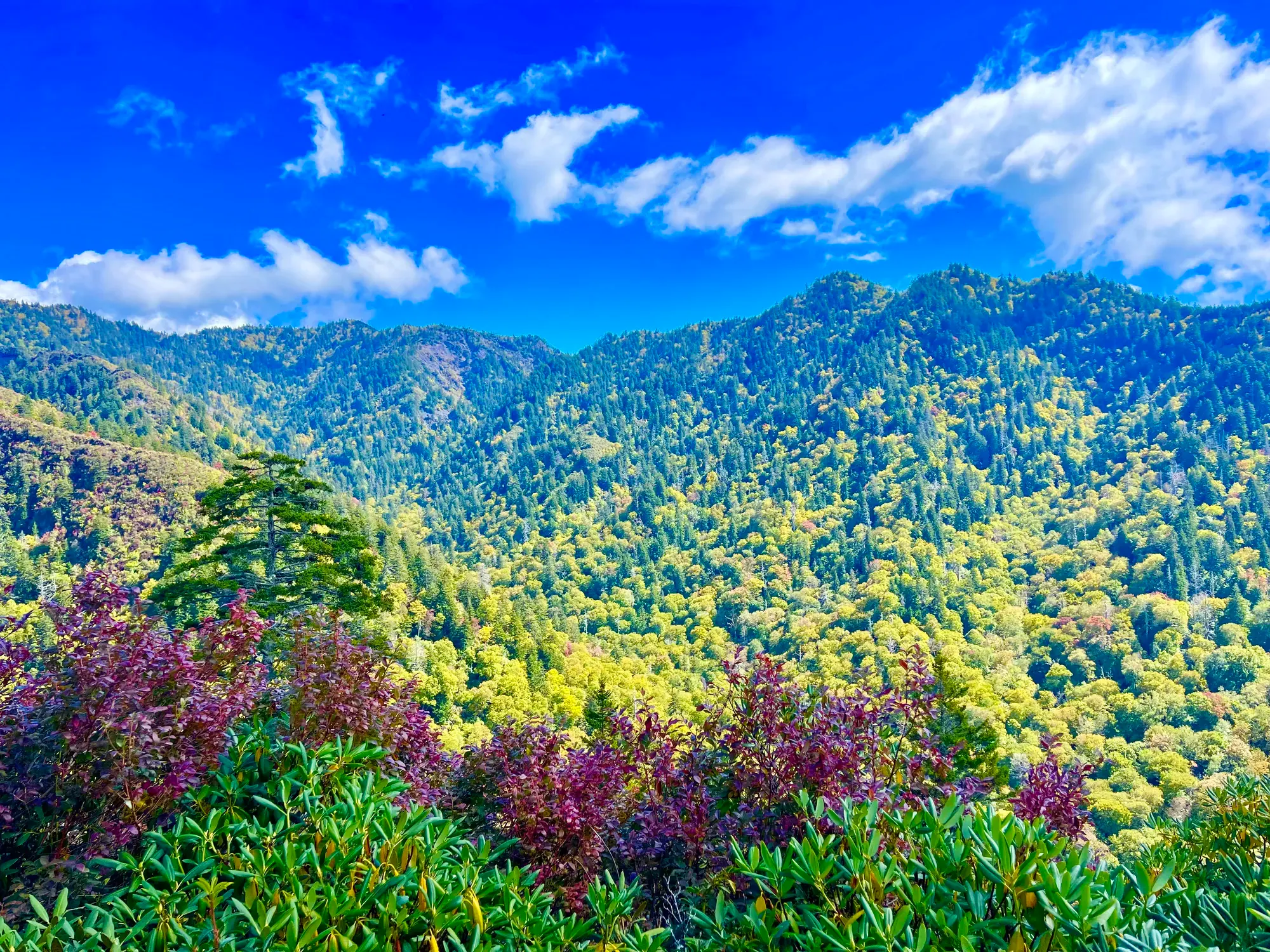
Great Smoky Mountains · Photo: David & Keri New
- 3.5 miDistance
- StrenuousDifficulty
The numbers, with sources
Distance: 3.5 miles round trip to the Chimney Tops overlook. Source
Gain: The NPS doesn’t publish the elevation gain. Source
Time: Unavailable: no published hiking time. Source
Difficulty: Challenging: steep inclines, stone stairs, roots and rocks. Source
Trailhead: Chimney Tops Trailhead on Newfound Gap Road (US 441), about 7 miles from Sugarlands Visitor Center. Source
Route type: Out-and-back Source
Built from official sources (checked Nov 6, 2026). Confirm current conditions with the park.
Recreation.gov permits, entrances & campgrounds
Recreation.gov (RIDB). Booking records date not published. NPS guidance above takes precedence. A listing doesn’t mean you need a permit or that there’s space on your dates.
Park campground options (33)
These records belong to the park’s NPS recreation area. We haven’t checked how close these are to the trail, when they open or whether sites are free; check the map and the booking page.
SMOKEMONT GROUP CAMP — Campground; RIDB reservable: yes. Season: not published in structured RIDB data. Recreation.gov (RIDB) source · Booking details
NPS reservation guidance: Campsite reservations are required and may be made up to twelve months in advance. NPS source
COSBY GROUP CAMP — Campground; RIDB reservable: yes. Season: not published in structured RIDB data. Recreation.gov (RIDB) source · Booking details
BIG CREEK GROUP CAMP — Campground; RIDB reservable: yes. Season: not published in structured RIDB data. Recreation.gov (RIDB) source · Booking details
ANTHONY CREEK HORSE CAMP — Campground; RIDB reservable: yes. Season: not published in structured RIDB data. Recreation.gov (RIDB) source · Booking details
BALSAM MOUNTAIN CAMPGROUND — Campground; RIDB reservable: yes. Season: not published in structured RIDB data. Recreation.gov (RIDB) source · Booking details
NPS reservation guidance: Campsite reservations are required and may be made up to six months in advance. NPS source
GREENBRIER PICNIC PAVILION — Campground; RIDB reservable: yes. Season: not published in structured RIDB data. Recreation.gov (RIDB) source · Booking details
TOW STRING HORSE CAMP — Campground; RIDB reservable: yes. Season: not published in structured RIDB data. Recreation.gov (RIDB) source · Booking details
COSBY PICNIC PAVILION — Campground; RIDB reservable: yes. Season: not published in structured RIDB data. Recreation.gov (RIDB) source · Booking details
ROUND BOTTOM HORSE CAMP — Campground; RIDB reservable: yes. Season: not published in structured RIDB data. Recreation.gov (RIDB) source · Booking details
Look Rock Campground — Campground; RIDB reservable: yes. Season: not published in structured RIDB data. Recreation.gov (RIDB) source · Booking details
NPS reservation guidance: Campsite reservations are required and may be made up to six months in advance. NPS source
CATALOOCHEE HORSE CAMP — Campground; RIDB reservable: yes. Season: not published in structured RIDB data. Recreation.gov (RIDB) source · Booking details
DEEP CREEK GROUP CAMP — Campground; RIDB reservable: yes. Season: not published in structured RIDB data. Recreation.gov (RIDB) source · Booking details
CADES COVE GROUP — Campground; RIDB reservable: yes. Season: not published in structured RIDB data. Recreation.gov (RIDB) source · Booking details
NPS reservation guidance: Campsite reservations are required and may be made up to twelve months in advance. NPS source
COSBY CAMPGROUND — Campground; RIDB reservable: yes. Season: not published in structured RIDB data. Recreation.gov (RIDB) source · Booking details
NPS reservation guidance: Campsite reservations are required and may be made up to six months in advance. NPS source
BIG CREEK CAMPGROUND (GREAT SMOKY MOUNTAINS NATIONAL PARK) — Campground; RIDB reservable: yes. Season: not published in structured RIDB data. Recreation.gov (RIDB) source · Booking details
NPS reservation guidance: Campsite reservations are required and may be made up to six months in advance. NPS source
ELKMONT CAMPGROUND — Campground; RIDB reservable: yes. Season: not published in structured RIDB data. Recreation.gov (RIDB) source · Booking details
NPS reservation guidance: Campsite reservations are required and may be made up to six months in advance. NPS source
APPALACHIAN CLUBHOUSE — Campground; RIDB reservable: yes. Season: not published in structured RIDB data. Recreation.gov (RIDB) source · Booking details
SMOKEMONT CAMPGROUND — Campground; RIDB reservable: yes. Season: not published in structured RIDB data. Recreation.gov (RIDB) source · Booking details
NPS reservation guidance: Campsite reservations are required and may be made up to six months in advance. NPS source
CADES COVE CAMPGROUND — Campground; RIDB reservable: yes. Season: not published in structured RIDB data. Recreation.gov (RIDB) source · Booking details
NPS reservation guidance: Campsite reservations are required and may be made up to six months in advance. NPS source
TWIN CREEKS PICNIC PAVILION — Campground; RIDB reservable: yes. Season: not published in structured RIDB data. Recreation.gov (RIDB) source · Booking details
CATALOOCHEE CAMPGROUND — Campground; RIDB reservable: yes. Season: not published in structured RIDB data. Recreation.gov (RIDB) source · Booking details
NPS reservation guidance: Campsite reservations are required and may be made up to six months in advance. NPS source
METCALF BOTTOMS PICNIC PAVILION — Campground; RIDB reservable: yes. Season: not published in structured RIDB data. Recreation.gov (RIDB) source · Booking details
Cades Cove Group Campground — Campground; RIDB reservable: no. Season: not published in structured RIDB data. Recreation.gov (RIDB) source · Booking details
RIDB lists reservable=false while NPS describes reservations. Follow NPS and verify booking details. NPS reservation guidance: Campsite reservations are required and may be made up to twelve months in advance. NPS source
Balsam Mt. Campground — Campground; RIDB reservable: no. Season: not published in structured RIDB data. Recreation.gov (RIDB) source
Deep Creek Campground — Campground; RIDB reservable: no. Season: not published in structured RIDB data. Recreation.gov (RIDB) source · Booking details
RIDB lists reservable=false while NPS describes reservations. Follow NPS and verify booking details. NPS reservation guidance: Campsite reservations are required and may be made up to six months in advance. NPS source
BIG CREEK HORSE CAMP — Campground; RIDB reservable: yes. Season: not published in structured RIDB data. Recreation.gov (RIDB) source · Booking details
ELKMONT GROUP CAMP — Campground; RIDB reservable: yes. Season: not published in structured RIDB data. Recreation.gov (RIDB) source · Booking details
NPS reservation guidance: Campsite reservations are required and may be made up to twelve months in advance. NPS source
ABRAM’S CREEK CAMPGROUND — Campground; RIDB reservable: yes. Season: not published in structured RIDB data. Recreation.gov (RIDB) source · Booking details
NPS reservation guidance: Campsite reservations are required and may be made up to six months in advance. NPS source
CATALOOCHEE GROUP CAMP — Campground; RIDB reservable: yes. Season: not published in structured RIDB data. Recreation.gov (RIDB) source · Booking details
Deep Creek Campground (NC) — Campground; RIDB reservable: yes. Season: not published in structured RIDB data. Recreation.gov (RIDB) source · Booking details
NPS reservation guidance: Campsite reservations are required and may be made up to six months in advance. NPS source
SPENCE CABIN — Campground; RIDB reservable: yes. Season: not published in structured RIDB data. Recreation.gov (RIDB) source · Booking details
DEEP CREEK PICNIC PAVILION — Campground; RIDB reservable: yes. Season: not published in structured RIDB data. Recreation.gov (RIDB) source · Booking details
COLLINS CREEK PICNIC PAVILION — Campground; RIDB reservable: yes. Season: not published in structured RIDB data. Recreation.gov (RIDB) source · Booking details
Route, junction by junction
Route selection → Described destination
The trail ends at an overlook, not the summit pinnacles. NPS describes a 3.5-mile round trip with steep inclines, a few early bridge crossings and stone stairs to a view of the surrounding mountains and the Chimney Tops. The 2016 wildfire changed the area, and the closed section beyond the overlook gate is off-limits. Source
No elevation profile yet:
No elevation profile yet: we haven’t verified a complete line for this route. No partial line, invented connector, scaled mileage or flat profile is substituted. Source
In-depth guide
Compiled from linked sources, checked Nov 6, 2026. Each paragraph links to its source.
Is this hike for you?
Chimney Tops is 3.5 miles (5.6 km) round trip to an overlook with a view of the surrounding mountains and the Chimney Tops themselves. It ends at the overlook, not on the pinnacles. Expect steep inclines, a few bridge crossings early on and stone stairs. The NPS doesn’t give an elevation gain or a hiking time. Source
The trail
The trail is steep, with stairs, roots and rocks. In November 2016 a wildfire burned this area and left it prone to erosion and other hazards. The trail past the overlook is closed: read the closed sign and don’t go past the gate. Source
Getting to the trailhead
Expect extreme crowding and limited parking, and consider a shuttle. The Chimney Tops Trailhead is on Newfound Gap Road (US 441), about 7 miles (11.3 km) from Sugarlands Visitor Center and 22 miles (35.4 km) from Oconaluftee Visitor Center. The nearest restroom is at Sugarlands. You need a parking tag to park anywhere in the Smokies for more than 15 minutes. The NPS doesn’t say when parking fills or when the last shuttle runs. Source
Pets
Pets aren’t allowed on this trail. The only park trails that allow them are the Gatlinburg Trail and the Oconaluftee River Trail; pets are also allowed in picnic areas, campgrounds and on roads. Source
Other hikes on the NPS page
The NPS page also lists West Prong, 5.4 miles (8.7 km) round trip, and the Cove Hardwood Nature Trail, 0.75 miles (1.2 km) round trip. Source
Map and elevation profile
Chimney Tops Trail is on the NPS trail map, and OpenStreetMap shows several pieces labeled with the trail’s name, but we haven’t verified a complete line for the hike, so there’s no elevation profile yet. Source · Source 2 · Source 3 · Source 4
Sources & planning limits
Reviewed 2026-11-06. Check current conditions for your trip dates.
Getting there and back
Chimney Tops Trailhead on Newfound Gap Road (US 441), about 7 miles from Sugarlands Visitor Center. Source
Return: Use the return described in the official route account. Don’t count on a shuttle, boat, flight or pickup unless you have confirmed it yourself. Source
Water
The NPS doesn’t publish a full list of water and restrooms along this route. Use only the facilities explicitly identified in the NPS account; confirm current operations. Source
Hazards
Expect extreme crowding. The trailhead is on Newfound Gap Road (US 441), about 7 miles from Sugarlands Visitor Center, where the nearest restroom is; NPS suggests a shuttle. A parking tag is required to park in the Smokies for more than 15 minutes. Pets are not allowed on this trail. Source
Season
This page can’t tell you current access. Check NPS conditions before departure. Source
Check current conditions and seasonal access with the park before you go. Check the park before departure. Source
Gear & rules
Respect current closures, signs and barriers. A mapped path is not proof that travel is permitted. Source
Filling a gap in your kit? Compare these packing essentials on Amazon. Choose gear for your route, conditions and the park’s guidance.
As an Amazon Associate we earn from qualifying purchases. How this works
The Gatlinburg Trail and Oconaluftee River Trail are the two park trails where pets are permitted. Pets are also allowed in picnic areas, in campgrounds, and on roads. Source
Questions
Which hike is this?
The trail ends at an overlook, not the summit pinnacles. NPS describes a 3.5-mile round trip with steep inclines, a few early bridge crossings and stone stairs to a view of the surrounding mountains and the Chimney Tops. The 2016 wildfire changed the area, and the closed section beyond the overlook gate is off-limits. 3.5 miles round trip to the Chimney Tops overlook. Source
Is a measured elevation profile available?
No elevation profile yet: we haven’t verified a complete line for this route. No partial line, invented connector, scaled mileage or flat profile is substituted. Source
Alternatives
Alternative-route distances and durations are unavailable unless separately described in the source. Side trails aren’t included. Source
Camp near Chimney Tops
Closest campgrounds by drive time to Chimney Tops Trail Trailhead:
- 32 min Elkmont (13.4 mi, in the park)
- 33 min Elkmont Group (13.5 mi, in the park)
- 39 min Tow String Horse Camp (19.9 mi, in the park)
- 39 min Smokemont (19 mi, in the park)
- 42 min Smokemont Group (19.5 mi, in the park)
Driving time with no traffic (OSRM, OpenStreetMap roads). Some park roads are shuttle-only in season. All camping near Great Smoky Mountains
More Great Smoky Mountains trail guides
- Abrams Falls5 mi
- Deep Creek Waterfalls Loop2.4 mi
- Gatlinburg Trail4 mi · Easy
- Grotto Falls2.6 mi
- Kuwohi (Clingmans Dome)1 mi
- Mount Le Conte via Alum Cave Trail10 mi · Strenuous