Great Smoky MountainsTrail guides
Abrams Falls
A five-mile round-trip forest walk from Cades Cove to a sandstone waterfall and pool; swimming is strongly discouraged.
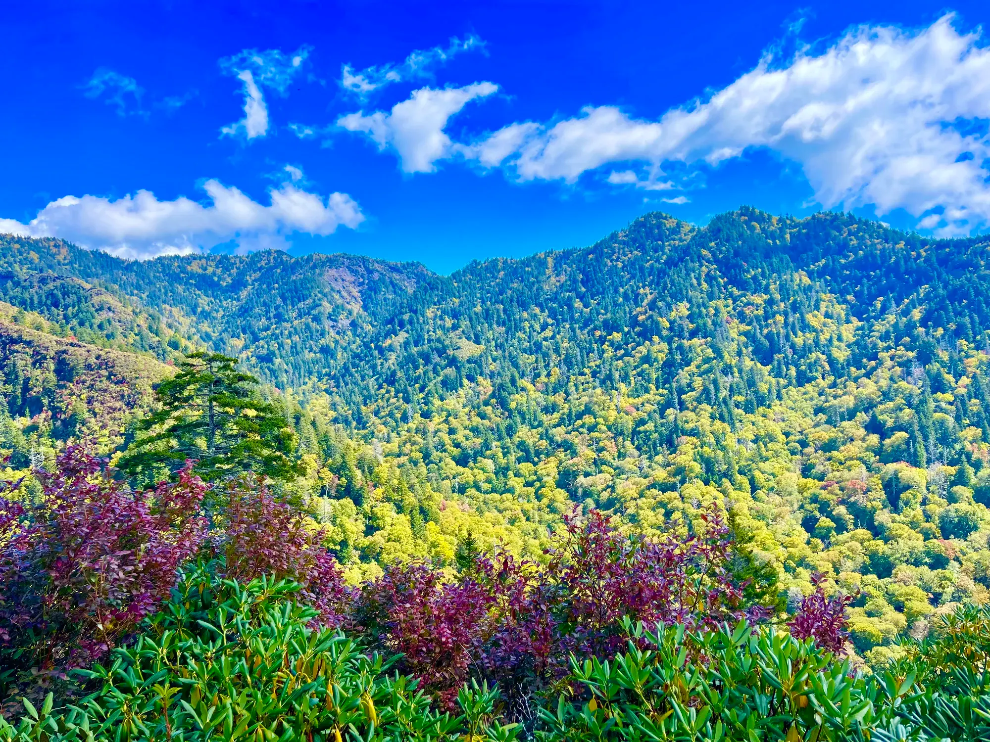
Great Smoky Mountains · Photo: David & Keri New
- 5 miDistance
The numbers, with sources
Distance: 5 miles (8 km) round trip. Source
Gain: The NPS doesn’t publish this. Source
Time: Walking duration not published; allow road time separately. Source
Difficulty: Occasional roots and rocks. The NPS doesn’t give a difficulty rating. Source
Trailhead: Abrams Falls Trailhead, at the end of Abrams Falls Road between Cades Cove Loop Road signposts 10 and 11. Source
Route type: out-and-back Source
Built from official sources (checked Nov 3, 2026). Confirm current conditions with the park.
Recreation.gov permits, entrances & campgrounds
Recreation.gov (RIDB). Booking records date not published. NPS guidance above takes precedence. A listing doesn’t mean you need a permit or that there’s space on your dates.
Nearby campground records
Within 10 straight-line miles of the trailhead. Distances are straight-line from map coordinates, not driving distances.
- ANTHONY CREEK HORSE CAMP: approximately 4.9 miles straight line. RIDB coordinates · Mapped route source
- Look Rock Campground: approximately 5.7 miles straight line. RIDB coordinates · Mapped route source
- CADES COVE GROUP: approximately 4.6 miles straight line. RIDB coordinates · Mapped route source
- CADES COVE CAMPGROUND: approximately 4.3 miles straight line. RIDB coordinates · Mapped route source
- ABRAM’S CREEK CAMPGROUND: approximately 4.7 miles straight line. RIDB coordinates · Mapped route source
Park campground options (33)
These records belong to the park’s NPS recreation area. We haven’t checked how close these are to the trail, when they open or whether sites are free; check the map and the booking page.
SMOKEMONT GROUP CAMP — Campground; RIDB reservable: yes. Season: not published in structured RIDB data. Recreation.gov (RIDB) source · Booking details
NPS reservation guidance: Campsite reservations are required and may be made up to twelve months in advance. NPS source
COSBY GROUP CAMP — Campground; RIDB reservable: yes. Season: not published in structured RIDB data. Recreation.gov (RIDB) source · Booking details
BIG CREEK GROUP CAMP — Campground; RIDB reservable: yes. Season: not published in structured RIDB data. Recreation.gov (RIDB) source · Booking details
ANTHONY CREEK HORSE CAMP — Campground; RIDB reservable: yes. Season: not published in structured RIDB data. Recreation.gov (RIDB) source · Booking details
BALSAM MOUNTAIN CAMPGROUND — Campground; RIDB reservable: yes. Season: not published in structured RIDB data. Recreation.gov (RIDB) source · Booking details
NPS reservation guidance: Campsite reservations are required and may be made up to six months in advance. NPS source
GREENBRIER PICNIC PAVILION — Campground; RIDB reservable: yes. Season: not published in structured RIDB data. Recreation.gov (RIDB) source · Booking details
TOW STRING HORSE CAMP — Campground; RIDB reservable: yes. Season: not published in structured RIDB data. Recreation.gov (RIDB) source · Booking details
COSBY PICNIC PAVILION — Campground; RIDB reservable: yes. Season: not published in structured RIDB data. Recreation.gov (RIDB) source · Booking details
ROUND BOTTOM HORSE CAMP — Campground; RIDB reservable: yes. Season: not published in structured RIDB data. Recreation.gov (RIDB) source · Booking details
Look Rock Campground — Campground; RIDB reservable: yes. Season: not published in structured RIDB data. Recreation.gov (RIDB) source · Booking details
NPS reservation guidance: Campsite reservations are required and may be made up to six months in advance. NPS source
CATALOOCHEE HORSE CAMP — Campground; RIDB reservable: yes. Season: not published in structured RIDB data. Recreation.gov (RIDB) source · Booking details
DEEP CREEK GROUP CAMP — Campground; RIDB reservable: yes. Season: not published in structured RIDB data. Recreation.gov (RIDB) source · Booking details
CADES COVE GROUP — Campground; RIDB reservable: yes. Season: not published in structured RIDB data. Recreation.gov (RIDB) source · Booking details
NPS reservation guidance: Campsite reservations are required and may be made up to twelve months in advance. NPS source
COSBY CAMPGROUND — Campground; RIDB reservable: yes. Season: not published in structured RIDB data. Recreation.gov (RIDB) source · Booking details
NPS reservation guidance: Campsite reservations are required and may be made up to six months in advance. NPS source
BIG CREEK CAMPGROUND (GREAT SMOKY MOUNTAINS NATIONAL PARK) — Campground; RIDB reservable: yes. Season: not published in structured RIDB data. Recreation.gov (RIDB) source · Booking details
NPS reservation guidance: Campsite reservations are required and may be made up to six months in advance. NPS source
ELKMONT CAMPGROUND — Campground; RIDB reservable: yes. Season: not published in structured RIDB data. Recreation.gov (RIDB) source · Booking details
NPS reservation guidance: Campsite reservations are required and may be made up to six months in advance. NPS source
APPALACHIAN CLUBHOUSE — Campground; RIDB reservable: yes. Season: not published in structured RIDB data. Recreation.gov (RIDB) source · Booking details
SMOKEMONT CAMPGROUND — Campground; RIDB reservable: yes. Season: not published in structured RIDB data. Recreation.gov (RIDB) source · Booking details
NPS reservation guidance: Campsite reservations are required and may be made up to six months in advance. NPS source
CADES COVE CAMPGROUND — Campground; RIDB reservable: yes. Season: not published in structured RIDB data. Recreation.gov (RIDB) source · Booking details
NPS reservation guidance: Campsite reservations are required and may be made up to six months in advance. NPS source
TWIN CREEKS PICNIC PAVILION — Campground; RIDB reservable: yes. Season: not published in structured RIDB data. Recreation.gov (RIDB) source · Booking details
CATALOOCHEE CAMPGROUND — Campground; RIDB reservable: yes. Season: not published in structured RIDB data. Recreation.gov (RIDB) source · Booking details
NPS reservation guidance: Campsite reservations are required and may be made up to six months in advance. NPS source
METCALF BOTTOMS PICNIC PAVILION — Campground; RIDB reservable: yes. Season: not published in structured RIDB data. Recreation.gov (RIDB) source · Booking details
Cades Cove Group Campground — Campground; RIDB reservable: no. Season: not published in structured RIDB data. Recreation.gov (RIDB) source · Booking details
RIDB lists reservable=false while NPS describes reservations. Follow NPS and verify booking details. NPS reservation guidance: Campsite reservations are required and may be made up to twelve months in advance. NPS source
Balsam Mt. Campground — Campground; RIDB reservable: no. Season: not published in structured RIDB data. Recreation.gov (RIDB) source
Deep Creek Campground — Campground; RIDB reservable: no. Season: not published in structured RIDB data. Recreation.gov (RIDB) source · Booking details
RIDB lists reservable=false while NPS describes reservations. Follow NPS and verify booking details. NPS reservation guidance: Campsite reservations are required and may be made up to six months in advance. NPS source
BIG CREEK HORSE CAMP — Campground; RIDB reservable: yes. Season: not published in structured RIDB data. Recreation.gov (RIDB) source · Booking details
ELKMONT GROUP CAMP — Campground; RIDB reservable: yes. Season: not published in structured RIDB data. Recreation.gov (RIDB) source · Booking details
NPS reservation guidance: Campsite reservations are required and may be made up to twelve months in advance. NPS source
ABRAM’S CREEK CAMPGROUND — Campground; RIDB reservable: yes. Season: not published in structured RIDB data. Recreation.gov (RIDB) source · Booking details
NPS reservation guidance: Campsite reservations are required and may be made up to six months in advance. NPS source
CATALOOCHEE GROUP CAMP — Campground; RIDB reservable: yes. Season: not published in structured RIDB data. Recreation.gov (RIDB) source · Booking details
Deep Creek Campground (NC) — Campground; RIDB reservable: yes. Season: not published in structured RIDB data. Recreation.gov (RIDB) source · Booking details
NPS reservation guidance: Campsite reservations are required and may be made up to six months in advance. NPS source
SPENCE CABIN — Campground; RIDB reservable: yes. Season: not published in structured RIDB data. Recreation.gov (RIDB) source · Booking details
DEEP CREEK PICNIC PAVILION — Campground; RIDB reservable: yes. Season: not published in structured RIDB data. Recreation.gov (RIDB) source · Booking details
COLLINS CREEK PICNIC PAVILION — Campground; RIDB reservable: yes. Season: not published in structured RIDB data. Recreation.gov (RIDB) source · Booking details
Route, junction by junction
Abrams Falls Road trailhead → forest trail
Start at the parking area off Abrams Falls Road, between Cades Cove Loop Road signposts 10 and 11, and follow Abrams Falls Trail into the forest. Source
Forest trail → Abrams Falls
The NPS gives 5 miles round trip and no distances in between. Look at the falls; don’t swim. Source
Abrams Falls → back to the trailhead
Return the way you came. The falls are the turnaround. Source
No elevation profile: we only draw one from a mapped route we can verify. Route source
In-depth guide
Compiled from linked sources, checked Nov 3, 2026. Each paragraph links to its source.
Decisions & preparation
Distances are shown only where the NPS gives them. Source
Turnaround & return planning
Turn back at the falls, or sooner if the group is running low on energy, water or daylight. Planning basis
Parking & transport timing
About halfway around the 11-mile one-way Cades Cove Loop Road. Allow up to three or four hours for the drive on top of hiking time. The NPS doesn’t say when parking fills. Source
What to bring by season
All seasons: the NPS Ten Essentials (navigation, sun protection, extra clothing, a light, first aid, fire supplies where allowed, repair tools, extra food, water and emergency shelter). Tell someone your route and when you’ll be back. Source
Warm weather: sun protection, plenty of water and extra food. Cold or wet weather: warm layers, rain gear and extra clothing in case you’re out longer than planned. Source
The NPS bridge-work closure notice doesn’t give a year; check current trail status before you go. Source
Children & mobility
Occasional roots and rocks on the trail. Source
Is this hike for you?
Abrams Falls is a five-mile round trip from Cades Cove through rhododendron, hemlock and pine-oak forest (with wildflowers in spring) to a 25-foot waterfall pouring over a sandstone ledge into a deep pool. That 25 feet is the height of the falls, not the climb; the NPS doesn’t give an elevation gain or a hiking time. You come back the same way. Source · Source 2
Getting to the trailhead
The trailhead is on the 11-mile, one-way Cades Cove Loop Road. About halfway around, turn onto Abrams Falls Road between loop-road signposts 10 and 11 and follow it to the trailhead parking area. The NPS says to allow up to three or four hours to drive the loop, on top of your hiking time. Because the road is one-way, you can’t just drive back the way you came. Source
You need a parking tag to park in the Smokies for more than 15 minutes. The NPS says this hike doesn’t need a reservation. Source
The trail and the falls
Expect occasional roots and rocks underfoot. The NPS strongly discourages swimming at Abrams Falls because of slippery rocks and a deadly undertow, so enjoy the pool from the edge and stay off the wet rocks. Source
Closures
The NPS description includes a notice of Monday-through-Thursday trail closures from August 24 to September 30 for footlog bridge replacement, with Friday-through-Sunday and Labor Day access. It doesn’t give a year, so check the current trail status before you go. Source
Water and toilets
There’s a pit toilet at the trailhead, open year-round. The NPS doesn’t list water on the trail, so bring what you’ll need. Source
Kids, dogs and wheelchairs
Pets aren’t allowed. In the park, dogs are allowed only on the Gatlinburg Trail and the Oconaluftee River Trail (plus picnic areas, campgrounds and roads). The NPS doesn’t say whether this trail suits young kids or people with limited mobility. Source · Source 2
Other waterfall hikes
The NPS also lists Deep Creek Waterfall Loop (2.4 miles round trip), Lynn Camp Prong Cascades (1.4 miles round trip) and West Prong (5.4 miles round trip). Each has its own trailhead. Source
Sources & planning limits
Reviewed 2026-11-03. Check current conditions for your trip dates.
- The bridge-work notice gives August 24–September 30 but no year. We don’t know if the work is finished. Source
- The NPS doesn’t give an elevation gain or hiking time. Source
- The NPS doesn’t say whether this trail suits kids or people with limited mobility. Source
- No elevation profile yet: we haven’t verified complete measurements for this route. Source
Getting there and back
Trailhead is roughly halfway around the 11-mile one-way Cades Cove Loop Road. NPS advises allowing up to three or four hours for the drive in addition to walking time. Source
Return: Return to the same trailhead; account separately for the one-way road journey. Source
Water
A year-round pit toilet is identified at the trailhead. The NPS page doesn’t list a place to refill water. Source
A year-round pit toilet is identified at the trailhead. The NPS page doesn’t list a place to refill water. Source
Hazards
Swimming is strongly discouraged because of slippery rocks and a deadly undertow. Source
Occasional roots and rocks occur on the trail. Source
Season
Spring wildflowers are mentioned; confirm current access and any bridge-work restrictions. Source
The closure notice we found has no year, so check current trail status before you go. Source
Gear & rules
Parking longer than 15 minutes requires a parking tag. Source
Filling a gap in your kit? Compare these packing essentials on Amazon. Choose gear for your route, conditions and the park’s guidance.
As an Amazon Associate we earn from qualifying purchases. How this works
Pets are not permitted on the Abrams Falls route. Source
Questions
Is five miles the outbound distance?
No. The NPS activity explicitly identifies five miles round trip. Source
Is the pool a swimming stop?
NPS strongly discourages swimming because of slippery rocks and deadly undertow. Source
Alternatives
NPS lists Deep Creek Waterfall Loop, Lynn Camp Prong Cascades and West Prong as separate alternatives. Source
Camp near Abrams Falls
Closest campgrounds by drive time to Abrams Falls Trail Trailhead:
- 16 min Anthony Creek Horse Camp (6.1 mi, in the park)
- 17 min Cades Cove (5.9 mi, in the park)
- 20 min Cades Cove Group (6.4 mi, in the park)
- 1 hr 9 min Look Rock (32.2 mi, in the park)
- 1 hr 15 min Elkmont Group (27.3 mi, in the park)
Driving time with no traffic (OSRM, OpenStreetMap roads). Some park roads are shuttle-only in season. All camping near Great Smoky Mountains
More Great Smoky Mountains trail guides
- Chimney Tops3.5 mi · Strenuous
- Deep Creek Waterfalls Loop2.4 mi
- Gatlinburg Trail4 mi · Easy
- Grotto Falls2.6 mi
- Kuwohi (Clingmans Dome)1 mi
- Mount Le Conte via Alum Cave Trail10 mi · Strenuous