Great Smoky MountainsTrail guides
Mount Le Conte via Alum Cave Trail
Alum Cave Trail passes through Arch Rock and reaches Alum Cave Bluffs before continuing toward Mount Le Conte. NPS lists the full Mount Le Conte option as a 10-mile round-trip hike.
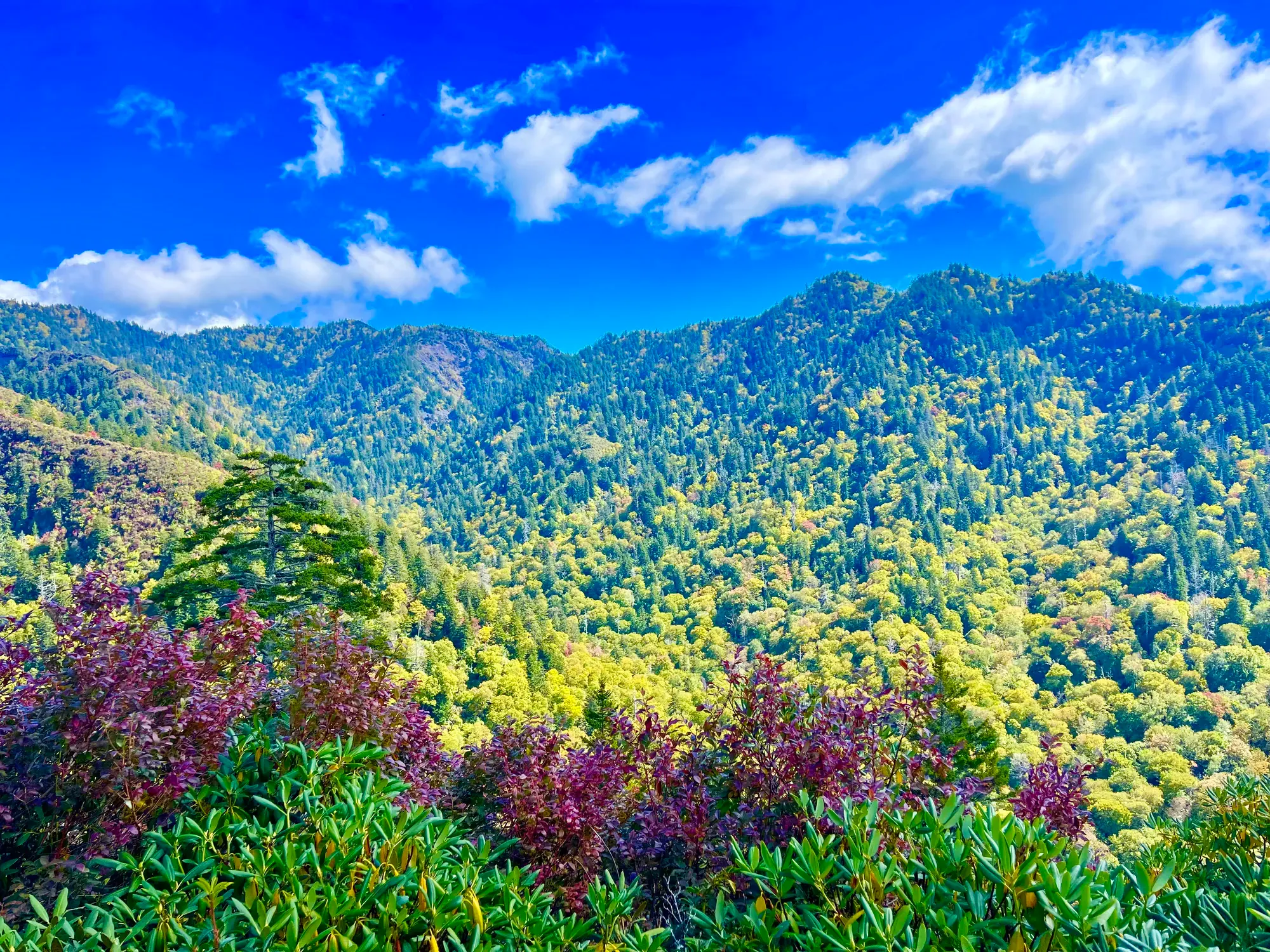
Great Smoky Mountains · Photo: David & Keri New
- 10 miDistance
- StrenuousDifficulty
The numbers, with sources
Distance: 10 miles round trip to Mount Le Conte Source
Difficulty: More strenuous than the Alum Cave Bluffs hike (NPS wording; no separate full-route rating published on this page). Source
Trailhead: Alum Cave Bluffs Trailhead, Newfound Gap Road (US 441), between mile markers 10 and 11 Source
Route type: out-and-back Source
Built from official sources (checked Nov 3, 2026). Confirm current conditions with the park.
Recreation.gov permits, entrances & campgrounds
Recreation.gov (RIDB). Booking records date not published. NPS guidance above takes precedence. A listing doesn’t mean you need a permit or that there’s space on your dates.
Nearby campground records
Within 10 straight-line miles of the trailhead. Distances are straight-line from map coordinates, not driving distances.
- SMOKEMONT GROUP CAMP: approximately 9.2 miles straight line. RIDB coordinates · Mapped route source
- GREENBRIER PICNIC PAVILION: approximately 6.9 miles straight line. RIDB coordinates · Mapped route source
- ELKMONT CAMPGROUND: approximately 7.6 miles straight line. RIDB coordinates · Mapped route source
- APPALACHIAN CLUBHOUSE: approximately 7.5 miles straight line. RIDB coordinates · Mapped route source
- SMOKEMONT CAMPGROUND: approximately 9.3 miles straight line. RIDB coordinates · Mapped route source
- TWIN CREEKS PICNIC PAVILION: approximately 4.8 miles straight line. RIDB coordinates · Mapped route source
- ELKMONT GROUP CAMP: approximately 7.8 miles straight line. RIDB coordinates · Mapped route source
- SPENCE CABIN: approximately 7.3 miles straight line. RIDB coordinates · Mapped route source
- COLLINS CREEK PICNIC PAVILION: approximately 7.9 miles straight line. RIDB coordinates · Mapped route source
Park campground options (33)
These records belong to the park’s NPS recreation area. We haven’t checked how close these are to the trail, when they open or whether sites are free; check the map and the booking page.
SMOKEMONT GROUP CAMP — Campground; RIDB reservable: yes. Season: not published in structured RIDB data. Recreation.gov (RIDB) source · Booking details
NPS reservation guidance: Campsite reservations are required and may be made up to twelve months in advance. NPS source
COSBY GROUP CAMP — Campground; RIDB reservable: yes. Season: not published in structured RIDB data. Recreation.gov (RIDB) source · Booking details
BIG CREEK GROUP CAMP — Campground; RIDB reservable: yes. Season: not published in structured RIDB data. Recreation.gov (RIDB) source · Booking details
ANTHONY CREEK HORSE CAMP — Campground; RIDB reservable: yes. Season: not published in structured RIDB data. Recreation.gov (RIDB) source · Booking details
BALSAM MOUNTAIN CAMPGROUND — Campground; RIDB reservable: yes. Season: not published in structured RIDB data. Recreation.gov (RIDB) source · Booking details
NPS reservation guidance: Campsite reservations are required and may be made up to six months in advance. NPS source
GREENBRIER PICNIC PAVILION — Campground; RIDB reservable: yes. Season: not published in structured RIDB data. Recreation.gov (RIDB) source · Booking details
TOW STRING HORSE CAMP — Campground; RIDB reservable: yes. Season: not published in structured RIDB data. Recreation.gov (RIDB) source · Booking details
COSBY PICNIC PAVILION — Campground; RIDB reservable: yes. Season: not published in structured RIDB data. Recreation.gov (RIDB) source · Booking details
ROUND BOTTOM HORSE CAMP — Campground; RIDB reservable: yes. Season: not published in structured RIDB data. Recreation.gov (RIDB) source · Booking details
Look Rock Campground — Campground; RIDB reservable: yes. Season: not published in structured RIDB data. Recreation.gov (RIDB) source · Booking details
NPS reservation guidance: Campsite reservations are required and may be made up to six months in advance. NPS source
CATALOOCHEE HORSE CAMP — Campground; RIDB reservable: yes. Season: not published in structured RIDB data. Recreation.gov (RIDB) source · Booking details
DEEP CREEK GROUP CAMP — Campground; RIDB reservable: yes. Season: not published in structured RIDB data. Recreation.gov (RIDB) source · Booking details
CADES COVE GROUP — Campground; RIDB reservable: yes. Season: not published in structured RIDB data. Recreation.gov (RIDB) source · Booking details
NPS reservation guidance: Campsite reservations are required and may be made up to twelve months in advance. NPS source
COSBY CAMPGROUND — Campground; RIDB reservable: yes. Season: not published in structured RIDB data. Recreation.gov (RIDB) source · Booking details
NPS reservation guidance: Campsite reservations are required and may be made up to six months in advance. NPS source
BIG CREEK CAMPGROUND (GREAT SMOKY MOUNTAINS NATIONAL PARK) — Campground; RIDB reservable: yes. Season: not published in structured RIDB data. Recreation.gov (RIDB) source · Booking details
NPS reservation guidance: Campsite reservations are required and may be made up to six months in advance. NPS source
ELKMONT CAMPGROUND — Campground; RIDB reservable: yes. Season: not published in structured RIDB data. Recreation.gov (RIDB) source · Booking details
NPS reservation guidance: Campsite reservations are required and may be made up to six months in advance. NPS source
APPALACHIAN CLUBHOUSE — Campground; RIDB reservable: yes. Season: not published in structured RIDB data. Recreation.gov (RIDB) source · Booking details
SMOKEMONT CAMPGROUND — Campground; RIDB reservable: yes. Season: not published in structured RIDB data. Recreation.gov (RIDB) source · Booking details
NPS reservation guidance: Campsite reservations are required and may be made up to six months in advance. NPS source
CADES COVE CAMPGROUND — Campground; RIDB reservable: yes. Season: not published in structured RIDB data. Recreation.gov (RIDB) source · Booking details
NPS reservation guidance: Campsite reservations are required and may be made up to six months in advance. NPS source
TWIN CREEKS PICNIC PAVILION — Campground; RIDB reservable: yes. Season: not published in structured RIDB data. Recreation.gov (RIDB) source · Booking details
CATALOOCHEE CAMPGROUND — Campground; RIDB reservable: yes. Season: not published in structured RIDB data. Recreation.gov (RIDB) source · Booking details
NPS reservation guidance: Campsite reservations are required and may be made up to six months in advance. NPS source
METCALF BOTTOMS PICNIC PAVILION — Campground; RIDB reservable: yes. Season: not published in structured RIDB data. Recreation.gov (RIDB) source · Booking details
Cades Cove Group Campground — Campground; RIDB reservable: no. Season: not published in structured RIDB data. Recreation.gov (RIDB) source · Booking details
RIDB lists reservable=false while NPS describes reservations. Follow NPS and verify booking details. NPS reservation guidance: Campsite reservations are required and may be made up to twelve months in advance. NPS source
Balsam Mt. Campground — Campground; RIDB reservable: no. Season: not published in structured RIDB data. Recreation.gov (RIDB) source
Deep Creek Campground — Campground; RIDB reservable: no. Season: not published in structured RIDB data. Recreation.gov (RIDB) source · Booking details
RIDB lists reservable=false while NPS describes reservations. Follow NPS and verify booking details. NPS reservation guidance: Campsite reservations are required and may be made up to six months in advance. NPS source
BIG CREEK HORSE CAMP — Campground; RIDB reservable: yes. Season: not published in structured RIDB data. Recreation.gov (RIDB) source · Booking details
ELKMONT GROUP CAMP — Campground; RIDB reservable: yes. Season: not published in structured RIDB data. Recreation.gov (RIDB) source · Booking details
NPS reservation guidance: Campsite reservations are required and may be made up to twelve months in advance. NPS source
ABRAM’S CREEK CAMPGROUND — Campground; RIDB reservable: yes. Season: not published in structured RIDB data. Recreation.gov (RIDB) source · Booking details
NPS reservation guidance: Campsite reservations are required and may be made up to six months in advance. NPS source
CATALOOCHEE GROUP CAMP — Campground; RIDB reservable: yes. Season: not published in structured RIDB data. Recreation.gov (RIDB) source · Booking details
Deep Creek Campground (NC) — Campground; RIDB reservable: yes. Season: not published in structured RIDB data. Recreation.gov (RIDB) source · Booking details
NPS reservation guidance: Campsite reservations are required and may be made up to six months in advance. NPS source
SPENCE CABIN — Campground; RIDB reservable: yes. Season: not published in structured RIDB data. Recreation.gov (RIDB) source · Booking details
DEEP CREEK PICNIC PAVILION — Campground; RIDB reservable: yes. Season: not published in structured RIDB data. Recreation.gov (RIDB) source · Booking details
COLLINS CREEK PICNIC PAVILION — Campground; RIDB reservable: yes. Season: not published in structured RIDB data. Recreation.gov (RIDB) source · Booking details
Route, junction by junction
Alum Cave Trailhead → Arch Rock
The approach to Arch Rock passes through old-growth forest with mountain streams along the way. NPS describes walking through Arch Rock as part of the Alum Cave Bluffs hike. The trail includes multiple sets of stairs and obstacles such as rocks and roots; NPS offers the Arch Rock turnaround as the more moderate option. Source
Arch Rock → Alum Cave Bluffs
Beyond Arch Rock, the trail becomes considerably steeper. Continue toward Alum Cave Bluffs, the destination of the NPS 4.6-mile round-trip hike. In cold weather the trail can be icy, and NPS warns of falling icicles. The published Arch Rock alternative is 2.8 miles round trip; these are round-trip itinerary totals rather than surveyed segment lengths. Source
Alum Cave Bluffs → Mount Le Conte / LeConte Lodge
NPS calls continuing beyond the bluffs to Mount Le Conte the more strenuous option. The official lodge operator identifies Arch Rock, Inspiration Point, and Alum Cave Bluffs as landmarks on its Alum Cave approach and describes views south and west over the Smokies. Higher on the route there are several exposed rock ledges with hand cables. The operator measures its route to the lodge, which should not be read as a separately measured route to the mountain summit. Source
1: Alum Cave Trailhead · 2: Arch Rock · 3: Alum Cave Bluffs · 4: LeConte Lodge
Traced line: 5.04 mi one way, about 2,697 ft of climbing and 153 ft of descent. Alum Cave trailhead to LeConte Lodge.
Elevations: USGS 3DEP (public domain). Route: National Park Service GIS. Terrain sampling and smoothing can miss short climbs and steep steps.
Elevation waypoint table
| Waypoint | Mile | Elevation (ft) |
|---|---|---|
| 1. Alum Cave Trailhead | 0.00 | 3,850 |
| 2. Arch Rock | 1.13 | 4,220 |
| 3. Alum Cave Bluffs | 2.24 | 5,046 |
| 4. LeConte Lodge | 5.04 | 6,394 |
Method: Centered 50 m moving average (5 m trapezoidal integration; clamped endpoints); 3 m hysteresis. Elevations and distances are estimates along the mapped route. Published route figures.
In-depth guide
Compiled from linked sources, checked Nov 3, 2026. Each paragraph links to its source.
Decisions & preparation
The NPS publishes distances only to Arch Rock, the bluffs and the summit, so those are the only ones we show. Source
Turnaround & return planning
Turn around at Arch Rock or the bluffs before anyone runs low on energy, water or daylight. Don’t plan on a road pickup partway. Planning basis
Parking & transport timing
The trailhead and its large parking area are 6.8 miles south of Sugarlands Visitor Center on US 441. Expect extreme crowding and limited parking; the NPS suggests a shuttle. It doesn’t say when the lot fills. Source
Alum Cave Trailhead is a stop for some of the park’s authorized shuttle companies. Most run March through October, and schedules and routes vary by company, so book with a provider before your hike. A parking tag doesn’t guarantee you a space. Shuttle source
What to bring by season
Bring the NPS’s Ten Essentials: navigation, sun protection, extra clothing, illumination, first aid, fire supplies where permitted, repair tools, extra food, water and emergency shelter. Leave your route and return plan with someone. Source
In warm weather, bring sun protection, plenty of water and extra food. In cold or wet weather, bring insulating layers, rain gear and extra clothing in case you’re delayed. Source
In winter, expect trail ice and falling icicles. The NPS recommends microspikes. Source
Children & mobility
The trail has multiple sets of stairs, steep sections, and obstacles like rocks and roots. Source
Is this hike for you?
Alum Cave is the shortest of five routes to Mount Le Conte, but it’s steep and rocky, with stairs and bridges. Plan for the descent as much as the climb: irregular steps are hard on tired legs. Arch Rock makes a more moderate turnaround, and the trail steepens considerably beyond it, so stop there and check everyone’s energy and the weather before you go on. It’s fine to pick a shorter destination before you start. Source · Source 2
The trail
The trail follows Alum Cave Creek through dense forest to Arch Rock, then climbs past the bluffs into spruce-fir forest. Near the summit, follow the signs for Cliff Top and Myrtle Point, the park’s recommended viewpoints. Check your map before adding either one, and leave time for the walk down. We haven’t checked the NPS elevation figures for this route against a mapped line, so there’s no total climb here. Source · Source 2
Getting there and parking
Newfound Gap Road (U.S. 441) normally stays open year-round when weather permits, but snow, ice and other hazards can close it. Check the park’s road closures before you drive, and have a backup plan. Source
You need a parking tag: $5 daily, $15 weekly or $40 annually. Most trailheads have no tag machines, so buy one first; Sugarlands Visitor Center and Newfound Gap Overlook have machines. Each tag covers one vehicle and must match its license plate. You have to display a physical tag, not a digital copy, so print an online daily or weekly tag yourself before you arrive (park staff won’t print it). For a rental car, wait until you know the plate. Source
Daily and weekly tags expire at 11:59 p.m. on the printed date. Online, you pick the visit date; machine tags start on the day you buy them. Vehicles with a state-issued disability placard or disability plates don’t need a tag. America the Beautiful passes, including Access and Senior passes, don’t replace it. Source
Hazards
Slick autumn leaves hide rocks and roots and can cause slips and ankle fractures, so slow down on the descent. Don’t hike after dark, when falls and wildlife encounters are more likely; carry a headlamp as a backup. After rain, expect swollen streams, bridge washouts, fallen trees and erosion. Don’t try a flooded stream crossing. Turn back or wait for the water to drop. Source
Look overhead for dead trees or limbs before you stop for a break, and stay on maintained trails. Ground-nesting yellowjackets live near trails and streams and can get aggressive if disturbed; skip fragrances, and if anyone in your group is at risk of a severe reaction, the park recommends an epinephrine kit. Northern copperheads and timber rattlesnakes live here too, so watch where you put your hands and feet, and check for ticks afterward. Source
Bears and elk
Don’t willfully approach within 50 yards (150 feet) of bears or elk, and don’t feed, touch or tease wildlife. You can carry bear spray, but never use it on people, tents or gear. Report spray use, unusual bear behavior, or bears in developed areas to a ranger. Source · Source 2
Staying overnight
Backcountry camping needs a permit and advance reservations, and you have to use designated campsites or shelters. If your itinerary includes a shelter, you sleep inside it. Consecutive nights at a shelter aren’t allowed, and the normal maximum group size is eight. A backcountry permit doesn’t replace your parking tag. Check current permit and fee details for your dates. Source · Source 2
Hang all scented items (food, trash, lip balm, toothpaste) on the bear cables at campsites and shelters. Keep all soap, even biodegradable, out of water sources. Bury human waste at least six inches deep and at least 100 feet from campsites, shelters, trails and water. Pack out trash instead of burning it. Source
Other options
Other routes to Mount Le Conte are longer: the Appalachian Trail and Boulevard at 16.2 miles round trip, Bullhead at 13.6, and Trillium Gap and Rainbow Falls at 13 miles each. For a shorter day, Cove Hardwood Nature Trail is 0.75 mile round trip, Andrews Bald is 3.6 miles and West Prong is 5.4 miles. Source · Source 2
Sources & planning limits
Reviewed 2026-11-03. Check current conditions for your trip dates.
- Permit, reservation and fee details change. Check the NPS for your travel dates. Source
Getting there and back
The trailhead and large parking area are 6.8 miles south of Sugarlands Visitor Center on US 441. Expect extreme crowding and limited parking; NPS suggests a shuttle. Source
Shuttle: NPS lists Alum Cave Trailhead among stops offered by authorized shuttle companies. Most services run March through October; schedules and routes vary by company. Contact a listed provider and secure transportation before the hike. The NPS page does not publish a common frequency or final pickup time, and a parking tag does not guarantee a parking space. Source
Return: The existing NPS itinerary is a round trip along Alum Cave Trail: 4.6 miles for the bluffs or 10 miles for the Mount Le Conte option. Use the Alum Cave approach for the return to the original trailhead. If arriving by a commercial shuttle, secure transportation before beginning; park staff cannot book a shuttle and cell service is limited. Source
Water
A pit toilet is available seasonally at the trailhead. Drinking water is not published on this page. Source
The park recommends carrying water and treatment supplies, with at least 1 liter per 2 hours of hiking. This is general Smokies hiking guidance, not a published water-source inventory for Alum Cave Trail. Source
Treat stream water before drinking because it may contain Giardia. NPS identifies boiling for one minute or using a filter that removes particles as small as 1 micron as treatment methods; it does not identify a dependable drinking-water stop on the Alum Cave trail page. Source
Hazards
Ice and falling icicles
Cold weather creates two distinct concerns on this route: ice underfoot and icicles falling from above. NPS recommends microspikes in winter. Source
Footing and exposure
The trail has stairs, steep sections, rocks and roots. The lodge operator additionally identifies exposed upper rock ledges with hand cables. Source
Sudden weather changes
General Smokies guidance warns that cool, wet and windy conditions can cause hypothermia even in summer. Put on rain gear before getting wet, dress in layers, and change wet clothes as soon as possible. Source
Limited communications and rescue
Cell service is extremely limited. NPS recommends considering a personal locator beacon and warns that rescue is not certain; rangers may need several hours to reach a backcountry incident. Leave an itinerary with a trusted person. Source
Season
In cold weather, prepare for ice on the trail and falling icicles; NPS recommends microspikes in winter. Opening dates are not published on this page. Source
Winter visitors should prepare for trail ice and falling icicles and consider the NPS microspike recommendation. This is a conditions warning, not a fixed seasonal opening or closing calendar. Source
The lodge operator describes rhododendron, myrtle and mountain laurel blooming in late spring and patches of Grass of Parnassus and gentian in late summer along the Alum Cave approach. These are seasonal descriptions rather than guaranteed bloom dates. Source
Gear & rules
Pets are not allowed on this hike. Only Gatlinburg Trail and Oconaluftee River Trail permit pets among park trails. Source
Filling a gap in your kit? Compare these packing essentials on Amazon. Choose gear for your route, conditions and the park’s guidance.
As an Amazon Associate we earn from qualifying purchases. How this works
NPS recommends letting the slowest hiker lead, keeping the group together, and staying on marked trails. Choose a route suited to the entire group and leave a trip plan with someone who is not going. Source
Carry navigation, sun protection, insulation and rain gear, a headlamp or flashlight, first aid, fire supplies, repair tools, food, water and emergency shelter. NPS calls these minimum essentials and recommends suitable hiking boots or shoes with ankle support. Source
Pets are not permitted on Alum Cave Trail. NPS identifies Gatlinburg Trail and Oconaluftee River Trail as the only park trails allowing pets. Source
A parking tag is required when parking in the Smokies for more than 15 minutes. Expect extreme crowding and limited parking at this trailhead; the trail page recommends considering a shuttle. Source
Questions
Can the hike be shortened?
Yes. NPS offers Arch Rock as a more moderate 2.8-mile round trip and Alum Cave Bluffs as a 4.6-mile round trip. The Mount Le Conte continuation is the more strenuous 10-mile round-trip option. Source
Are there restrooms at the start?
The trail page lists a pit toilet available seasonally at the trailhead. It does not give operating dates for that toilet. Source
How much climbing does the lodge approach involve?
The official lodge operator lists 2,700 feet up and 100 feet down on its 5-mile Alum Cave route to the lodge. Those totals describe the whole approach, not individual stretches or an absolute summit elevation. Source
Does a parking tag reserve a space?
No. NPS says parking is first come, first served and a valid tag does not guarantee a particular spot, location or time frame. Source
Who built the stone steps at Arch Rock?
The park trail crew built the steps in 2015 and 2016. NPS says they were not built by the Civilian Conservation Corps in the 1930s. Source
Is Alum Cave an enclosed cave?
It is a rocky overhang rather than a cave. The NPS place page describes the bluff as towering 75 feet overhead. Source
When should visitors arrive for parking?
NPS advises arriving early to improve the chance of finding a parking space, or considering a shuttle. Source
Is LeConte Lodge at the mountain’s summit?
The lodge is west of the summit at 6,360 feet. NPS separately identifies Mount LeConte’s summit elevation as 6,593 feet. Source
Alternatives
Arch Rock turnaround: NPS describes turning around at Arch Rock as a more moderate hike: 2.8 miles round trip. Source
Camp near Mount Le Conte via Alum Cave Trail
Closest campgrounds by drive time to Alum Cave trailhead Trailhead:
- 35 min Smokemont (17.3 mi, in the park)
- 36 min Elkmont Group (15.2 mi, in the park)
- 36 min Tow String Horse Camp (18.2 mi, in the park)
- 36 min Elkmont (15.1 mi, in the park)
- 38 min Smokemont Group (17.8 mi, in the park)
Driving time with no traffic (OSRM, OpenStreetMap roads). Some park roads are shuttle-only in season. All camping near Great Smoky Mountains
More Great Smoky Mountains trail guides
- Abrams Falls5 mi
- Chimney Tops3.5 mi · Strenuous
- Deep Creek Waterfalls Loop2.4 mi
- Gatlinburg Trail4 mi · Easy
- Grotto Falls2.6 mi
- Kuwohi (Clingmans Dome)1 mi