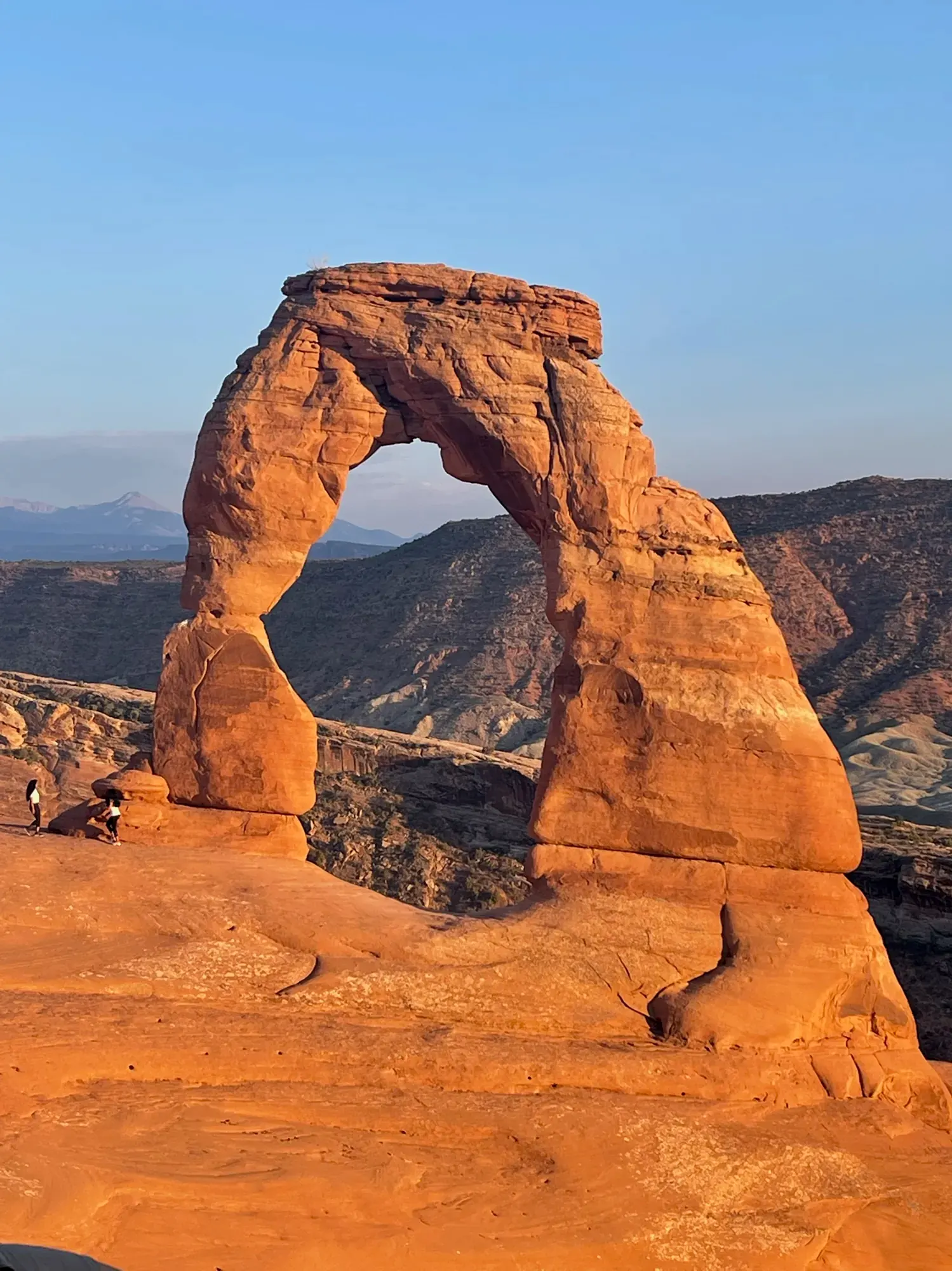
Utah’s Mighty 5
Southwest Utah to Moab: five parks linked by scenic byways, from Zion’s canyon to Arches.
Photo: David & Keri New
All five parks or a shorter Zion–Bryce trip?
All five parks
Start in Springdale and finish in Moab. Use Springdale, the Bryce area, Torrey and Moab as your four bases.
See the 7-day itineraryFour days in southwest Utah
Spend two days each in Zion and Bryce Canyon. Save Capitol Reef, Canyonlands and Arches for another trip.
See the 4-day routeToday in the parks
- ZionOpen · 2 closures
- Bryce CanyonOpen · 2 closures
- Capitol ReefOpen · 3 alerts
- CanyonlandsOpen · 1 alert
- ArchesOpen
NPS alerts as of Nov 20, 2026
At a glance
5 parks, 7 days.
- 1Zion2 days
- 2Bryce Canyon1 day
- 3Capitol Reef1 day
- 4Canyonlands1 day
- 5Arches2 days
Drive figures marked NPS come from the parks’ own pages; the rest are approximate road estimates, so check your route. Route lines and estimates use map data © OpenStreetMap contributors.
The route
Park by park, drive by drive.
-
Stop 1 · 2 days Zion We visited: Nov 2020 · May 2024 SleepWatchman, South, Lava PointCampsites book up to 6 months ahead
Springdale. Rockville if Springdale is full. Plan how you’ll reach the canyon shuttle.
Park guide Camping Where to stay - Drive · Zion to Bryce Canyon 86 mi≈ 2 hoursNPS UT-9 east through the Zion-Mt. Carmel Tunnel to Mt. Carmel Junction, US-89 north, UT-12 east, UT-63 south NPS source
-
Stop 2 · 1 day Bryce Canyon We visited: November 2020 SleepNorth, SunsetCampsites book up to 6 months ahead
Bryce Canyon City. Tropic if you’re continuing east toward Capitol Reef.
Park guide Camping Where to stay - Drive · Bryce Canyon to Capitol Reef ≈ 120 mi≈ 3 hoursApprox. UT-63 north, UT-12 east through Tropic, Escalante and Boulder to Torrey, UT-24 east to the visitor center
-
Stop 3 · 1 day Capitol Reef We visited: September 2021 SleepFruita, Fruita Group Campsite, Cedar Mesa and 1 moreCampsites book up to 6 months ahead
Torrey. Hanksville if you’re comfortable adding a drive back to Fruita.
Park guide Camping Where to stay - Drive · Capitol Reef to Canyonlands ≈ 153 mi≈ 2.5-3 hoursApprox. UT-24 east through Hanksville to I-70 (exit 149), I-70 east to Crescent Junction (exit 182), US-191 south, UT-313 west/south to Island in the Sky
-
Stop 4 · 1 day Canyonlands We visited: September 2021 SleepIsland in the Sky, The Needles, Needles group campsitesCampsites book up to 6 months ahead
Moab. Try the Arches side of Moab and keep the same room for Arches.
Park guide Camping Where to stay - Drive · Canyonlands to Arches ≈ 27 mi≈ 40 minutesApprox. UT-313 back to US-191, south on US-191 about 5 mi to the Arches entrance
-
Stop 5 · 2 days Arches We visited: September 2021 SleepDevils GardenCampsites book up to 6 months ahead
Keep your Moab base. Consider a different Moab property before adding another overnight move.
Park guide Camping Where to stay
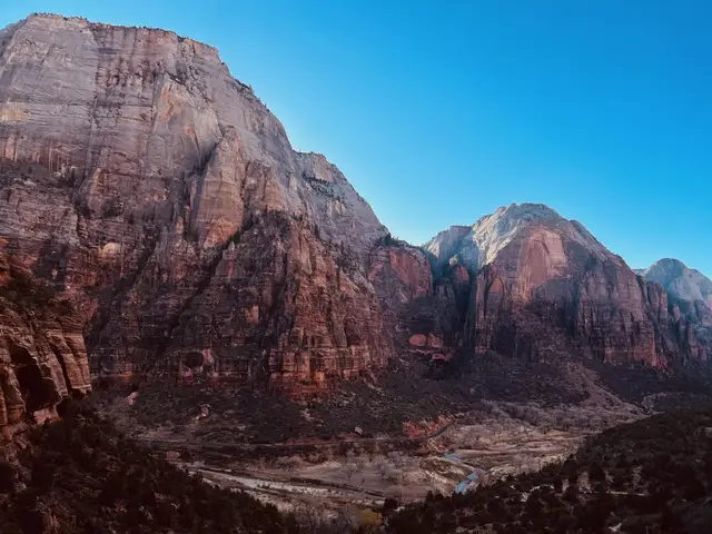
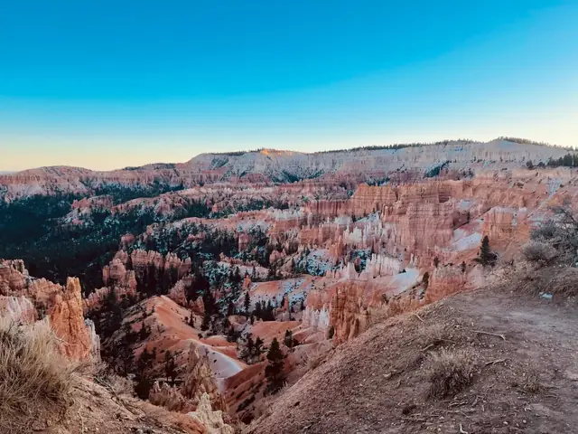
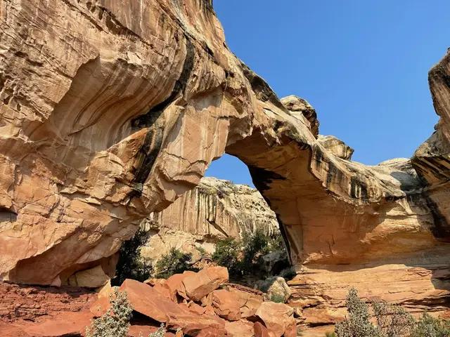
When to go
Best in May, September and October.
Each park’s month scores (5 is best), from our month-by-month research. The trip row lights up when every park scores 4 or higher.
Scores come from NPS weather and seasons pages and NOAA 1991–2020 climate normals. See best parks by month.
When is everything open?
Everything with published dates is normally open Apr 3 – Oct 18 (set by Bryce Canyon shuttle). A planning window from NPS seasons, not a guarantee.
Open all yearWatchman Campground · Fruita Campground · Needles Campground Loop A · Island in the Sky (Willow Flat) Campground · Main paved park road · Devils Garden Campground
Notes and sources for each item
- Zion Canyon shuttle NPS: normally daily March through November and near the end of December. Current table gives September 13–November 28 service, none November 29–December 25, then December 26–January 2. Full annual opening date not published in the current table; disjoint holiday service cannot be represented as one window. Private cars barred during shuttle season. Last verified · nps.gov
- Watchman Campground NPS: open year-round; reservations required. Last verified · nps.gov
- Kolob Terrace Road above Maloney Hill NPS: usually closes for several months from fall to spring due to snow, beginning at Maloney Hill. No specific dates published. Last verified · nps.gov
- Southern Scenic Drive beyond mile 3 NPS: temporary closure after snowstorms for plowing, typically a day or more. No fixed annual road season; Fairyland and Paria View spur roads close all winter. Last verified · nps.gov
- Bryce Canyon shuttle NPS 2026 schedule: April 3–October 18. 2027 schedule not published. Shuttle is optional; seasonal service is not a requirement to visit the park. Last verified · nps.gov
- Sunset Campground NPS says Sunset closes each winter from November into April. The 2026 campground table lists usual opening April 15 and peak season ending October 11, but its closure row refers to winter 2025–26; Loop A actually opened March 25, 2026. Exact 2026 closing and 2027 opening dates remain unconfirmed; we don’t guess them from reservation windows. Last verified · nps.gov
- Scenic Drive NPS: can close for snow, ice, mud or flash floods; no annual seasonal dates. Rated 2WD November 1, 2026; Grand Wash and Capitol Gorge spur roads closed. Last verified · nps.gov
- Fruita Campground NPS: open and reservable year-round. Last verified · nps.gov
- Island in the Sky Scenic Drive NPS lists the paved Scenic Drive open October 24, 2026; park roads may close temporarily for snowplowing. No annual closure window published. Last verified · nps.gov
- Needles Campground Loop A NPS campground operating data: Loop A open year-round; Loop B closes in winter. NPS winter page confirms winter camping, first-come, first-served. Last verified · nps.gov
- Island in the Sky (Willow Flat) Campground NPS winter page: campground open, first-come, first-served during winter; NPS campground data says normally open daily year-round. Last verified · nps.gov
- Main paved park road NPS: park normally open year-round, 24 hours; current conditions explicitly list main paved road open. Temporary weather or congestion closures possible. No timed entry in 2026. Last verified · nps.gov
- Devils Garden Campground NPS: reservations for nights March 1–October 31; November–February first-come, first-served. Reservation season is not a campground closure. Last verified · nps.gov
Plan your dates
Pick a start date.
The draft opens with 7 days across Zion, Bryce Canyon, Capitol Reef, Canyonlands, Arches. A start date adds booking windows. Choose lodging separately.
What to do first
- Reserve the overnight stops you care about most. Start with Springdale and Moab. If you’re camping in Zion, check Watchman’s release window before locking the rest of the route. Watchman campground rules
- Decide if Angels Landing is part of your trip. Apply for the lottery if you want to hike beyond Scout Lookout. The two routes on this page work without that hike. Angels Landing permit rules
- Day 1Zion
- Day 2Zion
- Day 3Bryce Canyon
- Day 4Capitol Reef
- Day 5Canyonlands
- Day 6Arches
- Day 7Arches
Book by.
Reservations, lotteries and campsites for your dates, from the official release schedules. Each date is when booking opens (or a lottery closes); popular ones sell out within minutes.
Open booking dates for this route
Campground season notes
Where no time is shown, the official page doesn’t publish one; check Recreation.gov the day before.
Not announced yet
- Arches timed entry As of Nov 1, 2026, NPS has made no announcement about 2027. The 2026 decision was announced on Feb 18, 2026. Source
Release schedules checked Nov 1, 2026; times are local to each park.
Day by day
7 days, planned.
Each day is built from our park guides, with official NPS facts.
-
Day 1ZionCanyon shuttle and Riverside Walk
- ShuttleZion Canyon Scenic Drive by shuttle: Use the shuttle to reach the listed canyon stops during the day; return to Zion Canyon Visitor Center after the final canyon stop.
- HikeRiverside Walk: Walk 1 mile one way, then return; the NPS trail assessment lists 154.2 feet of elevation gain.
- HikeLower Emerald Pool Trail: Walk from shuttle stop 5: 0.6 mile one way, then return; the NPS trail assessment lists 131.1 feet of elevation gain.
- SightCourt of the Patriarchs: Stop for views of Abraham, Isaac and Jacob.
Springdale. Compare overnight options
-
Day 2ZionEast-side highway and Canyon Overlook
- DriveZion–Mt. Carmel Highway: Drive east from Canyon Junction to Canyon Overlook, then return to Springdale on the timed route. Check the published vehicle restrictions before travel.
- HikeCanyon Overlook Trail: Walk the moderate Canyon Overlook Trail: 0.5 mile one way, 1 mile round trip. Return to the trailhead.
-
Day 3Bryce CanyonSunrise Point → Queen’s Garden/Navajo Combination Loop → Sunset Point → Inspiration Point → Bryce Point
- DriveFrom Zion: 86 mi, about 2 hours (NPS). UT-9 east through the Zion-Mt. Carmel Tunnel to Mt. Carmel Junction, US-89 north, UT-12 east, UT-63 south
- SightSunrise Point: The popular Queen’s Garden trail provides an unforgettable journey down a ridgeline
- HikeQueen’s Garden/Navajo Combination Loop: 2.9 mi 4.6 km 2-3 hrs 625 ft/ 191 m Combine Queen’s Garden & Navajo Loop to form a 2.9-mile loop.
- SightSunset Point: Nearly directly below the viewpoint, the park’s most famous hoodoo, Thor’s Hammer stands.
- SightInspiration Point: The viewpoint here consists of three levels that provide varied spectacular perspectives in all directions.
- SightBryce Point: Bryce Point provides a unique view of the Bryce Amphitheater area looking north.
Bryce Canyon City. Compare overnight options
-
Day 4Capitol ReefFruita & Highway 24: Scenic Drive + Hickman Bridge
- DriveFrom Bryce Canyon: approx. 120 mi, about 3 hours (approx., check your route). UT-63 north, UT-12 east through Tropic, Escalante and Boulder to Torrey, UT-24 east to the visitor center
- SeasonCheck NPS Alerts & Conditions for current road conditions and closures before including this area.
- StartCheck the NPS visitor center page for current operating hours before choosing your first stop.
- DriveScenic Drive: 7.9 paved miles, not a loop.
- SeePetroglyph Panel: Two wooden boardwalks
- HikeHickman Bridge: 0.9 mi one way · 400 ft gain · Moderate
- DriveHighway 24 through the Fremont River canyon: Free to drive. Fremont Culture petroglyphs along the highway, and ephemeral waterfalls during summer monsoons.
- Running late? DropHickman Bridge
Torrey. Compare overnight options
-
Day 5CanyonlandsIsland in the Sky: Island in the Sky Scenic Drive + Mesa Arch
- DriveFrom Capitol Reef: approx. 153 mi, about 2.5-3 hours (approx., check your route). UT-24 east through Hanksville to I-70 (exit 149), I-70 east to Crescent Junction (exit 182), US-191 south, UT-313 west/south to Island in the Sky
- StartCheck the NPS visitor center page for current operating hours before choosing your first stop.
- DriveIsland in the Sky Scenic Drive: A 34-mi round trip on paved mesa-top road past overlooks and trailheads.
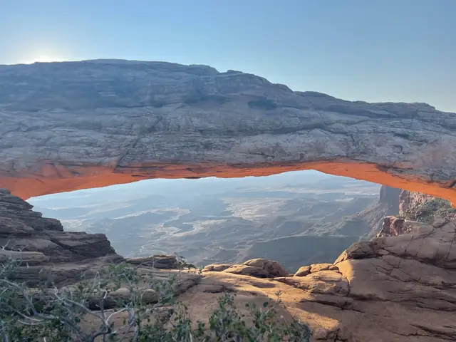
- HikeMesa Arch (Island): 0.6 mi round trip · 56 ft elevation change · Easy
- SeeGreen River Overlook
- HikeGrand View Point (Island): 1.8 mi round trip · 73 ft elevation change · Easy
- Running late? DropGrand View Point (Island)
-
Day 6ArchesLandscape Arch → The Windows → Double Arch → Balanced Rock
- DriveFrom Canyonlands: approx. 27 mi, about 40 minutes (approx., check your route). UT-313 back to US-191, south on US-191 about 5 mi to the Arches entrance
- HikeLandscape Arch: Walk the Landscape Arch segment from Devils Garden trailhead and return; the NPS trailhead page lists 1.8 miles round trip. This schedule excludes the longer Devils Garden routes and side spurs.
- HikeThe Windows: Roundtrip Distance : 1 mi (1.6 km) Time : 30-60 min Elevation Change : 99 ft (30 m) Difficulty : Easy
- HikeDouble Arch: Use the connector between the Windows and Double Arch parking areas; trails lead to Double Arch.
- SightBalanced Rock: Balanced Rock stands a staggering 128 feet (39 m) tall.
Keep your Moab base. Compare overnight options
-
Day 7ArchesDelicate Arch → Park Avenue Trail
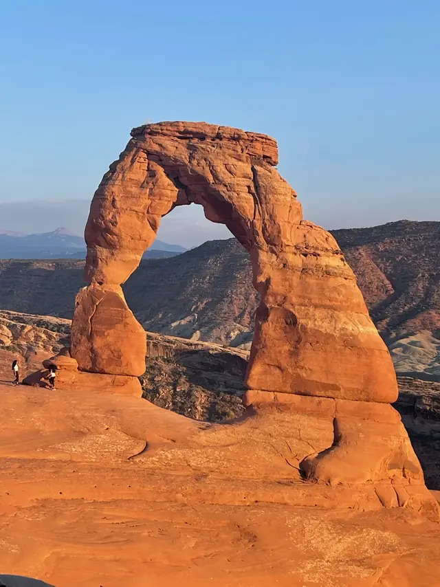
- HikeDelicate Arch: The trail to see Delicate Arch up close and personal is 3 miles (4.8 km) roundtrip and climbs 480 feet (146m).
- HikePark Avenue Trail: Roundtrip distance: 1.8 mi. Time: 1 hour. Elevation change: 322 ft (98 m). Difficulty: Moderate.
Zion & Bryce Canyon in four days
Two days in Zion and two at Bryce Canyon. Stay in Springdale and the Bryce area. Continue to Moab on a future trip.
Day 1 · Zion Canyon
Use the canyon shuttle when it’s running. Start with Riverside Walk and the main canyon stops.
Day 2 · East Zion
Try Canyon Overlook, then move to the Bryce area if you want an early start the next morning.
Day 3 · Bryce Amphitheater
Start on the rim. Add Queen’s Garden and Navajo Loop if both routes are open and conditions suit your group.
Day 4 · Bryce scenic drive
Pick southern overlooks as road conditions allow, then head home or back toward Zion.
Before you drive
Winter roads & closures.
Utah SR-12 (Bryce Canyon to Capitol Reef) crosses a 9,600 ft summit on Boulder Mountain and can be hazardous in winter. Check UDOT road conditions before driving. NPS source
Bryce Canyon: some roads may be temporarily closed during and immediately after winter storms, but the park is always open. NPS source
Zion-Mt. Carmel Tunnel: vehicles that are too large cannot drive between Canyon Junction and the East Entrance. Use the alternate routes NPS lists (via UT-20 to Bryce). NPS source
Want it built around you?
Take a printable park plan along.
Browse park itinerary bundles and free one-page planners for the stops on this route.
More road trips
-
 Rockies
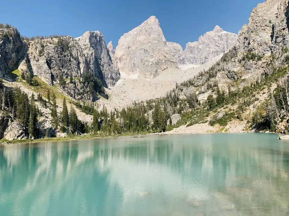
Yellowstone & Grand Teton5 days2 parks≈57 mi
-
 Southwest
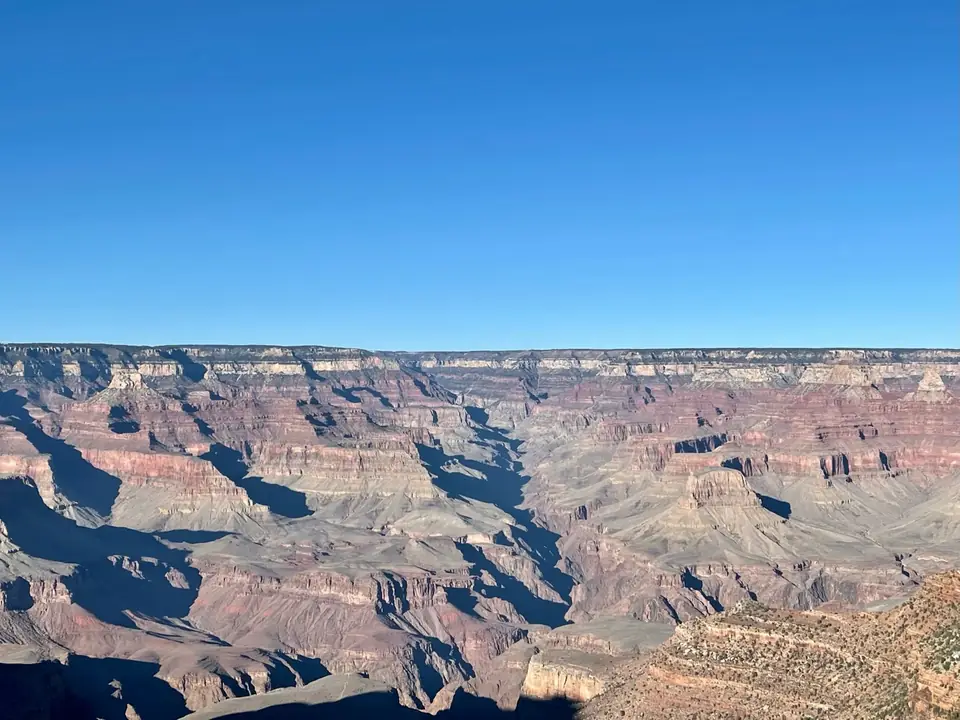
Grand Canyon, Zion & Bryce Canyon5 days3 parks≈335 mi
-
 West
Yosemite, Kings Canyon & Sequoia5 days3 parks≈175 mi
-
 West
Pacific Northwest5 days3 parks≈415 mi
-
 Rockies
Colorado5 days4 parks≈683 mi
We’ve been to every park on these routes. The order and days are a starting point; adjust them to your pace. Facts verified ; roads and rules change, so check each park’s conditions page before you drive.