Taggart Lake Trail
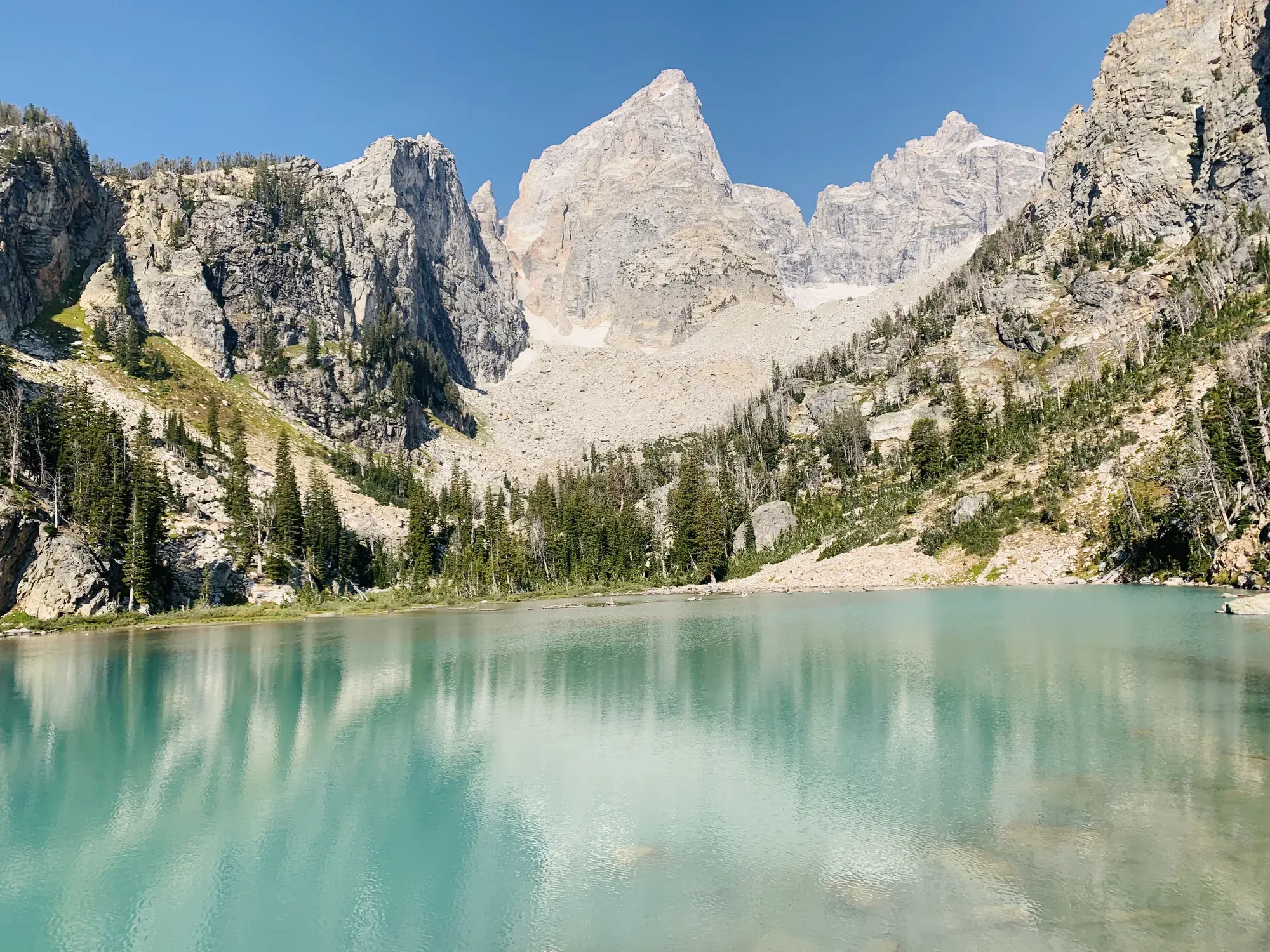
Get spectacular views of the Teton Range on this easy hike to Taggart Lake.
Grand Teton · Photo: David & Keri New
- 3 miDistance
- 360 ftElevation gain
- 1–2 hrTime
- EasyDifficulty
The numbers, with sources
Distance: 3 miles round trip Source
Gain: 360 feet elevation gain Source
Time: 1–2 hours Source
Difficulty: Easy with rocks, steps, gains and losses Source
Trailhead: Park at the Taggart Lake Trailhead for access to the Taggart Lake Trail. The Taggart Lake Trailhead is a popular spot and often fills in summer. NPS recommends arriving early; parking availability is not guaranteed. If parking along the road, follow all parking signs and pull fully off the main road. Source
Route type: out-and-back Source
Built from official sources (checked Nov 3, 2026). Confirm current conditions with the park.
Recreation.gov permits, entrances & campgrounds
Recreation.gov (RIDB). Booking records date not published. NPS guidance above takes precedence. A listing doesn’t mean you need a permit or that there’s space on your dates.
Nearby campground records
Within 10 straight-line miles of the trailhead. Distances are straight-line from map coordinates, not driving distances.
- Jenny Lake Campground: approximately 4.2 miles straight line. RIDB coordinates · Mapped route source
- Gros Ventre Campground: approximately 5.9 miles straight line. RIDB coordinates · Mapped route source
Park campground options (9)
These records belong to the park’s NPS recreation area. We haven’t checked how close these are to the trail, when they open or whether sites are free; check the map and the booking page.
Signal Mountain Campground — Campground; RIDB reservable: yes. Season: not published in structured RIDB data. Recreation.gov (RIDB) source · Booking details
NPS reservation guidance: Campsites are reservable on Recreation.gov. Plan ahead and reserve your site up to six months in advance. NPS source
Lizard Creek Campground — Campground; RIDB reservable: yes. Season: not published in structured RIDB data. Recreation.gov (RIDB) source · Booking details
NPS reservation guidance: Campsites are reservable on Recreation.gov. Plan ahead and reserve your site up to six months in advance. NPS source
Headwaters Campground at Flagg Ranch — Campground; RIDB reservable: yes. Season: not published in structured RIDB data. Recreation.gov (RIDB) source · Booking details
NPS reservation guidance: All campsites in the Headwaters Campground can be reserved. The maximum stay permitted at Headwaters Campground is 14 nights, and the maximum cumulative stay between all Grand Teton National Park campgrounds is 30 nights. NPS source
Jenny Lake Campground — Campground; RIDB reservable: yes. Season: not published in structured RIDB data. Recreation.gov (RIDB) source · Booking details
NPS reservation guidance: Campsites are reservable on Recreation.gov. Plan ahead and reserve your site up to six months in advance. The maximum stay permitted at Jenny Lake Campground is seven nights, and the maximum cumulative stay between all Grand Teton National Park campgrounds is 30 nights. NPS source
Gros Ventre Campground — Campground; RIDB reservable: yes. Season: not published in structured RIDB data. Recreation.gov (RIDB) source · Booking details
NPS reservation guidance: Campsites are reservable on Recreation.gov. Plan ahead and reserve your site up to six months in advance. The maximum stay permitted at Gros Ventre Campground is 14 nights, and the maximum cumulative stay between all Grand Teton National Park campgrounds is 30 nights. NPS source
Colter Bay Tent Village — Campground; RIDB reservable: yes. Season: not published in structured RIDB data. Recreation.gov (RIDB) source · Booking details
NPS reservation guidance: Tent Cabins are reservable on Recreation.gov. Plan ahead and reserve your site up to six months in advance. NPS source
Colter Bay Marina End Ties — Campground; RIDB reservable: yes. Season: not published in structured RIDB data. Recreation.gov (RIDB) source · Booking details
Colter Bay Campground — Campground; RIDB reservable: yes. Season: not published in structured RIDB data. Recreation.gov (RIDB) source · Booking details
NPS reservation guidance: Campsites are reservable on Recreation.gov. Plan ahead and reserve your site up to six months in advance. The maximum stay permitted at Colter Bay campground is 14 nights, and the maximum cumulative stay between all Grand Teton National Park campgrounds is 30 nights. NPS source
Colter Bay RV Park — Campground; RIDB reservable: yes. Season: not published in structured RIDB data. Recreation.gov (RIDB) source · Booking details
NPS reservation guidance: All campsites in the Colter Bay RV Park can be reserved. The maximum stay permitted at Colter Bay RV Park is 14 nights, and the maximum cumulative stay between all Grand Teton National Park campgrounds is 30 nights. NPS source
Route, junction by junction
Taggart Lake Trailhead → Bradley Lake split
Climb the aspen-covered moraine to the signed trail split. The NPS doesn’t give a distance to the junction. Source
Bradley Lake split → Taggart Lake
Stay left for Taggart Lake. The trail levels out toward the lakeshore. Source
Taggart Lake → back to the trailhead
Come back the same way for the 3-mile round trip. Going on to Bradley Lake makes it a different, longer hike. Source
No elevation profile: we only draw one from a mapped route we can verify. Route source
In-depth guide
Compiled from linked sources, checked Nov 3, 2026. Each paragraph links to its source.
Decisions & preparation
We only show a leg’s distance when the NPS publishes it. We don’t split the total into made-up pieces. Source
Turnaround & return planning
Turn back before the group runs low on energy, water or daylight. Don’t count on a pickup or rescue: you return the way you came. Planning basis
Parking & transport timing
Park at the Taggart Lake Trailhead. It often fills in summer, so arrive early, and a spot isn’t guaranteed. If you park along the road, follow the signs and pull fully off the main road. The NPS doesn’t say what time it fills. Source
What to bring by season
All seasons: the NPS Ten Essentials (navigation, sun protection, extra clothing, a light, first aid, fire supplies where allowed, repair tools, extra food, water and emergency shelter). Leave your plan and return time with someone. Source
Hot weather: sun protection, plenty of water and extra food. Cold or wet weather: warm layers and rain gear, plus extra clothing in case you’re out longer than planned. Source
In winter, you’ll need snowshoes or cross-country skis to reach Taggart Lake. Source
Children & mobility
3 mi (4.8 km) round trip with 360 ft (110 m) of gain and an average slope of 6%. The trail climbs and drops and has rocks and steps. Source
Is this hike for you?
Taggart Lake is an easy out-and-back with some of the best views of the Teton Range. It’s 3 miles round trip with 360 feet of elevation gain, and the NPS gives 1–2 hours. Easy doesn’t mean flat: the trail climbs and drops and has rocks and steps. Source
The trail
From the Taggart Lake Trailhead, the trail winds up an aspen-covered moraine and then opens up to views of the Tetons. At the Bradley Lake trail split, stay left for Taggart Lake. The trail then flattens out to the lakeshore, with the alpine lake in front of you and the Teton Range behind. Come back the same way. Source
Getting to the trailhead
Park at the Taggart Lake Trailhead. It’s popular and often fills in summer, so the NPS recommends arriving early, and there’s no guarantee you’ll get a spot. If you park along the road, follow the parking signs and pull fully off the main road. Source
Before you go
The NPS lists the trail year-round. In winter you’ll need snowshoes or cross-country skis. We didn’t find a current alert for it, but check the park’s alerts and the trailhead signs before you go. Source · Source 2
The NPS doesn’t list water or restrooms on the trail. Bring water and snacks for the round trip. If the group is slower than you expected, turn back early. Source
Kids, strollers and wheelchairs
The NPS accessibility notes give 3 mi (4.8 km) round trip, 360 ft (110 m) of gain and an average slope of 6%. That’s an average, so some stretches are steeper, and there are rocks and steps. The NPS doesn’t give a minimum age or rate the trail for strollers or wheelchairs. Source
Dogs, permits and fees
The NPS page doesn’t give a pet rule for this trail, so check the park’s pet rules before you bring a dog. Stay on the trail and follow posted signs. Source
You don’t need a reservation to hike it. Source
Check the NPS fees page for the entrance fee and passes. We don’t list a price we haven’t verified. Source
Distance and elevation
Our elevation chart follows the NPS trail line, which measures 1.6204 miles one way. Half the NPS 3-mile round trip is 1.50 miles, so the mapped line (1.62 miles) is 8.03% longer, and we haven’t resolved the difference. The NPS activity page gives 360 feet of gain and its trailhead page gives 350 feet of total climbing. The chart shows 303 feet of climbing on the way out only. We haven’t adjusted any of these to match, and the chart isn’t for navigating on the trail. Source · Source 2 · Source 3 · Source 4
The chart runs from the trailhead past the north moraine and the Bradley Lake junction to the east lakeshore. It leaves out the Beaver Creek loop and the Bradley Lake extension. The mapped pieces meet within 0.27 m, with no distance scaling. It samples USGS ground elevations, so it won’t show raised decks, individual steps or a wheelchair grade, and smoothing can miss short climbs. It doesn’t tell you if the trail is open, where to find water or how long the hike takes. Source · Source 2
Getting there and back
Park at the Taggart Lake Trailhead for access to the Taggart Lake Trail. The Taggart Lake Trailhead is a popular spot and often fills in summer. NPS recommends arriving early; parking availability is not guaranteed. If parking along the road, follow all parking signs and pull fully off the main road. Source
Return: Come back the way described above. Return along the same trail unless a separate transport plan has been confirmed. Source
Water
No complete route-specific drinking-water or restroom schedule confirmed. Carry water for the whole hike. Source
Hazards
Taggart Lake is a 3 mi (4.8 km) roundtrip hike with 360 ft (110 m) of elevation gain and an average slope of 6%. The trail gains and loses elevation and includes rocks and steps. Source
Season
In winter, Taggart Lake is accessible with snowshoes or cross-country skis. Source
In winter, Taggart Lake is accessible with snowshoes or cross-country skis. Source
Gear & rules
Follow current signs and closures, and treat any side trip as a separate decision. Source
Filling a gap in your kit? Compare these packing essentials on Amazon. Choose gear for your route, conditions and the park’s guidance.
As an Amazon Associate we earn from qualifying purchases. How this works
The NPS doesn’t publish a pet rule for this exact route. Confirm the applicable rule before bringing an animal. Source
Questions
Which route do these figures describe?
3 miles round trip Taggart Lake is an easy out-and-back from the signed trailhead, rather than the longer circuit involving nearby Bradley Lake. The published three-mile round trip and 360 feet of gain are for this Taggart hike. The route still gains and loses elevation and includes rocks and steps. Source
Is the trail open right now?
No. NPS details as of Nov 3, 2026. Confirm current conditions and closures with NPS. Source
Is there a measured elevation profile?
Yes. NPS publishes a 3-mile round trip; half that distance is the 1.50-mile outward comparison. Measured on the map, the way out is 1.62 miles, 8.03% longer, and the difference isn’t explained. The NPS activity page lists 360 feet of gain, while its trailhead page lists 350 feet of total climbing. The chart shows 303 feet of climbing on the way out only, and we haven’t adjusted it to match either NPS figure. Do not use the chart as on-trail navigation. Source
Alternatives
The trailhead is popular and can fill in summer. NPS recommends arriving early and obeying all roadside parking signs. Snowshoes or cross-country skis are the winter access described by the activity. A year-round season listing does not imply summer walking conditions on every visit. Source
Camp near Taggart Lake Trail
Closest campgrounds by drive time to Taggart Lake Trailhead:
- 9 min Jenny Lake (4.6 mi, in the park)
- 23 min Gros Ventre (13.5 mi, in the park)
- 25 min Signal Mountain (14.5 mi, in the park)
- 43 min Colter Bay (23.6 mi, in the park)
- 43 min Colter Bay RV Park (23.7 mi, in the park)
Driving time with no traffic (OSRM, OpenStreetMap roads). Some park roads are shuttle-only in season. All camping near Grand Teton
More Grand Teton trail guides
- Forks of Cascade Canyon9.4 mi · Easy
- Hidden Falls via Jenny Lake Shuttle Boat1 mi · Moderate
- Jenny Lake Loop7.1 mi
- String Lake3.7 mi · Easy