String Lake
NPS suggests beginning south along the east shore for a more gradual gain. The west side climbs to a ridge overlooking the lake. A relatively flat east shore does not describe the effort of the complete loop.
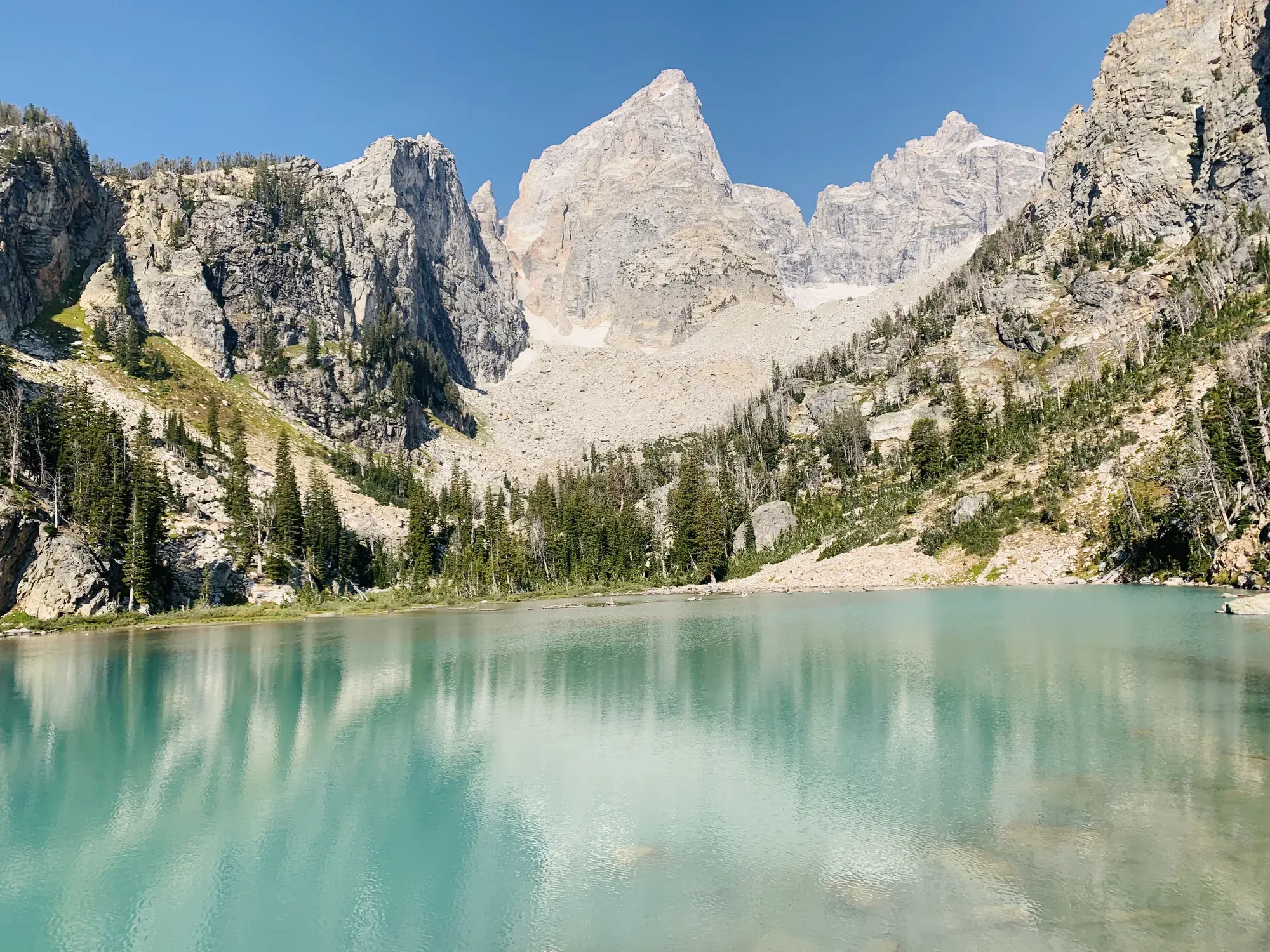
Grand Teton · Photo: David & Keri New
- 3.7 miDistance
- 540 ftElevation gain
- 2–3 hrTime
- EasyDifficulty
The numbers, with sources
Distance: NPS pairs 3.7 miles with 5.6 km for the loop, and those don’t match. We show both. Source
Gain: 540 feet elevation gain (NPS). Source
Time: 2–3 hours (NPS activity). Source
Difficulty: Easy rating; roots, rock and west-side ridge climb. Source
Trailhead: Park at the String and Leigh Lakes Trailhead for access to String Lake. Source
Route type: Loop Source
Built from official sources (checked Nov 3, 2026). Confirm current conditions with the park.
Recreation.gov permits, entrances & campgrounds
Recreation.gov (RIDB). Booking records date not published. NPS guidance above takes precedence. A listing doesn’t mean you need a permit or that there’s space on your dates.
Park campground options (9)
These records belong to the park’s NPS recreation area. We haven’t checked how close these are to the trail, when they open or whether sites are free; check the map and the booking page.
Signal Mountain Campground — Campground; RIDB reservable: yes. Season: not published in structured RIDB data. Recreation.gov (RIDB) source · Booking details
NPS reservation guidance: Campsites are reservable on Recreation.gov. Plan ahead and reserve your site up to six months in advance. NPS source
Lizard Creek Campground — Campground; RIDB reservable: yes. Season: not published in structured RIDB data. Recreation.gov (RIDB) source · Booking details
NPS reservation guidance: Campsites are reservable on Recreation.gov. Plan ahead and reserve your site up to six months in advance. NPS source
Headwaters Campground at Flagg Ranch — Campground; RIDB reservable: yes. Season: not published in structured RIDB data. Recreation.gov (RIDB) source · Booking details
NPS reservation guidance: All campsites in the Headwaters Campground can be reserved. The maximum stay permitted at Headwaters Campground is 14 nights, and the maximum cumulative stay between all Grand Teton National Park campgrounds is 30 nights. NPS source
Jenny Lake Campground — Campground; RIDB reservable: yes. Season: not published in structured RIDB data. Recreation.gov (RIDB) source · Booking details
NPS reservation guidance: Campsites are reservable on Recreation.gov. Plan ahead and reserve your site up to six months in advance. The maximum stay permitted at Jenny Lake Campground is seven nights, and the maximum cumulative stay between all Grand Teton National Park campgrounds is 30 nights. NPS source
Gros Ventre Campground — Campground; RIDB reservable: yes. Season: not published in structured RIDB data. Recreation.gov (RIDB) source · Booking details
NPS reservation guidance: Campsites are reservable on Recreation.gov. Plan ahead and reserve your site up to six months in advance. The maximum stay permitted at Gros Ventre Campground is 14 nights, and the maximum cumulative stay between all Grand Teton National Park campgrounds is 30 nights. NPS source
Colter Bay Tent Village — Campground; RIDB reservable: yes. Season: not published in structured RIDB data. Recreation.gov (RIDB) source · Booking details
NPS reservation guidance: Tent Cabins are reservable on Recreation.gov. Plan ahead and reserve your site up to six months in advance. NPS source
Colter Bay Marina End Ties — Campground; RIDB reservable: yes. Season: not published in structured RIDB data. Recreation.gov (RIDB) source · Booking details
Colter Bay Campground — Campground; RIDB reservable: yes. Season: not published in structured RIDB data. Recreation.gov (RIDB) source · Booking details
NPS reservation guidance: Campsites are reservable on Recreation.gov. Plan ahead and reserve your site up to six months in advance. The maximum stay permitted at Colter Bay campground is 14 nights, and the maximum cumulative stay between all Grand Teton National Park campgrounds is 30 nights. NPS source
Colter Bay RV Park — Campground; RIDB reservable: yes. Season: not published in structured RIDB data. Recreation.gov (RIDB) source · Booking details
NPS reservation guidance: All campsites in the Colter Bay RV Park can be reserved. The maximum stay permitted at Colter Bay RV Park is 14 nights, and the maximum cumulative stay between all Grand Teton National Park campgrounds is 30 nights. NPS source
Route, junction by junction
Route selection → Described destination
NPS suggests beginning south along the east shore for a more gradual gain. The west side climbs to a ridge overlooking the lake. A relatively flat east shore does not describe the effort of the complete loop. Source
No elevation profile yet:
No elevation profile yet: we haven’t verified a complete line for this route. No partial line, invented connector, scaled mileage or flat profile is substituted. Source
In-depth guide
Compiled from linked sources, checked Nov 3, 2026. Each paragraph links to its source.
Is this hike for you?
The String Lake Loop circles the lake with views of Mount St. John, Rockchuck Peak and the Jackson Hole Valley. The NPS calls it an easy 3.7 mi loop with 540 ft (160 m) of elevation gain and an average slope of 6%, taking 2–3 hours. Source
The NPS pairs 3.7 miles with 5.6 km, which don’t quite match, so we go by the miles. Source
The trail
Start by heading south along the east shore for a more gradual climb. The east side is fairly flat, with exposed roots and rocks to step over. The west side climbs to a ridge overlooking String Lake. Most of the trail is under trees, but it crosses an older, open burned area below the peaks before heading back into the forest. Source
Getting to the trailhead
Park at the String and Leigh Lakes Trailhead. Source
What we couldn’t confirm
The NPS doesn’t say when the lot fills or list services at the trailhead. Source
There’s no elevation profile yet: the String Lake Loop Trail is on the NPS trail maps, but we haven’t verified a complete line for the loop. Source
We didn’t find a complete matching route on OpenStreetMap either. Source
Sources & planning limits
Reviewed 2026-11-03. Check current conditions for your trip dates.
- The NPS pairs 3.7 miles with 5.6 km for the loop; the two don’t match. It lists 540 feet of elevation gain. Source
- We haven’t confirmed leg times, when the lot fills or any services not described above. Source
- There’s no elevation profile yet: we haven’t verified a complete, continuous line for this loop. Source
Getting there and back
Park at the String and Leigh Lakes Trailhead for access to String Lake. Source
Return: Use the return described in the official route account. Don’t count on a shuttle, boat, flight or pickup unless you have confirmed it yourself. Source
Water
The NPS doesn’t publish a full list of water and restrooms along this route. Use only the facilities explicitly identified in the NPS account; confirm current operations. Source
Hazards
The official accessibility field pairs 3.7 miles with 5.6 kilometers. These units do not correspond exactly. We show both as published instead of making up our own conversion. A measured complete profile verified from connected geometry is unavailable here. Source
Season
This page can’t tell you current access. Check NPS conditions before departure. Source
Check current conditions and seasonal access with the park before you go. Check the park before departure. Source
Gear & rules
Respect current closures, signs and barriers. A mapped path is not proof that travel is permitted. Source
Filling a gap in your kit? Compare these packing essentials on Amazon. Choose gear for your route, conditions and the park’s guidance.
As an Amazon Associate we earn from qualifying purchases. How this works
The NPS doesn’t publish a pet rule for this exact route; confirm with the park before bringing an animal. Source
Questions
Which hike is this?
NPS suggests beginning south along the east shore for a more gradual gain. The west side climbs to a ridge overlooking the lake. A relatively flat east shore does not describe the effort of the complete loop. NPS pairs 3.7 miles with 5.6 km for the loop, and those don’t match. We show both. Source
Is a measured elevation profile available?
No elevation profile yet: we haven’t verified a complete line for this route. No partial line, invented connector, scaled mileage or flat profile is substituted. Source
Alternatives
Alternative-route distances and durations are unavailable unless separately described in the source. Side trails aren’t included. Source
Camp near String Lake
Closest campgrounds by drive time to String Lake Trailhead:
- 9 min Jenny Lake (4.7 mi, in the park)
- 16 min Signal Mountain (8.7 mi, in the park)
- 33 min Colter Bay (17.9 mi, in the park)
- 34 min Colter Bay RV Park (17.9 mi, in the park)
- 35 min Colter Bay Tent Village (18.1 mi, in the park)
Driving time with no traffic (OSRM, OpenStreetMap roads). Some park roads are shuttle-only in season. All camping near Grand Teton
More Grand Teton trail guides
- Forks of Cascade Canyon9.4 mi · Easy
- Hidden Falls via Jenny Lake Shuttle Boat1 mi · Moderate
- Jenny Lake Loop7.1 mi
- Taggart Lake Trail3 mi · Easy