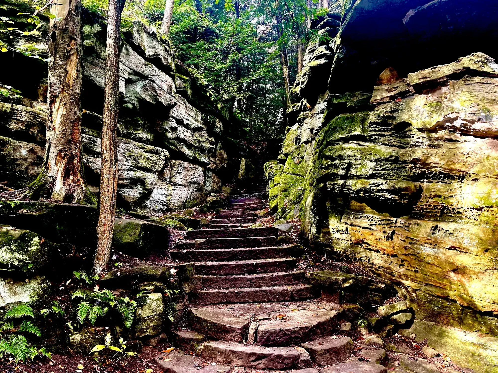
Ledges Trail Loop
The Ledges Trail circles a plateau of striking rock formations, with views along the way. Learn more about hiking this popular trail.
Cuyahoga Valley · Photo: David & Keri New
- 1.8 miDistance
- 1–2 hrTime
- ModerateDifficulty
The numbers, with sources
Distance: 1.8-mile loop Source
Gain: The NPS doesn’t publish the elevation gain. Source
Time: 1–2 hours Source
Difficulty: Rocky, hilly, unpaved Source
Trailhead: Use the signed trailhead named on the NPS trail page. Source
Route type: loop Source
Built from official sources (checked Nov 3, 2026). Confirm current conditions with the park.
Recreation.gov permits, entrances & campgrounds
Recreation.gov (RIDB). Booking records date not published. NPS guidance above takes precedence. A listing doesn’t mean you need a permit or that there’s space on your dates.
Park campground options (1)
These records belong to the park’s NPS recreation area. We haven’t checked how close these are to the trail, when they open or whether sites are free; check the map and the booking page.
CUYAHOGA VALLEY NATIONAL PARK PICNIC SHELTERS — Campground; RIDB reservable: yes. Season: not published in structured RIDB data. Recreation.gov (RIDB) source · Booking details
Route, junction by junction
Ledges Trailhead → signed loop
Check the map by the gate, then follow the Ledges Trail signs. The whole loop is 1.8 miles. The NPS doesn’t publish distances for every connector. Source
Ledges loop → Ledges Overlook
Follow the loop around the plateau. The overlook is on the loop, and there’s also a shorter walk to it across the grassy playfield from the parking lot. Source
Ledges Overlook → back to the trailhead
Finish the signed loop. Take a connector only if you mean to shorten the hike, and don’t follow the Pine Grove or Haskell Run connections thinking they lead back to your car. Source
No elevation profile yet:
No elevation profile yet: we haven’t verified complete measurements for this route. Source
In-depth guide
Compiled from linked sources, checked Nov 3, 2026. Each paragraph links to its source.
Decisions & preparation
We only show a leg’s distance when the NPS publishes it. We don’t split the total into made-up pieces. Source
Turnaround & return planning
If the group runs low on energy, water or daylight, take a connector back to the trailhead. Don’t count on a pickup or rescue. Planning basis
Parking & transport timing
Start at the Ledges Trailhead and check the park map. The NPS doesn’t say when parking fills. Source
What to bring by season
All seasons: the NPS Ten Essentials (navigation, sun protection, extra clothing, a light, first aid, fire supplies where allowed, repair tools, extra food, water and emergency shelter). Leave your plan and return time with someone. Source
Hot weather: sun protection, plenty of water and extra food. Cold or wet weather: warm layers and rain gear, plus extra clothing in case you’re out longer than planned. Source
Children & mobility
Not wheelchair accessible: hilly, unpaved and rocky in places. Service animals and leashed comfort pets are welcome. Audio description is available for the exhibit panels along the trail. Source
Is this hike for you?
The Ledges Trail is a 1.8-mile loop around a plateau of rock formations, with views along the way. The NPS gives 1–2 hours. It’s rocky, hilly and unpaved, with at least 80 feet of elevation change. If you just want the view, you can walk to the Ledges Overlook from the parking lot across the wide, grassy playfield, but that doesn’t take you around the loop. Source
The trail
Park at the Ledges Trailhead and look at the trail map on the bulletin board by the gate. The trail system is complex, with plenty of connector trails, so watch the signs and follow the Ledges Trail to complete the loop. You can use a connector to cut it short, but make sure it leads back to your car. The Ledges Overlook is along the loop. Source
Wear sturdy shoes or boots and watch your step, especially in winter when the trail can be icy or snow-covered. Climbing on the rock formations isn’t allowed, to protect the fragile habitat. Source
Longer starts
For a longer hike, start from the Pine Grove, Haskell Run or Kendall Lake trailheads. There are several options at trail junctions, so bring a map and plan your route. Source
Pine Grove Trailhead is near the southeast corner of the Octagon Shelter parking lot. The shelter has restrooms and seasonal water. Take either of the two paths to the left and behind the kiosk to reach the Ledges Trail. Source
For Haskell Run, park in the main lot for Happy Days Lodge and take the walkway through the tunnel under the road. The trailhead information is near the corner of the accessible parking lot behind the lodge. Hike the Haskell Run Trail for a quarter mile, then follow signs to the Ledges Trail. Source
Kendall Lake Trailhead makes for an even longer hike. The nearby Kendall Lake Shelter has public restrooms with running water on its lower level. Carefully cross the road to a connector to the Pine Grove Trail, then take one of two more connectors to the Ledges Trail. Round trip to the Ledges from here is at least 3 miles, and much more depending on your route. Source
Before you go
The NPS lists the hike for every season. We didn’t find a current alert for it, but check the park’s alerts and the trailhead signs before you go. If the group is slower than you planned, take a connector back early. Source · Source 2
There’s no elevation profile yet: we haven’t verified complete measurements for this route. Source · Source 2
Kids, strollers and wheelchairs
The NPS recommends this hike for ages 6 and older and leaves younger kids to your judgment. It isn’t wheelchair accessible: it’s hilly, unpaved and rocky in places. Audio description is available for the exhibit panels along the trail. Source
Getting there and back
Check the official map for where the trail starts. Source
Return: Come back the way described above. Complete the chosen loop to the original start. Source
Water
There are restrooms and seasonally available water at the shelter. Public restrooms with running water are available on the lower level of the nearby Kendall Lake Shelter . Source
Hazards
This trail is not wheelchair accessible. It is hilly with an unpaved surface that is rocky in places. Service animals and leashed comfort pets are welcome. Audio description is available for the exhibit panels along the trail. Source
Season
Use current official conditions; activity season labels are not a guarantee of access. Source
Current trail conditions require a trip-date check. Source
Gear & rules
Follow current signs and closures, and treat any side trip as a separate decision. Source
Filling a gap in your kit? Compare these packing essentials on Amazon. Choose gear for your route, conditions and the park’s guidance.
As an Amazon Associate we earn from qualifying purchases. How this works
Leashed pets are permitted on park trails, but not in park buildings. Leashes must be 6 feet long or less. Source
Questions
Which route do these figures describe?
1.8-mile loop. Pick the 1.8-mile Ledges loop if the rock formations are what you came for. This is a circuit around a plateau, with enough connecting trails that navigation matters even on a short walk. The overlook can also be reached across the grassy playfield from the parking lot; that shorter visit does not complete the loop. Source
Is the trail open right now?
No. NPS details as of Nov 3, 2026. Confirm current conditions and closures with NPS. Source
Is there a measured elevation profile?
No elevation profile: the named NPS features branch off or don’t pin down the exact route. No guessed joins or route shortcuts. Source
Alternatives
Pine Grove, Haskell Run and Kendall Lake provide longer approaches. Their mileages are not part of the 1.8-mile loop statistic. The Kendall Lake option is at least three miles round trip and can be much longer, depending on junction choices. Choose the starting point before comparing distances or deciding whether a shorter connector will fit the day. Source
More Cuyahoga Valley trail guides
- Blue Hen Falls from Boston3 mi · Easy
- Brandywine Gorge Loop1.5 mi