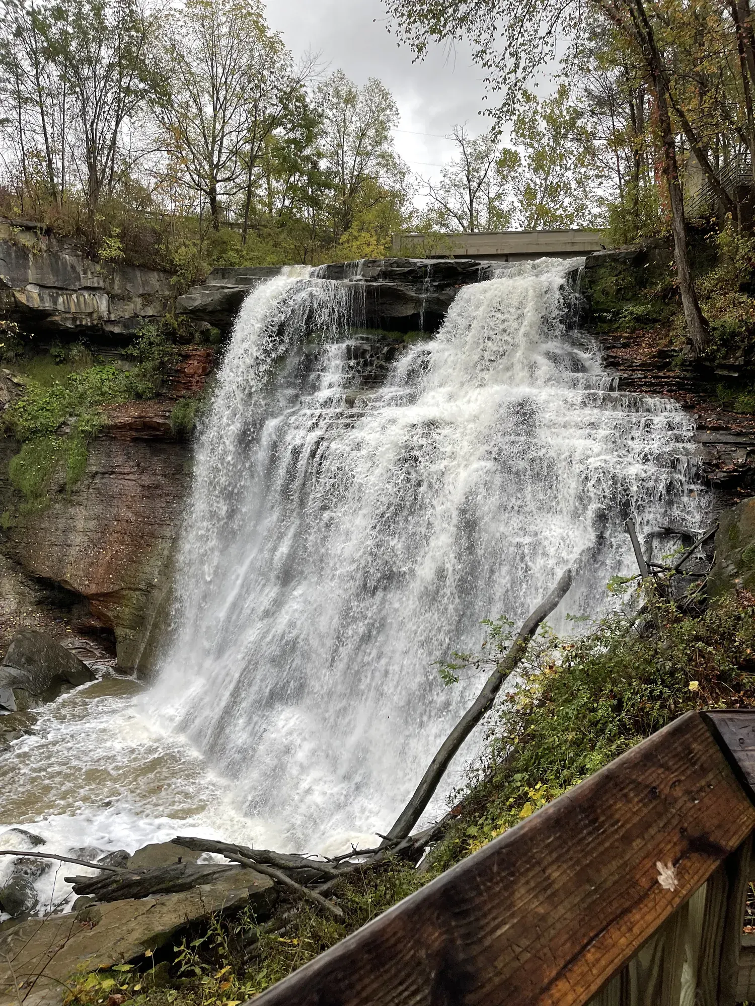
Brandywine Gorge Loop
The Brandywine Gorge Loop circles a deep ravine carved by Brandywine Creek, with views of Brandywine Falls along the way. Learn more about hiking this popular trail.
Cuyahoga Valley · Photo: David & Keri New
- 1.5 miDistance
- 1–2 hrTime
The numbers, with sources
Distance: 1.5 miles round trip Source
Gain: The NPS doesn’t publish the elevation gain. Source
Time: 1–2 hours Source
Difficulty: Hilly, rocky, unpaved Source
Trailhead: Use the signed trailhead named on the NPS trail page. Source
Route type: loop Source
Built from official sources (checked Nov 3, 2026). Confirm current conditions with the park.
Recreation.gov permits, entrances & campgrounds
Recreation.gov (RIDB). Booking records date not published. NPS guidance above takes precedence. A listing doesn’t mean you need a permit or that there’s space on your dates.
Park campground options (1)
These records belong to the park’s NPS recreation area. We haven’t checked how close these are to the trail, when they open or whether sites are free; check the map and the booking page.
CUYAHOGA VALLEY NATIONAL PARK PICNIC SHELTERS — Campground; RIDB reservable: yes. Season: not published in structured RIDB data. Recreation.gov (RIDB) source · Booking details
Route, junction by junction
Brandywine Falls Trailhead → gorge footbridge
Follow the falls path and turn left just before the boardwalk. Go clockwise down into the gorge and cross the footbridge. Source
Gorge footbridge → Inn at Brandywine Falls
Bear right at every intersection, pass the inn and cross the creek again above the falls. Source
Inn → falls boardwalk → parking
Turn right at the small bulletin board for the boardwalk and the parking lot. The full loop is 1.5 miles; the lower deck is an optional approximately 80 steps down. Source
No elevation profile yet:
No elevation profile yet: we haven’t verified complete measurements for this route. Source
In-depth guide
Compiled from linked sources, checked Nov 3, 2026. Each paragraph links to its source.
Decisions & preparation
The NPS gives distances only for the points listed above, so we don’t split the total into legs. Source
Turnaround & return planning
Turn back the way you came if the group is running low on energy, water or daylight. Planning basis
Parking & transport timing
Brandywine Falls Trailhead, where spaces are limited. The NPS doesn’t say when the lot fills. Source
What to bring by season
Pack the Ten Essentials: navigation, sun protection, extra clothing, a light, first aid, fire supplies where allowed, repair tools, extra food, water and emergency shelter. Tell someone your plan. Source
In warm weather bring sun protection, plenty of water and extra food. In cold or wet weather add warm layers and rain gear. Source
Children & mobility
Not wheelchair accessible: hilly, unpaved and rocky in places. Service animals and leashed comfort pets are welcome, and audio description is available for the exhibit panels. Wheelchair users can see Brandywine Falls from the upper boardwalk by the short path from the parking lot. Source
Is this hike for you?
The Brandywine Gorge Loop is a 1.5-mile hike with a 160-foot elevation change. It drops into the gorge, crosses the creek on a footbridge and climbs the other side, on a hilly, rocky, unpaved trail. The NPS says to allow 1–2 hours. If you only want to see the falls, the short walk to the boardwalk is a different, easier visit. Source
The trail
From Brandywine Falls Trailhead, follow the path toward the falls and turn left onto the trail just before the boardwalk. Going clockwise, you head down into the gorge, over the footbridge above the creek and back up the other side. Keep bearing right at every intersection. After you pass the Inn at Brandywine Falls and cross back over the creek (and over the falls), turn right at the small bulletin board. That path leads to the falls viewing boardwalk and back to the parking lot. For a closer look, follow the signs down approximately 80 steps to a lower viewing deck. Source
The loop uses pieces of several trails. If you didn’t get a trail map at the visitor center, use the one on the bulletin board near the restrooms or the NPS App. Stay on marked trails to protect this fragile habitat, and wear sturdy walking shoes. Source
Longer hikes from Boston
To skip the busy Brandywine Falls lot and make a longer day, you can start from the village of Boston. Bring a map: there are several options at trail intersections. From Boston Mill Visitor Center, cross the railroad tracks carefully, go around the visitor center and over the pedestrian bridge across the Cuyahoga River, then turn right and follow the signs and ground stencils to the Ohio & Erie Canal Towpath Trail. Turn left on the Towpath, go 0.5 miles north, then turn right on the connector toward Stanford House. Cross the road carefully, go up to the right past the pond and around the barn, then follow the Stanford Trail for 1.2 miles and the signs to the gorge loop. That’s approximately 5.7 miles round trip with a 440-foot total change in elevation. Source
From Boston Trailhead, take the connector from the southeast corner of the lot, turn right on the Towpath and follow the same route from there: approximately 5.5 miles round trip and 440 feet. From Stanford Trailhead (which also has horse trailer spaces; trailhead information is near the southern end of the lot), it’s 1.5 miles on connectors and the Stanford Trail to the loop, approximately 4 miles round trip with a 400-foot change in elevation. Source
Distance and elevation
The 160 feet is the NPS’s elevation change for the loop, not a total climb. Source
There’s no elevation profile yet: we haven’t verified complete measurements for this route. Source · Source 2
Before you go
The NPS lists this hike for winter, spring, summer and fall. Go early or late in the day to avoid the midday crowds; parking at Brandywine Falls Trailhead is limited. Check the park’s current alerts and the signs at the trailhead before you start. Source · Source 2
Turn back early if the group is slower than you expected, and stay together. Source
Water and restrooms
The nearest restrooms and water are at Brandywine Falls Trailhead, where drinking water is available seasonally. Bring your own water too, plus snacks and a layer. Source
Kids, strollers and wheelchairs
The NPS recommends this hike for ages 6 and older; use your judgment with younger kids. The trail isn’t wheelchair accessible, but wheelchair users can see Brandywine Falls from the upper boardwalk via the short path from the parking lot. Audio description is available for the exhibit panels along the trail. Source
Getting there and back
Check the official map for where the trail starts. Source
Return: Come back the way described above. Complete the chosen loop to the original start. Source
Water
If you didn’t get a trail map at the visitor center, consult the one at the bulletin board near the restrooms or use the NPS App . The hike at a glance Distance: 1.5 miles roundtrip (or more if starting elsewhere; see below) Elevation change: 160 feet Nearest restrooms & water: Brandywine Falls Trailhead Alternate routes For a longer hike that avoids the busy Brandywine Falls parking area, consider starting your hike from the village of Boston. There is also drinking water available seasonally at Brandywine Falls Trailhead. Stop at the visitor center and/or restrooms as needed. Source
Hazards
This trail is not wheelchair accessible. It is hilly with an unpaved surface that is rocky in places. Service animals and leashed comfort pets are welcome. Audio description is available for the exhibit panels along the trail. Wheelchair users can view Brandywine Falls by following the short path from the parking lot to the upper boardwalk viewing area. Source
Season
Use current official conditions; activity season labels are not a guarantee of access. Source
Current trail conditions require a trip-date check. Source
Gear & rules
Follow current signs and closures, and treat any side trip as a separate decision. Source
Filling a gap in your kit? Compare these packing essentials on Amazon. Choose gear for your route, conditions and the park’s guidance.
As an Amazon Associate we earn from qualifying purchases. How this works
Leashed pets are permitted on park trails, but not in park buildings. Leashes must be 6 feet long or less. Source
Questions
Which route do these figures describe?
1.5 miles round trip. This is the 1.5-mile Brandywine Gorge loop from Brandywine Falls Trailhead. The falls boardwalk alone is a different, shorter visit. The full circuit descends into the gorge and climbs the opposite side, so seeing the falls from the upper boardwalk doesn’t confirm whether the rest of the group will be comfortable on the loop. Source
Is the trail open right now?
No. NPS details as of Nov 3, 2026. Confirm current conditions and closures with NPS. Source
Is there a measured elevation profile?
No elevation profile: the named NPS features branch off or don’t pin down the exact route. No guessed joins or route shortcuts. Source
Alternatives
The Boston Mill, Boston Trailhead and Stanford approaches have separate round-trip totals: approximately 5.7, 5.5 and four miles respectively. They also involve additional climbing. Pick one of those if you want a longer hike. They aren’t just other places to park for the short loop. NPS recommends an early or late visit to avoid midday crowds. Source
More Cuyahoga Valley trail guides
- Blue Hen Falls from Boston3 mi · Easy
- Ledges Trail Loop1.8 mi · Moderate