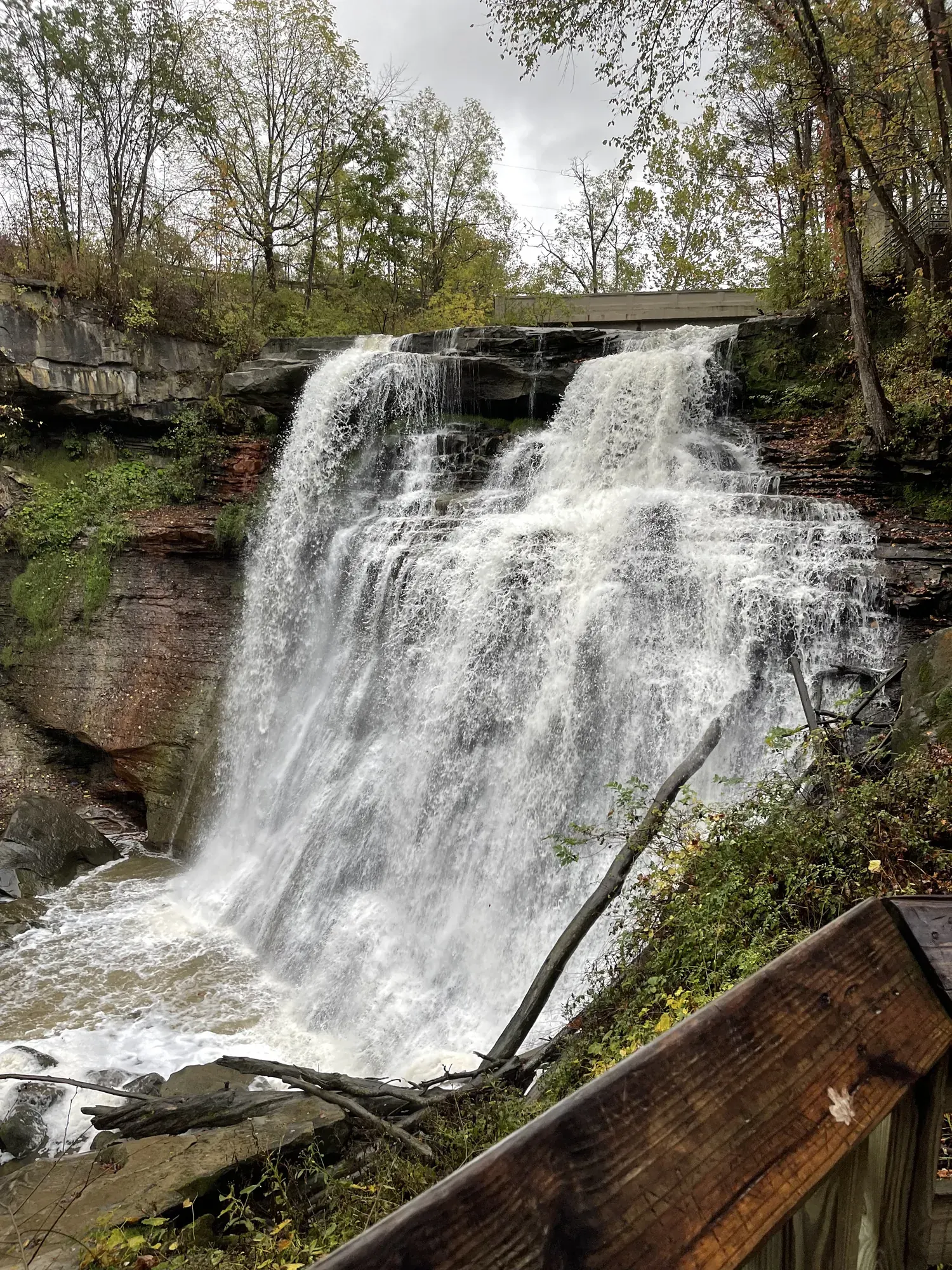
Blue Hen Falls from Boston
Follow the blue-blazed Buckeye Trail from Boston Mill Visitor Center. The route crosses Riverview Road and Boston Mills Road, climbs and descends two ridges and passes a maintenance area. Keep the crossings and return climb in the plan; the waterfall’s height does not describe the effort.
Cuyahoga Valley · Photo: David & Keri New
- 3 miDistance
- 580 ftElevation gain
- 1–2 hrTime
- EasyDifficulty
The numbers, with sources
Distance: 3 miles round trip from Boston Mill Visitor Center; farther parking adds distance. Source
Gain: 580 feet elevation change (NPS). Not confirmed as total climbing. Source
Time: 1–2 hours (NPS activity). Source
Difficulty: Hilly unpaved trail, stairs and road crossings; not wheelchair accessible. Source
Trailhead: The NPS doesn’t publish this for the whole route. Consult the official route description and park map for the start. Source
Route type: Out-and-back from Boston Source
Built from official sources (checked Nov 3, 2026). Confirm current conditions with the park.
Recreation.gov permits, entrances & campgrounds
Recreation.gov (RIDB). Booking records date not published. NPS guidance above takes precedence. A listing doesn’t mean you need a permit or that there’s space on your dates.
Park campground options (1)
These records belong to the park’s NPS recreation area. We haven’t checked how close these are to the trail, when they open or whether sites are free; check the map and the booking page.
CUYAHOGA VALLEY NATIONAL PARK PICNIC SHELTERS — Campground; RIDB reservable: yes. Season: not published in structured RIDB data. Recreation.gov (RIDB) source · Booking details
Route, junction by junction
Route selection → Described destination
Follow the blue-blazed Buckeye Trail from Boston Mill Visitor Center. The route crosses Riverview Road and Boston Mills Road, climbs and descends two ridges and passes a maintenance area. Keep the crossings and return climb in the plan; the waterfall’s height does not describe the effort. Source
No elevation profile yet:
No elevation profile yet: we haven’t verified a complete line for this route. No partial line, invented connector, scaled mileage or flat profile is substituted. Source
In-depth guide
Compiled from linked sources, checked Nov 3, 2026. Each paragraph links to its source.
Is this hike for you?
Blue Hen Falls is a 15-foot waterfall that’s pretty year-round, and the overlook is one of the most popular hikes in the Boston area. It’s 3 miles round trip from the Boston Mill Visitor Center on the rugged Buckeye Trail (more if you park farther away), with a 580-foot change in elevation. For most people, that’s steep. The NPS gives 1–2 hours. Wear sturdy shoes, and if the ground is wet or icy, save it for a drier day. Source
The trail
From the big park sign outside the visitor center, follow the curved path to the intersection of Riverview and Boston Mills roads. Cross Riverview Road carefully and look for the stone staircase that marks the start of the Buckeye Trail. It’s a statewide trail marked with blue blazes on trees and posts; follow them and stay on the marked trail to protect the forest and limit erosion. Source
The trail climbs and descends two steep ridges on the way. It starts with an immediate 200-foot climb, then a 100-foot staircase down to a footbridge over the creek. On the other side you climb a second hill and skirt a maintenance yard at the top. Cross Boston Mills Road carefully and watch for traffic, then zigzag down through the forest to the falls. Come back the same way, which means doing both climbs again. The trail is hilly, has steep inclines, switchbacks and stairs, and can be very muddy; mud and ice make it much harder. Source
Parking
Park at the Boston Mill Visitor Center or the Boston Trailhead. There are a few spaces at the oversize vehicle lot across from the main visitor center lot. The lots fill on weekends and warm days, so go early or late. Park only in designated areas; cars parked along the road can be ticketed and towed. Source
To skip the busy Boston lots, you can start elsewhere on the Buckeye Trail for a longer hike. The nearest option is the Jaite Trailhead, near Riverview and Vaughn roads. Check a map and bring extra water, since distances and times change. Source
Water and restrooms
There’s no drinking water at Blue Hen Falls. Fill your bottle at the Boston Mill Visitor Center, where you can also get maps and information during operating hours. Public restrooms are in the gray building next to the visitor center. Source
Dogs, strollers and wheelchairs
This section of the Buckeye Trail isn’t wheelchair accessible: it’s hilly and unpaved, rocky and muddy in places, with several staircases. Leashed pets are allowed on park trails (leash 6 feet or less) but not in park buildings. Service animals and leashed comfort pets are welcome. The visitor center’s exhibit panels have audio description. Source
What we couldn’t confirm
The NPS doesn’t say when the lots fill or list other services beyond what’s above. Source
There’s no elevation profile yet: Blue Hen Falls is on the NPS trail maps, but we haven’t verified a complete line for this hike. Source
We didn’t find a complete matching route on OpenStreetMap either. Source
Getting there and back
The NPS doesn’t publish this for the whole route. Consult the official route description and park map for the start. Source
Return: Use the return described in the official route account. Don’t count on a shuttle, boat, flight or pickup unless you have confirmed it yourself. Source
Water
The NPS doesn’t publish a full list of water and restrooms along this route. Use only the facilities explicitly identified in the NPS account; confirm current operations. Source
Hazards
NPS calls the 580 feet elevation change, and we don’t relabel it as total climbing. The NPS identifies water and restrooms near the visitor center and no drinking water at the falls. Starting elsewhere on the Buckeye Trail changes distance and time and is outside this three-mile variant. Source
Season
The Buckeye Trail includes steep inclines, switchbacks, and stairs. Mud and ice can greatly impact trail quality during wet or wintry conditions. Source
The Buckeye Trail includes steep inclines, switchbacks, and stairs. Mud and ice can greatly impact trail quality during wet or wintry conditions. Source
Gear & rules
Respect current closures, signs and barriers. A mapped path is not proof that travel is permitted. Source
Filling a gap in your kit? Compare these packing essentials on Amazon. Choose gear for your route, conditions and the park’s guidance.
As an Amazon Associate we earn from qualifying purchases. How this works
Leashed pets are permitted on park trails, but not in park buildings. Leashes must be 6 feet long or less. Source
Questions
Which hike is this?
Follow the blue-blazed Buckeye Trail from Boston Mill Visitor Center. The route crosses Riverview Road and Boston Mills Road, climbs and descends two ridges and passes a maintenance area. Keep the crossings and return climb in the plan; the waterfall’s height does not describe the effort. 3 miles round trip from Boston Mill Visitor Center; farther parking adds distance. Source
Is a measured elevation profile available?
No elevation profile yet: we haven’t verified a complete line for this route. No partial line, invented connector, scaled mileage or flat profile is substituted. Source
Alternatives
Alternative-route distances and durations are unavailable unless separately described in the source. Side trails aren’t included. Source
More Cuyahoga Valley trail guides
- Brandywine Gorge Loop1.5 mi
- Ledges Trail Loop1.8 mi · Moderate