Our favorite hike
Ledges Trail
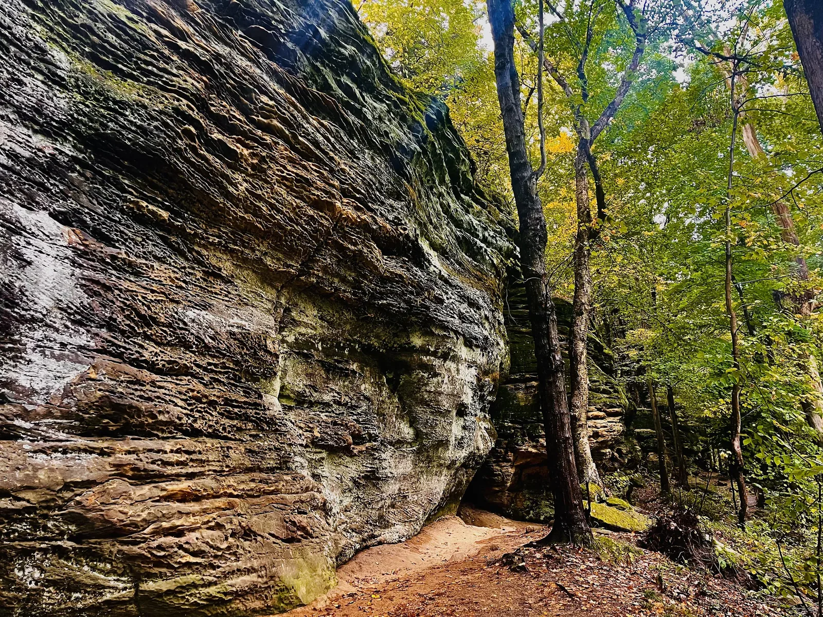
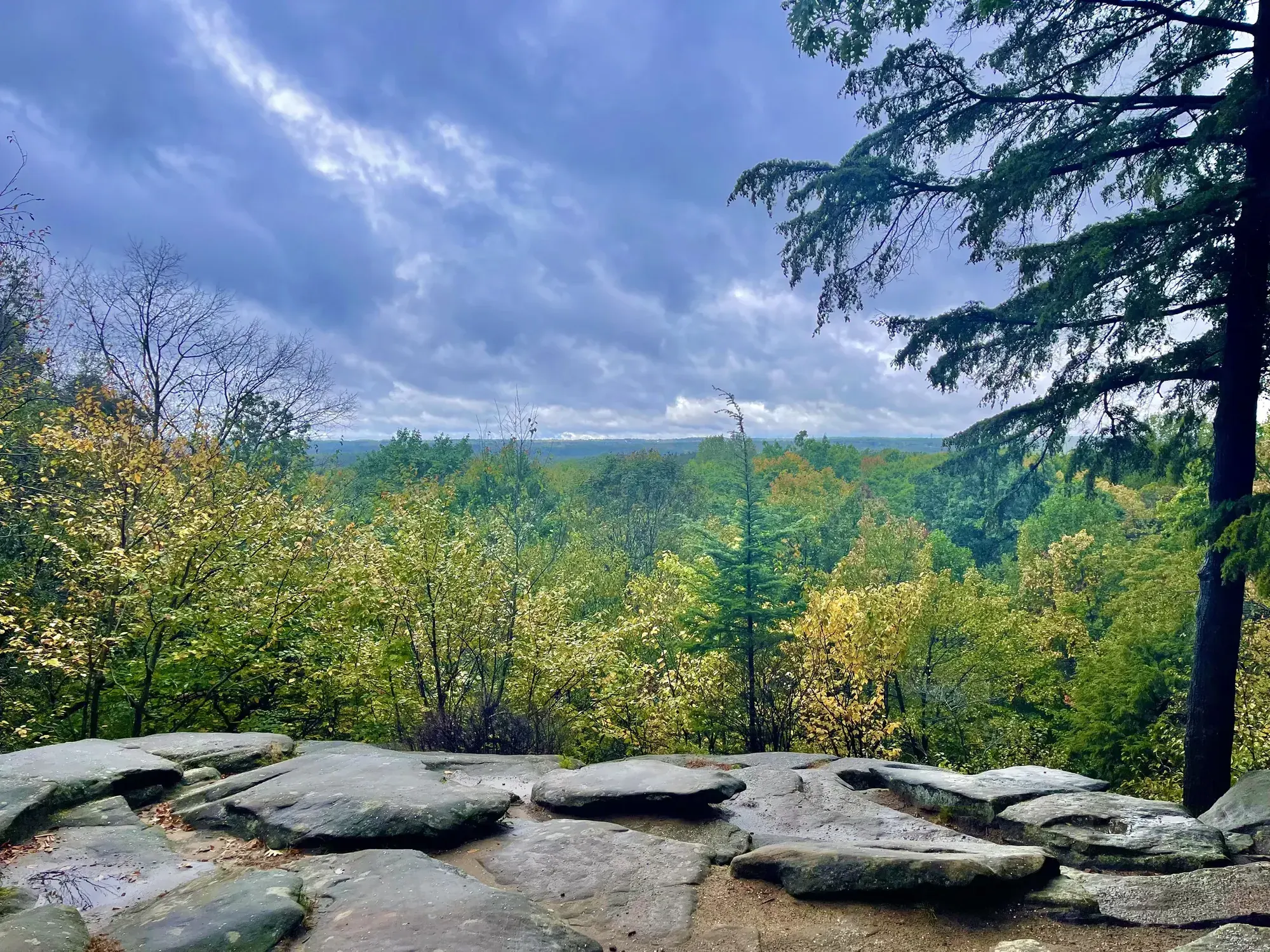
The trail loops around huge, mossy sandstone ledges, with narrow passages and stone steps, and comes out at an overlook above the forest. No other short hike in the park beats it.

Ohio
A 33,000-acre park in the river valley between Cleveland and Akron, with no entrance fee and no gates. It’s built around the Ohio & Erie Canal Towpath Trail, the Cuyahoga Valley Scenic Railroad and waterfalls like Brandywine Falls.
By David & Keri New, who have visited 63 of the 64 U.S. national parksUpdated
32Park 32 of our 63Visited Oct 2021
Saves this park and its trail guides on this device. Alerts and conditions are as of when you save; live maps and bookings need a connection.
NPS alertsAs of 6:03 AM ET, Nov 20
1 day is our starting point.
Start with Brandywine Falls and the Ledges Trail on day one. With a second day, bike the northern Towpath Trail from Lock 39 toward Brecksville and back, or ride the Explorer train back when it runs.
Open the 1-day itineraryOpen the 2-day itineraryOpen the backup itinerary
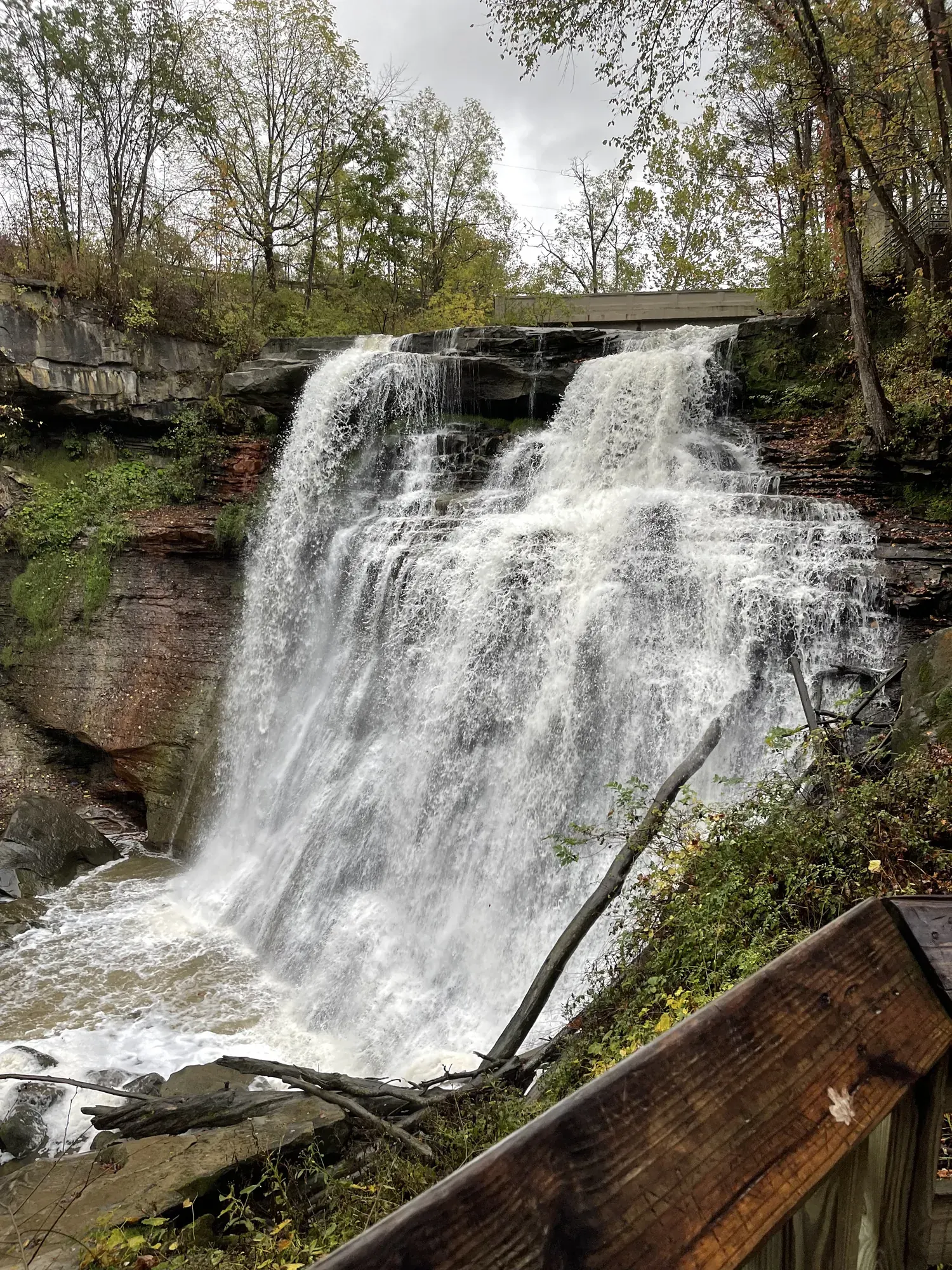
With a few hours, take the boardwalk to the Brandywine Falls viewing area. The upper overlook is accessible, and the lower deck is down a flight of steps. The falls area closes at dusk.
Ride the Cuyahoga Valley Scenic Railroad, which a separate operator runs. Buy tickets on the railroad's website. Rockside and Akron Northside are the main stations, and schedules vary by season.
If the Brandywine Falls lot is full, hike the Ledges first and come back later instead of parking on the road. If the Explorer is not running, ride the Towpath out and back. Check NPS conditions for Towpath closures.
Open the 1-day itineraryOpen the backup itineraryNational Park Service guidanceNPS park conditions
Akron or Cleveland, or the Inn at Brandywine Falls
There is no camping in the park. The Inn at Brandywine Falls is the one place to stay inside it. Otherwise, use hotels in Akron or Cleveland.
NPS lodging informationNPS camping rules and reservationsNPS directionsLodging and gateway towns
No entry reservation is needed. If you want the Inn at Brandywine Falls, book it first. For a bike-and-train day, check the Explorer program; its 2027 schedule is not published yet.
National Park Service guidanceNPS lodging informationNational Park Service guidance
Plan to drive between areas; there is no entrance fee. Brandywine Falls parking is generally full by 10 a.m. on weekends and in nice weather. David and Keri found that lot small, so arrive early.
NPS directionsNational Park Service guidanceNational Park Service guidanceDavid & Keri’s trip notes
Our visit
October 2021
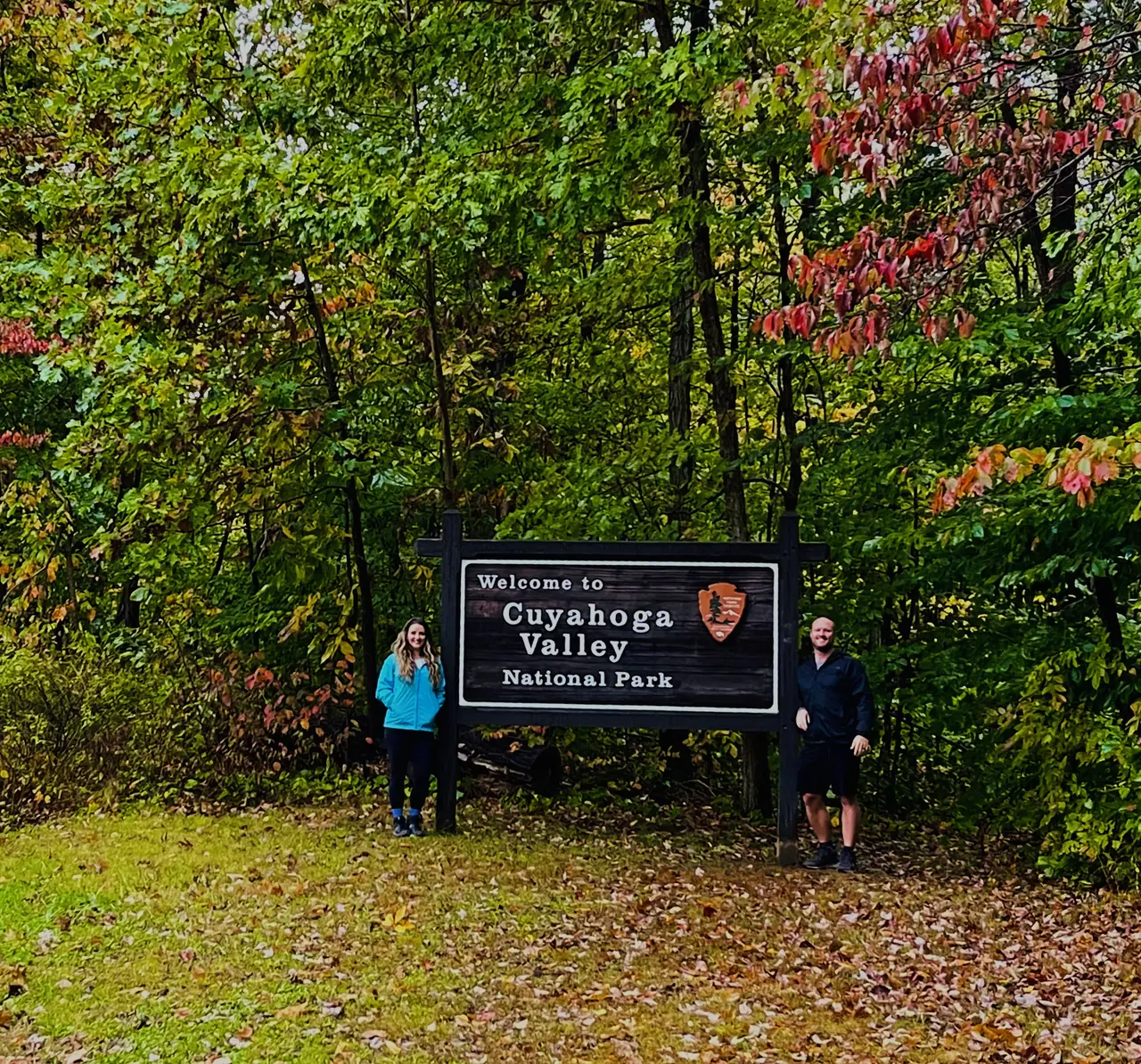
Why it’s on our list
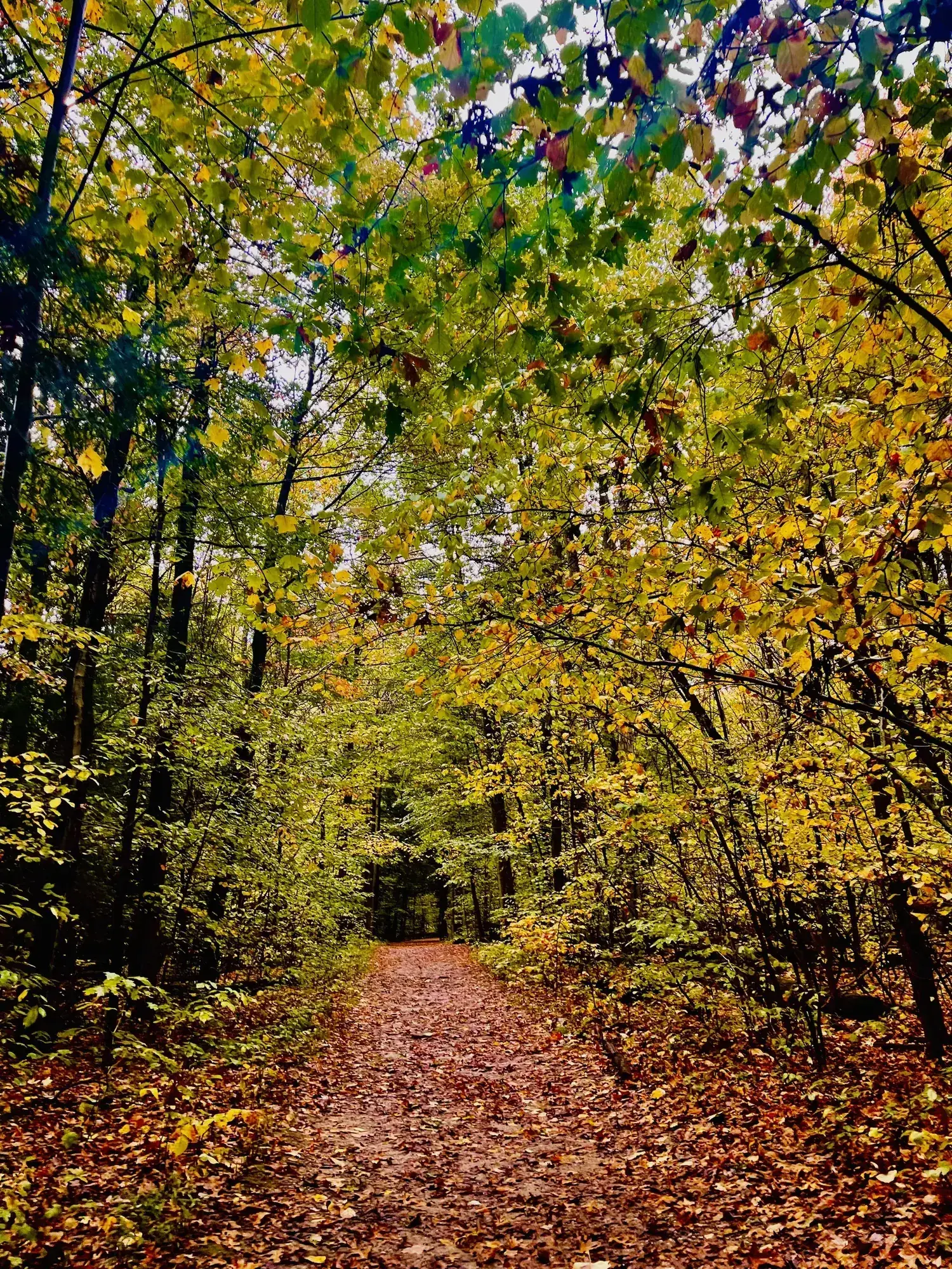
Cuyahoga Valley is a pleasant park featuring beautiful waterfalls, peaceful forests, interesting rock formations, and miles of enjoyable hiking and biking trails. It’s an excellent place to escape the surrounding cities and spend time outdoors. However, compared with the dramatic mountains, canyons, and wilderness areas found in many other national parks, the scenery feels relatively ordinary.
Our favorite moment
Visiting Brandywine Falls, hiking through the moss-covered rock formations on Ledges Trail, and riding the Cuyahoga Valley Scenic Railroad.
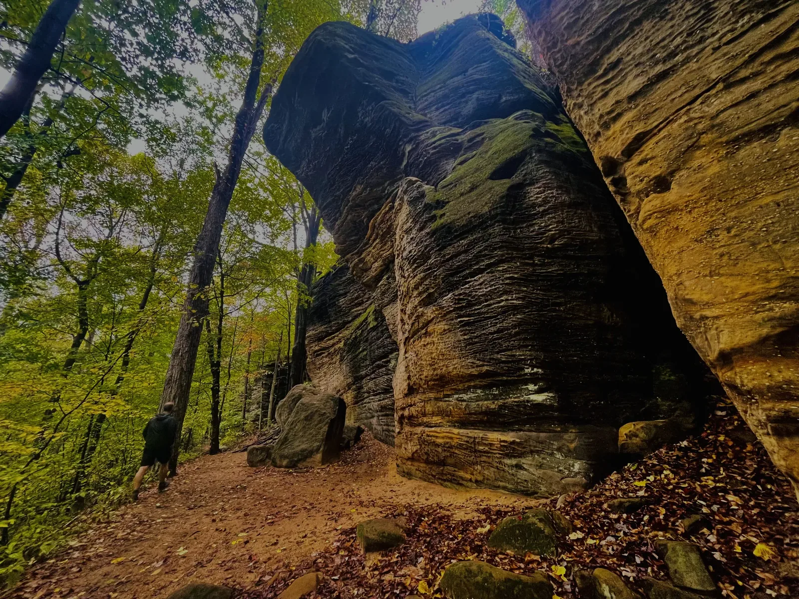
Photos by David & Keri New.
Firsthand · David & Keri New
Cuyahoga Valley is a green river valley between Cleveland and Akron, with waterfalls, sandstone ledges and an old canal towpath. It feels more like a big regional park than a wild one. Still, Brandywine Falls and the Ledges made it worth the trip. We went to Cleveland and had a fun day there. We did a hike and saw a waterfall. We also rented e-bikes and rode to a festival that was going on. The festival was really cool — I think we have a photo of us sitting in a big chair there. We had some amazing apple cider, and they had some farm animals on display. It was really cold on the trip.
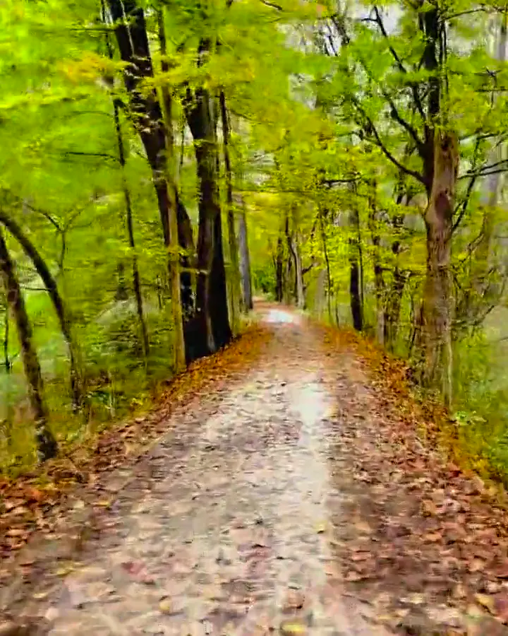
Ledges Trail
The trail loops around huge, mossy sandstone ledges, with narrow passages and stone steps, and comes out at an overlook above the forest. No other short hike in the park beats it.
On weekends, be at Brandywine Falls early, because the lot is small, and take the boardwalk down to the falls. The Ledges are a short drive away, so head there next.
The park is spread out, and the best way to see the valley is by train and by bike.
We’d bike the Ohio & Erie Canal Towpath Trail, then ride the scenic train back with our bikes.
Mid-October is a beautiful time here, with fall color coming on and the waterfalls running well, though weekends get busy at Brandywine Falls and the Ledges. It was overcast and gray when we went, and the leaves were only beginning to turn. It was really cold on the trip.
The village of Peninsula sits in the middle of the park and is a good place to stop, and locals love the Winking Lizard Tavern there. In fall, Szalay’s Farm Market is popular for sweet corn and pumpkins.
Day trip
We went to Cleveland and had a fun day there. We did a hike and saw a waterfall, rented e-bikes, and rode to a festival that was going on.
Best time
October
Free, open 24/7 year-round, no permits. October foliage is the peak. May and September are great. Summer is busy and humid. January-February are cold and quiet.
Month by monthItineraries
1 dayOur pick
Optional day 2 · Towpath and train
Cuyahoga Valley itinerary: every day stop by stop, with sources
Compare the 1-day plans, day by day →
Map
3 visitor centers and 1 campground on a map you can zoom and drag. Map data loads from OpenStreetMap when you tap.
Visitor centerCampground Roads and trails are community-mapped; check closures with the park.
Locations from the NPS visitor-center listing, checked Nov 13, 2026. Hours and what each one has
Locations from Recreation.gov, checked Nov 7, 2026.
Official NPS maps for Cuyahoga Valley (opens in a new tab) ↗
Trails
1 mi
About 45 minutes
Start: Kendall Lake Trailhead, Kendall Park Road, 1.6 miles west of Akron Cleveland Road.
1.4 mi
Wheelchair accessible to the first boardwalk overlook of Brandywine Falls; a spur off the boardwalk has many steps. Closes at dusk.
Loop · About 1 hour
Start: Brandywine Falls Trailhead, Brandywine Road, 1.7 miles north of Hines Hill Road.
2.2 mi
Ledges Trailhead is on Kendall Park Road in Boston Heights. Closes at dusk.
Loop · About 1-2 hours
Start: Ledges Trailhead; start at the bulletin board by the gate.
2.75 mi
From Horseshoe Pond Trailhead on Major Road.
About 1.5 hours
Start: Horseshoe Pond Trailhead, Major Road, 0.7 miles west of Riverview Road.
3.25 mi
Kendall Lake area.
About 2 hours
Start: Kendall Lake Trailhead, Kendall Park Road, 1.6 miles west of Akron Cleveland Road.
4.6 mi
Also used for skiing in winter.
About 2.5 hours
Start: Oak Hill Trailhead, Oak Hill Road, 0.9 miles south of Major Road.
5.25 mi
From Red Lock Trailhead on Highland Road.
About 2.5 hours
Start: Red Lock Trailhead, Highland Road, 0.5 mile east of Riverview Road.
5.6 mi
Part of the statewide Buckeye Trail (blue blazes).
One way (point to point) · About 3 hours
Start: Red Lock Trailhead, Highland Road, 0.5 mile east of Riverview Road.
19.5 mi
10 trailheads. Shared with bikes; leashed pets are allowed. Note the 2026-27 closure between Boston and Lock 29.
One way (point to point) · About Up to 10 hours
Start: Ten trailheads provide parking and access.
Distances, gains and difficulty as NPS publishes them; the bar shows the published distance, dashed where a longer option exists.
Camping
No camping is permitted in the national park. Backcountry camping and overnight stays in parking lots are prohibited; overnight RV parking is not allowed anywhere in the park. NPS lists nearby options: Heritage Farms (tents) and Valley Overlook (tents, furnished canvas tents and cabins) in Peninsula; Silver Springs Park in Stow (tents and RVs); Streetsboro/Cleveland KOA in Streetsboro (tents, RVs and cabins). Other listed campgrounds include Woodside Lake Park in Streetsboro, Hidden Valley in Ravenna, Roundup Lake in Mantua and Willow Lake Park in Medina. State park options include West Branch in Ravenna (tents and RVs), Punderson in Newbury Township and Findley in Wellington (both tents, RVs and cabins). Last verified · nps.gov
Check Recreation.gov for current openings. Availability can change before you book; a result here does not reserve a site or permit.
We have not verified a Recreation.gov campground or permit link for this park. Check Recreation.gov to book and confirm access with the park. This does not mean no facilities or openings exist. Opening-alert requests are coming soon for this park.
NPS prohibits camping in the national park; no developed campgrounds or backcountry camping. Last verified · nps.gov
Site totals are each campground’s size, not how many sites are open or bookable now. Check each campground and current alerts.
Published guidance from the linked park sources; parking availability is never guaranteed.
Affiliate link: we may earn a commission, at no extra cost to you. How this works
Affiliate link: we may earn a commission, at no extra cost to you. How this works
Fees, permits & rules
Last verified · nps.gov All Cuyahoga Valley fees, permits and booking deadlines →
As of November 1, 2026, NPS lists the Towpath Trail between Boston Trailhead and Lock 29 in Peninsula as closed for repairs, including replacement of the Stumpy Basin boardwalk built in 1991. Tentative closure dates remain August 24–November 20, 2026 and March 29–April 21, 2027. Check current conditions for reopening updates before visiting.
Last verified · Current Conditions (NPS)Since October 2026, a section of the former Stanford Road between Stanford Trailhead and the Brandywine Gorge Loop is closed for pavement removal. The closure also covers the northern half of the Stanford Trailhead lot and part of the Valley Trail.
Last verified · Current Conditions (NPS)Oak Hill Road from the northern Cuyahoga Falls line to the Everett Road connector is closed because of an embankment failure along Furnace Run. Detour: Everett Road to Riverview Road to Ira Road.
Last verified · Current Conditions (NPS)Don’t climb the falls, the fences or the rocks; accidents here have caused serious injuries and deaths. Stay at least 50 feet from the top and bottom of the falls. No events are permitted at Brandywine Falls on weekends, holidays or in October.
Last verified · Current Conditions (NPS)Ice Box Cave at Ritchie Ledges is closed to help slow the spread of white-nose syndrome in bats. Rock climbing isn’t permitted at the Ledges.
Last verified · Current Conditions (NPS)Class 1 and 2 e-bikes are allowed where regular bikes are allowed, in pedal mode only (no throttle). Only class 1 e-bikes are allowed on the East Rim mountain bike trails. Bike trails have a 15 mph limit, and 5 mph on blind curves, bridges and boardwalks.
Last verified · Physical Mobility (NPS)Alcohol is prohibited in the national park.
Last verified · Dining & Eating (NPS)Email me this guide Get a link to the Cuyahoga Valley guide in your inbox, to open again when you plan or before you go.
One email with the link. We don’t add you to any list unless you tick the box.
Historical recreation visits · 2021–2025 · as of Nov 3, 2026. Visits count entries, not unique people, parking spaces or trail crowding.
Busiest by average count: Jul. Quietest: Jan. Each bar is that month’s average visits across 5 years; unusual years and reported zeros are included. Past visits can’t tell you the best time of day to arrive.
Every month’s visits and NOAA weather, with the counts for each year →
NPS Visitor Use Statistics: monthly report · NPS monthly data · checked Nov 3, 2026; latest included year 2025.
Plan your visit
For any park: passes and free entrance days · what to pack · visiting with kids · stargazing
Getting there and park logistics →
Find a place to stay near Cuyahoga Valley → See camping and backup options for this park.
How this page is made. The section “What we’d tell a friend” is ours. Our recorded visits to Cuyahoga Valley include October 2021.Planning information, including any fees, permits, closures, weather and crowd figures shown here, is compiled from the National Park Service, Recreation.gov and other public sources, and each fact shows the date we last checked it. If something is wrong, tell us and we’ll log the fix on our corrections page.