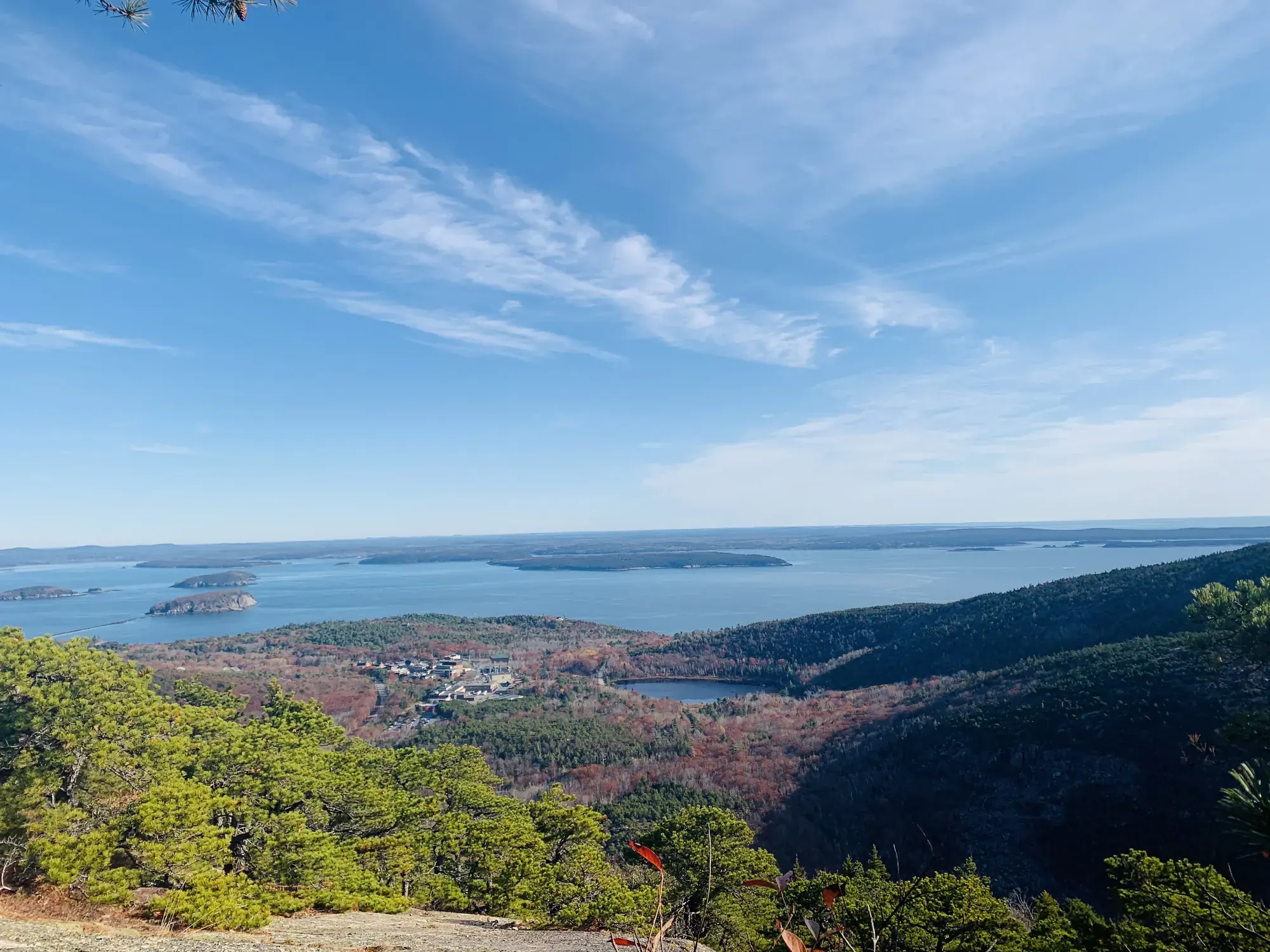
Great Head
Choose between the narrative’s shorter 1.3-mile loop and longer 1.9-mile loop at the forest junction. The summary says 1.7 miles instead, so we show that too. The high point’s 145-foot elevation above sea level is not a climb measurement.
Acadia · Photo: David & Keri New
- 1.7 miDistance
- 145 ftElevation gain
- 2–4 hrTime
- EasyDifficulty
The numbers, with sources
Distance: NPS conflicts: summary 1.7 miles; narrative 1.9-mile loop or shorter 1.3-mile loop. Source
Gain: 145 feet above sea level is the high point’s elevation. Total climb isn’t available. Source
Time: 2–4 hours (NPS activity). Source
Difficulty: Rocky scrambling and steep ocean drops; not wheelchair accessible. Source
Trailhead: The Trailhead: Where to Begin Access the Great Head Trail via the Park Loop Road. Walk to Sand Beach. Walk across Sand Beach keeping the ocean on your right. The Great Head Trail is on the far end of the beach. Depending on the tide and the season there could be a small stream to cross at the end of the beach. Getting to the Trailhead By Island Explorer bus Use Routes 3 (Sand Beach), 4 (Loop Road), or 10 (Blackwoods) and exit the bus at Sand Beach. By private vehicle After passing through the Sand Beach Entrance Station, find parking either in the right hand lane or in the Sand Beach Parking Lot. Expect congestion and limited parking at Sand Beach from July-August from 9 am to 3pm. The Park Loop Road is closed from Mid-December to Mid-April. In the winter months, you can access this trail via Schooner Head Road. Source
Route type: Loop variants Source
Built from official sources (checked Nov 3, 2026). Confirm current conditions with the park.
Recreation.gov permits, entrances & campgrounds
Recreation.gov (RIDB). Booking records date not published. NPS guidance above takes precedence. A listing doesn’t mean you need a permit or that there’s space on your dates.
Park campground options (4)
These records belong to the park’s NPS recreation area. We haven’t checked how close these are to the trail, when they open or whether sites are free; check the map and the booking page.
BLACKWOODS CAMPGROUND — Campground; RIDB reservable: yes. Season: not published in structured RIDB data. Recreation.gov (RIDB) source · Booking details
NPS reservation guidance: Ninety percent of campsites are released six months in advance on the first of each month at 10 am EST. The remaining 10 percent are released at 10 am 14 days ahead of a desired arrival date on a rolling basis. All campsite reservations must be made in advance at Recreation.gov. Reservations cannot be made through the campground office or in-person. NPS source
SEAWALL CAMPGROUND — Campground; RIDB reservable: yes. Season: not published in structured RIDB data. Recreation.gov (RIDB) source · Booking details
NPS reservation guidance: Ninety percent of campsites are released six months in advance on the first of each month at 10 am EST. The remaining 10 percent are released at 10 am 14 days ahead of a desired arrival date on a rolling basis. All campsite reservations must be made in advance at Recreation.gov. Reservations cannot be made through the campground office or in-person. NPS source
DUCK HARBOR CAMPGROUND — Campground; RIDB reservable: yes. Season: not published in structured RIDB data. Recreation.gov (RIDB) source · Booking details
NPS reservation guidance: Reservations are required to camp at Duck Harbor Campground. Reservations are available 7 months in advance of the reservation date. All reservations are released at 10 am April 1 for the entire season. NPS source
Schoodic Woods Campground — Campground; RIDB reservable: yes. Season: not published in structured RIDB data. Recreation.gov (RIDB) source · Booking details
NPS reservation guidance: Ninety percent of campsites are released six months in advance on the first of each month at 10 am EST. The remaining 10 percent are released at 10 am 14 days ahead of a desired arrival date on a rolling basis. All campsite reservations must be made in advance at Recreation.gov. Reservations cannot be made through the campground office or in-person. NPS source
Route, junction by junction
Route selection → Described destination
Choose between the narrative’s shorter 1.3-mile loop and longer 1.9-mile loop at the forest junction. The summary says 1.7 miles instead, so we show that too. The high point’s 145-foot elevation above sea level is not a climb measurement. Source
No elevation profile yet:
No elevation profile yet: we haven’t verified a complete line for this route. No partial line, invented connector, scaled mileage or flat profile is substituted. Source
In-depth guide
Compiled from linked sources, checked Nov 3, 2026. Each paragraph links to its source.
Is this hike for you?
Great Head Trail mixes ocean views, rocky scrambles and some history. It’s a 1.9-mile loop, or 1.3 miles if you take the shortcut at the forest junction. (The NPS summary says 1.7 miles.) The NPS allows 2–4 hours. The high point is 145 feet above sea level; that’s its height, not the climb, and the NPS doesn’t give an elevation gain. Source
The trail
The trail starts with granite steps at the far end of Sand Beach. Near the top of the steps, on the left, is a large millstone, 6′10″ across. Turn right at the top for an open ledge climb with views of Sand Beach and The Beehive. Source
The trail follows the headland on a gradual grade to the highest point, where you’ll find the ruins of a 1915 tea house and observatory tower that the Satterlee family, who owned the area in the early 1900s, built. There’s also a bronze plaque for David Phillips McKinney, who died here in 1969. Source
The trail then turns away from the shore and down through the forest to a junction marked by a cedar post. For the 1.3-mile loop, go left; it climbs steeply, then levels out back to Sand Beach. For the 1.9-mile loop, go straight; the trail angles back toward the ocean, and at the next junction you turn left for an easy walk back to the top of the steps. The NPS Great Head Photo Hike has step-by-step photos. Source
The trail is rocky, with uneven footing, short steep sections and steep drops into the ocean. Wear good shoes and keep children away from the edge. Source
Getting to the trailhead
Take the Park Loop Road to Sand Beach and walk across the beach with the ocean on your right; the trail is at the far end. Depending on the tide and season, there may be a small stream to cross. On the Island Explorer bus, take Routes 3 (Sand Beach), 4 (Loop Road) or 10 (Blackwoods) and get off at Sand Beach. By car, go through the Sand Beach Entrance Station and park in the right-hand lane or the Sand Beach Parking Lot. Expect crowds and limited parking from July-August, 9 am to 3pm. The Park Loop Road is closed from mid-December to mid-April; in winter, reach the trail from Schooner Head Road. Source
NPS maps and OpenStreetMap also show nearby paths, including Schooner Head Path, Western Head Road, Great Meadow Loop and Western Head Trail. Follow the signs for Great Head. Source · Source 2 · Source 3 · Source 4
Kids, dogs and wheelchairs
Great Head Trail isn’t wheelchair accessible: the footing is uneven and you have to scramble over rocks in a few places. There’s accessible parking and accessible restrooms at Sand Beach. Dogs must be on a leash no longer than 6 feet, and between May 15 and September 15 they’re only allowed on Sand Beach long enough to cross to the trailhead. Source
Reservations
The NPS activity page still carries an old Sand Beach vehicle-reservation note dating from 2021. Check the current rules with the park. Source
Before you go
The NPS doesn’t give times for each part of the loop, when parking fills or when the last bus leaves, so check those before you go. There’s no elevation profile yet. Source · Source 2
Sources & planning limits
Reviewed 2026-11-03. Check current conditions for your trip dates.
- The NPS activity page still has a vehicle-reservation note from 2021 for Sand Beach. Check current reservation rules with the park. Source
- NPS figures differ: the summary says 1.7 miles; the trail description gives a 1.9-mile loop or a shorter 1.3-mile loop. The 145 feet is the high point’s height above sea level, not the climb. Source
- The NPS doesn’t give times for each part of the loop, parking-fill times or last bus times. Source
- No elevation profile yet: we haven’t verified a complete map line for this loop. Source
Getting there and back
The Trailhead: Where to Begin Access the Great Head Trail via the Park Loop Road. Walk to Sand Beach. Walk across Sand Beach keeping the ocean on your right. The Great Head Trail is on the far end of the beach. Depending on the tide and the season there could be a small stream to cross at the end of the beach. Getting to the Trailhead By Island Explorer bus Use Routes 3 (Sand Beach), 4 (Loop Road), or 10 (Blackwoods) and exit the bus at Sand Beach. By private vehicle After passing through the Sand Beach Entrance Station, find parking either in the right hand lane or in the Sand Beach Parking Lot. Expect congestion and limited parking at Sand Beach from July-August from 9 am to 3pm. The Park Loop Road is closed from Mid-December to Mid-April. In the winter months, you can access this trail via Schooner Head Road. Source
Return: Use the return described in the official route account. Don’t count on a shuttle, boat, flight or pickup unless you have confirmed it yourself. Source
Water
The NPS doesn’t publish a full list of water and restrooms along this route. Use only the facilities explicitly identified in the NPS account; confirm current operations. Source
Hazards
The approach crosses Sand Beach to granite steps, with a possible stream crossing. Accessible beach parking and restrooms do not make Great Head accessible. The NPS page still has an old Sand Beach vehicle-reservation note. Check current requirements with the park. Source
Season
This page can’t tell you current access. Check NPS conditions before departure. Source
Check current conditions and seasonal access with the park before you go. Check the park before departure. Source
Gear & rules
Respect current closures, signs and barriers. A mapped path is not proof that travel is permitted. Source
Filling a gap in your kit? Compare these packing essentials on Amazon. Choose gear for your route, conditions and the park’s guidance.
As an Amazon Associate we earn from qualifying purchases. How this works
Dogs must be on a leash no longer than 6 feet. Between May 15 and September 15, dogs are only permitted on Sand Beach long enough to cross to the trail head. Source
Questions
Which hike is this?
Choose between the narrative’s shorter 1.3-mile loop and longer 1.9-mile loop at the forest junction. The summary says 1.7 miles instead, so we show that too. The high point’s 145-foot elevation above sea level is not a climb measurement. NPS conflicts: summary 1.7 miles; narrative 1.9-mile loop or shorter 1.3-mile loop. Source
Is a measured elevation profile available?
No elevation profile yet: we haven’t verified a complete line for this route. No partial line, invented connector, scaled mileage or flat profile is substituted. Source
Alternatives
Alternative-route distances and durations are unavailable unless separately described in the source. Side trails aren’t included. Source
More Acadia trail guides
- Beehive Loop1.4 mi · Strenuous
- Cadillac North Ridge4.4 mi · Moderate
- Gorham Mountain Loop3.5 mi
- Jordan Pond Path3.3 mi
- Ocean Path2.2 mi one way
- Precipice Loop3.2 mi · Strenuous
- Ship Harbor1.3 mi