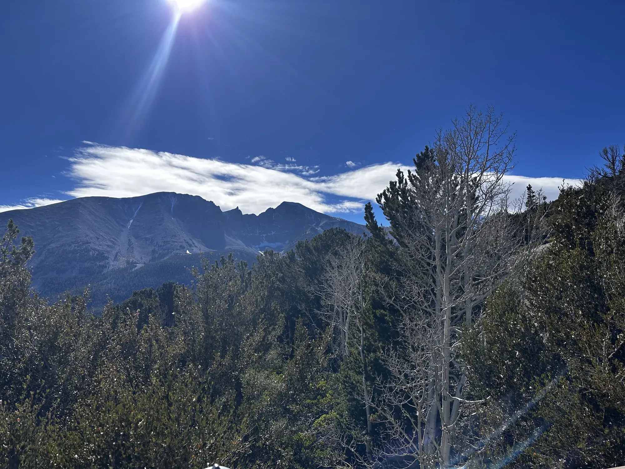
Wheeler Peak Summit
A strenuous 8.6-mile high-elevation summit hike with exposed upper slopes, wind, thunderstorms and possible summer snow.
Great Basin · Photo: David & Keri New
- 8.6 miDistance
- 3,100 ftElevation gain
- 4–10 hrTime
- StrenuousDifficulty
The numbers, with sources
Distance: 8.6 miles total. Source
Gain: 3,100 feet; starting elevation 10,160 feet. Source
Time: 4–10 hours, per the NPS. Source
Difficulty: Strenuous; steep and exposed, with the park’s steepest trail section near the summit. Source
Trailhead: Summit Trailhead near the upper Wheeler Peak Scenic Drive, two-thirds mile before Bristlecone Trailhead. Source
Route type: out-and-back Source
Built from official sources (checked Nov 3, 2026). Confirm current conditions with the park.
Recreation.gov permits, entrances & campgrounds
Recreation.gov (RIDB). Booking records date not published. NPS guidance above takes precedence. A listing doesn’t mean you need a permit or that there’s space on your dates.
Nearby campground records
Within 10 straight-line miles of the trailhead. Distances are straight-line from map coordinates, not driving distances.
- Wheeler Peak Campground: approximately 0.4 miles straight line. RIDB coordinates · Mapped route source
- Lower Lehman Creek Campground: approximately 3.4 miles straight line. RIDB coordinates · Mapped route source
- Upper Lehman Creek Campground: approximately 2.9 miles straight line. RIDB coordinates · Mapped route source
- Dump Station: approximately 4.7 miles straight line. RIDB coordinates · Mapped route source
- Grey Cliffs Campground: approximately 4.8 miles straight line. RIDB coordinates · Mapped route source
Park campground options (6)
These records belong to the park’s NPS recreation area. We haven’t checked how close these are to the trail, when they open or whether sites are free; check the map and the booking page.
Wheeler Peak Campground — Campground; RIDB reservable: yes. Season: not published in structured RIDB data. Recreation.gov (RIDB) source · Booking details
NPS reservation guidance: Make reservations on Recreation.gov. NPS source
Lower Lehman Creek Campground — Campground; RIDB reservable: yes. Season: not published in structured RIDB data. Recreation.gov (RIDB) source · Booking details
NPS reservation guidance: Make reservations on Recreation.gov. NPS source
Upper Lehman Creek Campground — Campground; RIDB reservable: yes. Season: not published in structured RIDB data. Recreation.gov (RIDB) source · Booking details
NPS reservation guidance: Make reservations on Recreation.gov. NPS source
Dump Station — Campground; RIDB reservable: no. Season: not published in structured RIDB data. Recreation.gov (RIDB) source
Grey Cliffs Campground — Campground; RIDB reservable: yes. Season: not published in structured RIDB data. Recreation.gov (RIDB) source · Booking details
NPS reservation guidance: Loops A and C of Grey Cliffs are available for reservation. Loop B is reserved for administrative use. Make reservations on Recreation.gov. NPS source
Baker Creek Campground — Campground; RIDB reservable: yes. Season: not published in structured RIDB data. Recreation.gov (RIDB) source · Booking details
NPS reservation guidance: Make reservations on Recreation.gov. NPS source
Route, junction by junction
Trailhead → Wheeler Peak Summit
Climb toward the saddle between Wheeler Peak and Bald Mountain, about 2.5 miles up, then continue above treeline to the rocky summit. Source
No elevation profile: we only draw one from a mapped route we can verify. Route source
In-depth guide
Compiled from linked sources, checked Nov 2, 2026. Each paragraph links to its source.
Is this hike for you?
Wheeler Peak is the second-highest point in Nevada and the highest one entirely inside the state. The NPS rates the hike strenuous: 8.6 miles (14.0 km) with 3,100 feet (945 m) of climbing from a start at 10,160 feet (3,097 m), taking 4 to 10 hours. It’s rocky and windy, one of the hardest trails in the park, and it ends with the steepest section of trail in the park, so save energy for that climb and for coming back down it. On a clear day you can see more than 100 miles from the top. Source
The trail
About 2.5 miles up you reach the saddle between Wheeler Peak and Bald Mountain. From there you’re above treeline and the tallest thing on the slope, which the NPS calls extremely dangerous when thunderstorms are coming. Make the saddle your decision point: if the weather is turning, go back. Source
The NPS recommends starting around dawn so fit, altitude-adjusted hikers are back by late morning or early afternoon. Thunderstorms and high winds are common, though, and an early start doesn’t guarantee anything. Turn around if clouds build or anyone is struggling. Source
Getting to the trailhead
Start at the Summit Trailhead near the top of the Wheeler Peak Scenic Drive, 2/3 of a mile before the Bristlecone Trailhead at the end of the road. Parking is limited, and parking along the road or outside marked spaces isn’t allowed, so have a backup plan. Source
Altitude, snow and storms
The trail starts around 10,000 feet. That gets you out of the summer heat of the Snake Valley, but altitude sickness and afternoon thunderstorms are real risks. Bring plenty of water and salty snacks, and head back to your car if you feel altitude symptoms or see thunderclouds rolling in. Snow can still be on the upper trail in summer, so check current trail and road conditions first. Source
Water and restrooms
There’s no drinking water along the Wheeler Peak Scenic Drive. The NPS suggests about one gallon per person per day. Fill up before you drive up, at the Lehman Caves Visitor Center (year-round) or the dump station (seasonal). The nearest restrooms are pit toilets with no running water at the Bristlecone Trailhead, past the start of this hike. Source
Dogs, kids and wheelchairs
Pets aren’t allowed on park trails; trained service animals are. The NPS says this trail isn’t accessible and doesn’t give a minimum age. Source
Elevation profile
The elevation chart follows the NPS summit trail line from the upper road toward the peak, so it shows the way up only; you come back the same way. It’s a terrain model, not a conditions report, and if its distance or climb differs from the NPS numbers, go by the NPS. Source
Sources & planning limits
Reviewed 2026-11-03. Check current conditions for your trip dates.
Getting there and back
Use designated Summit Trailhead spaces. Roadside parking and parking outside designated spaces are prohibited. Source
Return: Retrace the climb. NPS recommends a dawn start so prepared, acclimatized parties can return by late morning or early afternoon. Source
Water
No potable water along Wheeler Peak Scenic Drive. NPS advises about one gallon per person per day; year-round water at Lehman Caves Visitor Center, seasonal water at the dump station. Nearest toilets are pit toilets without running water at Bristlecone Trailhead. Source
No potable water along Wheeler Peak Scenic Drive. NPS advises about one gallon per person per day; year-round water at Lehman Caves Visitor Center, seasonal water at the dump station. Nearest toilets are pit toilets without running water at Bristlecone Trailhead. Source
Hazards
Exposed upper slopes create extreme lightning danger when thunderstorms approach. Source
Altitude sickness, high winds and lingering snow can require turning back. Source
Season
Summer snow can remain high on the route. Thunderstorms and high winds are common; altitude is a separate concern. Source
Summer snow can remain high on the route. Thunderstorms and high winds are common; altitude is a separate concern. Source
Gear & rules
No pets on park trails; trained service animals are allowed. Source
Do not park along the road or outside designated spaces. Source
Filling a gap in your kit? Compare these packing essentials on Amazon. Choose gear for your route, conditions and the park’s guidance.
As an Amazon Associate we earn from qualifying purchases. How this works
No pets on park trails; trained service animals are allowed. Source
Do not park along the road or outside designated spaces. Source
Questions
Is the trail above treeline for part of the climb?
Yes. NPS places the saddle about 2.5 miles up and describes the higher slopes as above treeline and extremely dangerous in approaching thunderstorms. Source
Can water be filled anywhere along the scenic drive?
NPS says potable water is not available along Wheeler Peak Scenic Drive; prepare supplies before the drive. Source
Alternatives
Camp near Wheeler Peak Summit
Closest campgrounds by drive time to Summit Trailhead:
- 2 min Wheeler Peak (0.8 mi, in the park)
- 21 min Upper Lehman Creek (8.7 mi, in the park)
- 24 min Lower Lehman Creek (9.5 mi, in the park)
- 35 min Grey Cliffs (12.9 mi, in the park)
- 38 min Baker Creek (14.2 mi, in the park)
Driving time with no traffic (OSRM, OpenStreetMap roads). Some park roads are shuttle-only in season. All camping near Great Basin
More Great Basin trail guides
- Alpine Lakes Loop2.7 mi · Easy