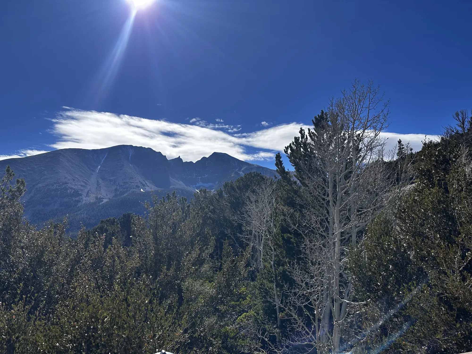
Alpine Lakes Loop
The Alpine Lakes Loop passes Teresa and Stella lakes through alpine meadows and conifer forest below Wheeler Peak and Doso Doyabi, the highest peaks of the Snake Range. It starts at the Bristlecone Trailhead at the end of the Wheeler Peak Scenic Drive, at 9,890 feet. NPS rates it Easy and gives 2.7 miles, 440 feet of elevation gain and 1.5 to 3 hours. The Bristlecone Trail shares the early sections, and linking the two makes 4.1 miles (6.6 km).
Great Basin · Photo: David & Keri New
- 2.7 miDistance
- 440 ftElevation gain
- 1.5–3 hrTime
- EasyDifficulty
The numbers, with sources
Distance: 2.7-mile (4.4 km) loop. Source
Gain: 440 feet (134 m). Source
Time: 1.5-3 hours (NPS trail overview; the activity duration field gives 1-3 hours). Source
Difficulty: Easy. Source
Trailhead: Bristlecone Trailhead at the end of the Wheeler Peak Scenic Drive. Source
Route type: Loop Source
Built from official sources (checked Nov 15, 2026). Confirm current conditions with the park.
Recreation.gov permits, entrances & campgrounds
Recreation.gov (RIDB). Booking records date not published. NPS guidance above takes precedence. A listing doesn’t mean you need a permit or that there’s space on your dates.
Park campground options (6)
These records belong to the park’s NPS recreation area. We haven’t checked how close these are to the trail, when they open or whether sites are free; check the map and the booking page.
Wheeler Peak Campground — Campground; RIDB reservable: yes. Season: not published in structured RIDB data. Recreation.gov (RIDB) source · Booking details
NPS reservation guidance: Make reservations on Recreation.gov. NPS source
Lower Lehman Creek Campground — Campground; RIDB reservable: yes. Season: not published in structured RIDB data. Recreation.gov (RIDB) source · Booking details
NPS reservation guidance: Make reservations on Recreation.gov. NPS source
Upper Lehman Creek Campground — Campground; RIDB reservable: yes. Season: not published in structured RIDB data. Recreation.gov (RIDB) source · Booking details
NPS reservation guidance: Make reservations on Recreation.gov. NPS source
Dump Station — Campground; RIDB reservable: no. Season: not published in structured RIDB data. Recreation.gov (RIDB) source
Grey Cliffs Campground — Campground; RIDB reservable: yes. Season: not published in structured RIDB data. Recreation.gov (RIDB) source · Booking details
NPS reservation guidance: Loops A and C of Grey Cliffs are available for reservation. Loop B is reserved for administrative use. Make reservations on Recreation.gov. NPS source
Baker Creek Campground — Campground; RIDB reservable: yes. Season: not published in structured RIDB data. Recreation.gov (RIDB) source · Booking details
NPS reservation guidance: Make reservations on Recreation.gov. NPS source
Route, junction by junction
Route selection → Described destination
The Alpine Lakes Loop passes Teresa and Stella lakes through alpine meadows and conifer forest below Wheeler Peak and Doso Doyabi, the highest peaks of the Snake Range. It starts at the Bristlecone Trailhead at the end of the Wheeler Peak Scenic Drive, at 9,890 feet. NPS rates it Easy and gives 2.7 miles, 440 feet of elevation gain and 1.5 to 3 hours. The Bristlecone Trail shares the early sections, and linking the two makes 4.1 miles (6.6 km). Source
No elevation profile yet:
No elevation profile yet: we haven’t verified a complete line for this route. No partial line, invented connector, scaled mileage or flat profile is substituted. Source
In-depth guide
Compiled from linked sources, checked Nov 15, 2026. Each paragraph links to its source.
Is this hike for you?
The Alpine Lakes Loop is one of the most popular hikes in Great Basin National Park. It’s a 2.7-mile (4.4 km) loop past Teresa and Stella lakes, through alpine meadows and conifer forest below Wheeler Peak and Doso Doyabi, the highest peaks of the Snake Range. The NPS rates it Easy, with 440 feet (134 m) of climbing and 1.5 to 3 hours of hiking. Another NPS listing says 1 to 3 hours. Source
The trail
The Bristlecone Trail shares the early part of the loop, and you can link the two for 4.1 miles (6.6 km) in all. The NPS page has a map of the overlapping sections (it doesn’t show in the NPS app). Look for wildflowers and wildlife in summer. A night hike gets you a huge sky. Source · Source 2 · Source 3
Getting to the trailhead
Start at the Bristlecone Trailhead at the end of the Wheeler Peak Scenic Drive, at 9,890 feet. Park only in designated spaces; parking along the road isn’t allowed. Once the Scenic Drive closes for winter, you have to reach the loop on the Lehman Creek Trail. Source
Altitude and storms
The loop starts just under 10,000 feet. That keeps you out of the summer heat of the Snake Valley, but altitude sickness and afternoon thunderstorms are real risks. Bring plenty of water and salty snacks, and head back to your car if you feel altitude symptoms or see thunderclouds building. Source
Water and restrooms
There’s no drinking water along the Wheeler Peak Scenic Drive. The NPS suggests about one gallon per person per day. You can fill up year-round at the Lehman Caves Visitor Center, or seasonally at the dump station. The only restrooms are pit toilets with no running water at the Bristlecone Trailhead. Source
Dogs, kids and wheelchairs
Pets aren’t allowed on park trails; trained service animals are. Source
The NPS says the loop isn’t accessible. Source
What we don’t know
The NPS lists the start as 9,890 feet / 2,987 meters, but 9,890 feet is about 3,014 meters, so go by the feet. It doesn’t give times between points, when the parking fills, or any services beyond the ones above. Source
There’s no elevation profile yet: we haven’t verified a complete line for this route. Source
Sources & planning limits
Reviewed 2026-11-15. Check current conditions for your trip dates.
- The NPS gives 1.5 to 3 hours in one place and 1 to 3 hours in another. It lists the start as 9,890 feet / 2,987 meters, but 9,890 feet is about 3,014 meters. Source
- The NPS doesn’t give times between points, parking-fill times or shuttle times, or services beyond the ones above. Source
- No elevation profile yet: we haven’t verified a complete line for this route. Source
Getting there and back
Bristlecone Trailhead at the end of the Wheeler Peak Scenic Drive. Source
Return: Use the return described in the official route account. Don’t count on a shuttle, boat, flight or pickup unless you have confirmed it yourself. Source
Water
The NPS doesn’t publish a full list of water and restrooms along this route. Use only the facilities explicitly identified in the NPS account; confirm current operations. Source
Hazards
Plan for altitude and the road season. The loop starts just under 10,000 feet, and NPS warns of altitude sickness and afternoon thunderstorms: carry plenty of water and salty snacks, and head back to your vehicle if you feel symptoms or see storms building. There is no potable water along the Scenic Drive; NPS suggests about a gallon per person per day, with water year-round at the Lehman Caves Visitor Center. After the Scenic Drive closes for winter, NPS says the loop has to be linked with the Lehman Creek Trail. Park only in designated spaces. Pets are not permitted on park trails; trained service animals are. The trailhead has pit toilets with no running water, and the loop is not accessible. Source
Season
This page can’t tell you current access. Check NPS conditions before departure. Source
Check current conditions and seasonal access with the park before you go. Check the park before departure. Source
Gear & rules
Respect current closures, signs and barriers. A mapped path is not proof that travel is permitted. Source
Filling a gap in your kit? Compare these packing essentials on Amazon. Choose gear for your route, conditions and the park’s guidance.
As an Amazon Associate we earn from qualifying purchases. How this works
The NPS doesn’t publish a pet rule for this exact route; confirm with the park before bringing an animal. Source
Questions
Which hike is this?
The Alpine Lakes Loop passes Teresa and Stella lakes through alpine meadows and conifer forest below Wheeler Peak and Doso Doyabi, the highest peaks of the Snake Range. It starts at the Bristlecone Trailhead at the end of the Wheeler Peak Scenic Drive, at 9,890 feet. NPS rates it Easy and gives 2.7 miles, 440 feet of elevation gain and 1.5 to 3 hours. The Bristlecone Trail shares the early sections, and linking the two makes 4.1 miles (6.6 km). 2.7-mile (4.4 km) loop. Source
Is a measured elevation profile available?
No elevation profile yet: we haven’t verified a complete line for this route. No partial line, invented connector, scaled mileage or flat profile is substituted. Source
Alternatives
Alternative-route distances and durations are unavailable unless separately described in the source. Side trails aren’t included. Source
More Great Basin trail guides
- Wheeler Peak Summit8.6 mi · Strenuous