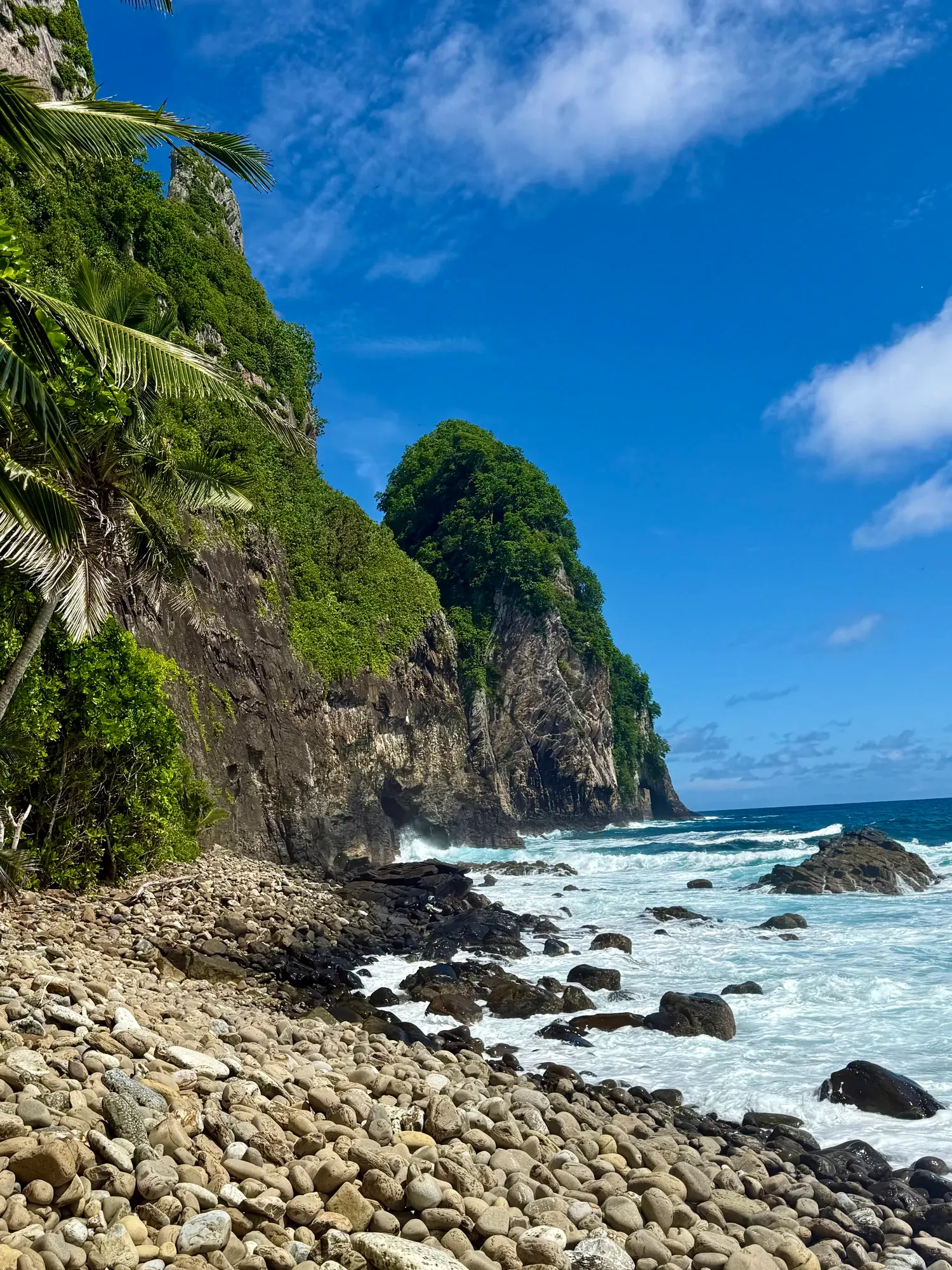
Tuafanua Trail
Follow the Tuafanua route to its rocky-beach destination using the designated ladders, steps and ropes, and plan the return before descending. The beach view doesn’t confirm a swimming destination.
American Samoa · Photo: David & Keri New
- 2.2 miDistance
- 219 ftElevation gain
- 2–3 hrTime
- ModerateDifficulty
The numbers, with sources
Distance: 2.2 miles total Source
Gain: 219 feet of gain Source
Time: 2–3 hours Source
Difficulty: See the official route and surface descriptions; no separate rating added. Source
Trailhead: The NPS listing doesn’t give driving directions or an exact trailhead. Source
Route type: out-and-back Source
Built from official sources (checked Nov 3, 2026). Confirm current conditions with the park.
Recreation.gov permits, entrances & campgrounds
Recreation.gov (RIDB). Booking records date not published. NPS guidance above takes precedence. A listing doesn’t mean you need a permit or that there’s space on your dates.
Route, junction by junction
Selected start → Selected destination
Follow the Tuafanua route to its rocky-beach destination using the designated ladders, steps and ropes, and plan the return before descending. The beach view doesn’t confirm a swimming destination. Source
No elevation profile: we only draw one from a mapped route we can verify. Route source
In-depth guide
Compiled from linked sources, checked Nov 2, 2026. Each paragraph links to its source.
Is this hike for you?
The Tuafanua trail drops to a rocky beach with the sound of the waves and a view west to Pola Island. The NPS rates it moderate: 2.2mi/3.54km total, 219ft/67m of elevation gain, and 2-3 hours. The catch is the descent, which uses ladders, steps and ropes. Source
Getting to the trailhead
The NPS page doesn’t give driving directions or an exact trailhead location. Ask the park for directions before you set out. Source
Permits, fees and dogs
The NPS says no reservation is needed for this hike, and it lists pets as allowed. Think hard about the ladders and ropes before bringing a dog. Source
The NPS lists no entrance fee for the park, but that doesn’t mean every activity is free. Source
Kids, strollers and wheelchairs
Because of the ladders, steps and ropes, the NPS says the viewpoint isn’t accessible. It doesn’t give age guidance, so decide whether your kids can manage the ropes and ladders both ways. Source
Before you go
The NPS doesn’t publish a season for this trail. When we checked, the park’s alert said the Mount Alava trail and Fatifati trail from the Fagasa pass to the summit were closed for trail work until further notice. You can still reach the Alava trail from the Old Vatia trail, a much steeper and more rugged climb, and the park suggests the Upper and Lower Sauma trails and the Tuafanua trail as other options. Check current alerts before you go. Source · Source 2
Agree as a group on the plan before you start. If anyone’s uneasy on the ladders or ropes, stop there and head back together. Source
Elevation profile
There’s no elevation profile yet: the NPS trail map line comes from its trail data and USGS 3DEP terrain, but we haven’t verified complete measurements for this route. Source
Sources & planning limits
Reviewed 2026-11-03. Check current conditions for your trip dates.
- We haven’t verified a single distance for this trail, so each NPS figure goes with the start and end it describes. Source
- NPS details are as of the date shown. Confirm access, services and reservations for your travel date. Source
- We don’t rate this trail for kids or mobility needs. Check the NPS accessibility details before you go. Source
- No elevation profile yet: we haven’t verified complete measurements for this route. Source
Getting there and back
The NPS listing doesn’t give driving directions or an exact trailhead. Source
Return: Complete the return arrangement described for this route. NPS labels the route moderate but explicitly identifies ladders, steps and ropes. That combination matters more to a party with mobility limitations than the distance alone. The NPS gives two to three hours and says the viewpoint is not accessible. Source
Water
Hazards
Season
The NPS does not publish a seasonal opening window for this route. Source
The NPS does not publish a seasonal opening window for this route. Source
Gear & rules
The NPS activity marks pets permitted: true. Source
Filling a gap in your kit? Compare these packing essentials on Amazon. Choose gear for your route, conditions and the park’s guidance.
As an Amazon Associate we earn from qualifying purchases. How this works
Questions
Which hike is this?
Follow the Tuafanua route to its rocky-beach destination using the designated ladders, steps and ropes, and plan the return before descending. The beach view doesn’t confirm a swimming destination. Source
Are the published figures fully consistent?
NPS labels the route moderate but explicitly identifies ladders, steps and ropes. That combination matters more to a party with mobility limitations than the distance alone. The NPS gives two to three hours and says the viewpoint is not accessible. Source
Is there an elevation profile?
Official NPS trail geometry sampled with USGS 3DEP. Profile coverage unconfirmed: the complete named GIS feature is shown, but its length is 36.62% below the published outward comparison. The missing distance is unresolved. Reference comparison uses 1.10 mi one way; the traced line measures 0.70 mi. The difference is unresolved. Distance comparison: half of the NPS 2.2-mile total, assuming you go out and back. The gap in trail length isn’t explained. Source
Alternatives
More American Samoa trail guides
- Mount Alava Trail7 mi · Strenuous