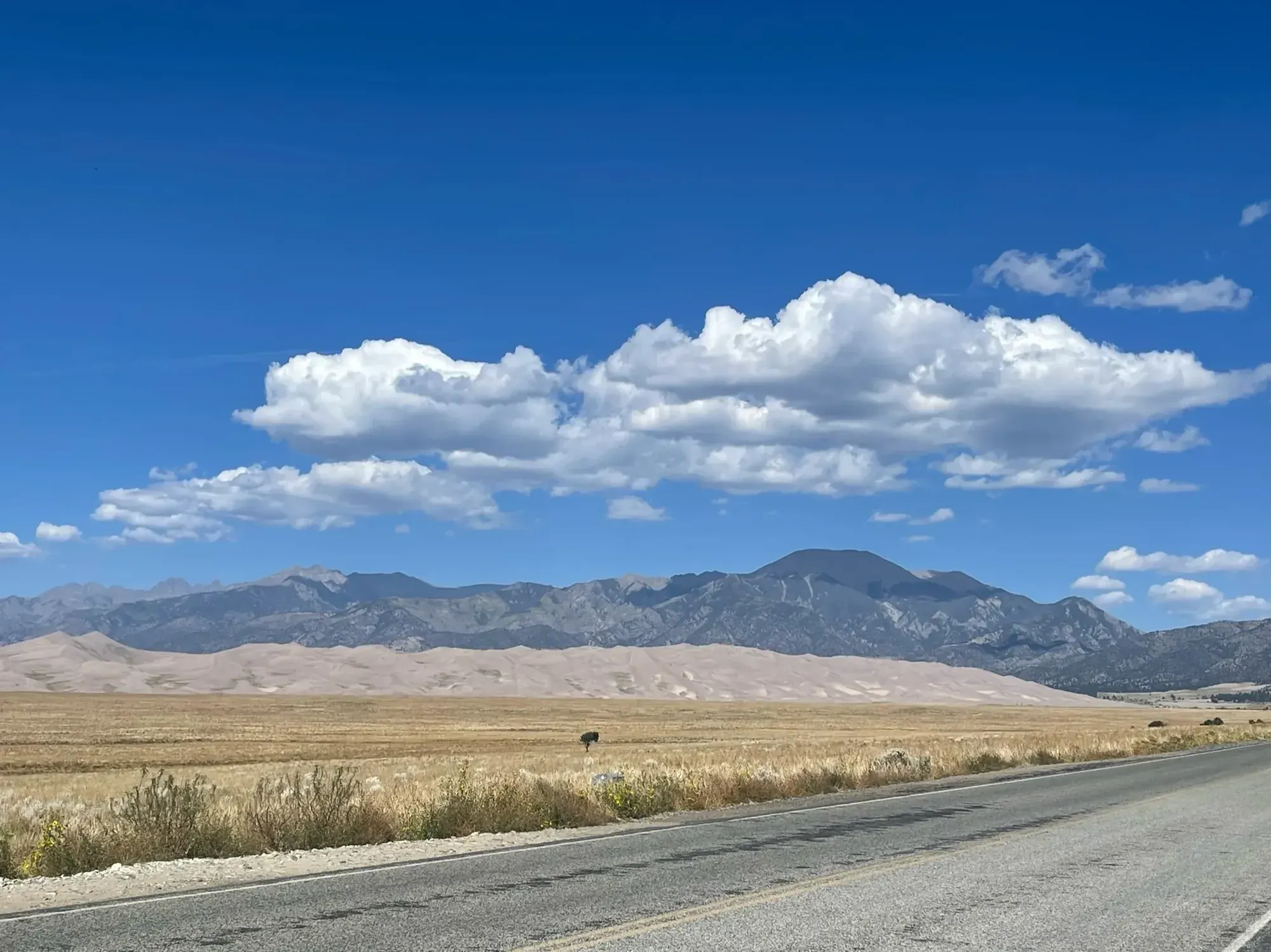
Star Dune
Star Dune is tied with Hidden Dune as one of the two tallest dunes in North America; NPS gives its height as 741 feet (225 m) from base to summit. There is no trail. NPS says the most direct way, with less up and down than going over High Dune on First Ridge, is to walk about 2 miles south down the Medano Creek bed from the Dunes Parking Lot until the pyramid-shaped dune comes into view, then follow a ridge to its summit. NPS gives an average of 6 hours over 6 miles round trip.
Great Sand Dunes · Photo: David & Keri New
- 6 miDistance
- 6 hrTime
The numbers, with sources
Distance: About 6 miles (9.6 km) round trip. Source
Gain: Unavailable: NPS gives Star Dune’s height (741 feet from base to summit), not the route’s elevation gain. Source
Time: About 6 hours on average; NPS says to plan as much as 9 hours if you are not acclimated to the altitude. Source
Difficulty: The NPS doesn’t rate the difficulty. Source
Trailhead: Dunes Parking Lot; walk about 2 miles south down the Medano Creek bed. Source
Route type: Off-trail round trip (NPS: there is no trail) Source
Built from official sources (checked Nov 15, 2026). Confirm current conditions with the park.
Recreation.gov permits, entrances & campgrounds
Recreation.gov (RIDB). Booking records date not published. NPS guidance above takes precedence. A listing doesn’t mean you need a permit or that there’s space on your dates.
Park campground options (2)
These records belong to the park’s NPS recreation area. We haven’t checked how close these are to the trail, when they open or whether sites are free; check the map and the booking page.
Medano Pass Primitive Road Campsites — Campground; RIDB reservable: no. Season: not published in structured RIDB data. Recreation.gov (RIDB) source
NPS reservation guidance: No reservations - sites are first-come, first-served NPS source
Pinon Flats Campground — Campground; RIDB reservable: yes. Season: not published in structured RIDB data. Recreation.gov (RIDB) source · Booking details
NPS reservation guidance: All sites are by reservation only through recreation.gov 1-877-444-6777 NPS source
Route, junction by junction
Route selection → Described destination
Star Dune is tied with Hidden Dune as one of the two tallest dunes in North America; NPS gives its height as 741 feet (225 m) from base to summit. There is no trail. NPS says the most direct way, with less up and down than going over High Dune on First Ridge, is to walk about 2 miles south down the Medano Creek bed from the Dunes Parking Lot until the pyramid-shaped dune comes into view, then follow a ridge to its summit. NPS gives an average of 6 hours over 6 miles round trip. Source
No elevation profile yet:
No elevation profile yet: we haven’t verified a complete line for this route. No partial line, invented connector, scaled mileage or flat profile is substituted. Source
In-depth guide
Compiled from linked sources, checked Nov 15, 2026. Each paragraph links to its source.
Is this hike for you?
Star Dune is tied with Hidden Dune as the tallest dune in North America, 741 feet (225 m) from base to summit. There’s no trail. The NPS gives an average of 6 hours over about 6 miles (9.6 km) round trip, and says to plan for as much as 9 hours if you’re not used to the high altitude and lower oxygen. That 741 feet is the dune’s height, not your total climb; the NPS doesn’t give an elevation gain. Source
The route
From the Dunes Parking Lot, walk about 2 miles (3.2 km) south down the wide, flat Medano Creek bed, with tall dunes on your right and mountains on your left, until the big pyramid-shaped Star Dune comes into view. Then follow a ridge to the summit, where dunes surround you in every direction. You can also get there from the top of High Dune on First Ridge, but the creek bed is more direct, with less up and down. Source
Popular hiking apps are often wrong here. The NPS gives the summit’s GPS coordinates as 37.7517639, -105.5580583. Source · Source 2 · Source 3
Look for unusual insects, plants, animal tracks, ripples and sand grains of every color. In warmer months, watch for one of 7 species of insects found nowhere else in the world. Source
Heat, storms and wind
In summer, start very early to avoid sand that can hit 150 degrees F and thunderstorms with lightning. Wind can come up any time of year with storm fronts, most often in the afternoon. Frigid temperatures and blizzards are common in winter. Source
Before you go
One odd thing on the NPS page: its time sentence says “Average round trip hiking time for High Dune is 6 hours over 6 miles,” though the page is about Star Dune, and the separate High Dune on First Ridge page gives 2 hours for High Dune. The NPS doesn’t say when parking fills, and there’s no elevation profile yet. Source · Source 2
Sources & planning limits
Reviewed 2026-11-15. Check current conditions for your trip dates.
- The NPS Star Dune page’s time sentence names High Dune (“6 hours over 6 miles”), while the separate High Dune on First Ridge page gives 2 hours for High Dune. Source
- The NPS doesn’t give times for each part of the hike, parking-fill times or other services beyond what’s above. Source
- No elevation profile yet: we haven’t verified a complete map line for this route. Source
Getting there and back
Dunes Parking Lot; walk about 2 miles south down the Medano Creek bed. Source
Return: Use the return described in the official route account. Don’t count on a shuttle, boat, flight or pickup unless you have confirmed it yourself. Source
Water
The NPS doesn’t publish a full list of water and restrooms along this route. Use only the facilities explicitly identified in the NPS account; confirm current operations. Source
Hazards
Treat this as a long day on sand at high altitude. NPS says to plan as much as 9 hours round trip if you are not acclimated. In summer, start very early to avoid sand that can reach 150 degrees F and thunderstorms with lightning. Winds can come any time of year during storm fronts, most often in the afternoon, and frigid temperatures and blizzards are common in winter. NPS warns that popular hiking applications are often inaccurate here and publishes the summit’s GPS coordinates: 37.7517639, -105.5580583. Source
Season
This page can’t tell you current access. Check NPS conditions before departure. Source
Check current conditions and seasonal access with the park before you go. Check the park before departure. Source
Gear & rules
Respect current closures, signs and barriers. A mapped path is not proof that travel is permitted. Source
Filling a gap in your kit? Compare these packing essentials on Amazon. Choose gear for your route, conditions and the park’s guidance.
As an Amazon Associate we earn from qualifying purchases. How this works
The NPS doesn’t publish a pet rule for this exact route; confirm with the park before bringing an animal. Source
Questions
Which hike is this?
Star Dune is tied with Hidden Dune as one of the two tallest dunes in North America; NPS gives its height as 741 feet (225 m) from base to summit. There is no trail. NPS says the most direct way, with less up and down than going over High Dune on First Ridge, is to walk about 2 miles south down the Medano Creek bed from the Dunes Parking Lot until the pyramid-shaped dune comes into view, then follow a ridge to its summit. NPS gives an average of 6 hours over 6 miles round trip. About 6 miles (9.6 km) round trip. Source
Is a measured elevation profile available?
No elevation profile yet: we haven’t verified a complete line for this route. No partial line, invented connector, scaled mileage or flat profile is substituted. Source
Alternatives
Alternative-route distances and durations are unavailable unless separately described in the source. Side trails aren’t included. Source
More Great Sand Dunes trail guides
- Mosca Pass Trail7 mi · Strenuous