Mosca Pass Trail
Just above the dunefield are montane woodlands of pinon and ponderosa pine, subalpine aspen and conifer forests, alpine lakes and rugged mountains over 13,000 feet (4,000 m) in elevation. The easiest access to forest in the national park is on the Montville Nature Trail and Mosca Pass Trail.
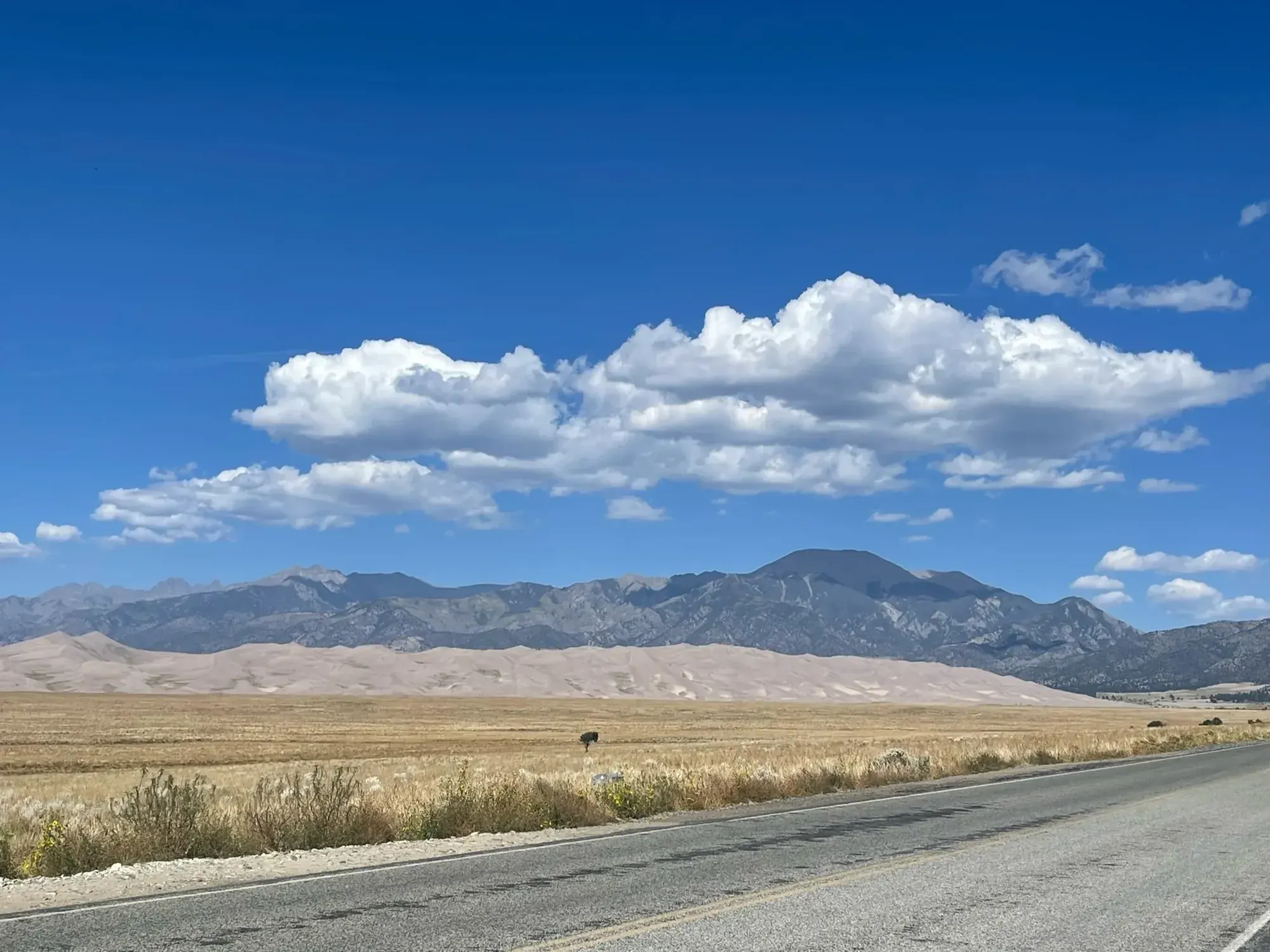
Great Sand Dunes · Photo: David & Keri New
- 7 miDistance
- 1,400 ftElevation gain
- 3.5 hrTime
- StrenuousDifficulty
The numbers, with sources
Distance: 7 miles round trip Source
Gain: 1,400 feet elevation gain Source
Time: Average 3.5 hours Source
Difficulty: Forest trail climbing to a mountain pass Source
Trailhead: The trailhead for Montville Trail and Mosca Pass Trail is located in a separate parking area just north of visitor center parking. Source
Route type: out-and-back Source
Built from official sources (checked Nov 3, 2026). Confirm current conditions with the park.
Recreation.gov permits, entrances & campgrounds
Recreation.gov (RIDB). Booking records date not published. NPS guidance above takes precedence. A listing doesn’t mean you need a permit or that there’s space on your dates.
Nearby campground records
Within 10 straight-line miles of the trailhead. Distances are straight-line from map coordinates, not driving distances.
- Medano Pass Primitive Road Campsites: approximately 4.9 miles straight line. RIDB coordinates · Mapped route source
- Pinon Flats Campground: approximately 0.8 miles straight line. RIDB coordinates · Mapped route source
Park campground options (2)
These records belong to the park’s NPS recreation area. We haven’t checked how close these are to the trail, when they open or whether sites are free; check the map and the booking page.
Medano Pass Primitive Road Campsites — Campground; RIDB reservable: no. Season: not published in structured RIDB data. Recreation.gov (RIDB) source
NPS reservation guidance: No reservations - sites are first-come, first-served NPS source
Pinon Flats Campground — Campground; RIDB reservable: yes. Season: not published in structured RIDB data. Recreation.gov (RIDB) source · Booking details
NPS reservation guidance: All sites are by reservation only through recreation.gov 1-877-444-6777 NPS source
Route, junction by junction
Trailhead → Selected destination or loop
The trail follows a small creek through shady aspen and evergreen forest to a low pass in the Sangre de Cristo Mountains. NPS notes that views are limited at the top. Choose it for the forest and historical passage through the mountains, rather than expecting a broad summit panorama at the endpoint. Source
No elevation profile: we only draw one from a mapped route we can verify. Route source
In-depth guide
Compiled from linked sources, checked Nov 2, 2026. Each paragraph links to its source.
Is this hike for you?
Mosca Pass Trail is a 7-mile (11 km) round trip with 1,400 feet (427 m) of elevation gain, averaging 3.5 hours. It follows a small creek through shady aspen and evergreen forest to a low pass in the Sangre de Cristo Mountains. The NPS calls it moderately strenuous, especially if you’re not used to Rocky Mountain elevations. Views at the top are limited, so it’s a hike for the forest, and you can turn around anywhere. Source
The trail
The trail continues past the Montville Nature Trail. Indigenous tribes and early settlers used this route to travel into the valley. Above the dunefield the park rises through pinon and ponderosa pine woodland and aspen and conifer forest to mountains over 13,000 feet (4,000 m). Source
If you want something shorter, Montville Nature Trail is the easiest, most popular forest hike in the park: 0.5 mile (1 km) round trip, 200 feet (60 m) of gain, about 30 minutes. It’s named for a late 1800s settlement of 20 houses, and a booklet at the trailhead has numbered stops about it. Near its high point there are views of Mt. Herard, the dunes and the valley. In summer it’s a good afternoon escape from the heat of the dunes. The park’s YouTube channel has a short video of Mosca Pass Trail in fall. Source
Getting to the trailhead
Both trails start from a separate parking area just north of the visitor center parking. Source
When to go
Mosca Pass Trail usually can’t be hiked in winter and early spring because of deep snow; you may need snowshoes or backcountry skis on the upper part from November through April. Montville is generally open year round, with small snowdrifts in winter. Source
Kids, dogs and wheelchairs
Neither trail is wheelchair accessible; there are rocks and uneven spots. Montville suits all ages, including young kids and seniors. Leashed pets are allowed on both; clean up after them. Source
Permits and fees
The NPS says this hike doesn’t need a reservation. Check the park’s entrance fee for your date. Source · Source 2
Before you go
The NPS doesn’t list water on the trail, so bring all you’ll need. Check current alerts and the forecast before you go, and turn back early if the group is slower than expected. Source · Source 2
There’s no elevation profile yet: the NPS trail map line comes from its trail data and USGS 3DEP terrain, but we haven’t verified complete measurements for this route. Source
Getting there and back
The trailhead for Montville Trail and Mosca Pass Trail is located in a separate parking area just north of visitor center parking. Source
Return: Come back the way described above. Return along the same trail unless a separate transport plan has been confirmed. Source
Water
No complete route-specific drinking-water or restroom schedule confirmed. Carry water for the whole hike. Source
Hazards
Montville Trail and Mosca Pass Trail are not wheelchair-accessible. There are rocks and uneven areas on the trail. Source
Season
Montville Trail is generally accessible year round, but there may be small snowdrifts in winter months. Mosca Pass Trail is generally not accessible for hiking in winter and early spring due to deep snow; snowshoes or backcountry skis may be needed on the upper parts of the trail from November through April. Source
Montville Trail is generally accessible year round, but there may be small snowdrifts in winter months. Mosca Pass Trail is generally not accessible for hiking in winter and early spring due to deep snow; snowshoes or backcountry skis may be needed on the upper parts of the trail from November through April. Source
Gear & rules
Follow current signs and closures, and treat any side trip as a separate decision. Source
Filling a gap in your kit? Compare these packing essentials on Amazon. Choose gear for your route, conditions and the park’s guidance.
As an Amazon Associate we earn from qualifying purchases. How this works
Pets are permitted on leash on Montville Trail and Mosca Pass Trail. Please be sure to clean up after your pet. Source
Questions
Which route do these figures describe?
7 miles round trip. Mosca Pass is the longer forest hike on an NPS page it shares with the Montville Nature Trail. Select the seven-mile round trip and 1,400-foot gain for Mosca, rather than borrowing Montville’s half-mile distance and thirty-minute duration. The two walks serve very different day plans from the same general starting area. Source
Is the trail open right now?
No. NPS details as of Nov 3, 2026. Confirm current conditions and closures with NPS. Source
Is there a measured elevation profile?
Official NPS trail geometry sampled with USGS 3DEP terrain; no mileage or gain scaling. NPS publishes 3.50 mi one way; the traced line measures 3.05 mi. The difference is unresolved. Source
Alternatives
The official duration description explicitly allows turning around anywhere along the route because the top has few views. So turning back early on the same trail is a fine plan. Montville remains a separately measured half-mile nature loop, with two hundred feet of gain and an average thirty-minute time. Source
Camp near Mosca Pass Trail
Closest campgrounds by drive time to Mosca Pass Trailhead:
- 3 min Piñon Flats (1 mi, in the park)
- 15 min Zapata Falls Campground ↗ (8.8 mi, Bureau of Land Management)
- 2 hr 43 min Alvarado Campground ↗ (96.5 mi, USDA Forest Service)
Driving time with no traffic (OSRM, OpenStreetMap roads). Some park roads are shuttle-only in season. All camping near Great Sand Dunes
More Great Sand Dunes trail guides
- Star Dune6 mi