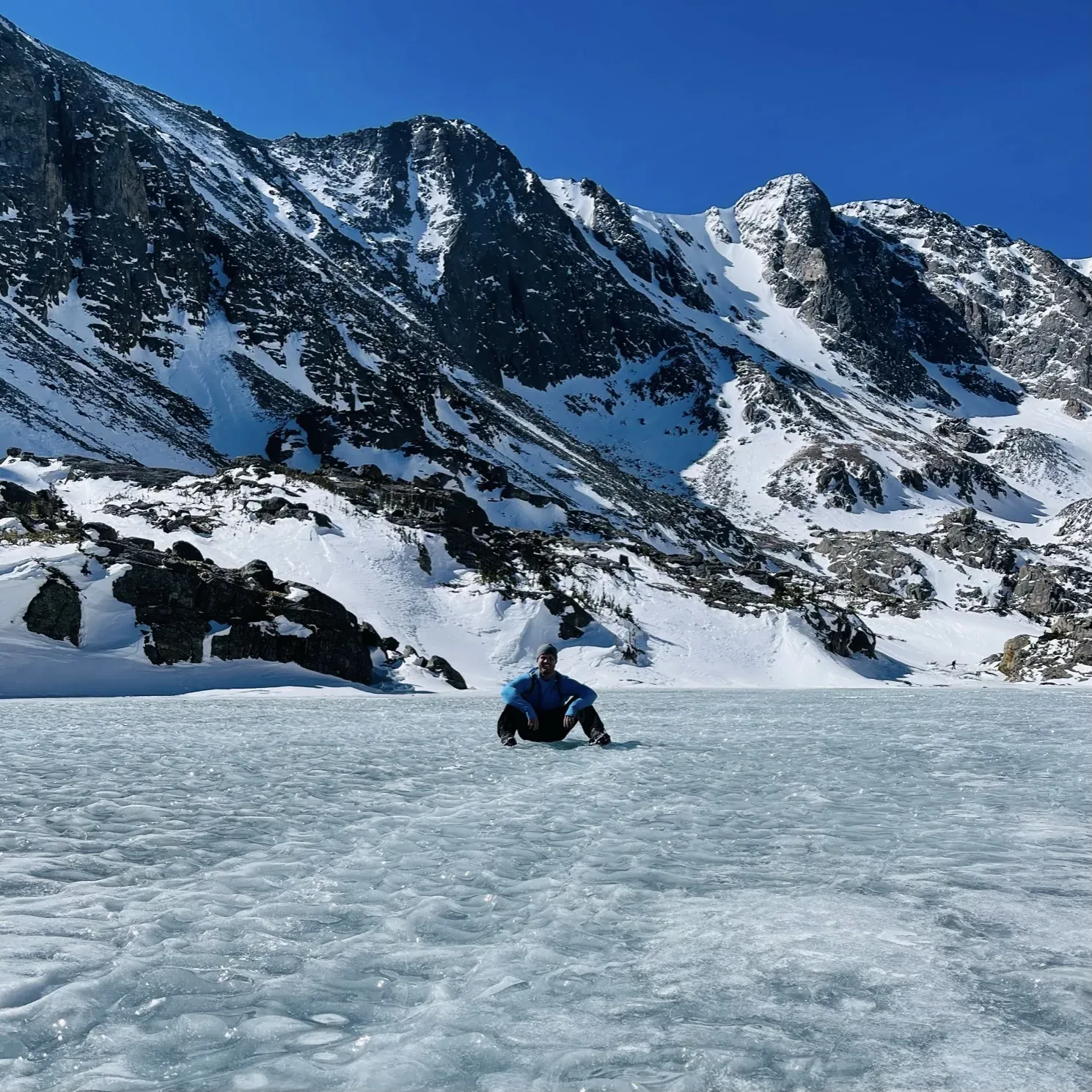
Sky Pond from Glacier Gorge
Sky Pond is a hiking destination reached from Glacier Gorge Trailhead in the Bear Lake Road corridor. The NPS corridor table lists Alberta Falls, The Loch and Timberline Falls as intermediate destinations from this trailhead.
Rocky Mountain · Photo: David & Keri New
- 4.2 mi one wayDistance
- 1,726 ftElevation gain
The numbers, with sources
Distance: 4.2 miles one way (NPS Bear Lake Road corridor table). Source
Gain: 1,726 feet (NPS Bear Lake Road corridor table). Source
Trailhead: Glacier Gorge Trailhead on Bear Lake Road Source
Route type: out-and-back Source
Built from official sources (checked Nov 3, 2026). Confirm current conditions with the park.
Recreation.gov permits, entrances & campgrounds
Recreation.gov (RIDB). Booking records date not published. NPS guidance above takes precedence. A listing doesn’t mean you need a permit or that there’s space on your dates.
Nearby campground records
Within 10 straight-line miles of the trailhead. Distances are straight-line from map coordinates, not driving distances.
- Rocky Mountain National Park Longs Peak Campground: approximately 5 miles straight line. RIDB coordinates · Mapped route source
- Rocky Mountain National Park Aspenglen Campground: approximately 6.7 miles straight line. RIDB coordinates · Mapped route source
- Rocky Mountain National Park Glacier Basin Campground: approximately 2.8 miles straight line. RIDB coordinates · Mapped route source
- Rocky Mountain National Park Moraine Park Campground: approximately 4.1 miles straight line. RIDB coordinates · Mapped route source
Park campground options (5)
These records belong to the park’s NPS recreation area. We haven’t checked how close these are to the trail, when they open or whether sites are free; check the map and the booking page.
Rocky Mountain National Park Timber Creek Campground — Campground; RIDB reservable: yes. Season: not published in structured RIDB data. Recreation.gov (RIDB) source · Booking details
NPS reservation guidance: Sites in Timber Creek Campground are available by reservation only. To make a reservation, visit https://www.recreation.gov/camping/campgrounds/260552. NPS source
Rocky Mountain National Park Longs Peak Campground — Campground; RIDB reservable: yes. Season: not published in structured RIDB data. Recreation.gov (RIDB) source · Booking details
NPS reservation guidance: Longs Peak Campground is open from July to early September. Campsites are available on a first-come, first-served basis only. To pay for overnight camping fees at Longs Peak Campground, campers can use the Scan & Pay function on the Recreation.gov Mobile App. It is easy to pay using the Scan and Pay feature. First, download the Recreation.gov Mobile App and then create or update an account. Additional directions are posted at Longs Peak Campground. NPS source
Rocky Mountain National Park Aspenglen Campground — Campground; RIDB reservable: yes. Season: not published in structured RIDB data. Recreation.gov (RIDB) source · Booking details
NPS reservation guidance: During the summer camping season (late May-mid-Oct), all campsites are available by reservation only. Reservations can be made up to 6 months in advance of your desired camping date. To make a reservation, visit www.recreation.gov and search for Rocky Mountain National Park. Look for Aspenglen Campground. NPS source
Rocky Mountain National Park Glacier Basin Campground — Campground; RIDB reservable: yes. Season: not published in structured RIDB data. Recreation.gov (RIDB) source · Booking details
NPS reservation guidance: Glacier Basin Campground is a reservation only campground. All sites are reservable up to six months in advance through www.recreation.gov. NPS source
Rocky Mountain National Park Moraine Park Campground — Campground; RIDB reservable: yes. Season: not published in structured RIDB data. Recreation.gov (RIDB) source · Booking details
NPS reservation guidance: Moraine Park Campground is open for the summer! Campsites are available for tents and RVs. Campsites are available by reservation only. To make a reservation, visit www.recreation.gov online, use the Recreation.gov Mobile App or call 1-877-444-6777 and search for Rocky Mountain National Park - Moraine Park Campground. NPS source
Route, junction by junction
Glacier Gorge Trailhead → Alberta Falls
Begin at Glacier Gorge, which NPS identifies as a gateway to Alberta Falls, The Loch, Mills Lake, and other destinations. The corridor table lists Alberta Falls 0.8 mile one way from this trailhead, with 233 feet of elevation gain. The park warns that the parking area fills early and recommends the seasonal Bear Lake Shuttle from Park & Ride. Source
Distance: Alberta Falls is 0.8 mile one way from Glacier Gorge. Source
Elevation: The table gives a starting elevation of 9,175 feet and 233 feet of gain to Alberta Falls; it does not publish the falls elevation in this row. Source
Alberta Falls → The Loch
Continue on the mapped approach toward The Loch. Beyond Alberta Falls, the corridor map shows routes branching toward Lake Haiyaha and Mills Lake; use the branch to The Loch for Sky Pond. The Loch is shown on the same drainage-side approach as Timberline Falls and the two lakes beyond. Source
Distance: The Loch is 3 miles one way from the Glacier Gorge trailhead. That’s the distance from the trailhead, not the length of the stretch from Alberta Falls. Source
Junction: Lake Haiyaha branch: Continue toward The Loch rather than the branch to Lake Haiyaha. Source
Junction: Mills Lake branch: Take the mapped branch toward The Loch; Mills Lake is on the separate Glacier Gorge branch. Source
The Loch → Timberline Falls
Follow the mapped route beyond The Loch toward Timberline Falls. The map shows Andrews Tarn and Andrews Glacier on a separate branch to the west; stay on the Timberline Falls and Sky Pond branch. Timberline Falls is the last waterfall destination listed in the corridor table before Sky Pond. Source
Distance: Timberline Falls is listed 3.8 miles one way from Glacier Gorge. That’s the distance from the trailhead. NPS doesn’t give a length for this stretch. Source
Junction: Andrews Tarn branch: Continue toward Timberline Falls and Sky Pond rather than following the Andrews Tarn branch. Source
Timberline Falls → Sky Pond via Lake of Glass
The NPS corridor map shows Lake of Glass between Timberline Falls and Sky Pond. Continue on that mapped branch to Sky Pond, the final labeled lake on this spur. The map shows the order of these landmarks but says nothing about handholds, the size of the scramble, or a safe line across wet rock. Source
Distance: Sky Pond is 4.2 miles one way from Glacier Gorge according to the corridor table. No separate mileage to Lake of Glass is supplied there. Source

1: Glacier Gorge Trailhead · 2: Alberta Falls · 3: The Loch · 4: Timberline Falls · 5: Sky Pond: traced destination
Traced line: 4.22 mi one way, about 1,738 ft of climbing and 75 ft of descent. Glacier Gorge trailhead to Sky Pond.
Elevations: USGS 3DEP (public domain). Route: National Park Service GIS. Terrain sampling and smoothing can miss short climbs and steep steps.
Elevation waypoint table
| Waypoint | Mile | Elevation (ft) |
|---|---|---|
| 1. Glacier Gorge Trailhead | 0.00 | 9,183 |
| 2. Alberta Falls | 0.83 | 9,419 |
| 3. The Loch | 3.02 | 10,198 |
| 4. Timberline Falls | 3.78 | 10,502 |
| 5. Sky Pond: traced destination | 4.22 | 10,845 |
Method: Centered 50 m moving average (5 m trapezoidal integration; clamped endpoints); 3 m hysteresis. Elevations and distances are estimates along the mapped route. Published route figures.
In-depth guide
Compiled from linked sources, checked Nov 3, 2026. Each paragraph links to its source.
Decisions & preparation
We only show distances between points where the NPS publishes them. We don’t split the total into made-up segments. Source
Turnaround & return planning
Turn back at Alberta Falls, The Loch or Timberline Falls if the group is running low on energy, water or daylight. Plan on walking back the way you came; don’t count on a pickup. Planning basis
Parking & transport timing
The Glacier Gorge lot fills early. When the summer shuttle runs, the NPS recommends parking at Park & Ride and taking the Bear Lake Shuttle; there’s no shuttle in winter. As of November 2, 2026, the shuttle season and the 2026 Timed Entry+ Bear Lake Road reservation dates were over. The NPS doesn’t say when the lot fills or give pickup times at this trailhead. Source
The free Bear Lake Route stopped at Park & Ride, Bierstadt Lake Trailhead, Glacier Gorge Trailhead and Bear Lake. In 2026 it ran May 22–October 18, 6:30 a.m.–7:30 p.m., every 10–15 minutes. The last bus left the Bear Lake stop at 7:30 p.m. (no separate time is published for Glacier Gorge). It had stopped for the season by November 2. The separate ticketed Hiker Shuttle to Estes Park left Park & Ride for the last time each day at 6 p.m. Shuttle source
What to bring by season
Any season: the NPS Ten Essentials (navigation, sun protection, extra clothing, a light, first aid, fire supplies where allowed, repair tools, extra food, water and emergency shelter). Tell someone your route and when you’ll be back. Source
Warm weather: sun protection, plenty of water and extra food. Cold or wet weather: warm layers and rain gear, plus an extra layer in case you’re out longer than planned. Source
Expect snow-packed trails and winter conditions across most of the park from October to early June. Higher up you’ll need to be ready for snow and ice: traction devices are advised and snowshoes may be needed. Source
Don’t count on spring trails in March, April and May. The NPS says March and April are historically among the snowiest months and advises warm layers, traction devices and snowshoes through May. Source
The park’s trail report updated October 22, 2026 noted the first real high-elevation snow and freezing temperatures, and its October 15 Glacier Gorge report said Alberta Falls could be icy. Conditions can be better or worse by the time you go. Source
The Bear Lake shuttle season ended October 18, 2026. Plan a November trip without it; there’s no 2027 schedule yet. Source
Children & mobility
We haven’t found a stroller or wheelchair rating or a minimum age for this trail. Think about the steps, the exposed spots and the long walk back. (Unconfirmed: No suitability rating.) Source
Is this hike for you?
Sky Pond is 4.2 miles one way from the Glacier Gorge Trailhead, with 1,726 feet of climbing from a start at 9,175 feet. The way up passes Alberta Falls, The Loch and Timberline Falls, so there are plenty of good places to stop short. Agree before you start that turning back early is fine, and rest or turn around if someone is tired, unwell or pushing too hard, as the park advises. Source
For a shorter lake, Mills Lake is 2.7 miles one way from Glacier Gorge with 816 feet of climbing. For something flat, Sprague Lake Loop is 0.8 mile, wheelchair and stroller accessible, with benches and viewpoints. Moraine Park Discovery Center has exhibits and is open seasonally, late May to early October. Source
Getting to the trailhead
Bear Lake Road leaves U.S. Highway 36/Trail Ridge Road about 0.2 mile from the Beaver Meadows Entrance and 1.4 miles from the Beaver Meadows Visitor Center. It runs 9.2 miles, climbing from about 8,200 feet to 9,475 feet at Bear Lake. Glacier Gorge is along the way. Source
Park & Ride is about 5.2 miles up from the Trail Ridge Road junction. It’s the biggest lot on the road and is open year-round, but there’s no shuttle in winter, so check the schedule before you count on a bus. Source
Timed entry
Under the 2026 rules, if you entered the Bear Lake Road corridor and then left, you could only come back in after 2 p.m. Pack everything before you go in. Reservations weren’t transferable: the named holder had to be in the car with the confirmation and photo ID. Cell service at the entrance stations is unreliable and partial screenshots may be turned away, so save the full confirmation ahead of time. Check the rules for your season. Source · Source 2
Lightning
Lightning is common here from June through September and can strike about ten miles out from a storm. If you hear thunder, you may already be in range, so decide to retreat before you reach the exposed upper basin. Source
A building or a metal-topped vehicle is the safest shelter; nowhere outdoors is fully safe. Below treeline is better than an open slope, but scattered trees don’t protect much. Stay out of rock overhangs, caves and wet gullies. Wait at least 30 minutes after the last thunder before moving on, and if that eats your spare time, shorten the hike. Source
Staying warm
Wear wicking layers with a waterproof shell, and skip cotton and jeans. Even in summer, bring a warm hat, gloves and spare wool socks. Source
Watch for uncontrolled shivering, slow or slurred speech, memory lapses, fumbling hands, stumbling and exhaustion. Those are signs of hypothermia: get the person to shelter, into dry clothes and off the cold ground, get medical help, and forget about the lake. Source
Wildlife
Stay at least 75 feet from all wildlife and at least 120 feet from black bears, moose and mountain lions, and back off more if an animal reacts to you. Use binoculars or a zoom lens. Source
Leave young animals alone, even if they seem abandoned; the mother is often just off feeding. Feeding or harassing wildlife is illegal, so keep snacks put away. Source
Sources & planning limits
Reviewed 2026-11-03. Check current conditions for your trip dates.
- We haven’t confirmed access, transport or services for your date. Check with the NPS before you rely on them. Source
Getting there and back
The Glacier Gorge parking area fills early. During summer shuttle operations, NPS recommends parking at Park & Ride and using the Bear Lake Shuttle; shuttle service is not available in winter. As of November 2, 2026, the published shuttle season and the 2026 Timed Entry+ Bear Lake Road reservation dates have ended. Source
Shuttle: The free Bear Lake Route served Park & Ride, Bierstadt Lake Trailhead, Glacier Gorge Trailhead, and Bear Lake. The published 2026 season ran May 22–October 18, 6:30 a.m.–7:30 p.m., with buses every 10–15 minutes. The last bus departed the Bear Lake stop at 7:30 p.m.; that is not a separately published departure time from Glacier Gorge. This service has ended as of November 2. The separate ticketed Hiker Shuttle to Estes Park had its final departure from Park & Ride at 6 p.m. Source
Return: The corridor map connects the Sky Pond spur back to Glacier Gorge by way of Lake of Glass, Timberline Falls, The Loch, and Alberta Falls. Retrace that mapped approach for the trailhead return. During the published 2026 shuttle season, Glacier Gorge was a Bear Lake Route stop for returning to Park & Ride; shuttle service is not available in winter. Source
Water
Do not drink untreated lake or stream water. NPS says to purify drinking water to prevent Giardia and other waterborne diseases. Its guidance specifies a full rolling boil for at least five minutes or a filter that removes Giardia. Source
Bring full water bottles and food for the day. The shuttle page says there are no stores or food services at Park & Ride or anywhere in the Bear Lake Road corridor; it doesn’t confirm a potable-water refill point at Glacier Gorge or beyond. Source
Hazards
Moving water and slippery edges
Keep at least one body length back from riverbank and waterfall edges. Rocks and vegetation beside moving water can be icy, wet, and slippery. NPS advises staying on designated trails and turning back if water is flowing across a trail, rather than trying to cross. Source
Lightning
Start early and plan to be below treeline or at shelter before a storm. If caught above treeline, move away from summits and isolated trees and rocks. The page warns against sheltering in small cave entrances and overhangs. Source
High elevation
NPS warns that high elevation increases dehydration, sunburn, and mountain-sickness risk. Its guidance is to drink water, reapply sunscreen, and descend if sickness or physical problems develop. This is parkwide guidance, not a prediction about a particular visitor. Source
Snow and avalanche terrain
Stay back from steep snow slopes and cornices. Ask a ranger about avalanche potential and know how to recognize dangerous snow conditions. A summer trail map doesn’t confirm a safe winter route. Source
Cold and wind
Temperatures can drop even in summer at high elevations. NPS recommends layered clothing and appropriate jackets, and explains that increasing wind can make exposed skin feel much colder. Check the wind-chill forecast as well as the air temperature. Source
Trees and branches
Falling trees and branches are an ever-present year-round hazard in forested areas. Look up and remain aware of surroundings because branches and trees can fall without warning. Source
Season
Glacier Gorge is a popular year-round hiking destination; this doesn’t confirm year-round access to Sky Pond itself. Bear Lake Road shuttle service operates in summer and is unavailable in winter. Source
Expect snow-packed trails and winter conditions in most of Rocky from October to early June. Higher areas require preparation for snow and ice; traction devices are advised and snowshoes may be necessary. Source
March, April, and May should not be assumed to bring warm spring trail conditions. NPS says March and April are historically among the snowiest months and advises warm layers, traction devices, and snowshoes for trips through May. Source
The general trail-conditions report updated October 22, 2026 describes the first notable high-elevation snow and freezing temperatures. Its October 15 Glacier Gorge report specifically says Alberta Falls could be icy. This is dated guidance, and the page warns conditions may be better or worse by the time a hike begins. Source
The listed Bear Lake shuttle season ended October 18, 2026. Plan November access without the seasonal shuttle; these sources do not publish a 2027 shuttle schedule. Source
Gear & rules
Pets are prohibited on trails and in the backcountry. Source
Filling a gap in your kit? Compare these packing essentials on Amazon. Choose gear for your route, conditions and the park’s guidance.
As an Amazon Associate we earn from qualifying purchases. How this works
Carry a paper map and compass and know how to use them, in addition to a phone or GPS. Bring the Ten Essentials, sufficient food and water, appropriate footwear, and extra layers for changing weather. Source
NPS recommends closed-toed footwear with treaded soles. It advises waterproof outer layers, warm clothing, extra socks, hat and gloves, sunglasses or goggles, and sunscreen in any season. Traction devices can help even during summer if trails remain icy. Source
Pets are prohibited on all park trails, tundra, and meadows. Pets may not be left unattended in vehicles if doing so creates a danger to the animal or if the animal becomes a public nuisance. Source
Complete a trip plan and share it with trusted contacts before leaving. NPS also recommends an outdoor emergency plan even for experienced visitors. Source
Pace
NPS advises knowing the limits of everyone in the group. If tired, unwell, or pushing anyone too hard, rest and turn back; reaching the planned destination is optional. The opened official sources do not publish a total Sky Pond hiking time or times for these stretches. Source
Questions
Where should a visitor park when Glacier Gorge is full?
NPS recommends Park & Ride and the Bear Lake Shuttle during the shuttle season. Glacier Gorge parking fills early. The park also asks visitors to consider another area and return later if parking or trails are too crowded. In winter the shuttle is unavailable. Source
Is Lake of Glass before Sky Pond?
Yes. The official corridor map shows the Sky Pond approach passing The Loch, Timberline Falls, and Lake of Glass in that order. The separate Andrews Tarn branch is not the Sky Pond route. Source
Can a shuttle ride return to Estes Park after a late hike?
During the 2026 season the last Hiker Shuttle left Park & Ride at 6 p.m. NPS warned that no other buses or public transit would return passengers to Estes Park if they missed it. The later Bear Lake Route service was an in-park connection, not a later Estes Park departure. Source
Is a trail that is popular year-round snow-free?
No. NPS says to expect winter conditions and snow-packed trails in most areas from October to early June. A generally accessible trailhead doesn’t confirm safe access to Sky Pond. Source
Do you have to keep going just because you’re close?
No. NPS tells visitors to know everyone’s limits, rest or turn back if tired or unwell, and accept turning around before reaching the hiking goal. Source
Alternatives
Sprague Lake Loop: 0.8-mile loop; NPS describes it as wheelchair and stroller accessible. Bear Lake Road access requirements still apply. Source
Camp near Sky Pond from Glacier Gorge
Closest campgrounds by drive time to Glacier Gorge Trailhead:
- 12 min Glacier Basin (3.7 mi, in the park)
- 23 min Moraine Park (8.2 mi, in the park)
- 37 min Aspenglen (15.8 mi, in the park)
- 49 min Longs Peak (19.9 mi, in the park)
- 49 min Meeker Park Overflow Campground ↗ (20.9 mi, USDA Forest Service)
Driving time with no traffic (OSRM, OpenStreetMap roads). Some park roads are shuttle-only in season. All camping near Rocky Mountain
More Rocky Mountain trail guides
- Alluvial FanEasy
- Deer Mountain from Deer Ridge Junction6.1 mi
- Sprague Lake0.7 mi