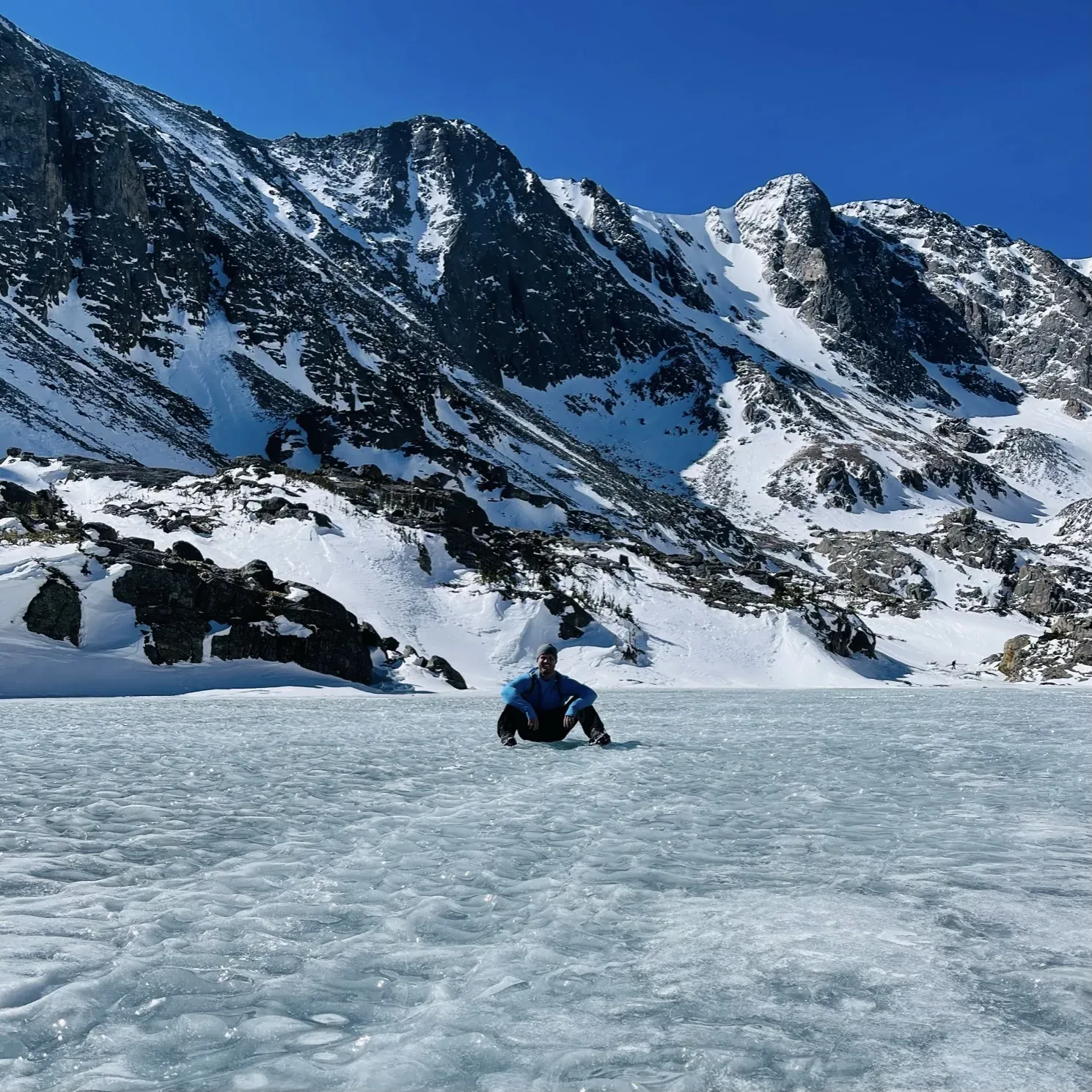
Deer Mountain from Deer Ridge Junction
A 6.1-mile summit return walk from Deer Ridge Junction; lower starting elevation may mean less snow than other summit routes, but winter traction is recommended.
Rocky Mountain · Photo: David & Keri New
- 6.1 miDistance
The numbers, with sources
Distance: 6.1 miles round trip from the trailhead. Source
Gain: Not published by the NPS. Source
Time: Not published by the NPS. Source
Difficulty: The NPS doesn’t give a difficulty rating. Source
Trailhead: Deer Ridge Junction. Source
Route type: out-and-back Source
Built from official sources (checked Nov 3, 2026). Confirm current conditions with the park.
Recreation.gov permits, entrances & campgrounds
Recreation.gov (RIDB). Booking records date not published. NPS guidance above takes precedence. A listing doesn’t mean you need a permit or that there’s space on your dates.
Nearby campground records
Within 10 straight-line miles of the trailhead. Distances are straight-line from map coordinates, not driving distances.
- Rocky Mountain National Park Longs Peak Campground: approximately 8.2 miles straight line. RIDB coordinates · Mapped route source
- Rocky Mountain National Park Aspenglen Campground: approximately 1.3 miles straight line. RIDB coordinates · Mapped route source
- Rocky Mountain National Park Glacier Basin Campground: approximately 4.1 miles straight line. RIDB coordinates · Mapped route source
- Rocky Mountain National Park Moraine Park Campground: approximately 1.7 miles straight line. RIDB coordinates · Mapped route source
Park campground options (5)
These records belong to the park’s NPS recreation area. We haven’t checked how close these are to the trail, when they open or whether sites are free; check the map and the booking page.
Rocky Mountain National Park Timber Creek Campground — Campground; RIDB reservable: yes. Season: not published in structured RIDB data. Recreation.gov (RIDB) source · Booking details
NPS reservation guidance: Sites in Timber Creek Campground are available by reservation only. To make a reservation, visit https://www.recreation.gov/camping/campgrounds/260552. NPS source
Rocky Mountain National Park Longs Peak Campground — Campground; RIDB reservable: yes. Season: not published in structured RIDB data. Recreation.gov (RIDB) source · Booking details
NPS reservation guidance: Longs Peak Campground is open from July to early September. Campsites are available on a first-come, first-served basis only. To pay for overnight camping fees at Longs Peak Campground, campers can use the Scan & Pay function on the Recreation.gov Mobile App. It is easy to pay using the Scan and Pay feature. First, download the Recreation.gov Mobile App and then create or update an account. Additional directions are posted at Longs Peak Campground. NPS source
Rocky Mountain National Park Aspenglen Campground — Campground; RIDB reservable: yes. Season: not published in structured RIDB data. Recreation.gov (RIDB) source · Booking details
NPS reservation guidance: During the summer camping season (late May-mid-Oct), all campsites are available by reservation only. Reservations can be made up to 6 months in advance of your desired camping date. To make a reservation, visit www.recreation.gov and search for Rocky Mountain National Park. Look for Aspenglen Campground. NPS source
Rocky Mountain National Park Glacier Basin Campground — Campground; RIDB reservable: yes. Season: not published in structured RIDB data. Recreation.gov (RIDB) source · Booking details
NPS reservation guidance: Glacier Basin Campground is a reservation only campground. All sites are reservable up to six months in advance through www.recreation.gov. NPS source
Rocky Mountain National Park Moraine Park Campground — Campground; RIDB reservable: yes. Season: not published in structured RIDB data. Recreation.gov (RIDB) source · Booking details
NPS reservation guidance: Moraine Park Campground is open for the summer! Campsites are available for tents and RVs. Campsites are available by reservation only. To make a reservation, visit www.recreation.gov online, use the Recreation.gov Mobile App or call 1-877-444-6777 and search for Rocky Mountain National Park - Moraine Park Campground. NPS source
Route, junction by junction
Deer Ridge Junction → Deer Mountain Trail
Start at Deer Ridge Junction and follow the signed trail to the summit. Source
Deer Mountain Trail → summit
The NPS activity page rounds the hike to 6 miles round trip and gives no distances in between. Source
Summit → Deer Ridge Junction
Come back the same way. Turn around earlier if the group is running out of steam. Source
Traced line: 3.07 mi one way, about 1,286 ft of climbing and 176 ft of descent. Deer Mountain from Deer Ridge Junction.
Elevations: USGS 3DEP (public domain). Route: National Park Service GIS. Terrain sampling and smoothing can miss short climbs and steep steps.
Elevation waypoint table
No named waypoints could be confidently located on this traced line.
Method: Centered 50 m moving average (5 m trapezoidal integration; clamped endpoints); 3 m hysteresis. Elevations and distances are estimates along the mapped route. Published route figures.
In-depth guide
Compiled from linked sources, checked Nov 3, 2026. Each paragraph links to its source.
Decisions & preparation
Distances are shown only where the NPS gives them. Source
Turnaround & return planning
Turn back at the summit, or sooner if the group is running low on energy, water or daylight. Planning basis
Parking & transport timing
Start at Deer Ridge Junction. The NPS doesn’t give parking capacity or say when it fills. Source
What to bring by season
All seasons: the NPS Ten Essentials (navigation, sun protection, extra clothing, a light, first aid, fire supplies where allowed, repair tools, extra food, water and emergency shelter). Tell someone your route and when you’ll be back. Source
Warm weather: sun protection, plenty of water and extra food. Cold or wet weather: warm layers, rain gear and extra clothing in case you’re out longer than planned. Source
Less snow than other summit trails because it starts lower. In winter, bring traction devices, especially after the first mile. Source
Children & mobility
The NPS doesn’t say whether the trail suits kids, strollers or wheelchairs. Source
Is this hike for you?
Deer Mountain is a 6.1-mile round trip from Deer Ridge Junction to the summit, with scenic views and a chance to see wildlife (no guarantees). Because it starts lower than other summit trails, it gets less snow. The NPS doesn’t publish an elevation gain, a difficulty rating or a hiking time. Source · Source 2
The trail
Start at Deer Ridge Junction and come back the same way. Other trails with the Deer Mountain name head off to the north and east; they’re different hikes, so check signs at the junctions. Source · Source 2
Winter
Less snow doesn’t mean no snow. In winter the NPS recommends traction devices, especially after the first mile, and says snowshoes generally aren’t needed. Turn around if the footing gets beyond your group. Source
Before you go
The NPS page doesn’t list water, restrooms or shelter on the trail, so bring what you need. It also doesn’t say whether the trail suits kids, strollers or wheelchairs, or give parking details, fees or reservation rules. Check those with the park for your date. Source · Source 2
Elevation profile
The elevation chart follows the NPS map line on the western approach from Deer Ridge Junction to the summit, not the northern and eastern trails. On that line the USGS 3DEP terrain model measures 3.07 miles one way, with elevations from about 8,913 to 10,022 feet and about 1,286 feet of climbing and 176 feet of descent going up. These are our estimates, not NPS figures, and we haven’t stretched the line to match the NPS mileage. The chart is smoothed (a fifty-meter window and a three-meter threshold), so short steps and small rises may not show. Source · Source 2
Sources & planning limits
Reviewed 2026-11-03. Check current conditions for your trip dates.
Getting there and back
Start at Deer Ridge Junction using a current park map. The NPS page doesn’t say how big the lot is or when it fills. Source
Return: Retrace the selected summit route to Deer Ridge Junction; the 6.1-mile figure includes the return. Source
Water
The NPS page doesn’t list water or a restroom on this trail. Source
The NPS page doesn’t list water or a restroom on this trail. Source
Hazards
Winter snow and traction needs remain despite comparatively lower snow. Source
Check current trail conditions with the park. Source
Season
NPS says lower starting elevation can mean less snow than other summit trails; winter traction devices are recommended, especially after the first mile. Source
NPS says lower starting elevation can mean less snow than other summit trails; winter traction devices are recommended, especially after the first mile. Source
Gear & rules
Follow current NPS route and access instructions. The NPS page doesn’t say whether this trail needs a permit. Source
Filling a gap in your kit? Compare these packing essentials on Amazon. Choose gear for your route, conditions and the park’s guidance.
As an Amazon Associate we earn from qualifying purchases. How this works
Follow current NPS route and access instructions. The NPS page doesn’t say whether this trail needs a permit. Source
Questions
Does less snow mean the trail is snow-free?
No. NPS still recommends winter traction, especially after the first mile. Source
Does the NPS give a climb or a hiking time?
No. Those figures remain unspecified rather than being filled from memory. Source
Alternatives
Camp near Deer Mountain from Deer Ridge Junction
Closest campgrounds by drive time to Deer Mountain Trailhead:
- 9 min Aspenglen (4.7 mi, in the park)
- 13 min Moraine Park (5.1 mi, in the park)
- 20 min Glacier Basin (8.3 mi, in the park)
- 33 min Longs Peak (14.3 mi, in the park)
- 33 min Meeker Park Overflow Campground ↗ (15.3 mi, USDA Forest Service)
Driving time with no traffic (OSRM, OpenStreetMap roads). Some park roads are shuttle-only in season. All camping near Rocky Mountain
More Rocky Mountain trail guides
- Alluvial FanEasy
- Sky Pond from Glacier Gorge4.2 mi one way
- Sprague Lake0.7 mi