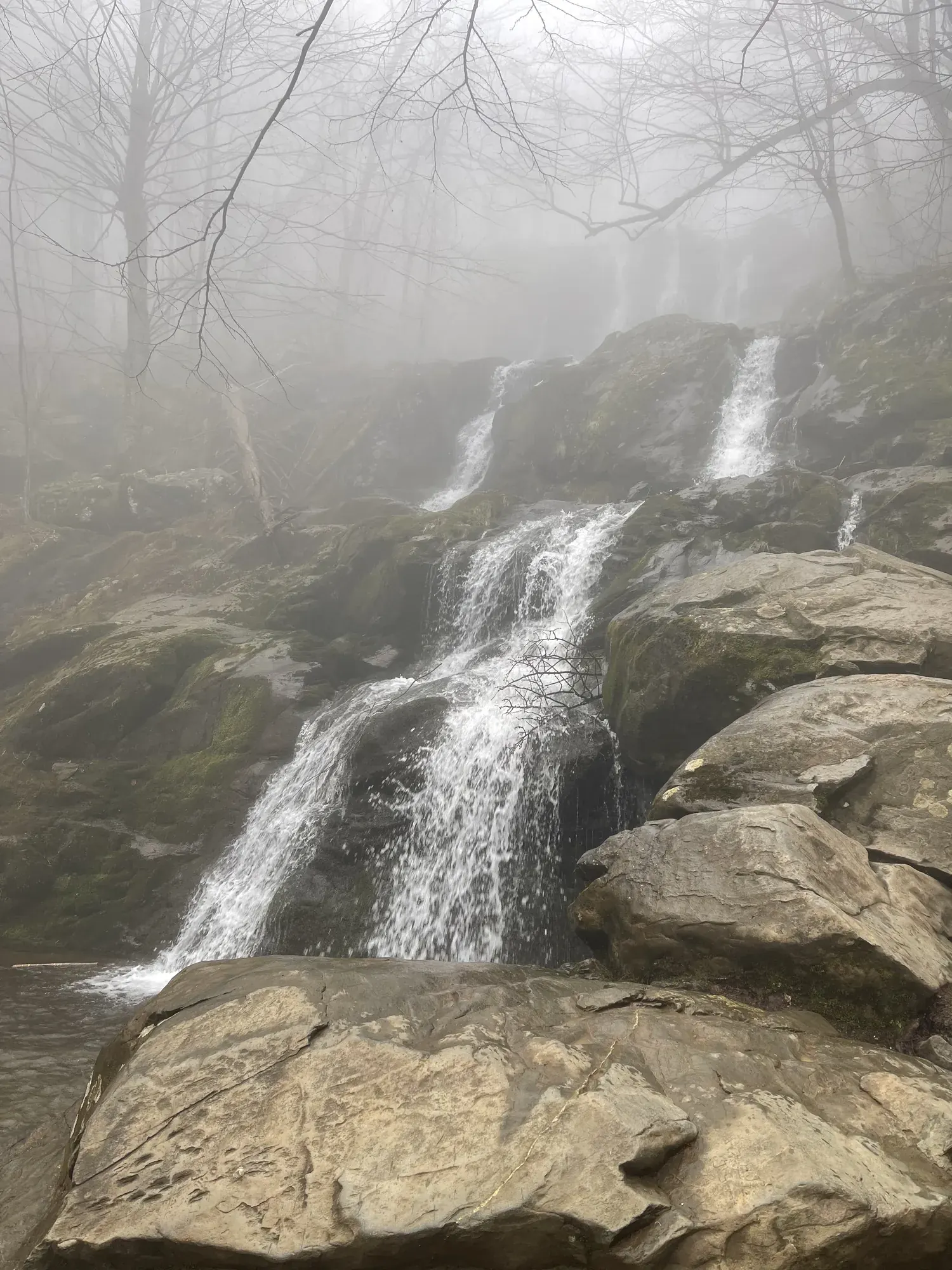
Old Rag Circuit
The Old Rag circuit includes a rock scramble and a summit with a 360-degree view. The route returns by the Saddle Trail and Weakley Hollow Fire Road.
Permit required
Shenandoah · Photo: David & Keri New
- 9.4 miDistance
- 2,348 ftElevation gain
- 7 hrTime
- StrenuousDifficulty
The numbers, with sources
Distance: 9.4-mile circuit Source
Gain: 2,348 feet Source
Time: 7 hours 30 minutes Source
Difficulty: Very Strenuous Source
Trailhead: Old Rag parking area at the park boundary Source
Route type: loop Source
Built from official sources (checked Nov 3, 2026). Confirm current conditions with the park.
Recreation.gov permits, entrances & campgrounds
Recreation.gov (RIDB). Booking records date not published. NPS guidance above takes precedence. A listing doesn’t mean you need a permit or that there’s space on your dates.
Nearby campground records
Within 10 straight-line miles of the trailhead. Distances are straight-line from map coordinates, not driving distances.
- Big Meadows Campground - Shenandoah (VA): approximately 8.4 miles straight line. RIDB coordinates · Mapped route source
Park campground options (4)
These records belong to the park’s NPS recreation area. We haven’t checked how close these are to the trail, when they open or whether sites are free; check the map and the booking page.
Loft Mountain Campground — Campground; RIDB reservable: yes. Season: not published in structured RIDB data. Recreation.gov (RIDB) source · Booking details
NPS reservation guidance: There is a combination of sites offered through reservations and on a first-come, first-served basis at Loft Mountain Campground. Reservations are highly recommended, especially on weekends and holidays. Reservations for many standard sites may be made up to 6 months in advance, with additional sites becoming available 2 weeks prior, and 4 days prior your stay. NPS source
Lewis Mountain Campground — Campground; RIDB reservable: yes. Season: not published in structured RIDB data. Recreation.gov (RIDB) source · Booking details
NPS reservation guidance: Lewis Mountain Campground operates on a self-registration, first-come, first-serve basis. There are no reservable sites. Please follow the posted directions to register once arriving at the campground. NPS source
MATHEWS ARM CAMPGROUND — Campground; RIDB reservable: yes. Season: not published in structured RIDB data. Recreation.gov (RIDB) source · Booking details
NPS reservation guidance: There is a combination of sites offered through reservations and on a first-come, first-served basis at Mathews Arm Campground. Reservations are highly recommended, especially on weekends and holidays. Reservations for many standard sites may be made up to 6 months in advance, with additional sites becoming available 2 weeks prior, and 4 days prior your stay. Group sites can be reserved up to one year in advance. NPS source
Big Meadows Campground - Shenandoah (VA) — Campground; RIDB reservable: yes. Season: not published in structured RIDB data. Recreation.gov (RIDB) source · Booking details
NPS reservation guidance: All sites at Big Meadows Campground are by reservation only. Rangers can make limited reservations on site, but availability is not guaranteed. It is recommended you make your reservation ahead of time. Reservations can be made through Recreation.gov as well as the site map on the campground page. Check the map to see when specific sites are scheduled to be released. Reservable sites will be released in sections: 6 months prior to the date of your arrival - 50% of reservable sites will be released; 2 weeks prior to the date of your arrival - 25% of reservable sites will be released; 4 days prior to the date of your arrival - the remaining 25% of reservable sites will be released. Reservations for Big Meadows Campground can be made online at any time. NPS source
Route, junction by junction
Old Rag boundary parking → Ridge Trail rock scramble
Begin on the blue-blazed Ridge Trail from the boundary parking area, as directed in the NPS circuit description. The park describes the summit routes as long hikes with significant elevation change. The scramble requires good upper-body strength; children and shorter adults often need assistance. The official planning guide warns that narrow sections can develop long lines and substantial waits. Source
Ridge Trail rock scramble → Old Rag summit
Continue on Ridge Trail across the rock scramble to the summit area. NPS describes this as an adventurous scramble and highlights a 360-degree view. It also calls the summit hike physically demanding and potentially dangerous without proper planning. This is the very strenuous circuit, rather than the Berry Hollow approach that avoids the scramble. Source
Old Rag summit → Old Rag Shelter and fire-road transition
Descend on the blue-blazed Saddle Trail. After passing Old Rag Shelter, the route becomes a fire road. The NPS map marks both Old Rag Shelter and Byrds Nest 1 Shelter as day-use shelters; they should not be treated as an overnight accommodation plan. Source
Fire-road transition below Old Rag Shelter → Weakley Hollow Fire Road
At the T-intersection, turn right. Immediately turn right again at the fork to join yellow-blazed Weakley Hollow Fire Road. The NPS map specifically cautions hikers to use the fork toward Old Rag parking. Source
Junction: T-intersection and immediate fork: Turn right at the T, then immediately right onto yellow-blazed Weakley Hollow Fire Road. Source
Weakley Hollow Fire Road → Old Rag boundary parking via Ridge Access Trail
Follow the circuit back by turning right onto Ridge Access Trail. Turn left where it meets Ridge Trail to return to the starting point. These turns complete the NPS-described circuit; the return uses the Saddle Trail and fire road rather than reversing the scramble. Source
Junction: Ridge Access Trail: Turn right onto Ridge Access, then left onto Ridge Trail. Source
No elevation profile: we only draw one from a mapped route we can verify. Route source
In-depth guide
Compiled from linked sources, checked Nov 2, 2026. Each paragraph links to its source.
Is this hike for you?
Old Rag isn’t just a long walk. Besides the stamina for a big elevation change, you need upper-body strength for tight rock scrambles, and a strong walker can still struggle with them. Talk through everyone’s endurance, scrambling ability and patience with delays before you pick it. Source
Shenandoah bases its difficulty ratings mostly on distance and elevation gain, adjusted for terrain, and admits the formula is imperfect. Read the scramble warnings too. Source
Pick a backup hike before you leave home; the park suggests less crowded alternatives. Download its directions and map, because cell service near Old Rag is unreliable. Source
Tickets and reservations
You need an Old Rag day-use ticket. One person can reserve up to four tickets a day in their name, so a bigger group needs a second person to book the rest. The purchaser has to be there and show photo ID; the others don’t need ID. Source
You can change or cancel on Recreation.gov until noon the day before. Date changes depend on availability, and tickets are nonrefundable for any reason. If the weather turns bad after that, don’t hike just because you paid. Source
Weakley Hollow Fire Road is outside the ticket area, but the summit trails aren’t, so check the ticket map against your whole route. Source
Getting to the trailhead
The main Old Rag trailheads are at the park boundary, not on Skyline Drive. Allow about 1–1.5 hours to drive there from Dickey Ridge or Byrd Visitor Center. Source
Parking in NPS lots is free. Nearby landowners may charge for private spaces, which doesn’t cover park entrance. Don’t park on road shoulders, and respect private property on the way to the ranger station. Source
We haven’t confirmed current access, including any construction work near Old Rag. Check the park’s alerts before you go. Source · Source 2
On the trail
Shenandoah marks trailheads and junctions with cement posts; metal bands give trail names and mileages. Check each one against your map. Blue blazes mark hiking trails, white blazes the Appalachian Trail, and yellow blazes trails also open to horses. Source
Old Rag’s west summit is closed to all public use; stay behind the signs and barriers. On the rock outcrops, use existing trails and watch out for small plants and lichens. Sudden winds can blow away wrappers, so secure loose things and pack out every scrap. Source
What to bring
The park suggests one snack per person per hour, including salty ones to replace electrolytes. Bring a flashlight with spare batteries (not just your phone), an emergency whistle, a map, sturdy footwear, sun protection and extra clothing. Source
The NPS doesn’t list water on the trail. Bring plenty for the heat and the climb. Source
It can be 10–20 degrees cooler on the mountain than in the valley, so bring layers. Ticks live throughout Shenandoah and can carry disease, and poison ivy grows along trails, roads and parking lot edges. If you touch it, wash with soap and water. Source
Staying overnight
An overnight trip needs a backcountry permit from Recreation.gov, available up to 90 days ahead or on the day you start. It’s $9 per person plus a $6 reservation fee, however many nights you stay. Source
Camping is dispersed, so a permit doesn’t hold a particular site; the park recommends a pre-existing one, and you need to check the setbacks. Camping is banned above 2,800 feet on Old Rag and near Byrd’s Nest Shelter. Groups are limited to ten people. Pack out all garbage and food scraps, and use designated toilets where there are any. Source · Source 2
Sources & planning limits
Reviewed 2026-11-03. Check current conditions for your trip dates.
Getting there and back
The main trailhead parking lot is closed for improvements that began May 4, 2026, with completion expected by November 2026. Use existing overflow lots; a ticket does not guarantee parking. Source
Return: Complete the circuit by descending Saddle Trail, passing Old Rag Shelter, and taking the two right turns onto Weakley Hollow Fire Road. Turn right onto Ridge Access and left onto Ridge Trail to regain the starting point. NPS gives these directions for the circuit rather than directing a return through the rock scramble. Source
Water
Bring all the drinking water needed for the hike. The NPS handout explicitly says no water is available at Old Rag; its preparation list also includes food, extra clothing, flashlights, and sturdy footwear. Source
Hazards
Wet or icy rock
Do not attempt Old Rag when rocks are wet or icy. This is an explicit warning in the NPS trail handout, in addition to the separate winter recommendation to carry traction devices. Source
Scramble difficulty
The rock scramble requires good upper-body strength, and children and shorter adults often need assistance. NPS asks visitors to make sure they are physically able to complete their selected Old Rag hike. Source
Crowding and darkness
Allow extra time for significant waits at difficult sections. Know when darkness will arrive, and plan for delays and emergencies with overnight provisions. The handout warns that these problems occur more often than visitors may expect. Source
Communications and emergency location
Cell service near Old Rag is unreliable. Numbers beneath the trail blazes are search-and-rescue reference markers; note them while walking and report the nearest number if an incident must be reported. Source
Sensitive rock-outcrop plants
Rare and endangered plants occupy the rocky granite-boulder environment and are particularly vulnerable to trampling. Stay on the trail and observe rock-outcrop management closures. Source
Season
Year round; day-use tickets required March 1–November 30. Source
In colder weather, trails can be icy or snow-covered even when lower elevations are clear. NPS advises carrying microspikes or traction-coil devices for boots. This guidance does not override its warning against attempting the hike on wet or icy rocks. Source
Summer and fall are identified as peak-visitation periods. Weekdays are suggested to improve the experience because weekends can bring full parking lots and long waits at narrow rock scrambles. Source
Day-use tickets apply March 1 through November 30. The 2026 parking project was expected to finish by November, but the opened FAQ still directs visitors to overflow lots while the main lot is closed; it does not confirm that work is complete. Source
Gear & rules
Pets are prohibited on the Ridge, Saddle and Ridge Access trails and between Post Office Junction and Old Rag Shelter. Source
Filling a gap in your kit? Compare these packing essentials on Amazon. Choose gear for your route, conditions and the park’s guidance.
As an Amazon Associate we earn from qualifying purchases. How this works
The official preparation list includes sturdy footwear, flashlights, extra clothing layers, food, and drinking water. Plan for delays and emergencies with overnight provisions, while observing the separate camping restrictions. Source
Bring a printed or downloaded Old Rag trail map and choose the route before starting. Pack as lightly as conditions allow: NPS notes that backpacks can be difficult to maneuver through the scramble, but says to account for weather, difficulty, length, and time. Source
At the entrance station, bring an entrance pass or payment, photo identification, and a ticket printout, preferably, or screenshot. The person who reserved the tickets must present photo ID; cell service is unreliable and tickets are not sold at the station. Source
Camping is prohibited above 2,800 feet, and legal overnight sites are very limited. Plan a backcountry trip around those restrictions instead of assuming camping near the summit is available. Source
Pets are prohibited on Ridge, Saddle, Ridge Access, and the section between Post Office Junction and Old Rag Shelter. Service animals are welcome according to the trail page, which also says this trail does not meet ADA accessibility guidelines. Source
Pace
NPS lists a hiking time of 7 hours 30 minutes and a duration of 7–8 hours for the full circuit. Its duration note excludes individual fitness, exploration, rest, and similar factors. The printed map separately gives a 6–10-hour range; neither source publishes times for individual stretches. Source
Questions
Does everyone need a day-use ticket?
Yes. Every person needs a ticket regardless of age during the March–November ticket season. Each ticket covers one person, and an entrance pass is a separate requirement. Source
Does a ticket guarantee parking?
No. NPS parking is free, but a day-use ticket does not guarantee a space. NPS strongly recommends carpooling because parking is limited. Source
Can the scramble be avoided?
The Berry Hollow summit approach avoids the rock scramble. The handout lists a 5.4-mile round trip and instructs visitors to return by the same route to avoid the very strenuous, often crowded Ridge Trail scramble. Berry Hollow parking is extremely limited. Source
Should navigation simply use “Old Rag”?
No. NPS warns that this can send visitors to the wrong location. For Android it specifies “Old Rag Parking (Ranger Station)”; for iPhone, “Old Rag Parking - Lower Lot.” Set the destination or download the map before leaving home. Source
Can tickets be purchased at the ranger station?
No. Reserve before arriving because tickets are not sold in person at the entrance station. The FAQ gives Recreation.gov or 877-444-6777 as booking options. Source
Can the ticket date be changed or cancelled?
Changes or cancellations are made through Recreation.gov by noon the day before the ticket is valid. NPS says it cannot issue refunds; date changes depend on availability. Source
Does starting before sunrise avoid the ticket requirement?
During the ticket season, tickets are required at any time of day, including before sunrise and after sunset. A ticket is valid only for the selected date. Source
What do the numbers below the trail blazes mean?
They are search-and-rescue reference numbers. Note them as you pass; reporting the nearest number helps park staff locate an incident. Source
Alternatives
Stony Man: 1.6-mile round-trip hike, rated Easiest by NPS. Source
Camp near Old Rag Circuit
Closest campgrounds by drive time to Dickey Ridge Visitor Center:
- 38 min Elizabeth Furnace ↗ (17.4 mi, USDA Forest Service)
- 41 min Mathews Arm (18.3 mi, in the park)
- 1 hr 5 min Camp Roosevelt ↗ (36 mi, USDA Forest Service)
- 1 hr 15 min Little Fort ↗ (26.2 mi, USDA Forest Service)
- 1 hr 19 min Wolf Gap ↗ (44.5 mi, USDA Forest Service)
Driving time with no traffic (OSRM, OpenStreetMap roads). Some park roads are shuttle-only in season. All camping near Shenandoah
More Shenandoah trail guides
- Dark Hollow Falls1.4 mi · Moderate
- Hawksbill Summit from Hawksbill Gap1.7 mi · Moderate
- Stony Man1.6 mi · Easy