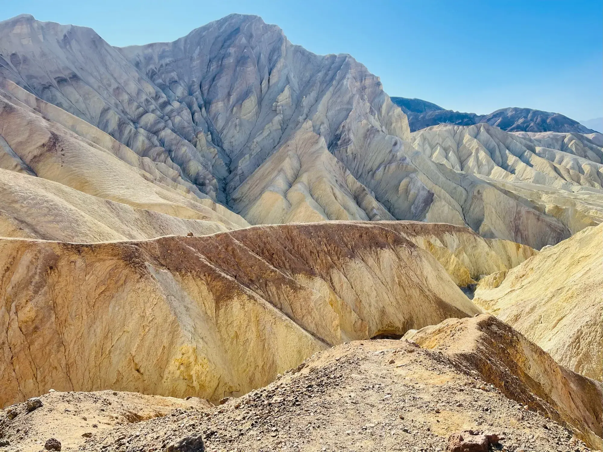
Mosaic Canyon
A four-mile out-and-back canyon route through polished narrows and scrambling obstacles to an impassable dryfall.
Death Valley · Photo: David & Keri New
- 4 miDistance
- 1,200 ftElevation gain
- 2.5–3 hrTime
- StrenuousDifficulty
The numbers, with sources
Distance: 4 miles round trip for the full described route. Source
Gain: 1,200 feet in the NPS route summary. Source
Time: 2.5–3 hours round trip. Source
Difficulty: Moderate, with scrambling and slick winding narrows. Source
Trailhead: End of the 2.3-mile unpaved Mosaic Canyon Road near Stovepipe Wells. Source
Route type: out-and-back Source
Built from official sources (checked Nov 3, 2026). Confirm current conditions with the park.
Recreation.gov permits, entrances & campgrounds
Recreation.gov (RIDB). Booking records date not published. NPS guidance above takes precedence. A listing doesn’t mean you need a permit or that there’s space on your dates.
Park campground options (4)
These records belong to the park’s NPS recreation area. We haven’t checked how close these are to the trail, when they open or whether sites are free; check the map and the booking page.
Death Valley Backcountry Roadside Camping — Campground; RIDB reservable: yes. Season: not published in structured RIDB data. Recreation.gov (RIDB) source · Booking details
Furnace Creek Campground — Campground; RIDB reservable: yes. Season: not published in structured RIDB data. Recreation.gov (RIDB) source · Booking details
NPS reservation guidance: During the cooler winter season, the campground is fully open. Reservations are accepted from October 15 to April 15. Make reservations from 5 days to 6 months in advance by calling 877-444-6777 or visiting www.recreation.gov. The remainder of the year, the campground reduces to 41 sites and is first-come, first-served. Note: The NPS reserves the right to hold reserved sites at any time due to management needs. NPS source
Sunset Campground — Campground; RIDB reservable: no. Season: not published in structured RIDB data. Recreation.gov (RIDB) source
NPS reservation guidance: All sites are first come, first served, however the NPS reserves the right to reserve sites at any time due to management needs. NPS source
Emigrant Campground — Campground; RIDB reservable: no. Season: not published in structured RIDB data. Recreation.gov (RIDB) source
NPS reservation guidance: All sites are first-come, first-served. NPS source
Route, junction by junction
Trailhead → Mosaic Canyon
Follow the canyon through narrows and scrambling obstacles. The full route ends at an impassable 25-foot dryfall. Source
No elevation profile yet:
No elevation profile yet: we haven’t verified complete measurements for this route. Source
In-depth guide
Compiled from linked sources, checked Nov 2, 2026. Each paragraph links to its source.
Is this hike for you?
Mosaic Canyon is a great hike if you like geology or a bit of adventure. Almost right away you’re in slick, winding narrows, and farther up there’s some scrambling. The full route is 4 miles (6.4 km) round trip with 1,200 ft (366 m) of elevation gain, taking 2.5-3 hours; the NPS rates it moderate. How far you go is up to you. Many people turn around at a boulder jam about 1.3 miles (2 km) up the canyon. Source
Flash floods and heat
Mosaic Canyon floods often. Don’t go in if there’s any chance of rain. Dry ground at the parking lot doesn’t mean the canyon is safe. Source
The NPS advises against hiking after 10 am in summer. Source
The trail
The narrows are polished smooth by debris-laden flood water, so watch your footing, and remember you’ll come back over every obstacle you climb on the way in. Look for the mosaic breccia the canyon is named for: rock made of older, smaller pieces naturally cemented together. Source
Past the boulder jam the route goes through more narrows and open canyon until an impassable 25 ft (7.6 m) vertical dryfall in a dramatic amphitheater blocks the way. That’s the turnaround. The dryfall’s height has nothing to do with the 1,200 ft of gain, and you’re not meant to climb it. Source
Getting to the trailhead
The trailhead is at the end of the 2.3 mile (3.7km) unpaved Mosaic Canyon Road, just west of Stovepipe Wells Village off CA-190 and across from Stovepipe Wells Campground. The road is usually passable by sedans. There’s a large gravel parking area, but buses and large RVs aren’t recommended. Source
Restrooms and dogs
The closest restroom is at the Stovepipe Wells Village general store and restaurant. Don’t leave toilet paper in the canyon. Pets aren’t allowed on any trail in Death Valley National Park, even if carried, and don’t leave your animal in your vehicle. Ask a ranger about dirt roads where you can walk a dog. The NPS doesn’t rate the canyon for kids, strollers or wheelchairs; the scrambling and slick rock are what to go on. Source
Sources & planning limits
Reviewed 2026-11-03. Check current conditions for your trip dates.
Getting there and back
Unpaved road typically passable by sedans; large gravel parking area. Buses and large RVs are not recommended. Source
Return: Retrace the canyon to the same trailhead. The boulder jam about 1.3 miles in is a shorter turnaround, not the full-route end. Source
Water
Closest restroom identified at Stovepipe Wells Village general store and restaurant. The NPS doesn’t list a refill on the trail. Source
Closest restroom identified at Stovepipe Wells Village general store and restaurant. The NPS doesn’t list a refill on the trail. Source
Hazards
Frequent flash floods: do not enter if there is a chance of rain. Source
Smooth narrows, boulder scrambling and dryfalls require careful footing. Source
Season
Do not enter with a chance of rain. NPS advises against hiking after 10 am in summer. Source
Do not enter with a chance of rain. NPS advises against hiking after 10 am in summer. Source
Gear & rules
Pets are not allowed on Death Valley trails, even if carried; do not leave an animal in a vehicle. Source
Do not leave toilet paper in the canyon. Source
Filling a gap in your kit? Compare these packing essentials on Amazon. Choose gear for your route, conditions and the park’s guidance.
As an Amazon Associate we earn from qualifying purchases. How this works
Pets are not allowed on Death Valley trails, even if carried; do not leave an animal in a vehicle. Source
Do not leave toilet paper in the canyon. Source
Questions
Is the boulder jam the official end?
No. Many visitors stop about 1.3 miles in, but the full described route continues to an impassable 25-foot dryfall. Source
Can the route be entered when rain is possible?
NPS says not to enter if there is a chance of rain because flash floods occur frequently. Source
Alternatives
Camp near Mosaic Canyon
Closest campgrounds by drive time to Mosaic Canyon Trailhead:
- 42 min Furnace Creek (26.8 mi, in the park)
- 42 min Death Valley Backcountry Roadside Camping (27 mi, in the park)
Driving time with no traffic (OSRM, OpenStreetMap roads). Some park roads are shuttle-only in season. All camping near Death Valley
More Death Valley trail guides
- Golden Canyon2 mi · Moderate