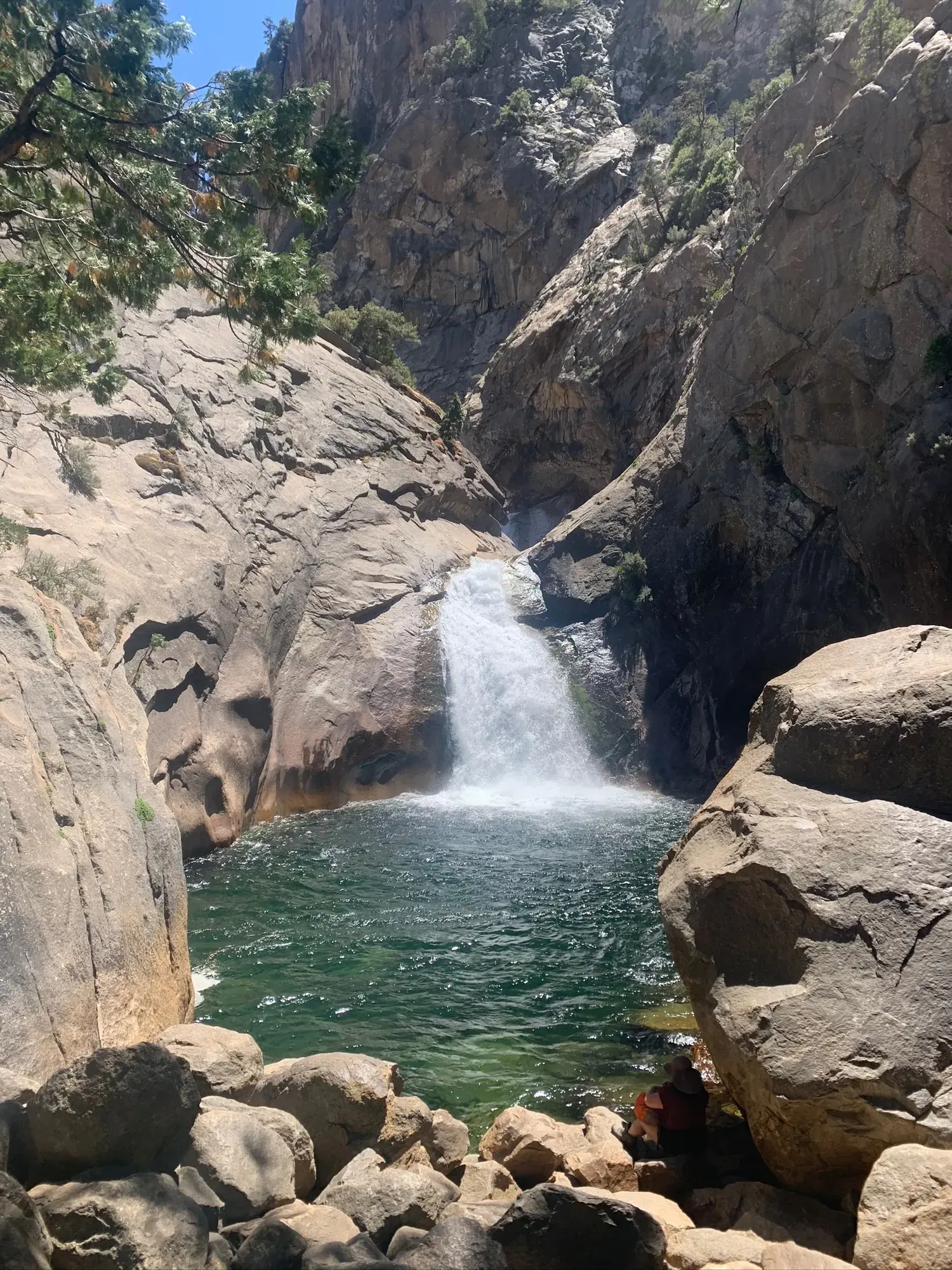
Mist Falls
An eight-mile round-trip Cedar Grove walk from Roads End to a powerful cascade, with a wooded climb and serious river hazards.
Kings Canyon · Photo: David & Keri New
- 8 miDistance
- 600 ftElevation gain
The numbers, with sources
Distance: 8 miles round trip. Source
Gain: The last mile gains 600 feet. The NPS doesn’t publish a total climb. Source
Time: NPS describes an all-day walk; no numerical duration is supplied. Source
Difficulty: Initially relatively flat and open, then a wooded climb; no formal rating supplied here. Source
Trailhead: Roads End Permit Station, Woods Creek and Bubbs Creek Trailhead. Source
Route type: out-and-back Source
Built from official sources (checked Nov 3, 2026). Confirm current conditions with the park.
Recreation.gov permits, entrances & campgrounds
Recreation.gov (RIDB). Booking records date not published. NPS guidance above takes precedence. A listing doesn’t mean you need a permit or that there’s space on your dates.
Route, junction by junction
Trailhead → Mist Falls
From Roads End follow the Woods Creek and Bubbs Creek approach; take the left trail at the first junction about two miles in. Source
No elevation profile yet:
No elevation profile yet: we haven’t verified complete measurements for this route. Source
In-depth guide
Compiled from linked sources, checked Nov 2, 2026. Each paragraph links to its source.
Is this hike for you?
Mist Falls is an 8-mile round-trip hike from Roads End in Cedar Grove, Kings Canyon National Park, and the NPS calls it an all-day walk. The last mile climbs 600 feet; that’s one stretch, not the total climb for the hike. The NPS doesn’t give a hiking time. Source
The trail
Start at the Roads End Permit Station, at the Woods Creek and Bubbs Creek Trailhead. The first junction is about two miles in: take the left trail for Mist Falls, and come back the same way. Several trails leave Roads End. Zumwalt Meadows is fairly flat, while Bubbs Creek, Mist Falls, Paradise Valley and Copper Creek all climb, so check the signs. A panel at the trailhead has a map and pictures of the area. Source · Source 2
Mist and spray make the rocks around the falls slippery and treacherous, and people have slipped and fallen here. Water that looks calm can hide currents strong enough to pull someone under, and the NPS says drowning in rivers like this is the most common cause of death in Sequoia and Kings Canyon National Parks. Enjoy the falls from dry ground and stay out of the water. Source
Getting to the trailhead
Roads End is at the final loop of Highway 180 in Cedar Grove, about an hour down Highway 180 from Kings Canyon Visitor Center. The road is seasonal, so check that it’s open for your dates. The NPS Mist Falls page also mentions Roaring River in its parking details, which we haven’t been able to sort out, so confirm parking with the park. Source
Kings Canyon is active bear country. Put anything with a scent in the food-storage lockers before you set off: bears have a keen sense of smell and can seriously damage cars. Source
Water and food
The canyon is hot and dry in summer. The NPS doesn’t list drinking water on the trail, so carry what you need for the whole hike and the walk back from the falls. Source · Source 2
Kids, strollers and wheelchairs
The trail isn’t considered wheelchair accessible. At the Road’s End parking area there’s one van-accessible and one standard accessible parking space near the wilderness permit station, and another van-accessible space next to the restroom. Source
Before you go
We haven’t confirmed permit, reservation or fee terms for this hike, so check with the NPS for your travel date. There’s no elevation profile yet because we couldn’t get a verified continuous trail line from the NPS map data. Source
Sources & planning limits
Reviewed 2026-11-03. Check current conditions for your trip dates.
- We haven’t verified this point. Check the linked NPS page for anything your trip depends on. Source
- NPS details are as of the date shown. Confirm road access, transport and services for your travel date. Source
- We haven’t confirmed current permit, reservation or fee terms. Check NPS for your travel date. Source
- No elevation profile yet: we haven’t verified complete measurements for this route. Source
Getting there and back
Roads End is the final Highway 180 loop in Cedar Grove. Seasonal highway access requires confirmation. Source
Return: Retrace the route to Roads End. Do not enter the river or approach slippery wet rocks at the falls. Source
Water
The NPS doesn’t list drinking water or a restroom on this trail. Scented items belong in food-storage lockers. Source
The NPS doesn’t list drinking water or a restroom on this trail. Scented items belong in food-storage lockers. Source
Hazards
Mist and spray make rocks slippery and treacherous. Source
Apparently calm river water can conceal currents that drag people under. Source
Kings Canyon is an active bear area; stow scented items in lockers. Source
Season
The NPS describes winter Highway 180 closure in mid-November and typical reopening the fourth Friday in April; dates are not a guarantee. Source
The NPS describes winter Highway 180 closure in mid-November and typical reopening the fourth Friday in April; dates are not a guarantee. Source
Gear & rules
Stow anything with a scent in food-storage lockers. Source
Filling a gap in your kit? Compare these packing essentials on Amazon. Choose gear for your route, conditions and the park’s guidance.
As an Amazon Associate we earn from qualifying purchases. How this works
Stow anything with a scent in food-storage lockers. Source
Questions
Is the final-mile climb the total route gain?
The NPS only says the last mile gains 600 feet. It doesn’t give a total climb. Source
Is calm-looking water safe to swim in?
No. NPS warns that currents below the surface can drag people under. Source
Alternatives
More Kings Canyon trail guides
- Buena Vista Peak2 mi