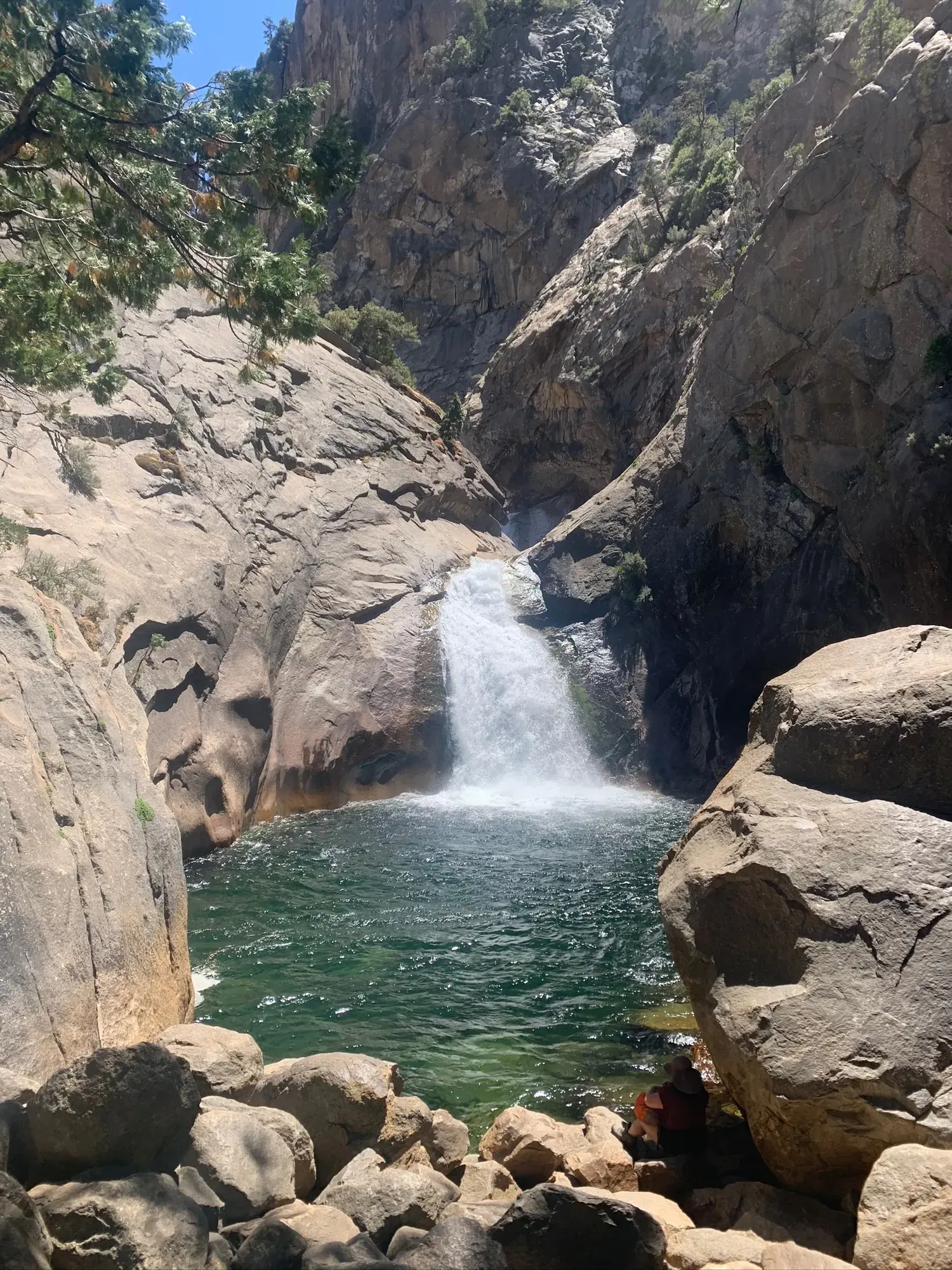
Buena Vista Peak
Buena Vista Peak is a short climb to a viewpoint south of Grant Grove. From the trailhead on the Generals Highway, across the highway from the Kings Canyon Overlook, the trail goes 1 mile through mixed conifer forest and wildflowers, past large granite boulders, to the top, and you return the same way. NPS gives 2 miles round trip and 400 feet of elevation gain, and lists views of Redwood Canyon, Sierra Crest summits and the Kings Canyon high country from the top.
Kings Canyon · Photo: David & Keri New
- 2 miDistance
- 400 ftElevation gain
- 1–2 hrTime
The numbers, with sources
Distance: 2 miles round trip (1 mile each way). Source
Gain: 400 feet. Source
Time: 1-2 hours (NPS activity duration). Source
Difficulty: The NPS doesn’t rate the difficulty. Source
Trailhead: Buena Vista trailhead on the Generals Highway, 6 miles south of Grant Grove, across the highway from the Kings Canyon Overlook. Source
Route type: Out-and-back (NPS: return the same way you came) Source
Built from official sources (checked Nov 15, 2026). Confirm current conditions with the park.
Recreation.gov permits, entrances & campgrounds
Recreation.gov (RIDB). Booking records date not published. NPS guidance above takes precedence. A listing doesn’t mean you need a permit or that there’s space on your dates.
Route, junction by junction
Route selection → Described destination
Buena Vista Peak is a short climb to a viewpoint south of Grant Grove. From the trailhead on the Generals Highway, across the highway from the Kings Canyon Overlook, the trail goes 1 mile through mixed conifer forest and wildflowers, past large granite boulders, to the top, and you return the same way. NPS gives 2 miles round trip and 400 feet of elevation gain, and lists views of Redwood Canyon, Sierra Crest summits and the Kings Canyon high country from the top. Source
No elevation profile yet:
No elevation profile yet: we haven’t verified a complete line for this route. No partial line, invented connector, scaled mileage or flat profile is substituted. Source
In-depth guide
Compiled from linked sources, checked Nov 15, 2026. Each paragraph links to its source.
Is this hike for you?
Buena Vista Peak is a short climb to a viewpoint south of Grant Grove: 1 mile each way, 2 miles round trip, with 400 feet of elevation gain. The NPS gives 1-2 hours. From the top you look out over Redwood Canyon, Sierra Crest summits and the Kings Canyon high country. Source
The trail
The trail winds through mixed conifer forest and wildflowers, past giant granite boulders, to the top. Come back the same way. Source
Getting to the trailhead
The trailhead is 6 miles south of Grant Grove in Kings Canyon National Park, on the Generals Highway across from the Kings Canyon Overlook, and has a parking area. From the north, take Highway 180 east to the Generals Highway turn-off, then go 5 miles on the Generals Highway. From the south, take Highway 198 east to Foothills, then go 40 miles up the Generals Highway. Source
When to go
You can hike it year-round, but the NPS recommends summer or fall. Expect ice and deep snow in winter and early spring. Source
Kids, strollers and wheelchairs
The trailhead parking is paved and flat but has no designated accessible spaces. The NPS doesn’t give a minimum age or describe the trail surface beyond the forest and boulders. Source
Dogs
Pets aren’t allowed on any trails in Sequoia and Kings Canyon National Parks. Leashed pets can walk in developed areas like campgrounds, picnic areas and along roads open to traffic. Service dogs as defined by the ADA are allowed on trails; emotional support dogs don’t qualify. The Americans with Disabilities Act (ADA) website has the details. Source
Getting there and back
Buena Vista trailhead on the Generals Highway, 6 miles south of Grant Grove, across the highway from the Kings Canyon Overlook. Source
Return: Use the return described in the official route account. Don’t count on a shuttle, boat, flight or pickup unless you have confirmed it yourself. Source
Water
The NPS doesn’t publish a full list of water and restrooms along this route. Use only the facilities explicitly identified in the NPS account; confirm current operations. Source
Hazards
Check the season before you go. NPS says the trail can be hiked year-round but recommends summer or fall, because icy conditions and deep snow can be present in winter and early spring. The trailhead is 6 miles south of Grant Grove: 5 miles along the Generals Highway from its turn-off on Highway 180, or 40 miles up the Generals Highway from Foothills. Pets are not permitted on any trails in Sequoia and Kings Canyon; qualified service dogs are allowed. The trailhead parking is paved and flat but has no designated accessible spaces. Source
Season
The Buena Vista trail can be visited throughout the year, but NPS recommends hiking this trail in the summer or fall. Icy conditions and deep snow can be present in winter and early spring. Source
The Buena Vista trail can be visited throughout the year, but NPS recommends hiking this trail in the summer or fall. Icy conditions and deep snow can be present in winter and early spring. Source
Gear & rules
Respect current closures, signs and barriers. A mapped path is not proof that travel is permitted. Source
Filling a gap in your kit? Compare these packing essentials on Amazon. Choose gear for your route, conditions and the park’s guidance.
As an Amazon Associate we earn from qualifying purchases. How this works
Please be aware that pets are not permitted on any trails at Sequoia and Kings Canyon National Parks. However, leashed pets are allowed to be walked in developed areas like campgrounds, picnic areas, and along roads that are open to vehicle traffic. Qualified ADA-defined service dogs are allowed on trails in national parks. Dogs whose sole function is to provide comfort or emotional support do not qualify as service animals under the ADA. For more information about ADA service animal requirements, please go to the Americans with Disabilities Act (ADA) website . Source
Questions
Which hike is this?
Buena Vista Peak is a short climb to a viewpoint south of Grant Grove. From the trailhead on the Generals Highway, across the highway from the Kings Canyon Overlook, the trail goes 1 mile through mixed conifer forest and wildflowers, past large granite boulders, to the top, and you return the same way. NPS gives 2 miles round trip and 400 feet of elevation gain, and lists views of Redwood Canyon, Sierra Crest summits and the Kings Canyon high country from the top. 2 miles round trip (1 mile each way). Source
Is a measured elevation profile available?
No elevation profile yet: we haven’t verified a complete line for this route. No partial line, invented connector, scaled mileage or flat profile is substituted. Source
Alternatives
Alternative-route distances and durations are unavailable unless separately described in the source. Side trails aren’t included. Source
Camp near Buena Vista Peak
Closest campgrounds by drive time to Buena Vista Trailhead:
- 11 min Sunset (6 mi, in the park)
- 11 min Azalea (6.4 mi, in the park)
- 13 min Stony Creek Sequoia ↗ (7.3 mi, USDA Forest Service)
- 13 min Upper Stony Creek Campground ↗ (7.3 mi, USDA Forest Service)
- 13 min Crystal Springs (6.6 mi, in the park)
Driving time with no traffic (OSRM, OpenStreetMap roads). Some park roads are shuttle-only in season. All camping near Kings Canyon
More Kings Canyon trail guides
- Mist Falls8 mi