Our favorite hike
Mist Falls
From Roads End you follow the South Fork of the Kings River up the canyon, with granite walls the whole way, to a big, loud waterfall. Walking it is how you feel how deep this canyon is.

California
Northern half of the Sequoia & Kings Canyon pair: the General Grant Tree and the Grant Grove sequoias, then Highway 180 down into Cedar Grove, a glacier-carved canyon on the South Fork of the Kings River.
By David & Keri New, who have visited 63 of the 64 U.S. national parksUpdated
5Park 5 of our 63Visited Jul 2020
Saves this park and its trail guides on this device. Alerts and conditions are as of when you save; live maps and bookings need a connection.
NPS alertsAs of 6:03 AM ET, Nov 20
1 day is our starting point.
Start with the General Grant Tree and North Grove when trails are suitable. Give Mist Falls a second day and save Roaring River Falls and Zumwalt Meadow for day three only when Highway 180 is open to the relevant trailheads.
Open the 3-day itinerarySequoia and Kings Canyon road informationNPS park conditions
With a few hours, enter at Big Stump and walk the paved 1/3-mile General Grant Tree Trail. The 2-mile Big Stump Loop starts just past the entrance. Ask at the Kings Canyon Visitor Center first, since snow, ice or fire work can close trails.
National Park Service guidanceGrant Grove visitor informationNPS park conditions
Hike Buena Vista Peak, a 2-mile round trip that starts just south of the Kings Canyon Overlook on the Generals Highway, 6 miles southeast of Grant Grove Village. The top looks over Redwood Canyon and the high Sierra.
If the road into Cedar Grove is closed, keep your day at Grant Grove. Visit the General Grant Tree, then add North Grove if the trail is clear. Go to Giant Forest only if the connector and the return road are open.
Grant Grove visitor informationSequoia and Kings Canyon road informationNPS park conditions
Grant Grove for the sequoias or Cedar Grove for Roads End
Choose a Grant Grove area stay if the sequoias are your main goal or the canyon road is closed. When Cedar Grove lodging and Highway 180 are open, a night in the canyon saves a return drive between the Roads End and waterfall days.
Lodging and gateway townsSequoia and Kings Canyon road informationNPS lodging information
Confirm Highway 180 access beyond Grant Grove and the operating dates of any Cedar Grove stay before booking. Check Generals Highway separately if you are combining the trip with Sequoia.
Sequoia and Kings Canyon road informationNPS park conditionsLodging and gateway towns
Use Highway 180 from Fresno to the Big Stump Entrance. There is no gas in the park. Carry tire chains from fall through spring. Highway 180 past Hume Lake Road to Cedar Grove closes for winter, typically early to mid-November until late April or early May.
Our visit
July 2020
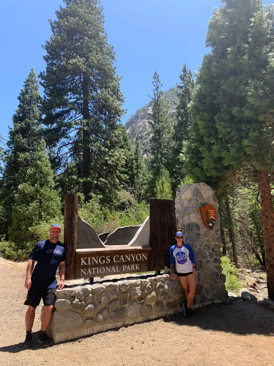
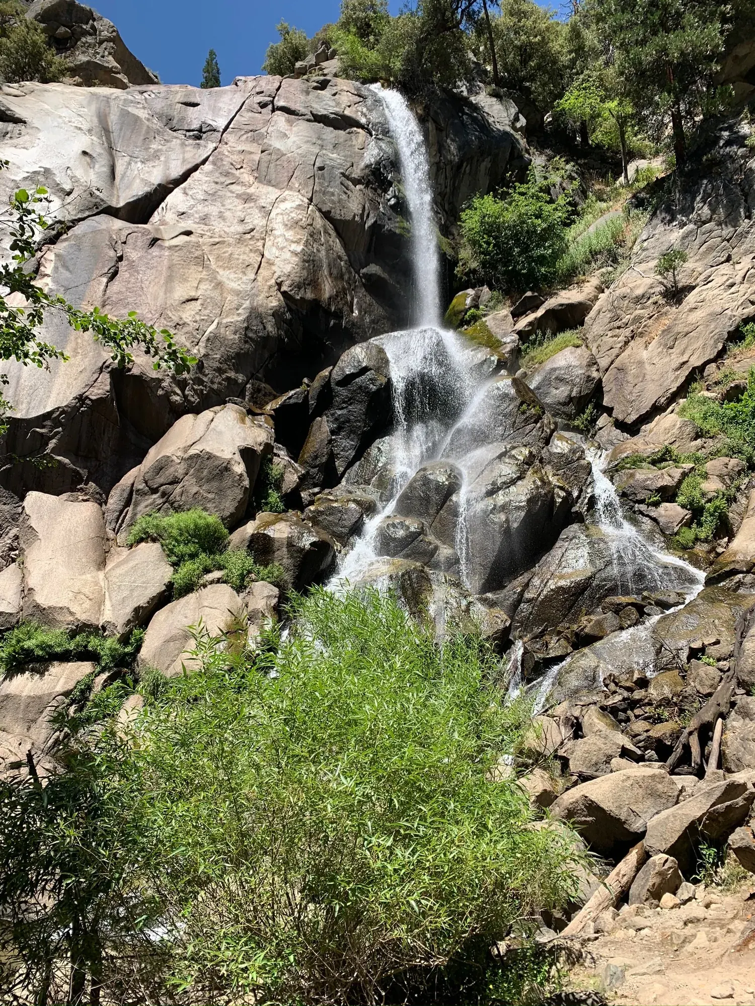
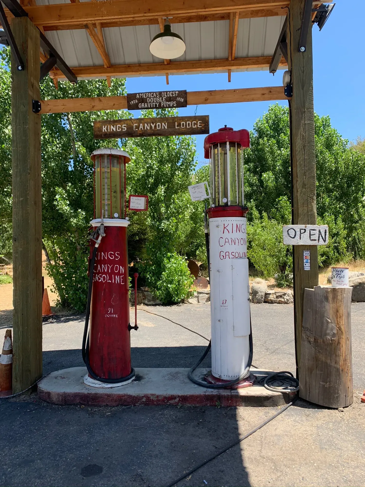
Why it’s on our list
Kings Canyon is often overshadowed by its famous neighbors, Yosemite and Sequoia, but it has some incredible scenery of its own. The towering granite cliffs, deep valleys, massive sequoia trees, and beautiful mountain landscapes make it a fantastic park. It may not receive the same attention as California’s other giants, but it’s absolutely worth exploring.
Our favorite moment
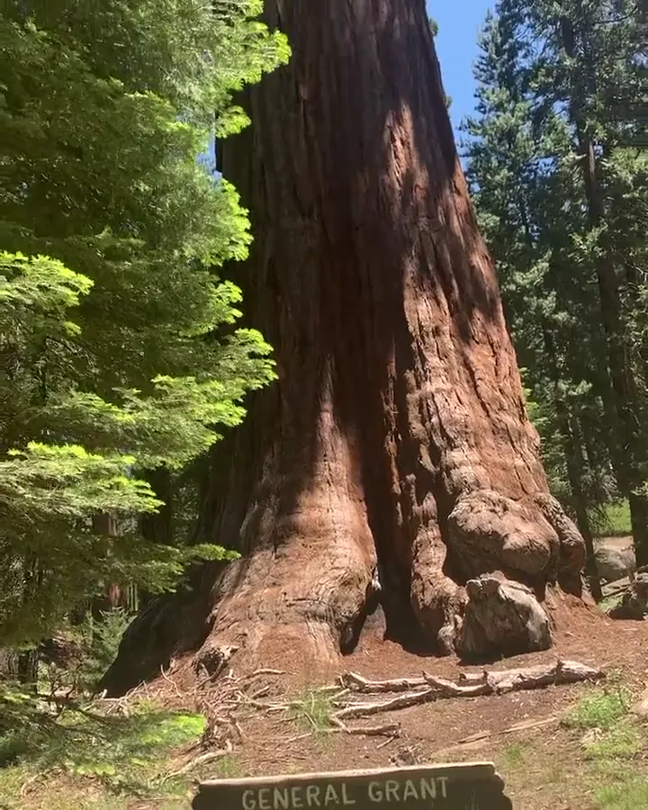
Visiting the General Grant Tree, driving into Kings Canyon, and hiking through Zumwalt Meadow.
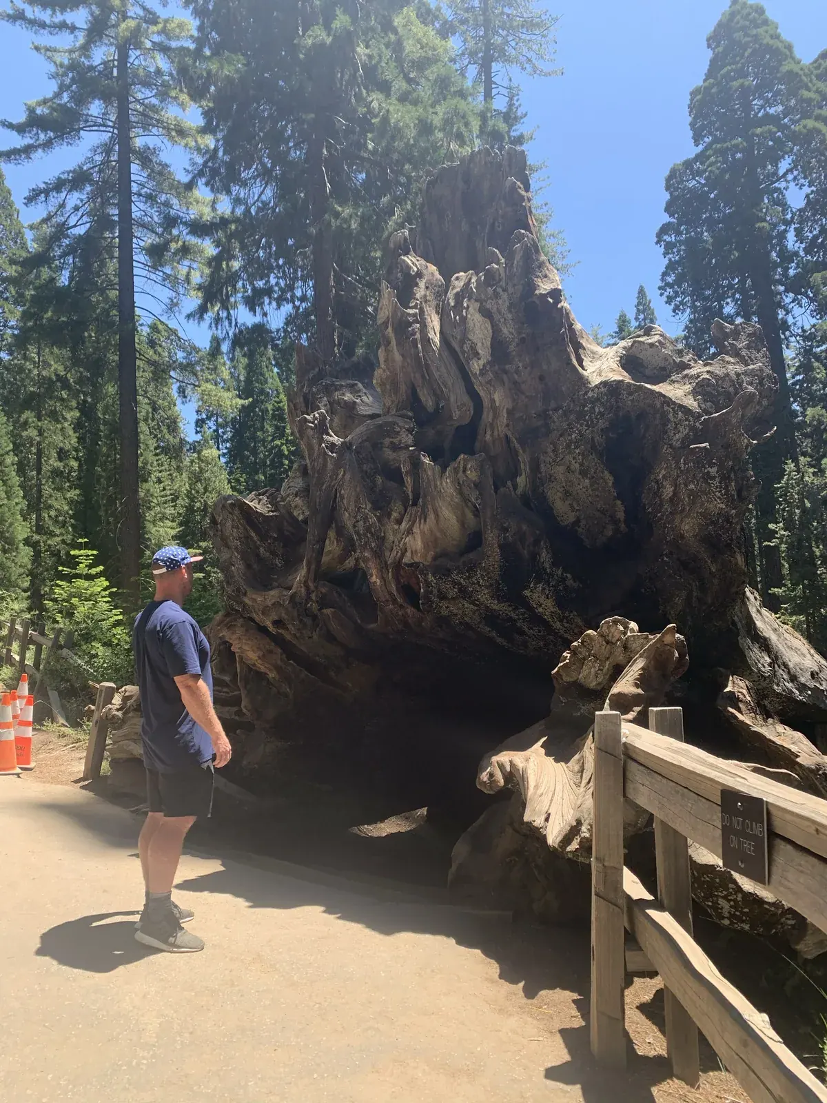
Photos by David & Keri New.
Firsthand · David & Keri New
Few canyons in North America are deeper than Kings Canyon. It has granite walls, waterfalls like Roaring River and Grizzly Falls, and giant sequoias up top at Grant Grove. It feels like Yosemite without the crowds. Kings Canyon was very similar, and it was hard to tell the two parks apart.
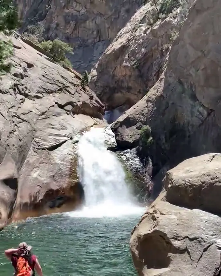
Mist Falls
From Roads End you follow the South Fork of the Kings River up the canyon, with granite walls the whole way, to a big, loud waterfall. Walking it is how you feel how deep this canyon is.
Give Cedar Grove a full day. The drive down Highway 180 is long and winding, the road closes in winter, and services are limited, so fill up the tank and pack a lunch.
Driving in and out in one day was a lot. A night down in Cedar Grove would have been the better plan.
We’d head up to Panoramic Point and Buena Vista Peak for the big views over the Sierra.
Go in early July and the road down to Cedar Grove is open and the waterfalls are still running. It was sunny and clear for us, and it does get warm down in the canyon. The crowds are a fraction of what Yosemite gets.
The Kings Canyon Scenic Byway is the attraction here, and Junction View looks straight down into the canyon. Hume Lake, just outside the park in the national forest, is a nice lake stop with a small store.
Entry
Check entry rules
You still need an entrance pass: $35 per vehicle, good for 7 days.
Fees and permitsBest time
September
Grant Grove open all year. Hwy 180 to Cedar Grove typically late April to mid November. September best. June-August and October good. December-March snowbound.
Month by monthItineraries
1 dayOur pick
2 days
3 days
Kings Canyon itinerary: every day stop by stop, with sources
Compare the 1-, 2- and 3-day plans, day by day →
Map
6 visitor centers and 15 campgrounds on a map you can zoom and drag. Map data loads from OpenStreetMap when you tap.
Visitor centerCampground Roads and trails are community-mapped; check closures with the park.
Locations from the NPS visitor-center listing, checked Nov 13, 2026. Hours and what each one has
Locations from Recreation.gov, checked Nov 7, 2026. Compare the campgrounds
Trails
0.1 mi
Short, shady walk to a waterfall in a granite chute, 3 mi east of the Cedar Grove Village road.
Out and back · About 15 minutes (estimated)
Start: Parking area 3 miles east of Cedar Grove Village road.
0.3 mi
Past the General Grant Tree (the Nation’s Christmas Tree since 1926, which NPS calls the world’s second-largest tree), the Fallen Monarch and Gamlin Cabin. Paved but not designated wheelchair-accessible.
Loop · About 15 minutes (estimated)
Start: General Grant Tree parking area, 1 mile northwest of Kings Canyon Visitor Center.
0.5 mi
Views of Hume Lake and the High Sierra; road open late spring to first snow.
Out and back · About 15 minutes (estimated)
Start: Panoramic Point parking area; start near the restroom and stay left at junctions, returning the same way.
0.8 mi
No longer a loop after 2019 flooding: cross the river on a bridge for meadow and cliff views, then continue 0.8 mi on the Kanawyer Loop toward Road’s End and Muir Rock.
Out and back
Start: Zumwalt Meadow parking area, 4.5 miles east of Cedar Grove Village.
1.5 mi
Lightly traveled sequoia and meadow loop from the Grant Tree parking area.
Loop
Start: Grant Tree parking area, 1 mile northwest of Kings Canyon Visitor Center.
2 mi
Just past the Big Stump Entrance, through a grove logged in the late 1800s.
Loop
Start: Big Stump trailhead just past Big Stump Entrance on Highway 180.
2 mi
Granite summit with a 360-degree view over Redwood Canyon; trailhead 6 mi southeast of Grant Grove Village on the Generals Highway.
Out and back · About 1-2 hours
Start: Buena Vista trailhead on Generals Highway, 6 miles southeast of Grant Grove Village.
2 mi
Up the Don Cecil Trail to a shady glen; about 1 1/2 hours.
Out and back · About 1.5 hours
Start: Don Cecil Trail; park near Cedar Grove Visitor Center and follow the access trail across Highway 180.
4.4 mi
To an 8,209 ft summit looking into Redwood Canyon; trailhead 8 mi south of Grant Grove on the Generals Highway.
Out and back · About 1.75 hours (estimated)
Start: Big Baldy trailhead on Generals Highway, 8 miles south of Grant Grove Village.
5 mi
Via the Hotel Creek Trail, 3-4 hours. Passes through the 2024 Happy Fire footprint: expect downed trees and don’t linger in burned sections.
Out and back · About 3-4 hours
Start: Hotel Creek Trail; drive past Cedar Grove Visitor Center and Village, then turn right at the fork.
8 mi
From Road’s End along the South Fork to one of the largest waterfalls in the two parks; 4-5 hours.
Out and back · About 4-5 hours
Start: Road’s End; trailhead just beyond the permit station.
13 mi
All-day climb past Sheep Creek to a panorama of the backcountry.
Out and back · About All day
Start: Don Cecil Trail; park near Cedar Grove Visitor Center and follow the access trail across Highway 180.
Distances, gains and difficulty as NPS publishes them; the bar shows the published distance, dashed where a longer option exists.
Camping
Fees, permits & rules
Last verified · nps.gov All Kings Canyon fees, permits and booking deadlines →
Not a U.S. resident? Each visitor aged 16+ also pays a $100 nonresident fee here, unless your car has an annual pass. Visiting from abroad →
NPS says the road to the Cedar Grove area closes for the winter season on November 13, 2026 (it typically reopens in May). Cedar Grove’s campgrounds, lodge, market, grill and showers are already closed for the season, and self-issue wilderness permits are available at the Road’s End kiosk.
Last verified · Current Conditions (NPS)Non-US residents aged 16 and older pay a $100 per-person fee on top of the standard entrance pass unless admitted with an Annual or America the Beautiful pass. Entrance stations are cashless.
Last verified · Fees & Passes - Sequoia & Kings Canyon (NPS)In 2026, the wilderness quota season ran May 22-Sept 26. The 2027 quota dates are not announced yet (NPS, checked Nov 2026). Free, self-issued permits apply Sept 27, 2026-May 20, 2027; kiosks include Kings Canyon Visitor Center and Road’s End.
Last verified · Wilderness Permits & Reservations (NPS)Email me this guide Get a link to the Kings Canyon guide in your inbox, to open again when you plan or before you go.
One email with the link. We don’t add you to any list unless you tick the box.
Historical recreation visits · 2021–2025 · as of Nov 3, 2026. Visits count entries, not unique people, parking spaces or trail crowding.
Busiest by average count: Jul. Quietest: Feb. Each bar is that month’s average visits across 5 years; unusual years and reported zeros are included. Past visits can’t tell you the best time of day to arrive.
Every month’s visits and NOAA weather, with the counts for each year →
NPS Visitor Use Statistics: monthly report · NPS monthly data · checked Nov 3, 2026; latest included year 2025.
Plan your visit
For any park: passes and free entrance days · what to pack · visiting with kids · stargazing
Getting there and park logistics →
Find a place to stay near Kings Canyon → See camping and backup options for this park.
How this page is made. The section “What we’d tell a friend” is ours. Our recorded visits to Kings Canyon include July 2020.Planning information, including any fees, permits, closures, weather and crowd figures shown here, is compiled from the National Park Service, Recreation.gov and other public sources, and each fact shows the date we last checked it. If something is wrong, tell us and we’ll log the fix on our corrections page.