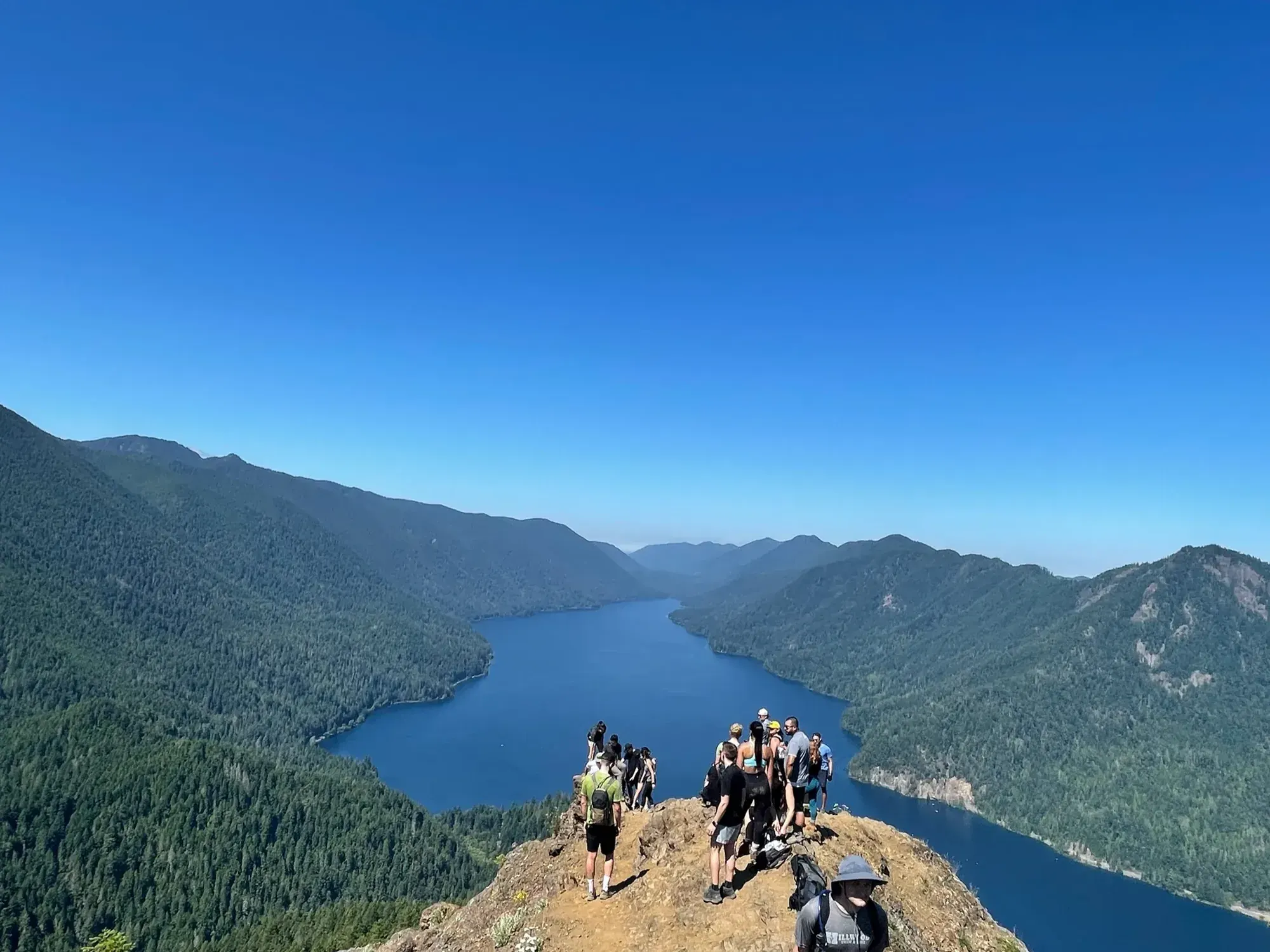
Marymere Falls from Storm King Ranger Station
Begin at Storm King Ranger Station for the Marymere Falls approach through old-growth forest. The Lake Crescent Lodge approach is an alternate start and is not assumed to have the same distance.
Olympic · Photo: David & Keri New
- 0.9 mi one wayDistance
- EasyDifficulty
The numbers, with sources
Distance: 0.9 mile one way Source
Gain: No total route gain stated; the waterfall height is 90 feet Source
Time: The NPS does not publish a walking time for this route. Source
Difficulty: See the official route and surface descriptions; no separate rating added. Source
Trailhead: Storm King Ranger Station; Lake Crescent Lodge is an alternate approach. Source
Route type: out-and-back Source
Built from official sources (checked Nov 3, 2026). Confirm current conditions with the park.
Recreation.gov permits, entrances & campgrounds
Recreation.gov (RIDB). Booking records date not published. NPS guidance above takes precedence. A listing doesn’t mean you need a permit or that there’s space on your dates.
Nearby campground records
Within 10 straight-line miles of the trailhead. Distances are straight-line from map coordinates, not driving distances.
- SOL DUC HOT SPRINGS RESORT CAMPGROUND: approximately 7.1 miles straight line. RIDB coordinates · Mapped route source
- Fairholme Campground: approximately 6 miles straight line. RIDB coordinates · Mapped route source
Park campground options (8)
These records belong to the park’s NPS recreation area. We haven’t checked how close these are to the trail, when they open or whether sites are free; check the map and the booking page.
Mora Campground — Campground; RIDB reservable: yes. Season: not published in structured RIDB data. Recreation.gov (RIDB) source · Booking details
NPS reservation guidance: All campsites are reservable during the peak season online at www.recreation.gov up to 6 months in advance. Any unreserved or cancelled sites will be sold in the field at the Mora Ranger Station on a first-come, first-served basis. Campsites are first-come, first-served the rest of the year. NPS source
Log Cabin Resort Campground — Campground; RIDB reservable: yes. Season: not published in structured RIDB data. Recreation.gov (RIDB) source · Booking details
SOL DUC HOT SPRINGS RESORT CAMPGROUND — Campground; RIDB reservable: yes. Season: not published in structured RIDB data. Recreation.gov (RIDB) source · Booking details
Deer Park Campground — Campground; RIDB reservable: no. Season: not published in structured RIDB data. Recreation.gov (RIDB) source
NPS reservation guidance: First come, first served. NPS source
Hoh Rainforest Campground — Campground; RIDB reservable: yes. Season: not published in structured RIDB data. Recreation.gov (RIDB) source · Booking details
NPS reservation guidance: Reservations accepted for June 1st through September 15th for 2021. First come, first served the rest of the year. NPS source
KALALOCH — Campground; RIDB reservable: yes. Season: not published in structured RIDB data. Recreation.gov (RIDB) source · Booking details
NPS reservation guidance: Online reservations accepted for peak season. All sites are first-come, first-served in off season. Check recreation.gov for current season dates. NPS source
Staircase Campground — Campground; RIDB reservable: yes. Season: not published in structured RIDB data. Recreation.gov (RIDB) source · Booking details
NPS reservation guidance: Reservable on recreation dot gov from July 5-August 31st, 2023. Reservations are available up to 14 days in advance, and may not be made for same day. If any sites are not reserved, they become available first come, first served the day of. NPS source
Fairholme Campground — Campground; RIDB reservable: yes. Season: not published in structured RIDB data. Recreation.gov (RIDB) source · Booking details
NPS reservation guidance: By reservation only. NPS source
Route, junction by junction
Storm King Ranger Station → forest approach
Start near Lake Crescent and follow the Marymere Falls trail into the forest. Source
Forest approach → falls
Keep going to the falls (1.8 miles round trip in all). The NPS doesn’t give distances for the junctions along the way. Source
Falls → Storm King start
Come back the same way. Don’t take a neighboring mountain trail by mistake. Source
No elevation profile: we only draw one from a mapped route we can verify. Route source
In-depth guide
Compiled from linked sources, checked Nov 3, 2026. Each paragraph links to its source.
Decisions & preparation
The NPS gives distances only for the points listed above, so we don’t split the total into legs. Source
Turnaround & return planning
Turn back sooner if the group is running low on energy, water or daylight. Planning basis
Parking & transport timing
Storm King Ranger Station, or from Lake Crescent Lodge. The NPS doesn’t say when parking fills. Source
What to bring by season
Pack the Ten Essentials: navigation, sun protection, extra clothing, a light, first aid, fire supplies where allowed, repair tools, extra food, water and emergency shelter. Tell someone your plan. Source
In warm weather bring sun protection, plenty of water and extra food. In cold or wet weather add warm layers and rain gear. Source
Children & mobility
The NPS doesn’t publish an accessibility rating for this trail. Source
Is this hike for you?
Marymere Falls is the most popular day hike at Lake Crescent: 0.9 mile (1.4 km) one way through old-growth forest to a 90-foot (27 meter) waterfall. The NPS doesn’t give a hiking time. Source
The trail
The trail starts at Storm King Ranger Station, and you come back the same way. The NPS doesn’t publish an elevation gain; the 90 feet is the height of the falls, not the climb. Source · Source 2
There’s no elevation profile yet: the NPS trail map line comes from its trail data and USGS 3DEP terrain, but we haven’t verified complete measurements for this route. Source
Getting to the trailhead
Park at Storm King Ranger Station. You can also reach the trail from Lake Crescent Lodge. The NPS doesn’t say when parking fills. Source · Source 2
Before you go
The NPS doesn’t give a season for this trail, so check the park’s current alerts before you go. One posted alert said Hurricane Ridge Road closed Monday 11/2 at 10:00am because of icy conditions; that’s a different part of the park, but it shows how fast roads can change. Source · Source 2
Decide where you’ll turn around before you start. Stay together, and turn back early if the group is slower than you expected. Source
Kids, strollers and wheelchairs
The NPS doesn’t publish an accessibility rating for this trail or say what ages it suits. Source · Source 2
Dogs, permits and fees
The NPS doesn’t publish a pet rule for this trail, so check the park’s pet rules before you bring a dog. Stay on the trail. The NPS doesn’t say whether this hike needs a reservation. Source · Source 2
Park entry is $30.00 per private, non-commercial vehicle (15 passengers or fewer). It covers everyone in the car for seven consecutive days. Source
Sources & planning limits
Reviewed 2026-11-03. Check current conditions for your trip dates.
- We haven’t confirmed access, transport or services for any given date. Check with the NPS before you rely on them. Source
- NPS details are as of the date shown. Confirm access, services and reservations for your travel date. Source
- The NPS doesn’t say whether this trail suits kids or people with limited mobility. Check its accessibility page before you choose it. Source
- No elevation profile yet: we haven’t verified complete measurements for this route. Source
Getting there and back
Storm King Ranger Station; Lake Crescent Lodge is an alternate approach. Source
Return: Complete the return arrangement described for this route. The 90-foot number describes the waterfall, not the trail climb. The published 0.9-mile distance is one way, and returning to the ranger-station start is a second traversal. This hike doesn’t include climbing Mount Storm King. Source
Water
Hazards
The trail starts from the Storm King Ranger Station but can also be accessed from Lake Crescent Lodge. Source
Season
The NPS does not publish a seasonal opening window for this route. Source
The NPS does not publish a seasonal opening window for this route. Source
Gear & rules
The NPS does not publish pet rules for this exact route. Source
Filling a gap in your kit? Compare these packing essentials on Amazon. Choose gear for your route, conditions and the park’s guidance.
As an Amazon Associate we earn from qualifying purchases. How this works
Questions
Which hike is this?
Begin at Storm King Ranger Station for the Marymere Falls approach through old-growth forest. The Lake Crescent Lodge approach is an alternate start and is not assumed to have the same distance. Source
Are the published figures fully consistent?
The 90-foot number describes the waterfall, not the trail climb. The published 0.9-mile distance is one way, and returning to the ranger-station start is a second traversal. This hike doesn’t include climbing Mount Storm King. Source
Is there an elevation profile?
Official NPS trail geometry sampled with USGS 3DEP. The chart follows the mapped trail from the ranger-station side to the lower Marymere Falls viewpoint, not the loop back from the last viewpoint. Source
Alternatives
Camp near Marymere Falls from Storm King Ranger Station
Closest campgrounds by drive time to Storm King Ranger Station Trailhead:
- 17 min Fairholme (7.4 mi, in the park)
- 24 min Littleton Horse Camp ↗ (12.2 mi, USDA Forest Service)
- 50 min Sol Duc Hot Springs Resort (21.7 mi, in the park)
- 1 hr 26 min Dungeness Forks Campground ↗ (48.2 mi, USDA Forest Service)
- 1 hr 42 min Kalaloch (70.4 mi, in the park)
Driving time with no traffic (OSRM, OpenStreetMap roads). Some park roads are shuttle-only in season. All camping near Olympic
More Olympic trail guides
- Hall of Mosses Trail0.8 mi · Strenuous
- Hurricane Hill Trail3 mi · Strenuous
- Moments in Time0.8 mi · Strenuous
- Sol Duc Falls Trail0.8 mi one way · Easy