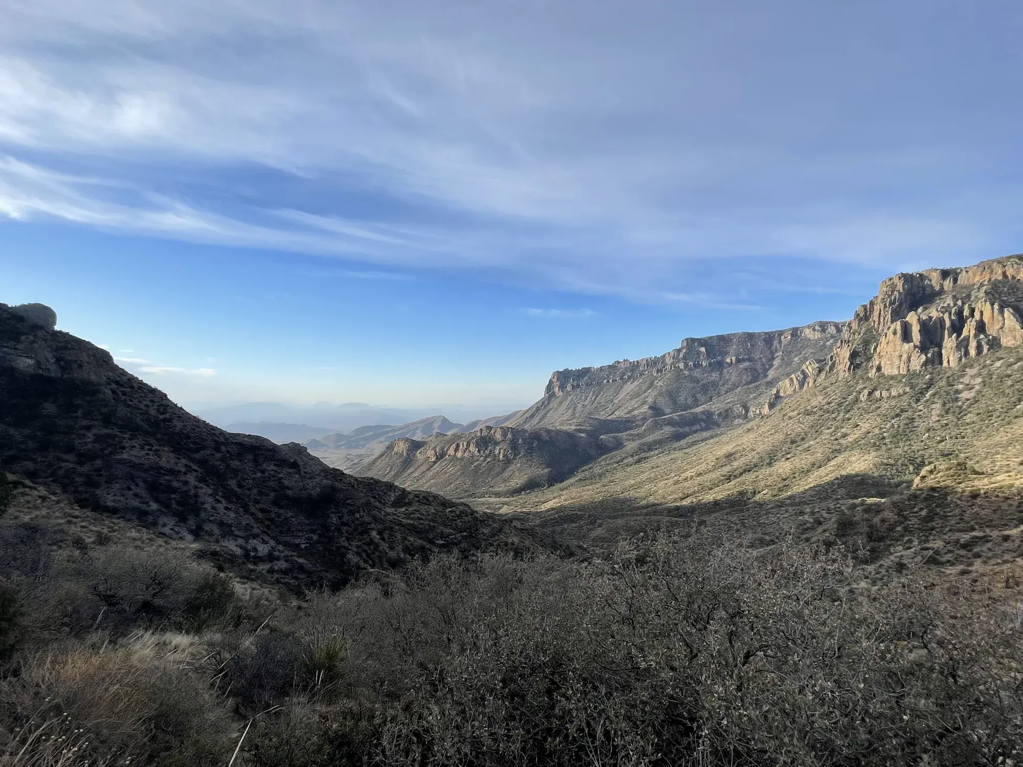
Lost Mine Trail
The Lost Mine Trail climbs to the side of Lost Mine Peak, offering spectacular views of Juniper Canyon and the Northeast Rim of the Chisos.
Big Bend · Photo: David & Keri New
- 4.8 miDistance
- 3 hrTime
- ModerateDifficulty
The numbers, with sources
Distance: 4.8 miles round trip Source
Gain: The NPS doesn’t publish the elevation gain. Source
Time: Around 3 hours Source
Difficulty: Steep upper trail with switchbacks and steps Source
Trailhead: Located at mile 5 along the Chisos Basin Road. Source
Route type: out-and-back Source
Built from official sources (checked Nov 3, 2026). Confirm current conditions with the park.
Recreation.gov permits, entrances & campgrounds
Recreation.gov (RIDB). Booking records date not published. NPS guidance above takes precedence. A listing doesn’t mean you need a permit or that there’s space on your dates.
Nearby campground records
Within 10 straight-line miles of the trailhead. Distances are straight-line from map coordinates, not driving distances.
- Big Bend Backcountry Camping: approximately 6.1 miles straight line. RIDB coordinates · Mapped route source
- Chisos Basin Group Campground (Big Bend, TX): approximately 1.1 miles straight line. RIDB coordinates · Mapped route source
- Chisos Basin Campground (Big Bend, TX): approximately 1.1 miles straight line. RIDB coordinates · Mapped route source
Park campground options (6)
These records belong to the park’s NPS recreation area. We haven’t checked how close these are to the trail, when they open or whether sites are free; check the map and the booking page.
Rio Grande Village (Big Bend, TX) — Campground; RIDB reservable: yes. Season: not published in structured RIDB data. Recreation.gov (RIDB) source · Booking details
NPS reservation guidance: Please plan ahead. Reservations are required for this campground. There are no first come, first served campsites. This campground is open year-round, but only a limited number of campsites are available in the summer months due to the extreme heat (110+ degrees). May 1 - October 31, 2021: 17 campsites reservable 6 months in advance and 7 sites reservable up to 14 days in advance. November through April: 60 sites reservable up to 6 months in advance and 33 sites reservable up to 14 days in advance Reservations for Rio Grande Village Campground are made at: https://www.recreation.gov/camping/campgrounds/234035 NPS source
Cottonwood (Big Bend, TX) — Campground; RIDB reservable: yes. Season: not published in structured RIDB data. Recreation.gov (RIDB) source · Booking details
NPS reservation guidance: Plan Ahead: there are NO first come, first served campsites Reservations required. All campsites are reservation only, up to 14 days in advance. Campground is operated at a reduced capacity during the heat of summer (May 1- October 31) Reservations for Cottonwood Campground are made at: https://www.recreation.gov/camping/campgrounds/234078 NPS source
Rio Grande Village Group Campground (Big Bend, TX) — Campground; RIDB reservable: yes. Season: not published in structured RIDB data. Recreation.gov (RIDB) source · Booking details
Big Bend Backcountry Camping — Campground; RIDB reservable: yes. Season: not published in structured RIDB data. Recreation.gov (RIDB) source · Booking details
Chisos Basin Group Campground (Big Bend, TX) — Campground; RIDB reservable: yes. Season: not published in structured RIDB data. Recreation.gov (RIDB) source · Booking details
Chisos Basin Campground (Big Bend, TX) — Campground; RIDB reservable: yes. Season: not published in structured RIDB data. Recreation.gov (RIDB) source · Booking details
NPS reservation guidance: Reservations are required. No first-come, first-serve camping. The Chisos Basin Campground is open year-round. -- 2/3 of campsites are reservable up to 6 months in advance. -- 1/3 of campsites are reservable up to 14 days in advance. Reservations for Chisos Basin Campground are made at: https://www.recreation.gov/camping/campgrounds/234038 NPS source
Route, junction by junction
Trailhead → Selected destination or loop
The upper trail climbs steeply through switchbacks and steps before reaching a ridge with broader views. Follow the switchbacks to limit erosion. The one-mile saddle is a useful alternative when time or energy is limited; it does not require continuing to the ridge to make a worthwhile visit. Source
No elevation profile: we only draw one from a mapped route we can verify. Route source
In-depth guide
Compiled from linked sources, checked Nov 2, 2026. Each paragraph links to its source.
Is this hike for you?
Lost Mine Trail rises 1,100 feet over 2.4 miles (4.8 miles round trip) through woodland and grassland to views of the Chisos landscape, with some of the best views in Big Bend National Park. The NPS says the average hike takes around three hours. The upper half is steep, with switchbacks and steps. Despite the name, the trail doesn’t go to the summit of Lost Mine Peak. Source
The trail
If you’re short on time or energy, the first mile takes you to a scenic overlook and makes a good turnaround. Past that, the trail climbs steeply through switchbacks and steps to a ridge with wider views. Stay on the trail and follow the switchbacks to prevent erosion. The trail surface is dirt and rock. Source
This is mountain lion and black bear country. Keep kids close and don’t let them hike alone or run ahead. If you see a mountain lion, don’t run. Source
Getting to the trailhead
The trailhead is at mile 5 on the Chisos Basin Road. The lot holds fifteen vehicles and often fills between 8 and 9 am in the November–April busy season. Don’t park along the road; if it’s full, hike another trail and come back to Lost Mine another time. Source
When to go
The NPS lists this hike for winter, spring, summer and fall, and says it’s good at any time of day because the climb often leads to cooler air higher up. Protect yourself from the desert sun even in the mountains: sunscreen and a wide-brimmed hat. Check the park’s current alerts and the forecast before you go, and read the signs at the trailhead. Source · Source 2
Water and food
Carry 1 liter of water per person per hour you plan to hike, plus a snack. There are no toilets on the trail. Bury human waste six inches deep, at least 100 yards from the trail or any water source or drainage, and pack out your toilet paper; don’t bury or burn it. Source
Dogs, permits and fees
The NPS doesn’t publish a pet rule for this trail, so check the park’s pet rules before you bring a dog. Yield to other hikers and keep the noise down. The NPS says no reservation is needed for this hike; park entrance rules still apply. Source
See the NPS fees page for the current park entrance fee and passes. Source
Map and elevation profile
The NPS trail map line comes from its trail data and USGS 3DEP terrain, but we haven’t verified complete measurements for this route, so there’s no elevation profile yet. Source
Getting there and back
Located at mile 5 along the Chisos Basin Road. Source
Return: Come back the way described above. Return along the same trail unless a separate transport plan has been confirmed. Source
Water
There are no toilets along this trail. Carry 1 liter of water per person per hour that you plan to hike. Source
Hazards
The trail surface is composed of dirt and rocks. The second half of the trail includes switchbacks and steps. Source
Season
Use current official conditions; activity season labels are not a guarantee of access. Source
Current trail conditions require a trip-date check. Source
Gear & rules
Follow current signs and closures, and treat any side trip as a separate decision. Source
Filling a gap in your kit? Compare these packing essentials on Amazon. Choose gear for your route, conditions and the park’s guidance.
As an Amazon Associate we earn from qualifying purchases. How this works
The NPS doesn’t publish a pet rule for this exact route. Confirm the applicable rule before bringing an animal. Source
Questions
Which route do these figures describe?
4.8 miles round trip Lost Mine climbs through a woodland-grassland setting to views of the Chisos landscape. The name does not mean this maintained route reaches the summit of Lost Mine Peak. NPS describes a 4.8-mile round trip rising 1,100 feet, with a shorter scenic turnaround about one mile into the walk. Source
Is the trail open right now?
No. NPS details as of Nov 3, 2026. Confirm current conditions and closures with NPS. Source
Is there a measured elevation profile?
Official NPS trail geometry sampled with USGS 3DEP terrain; no mileage or gain scaling. NPS publishes 2.40 mi one way; the traced line measures 2.30 mi. The difference is unresolved. Source
Alternatives
The small parking area is a major constraint. The NPS says the lot holds fifteen vehicles and often fills between 8 and 9 am in the November–April peak season. This is historical planning guidance, not a guarantee of space. The activity says not to park along the road: choose another trail and return later if necessary. Source
More Big Bend trail guides
- Santa Elena Canyon Trail1.6 mi · Moderate