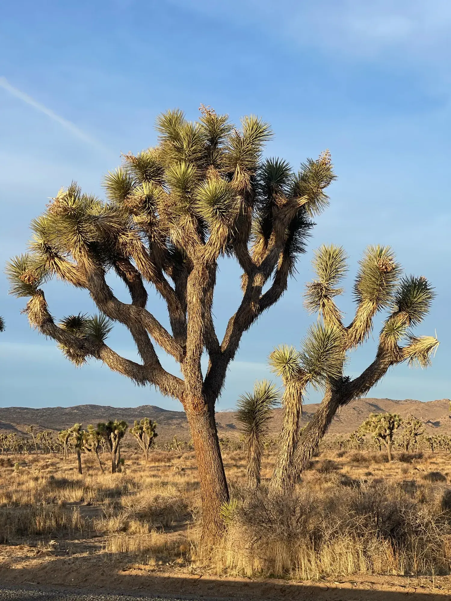
Lost Horse Mine Loop
A 6.8-mile loop through Joshua Tree mining history, with a separate four-mile out-and-back option to the stamp mill.
Joshua Tree · Photo: David & Keri New
- 6.8 miDistance
- 900 ftElevation gain
- 2–4 hrTime
- StrenuousDifficulty
The numbers, with sources
Distance: 6.8-mile full loop; separate stamp-mill out-and-back is 4 miles round trip. Source
Gain: 900 feet for the loop. 550 feet for the separate stamp-mill hike. Source
Time: 2–4 hours in the activity field, without a separate duration for each variant. Source
Difficulty: Deep sand, uneven rock, steep inclines and installed steps; limited shade. Source
Trailhead: End of the one-mile dirt Lost Horse Mine Road, off Keys View Road. Source
Route type: loop Source
Built from official sources (checked Nov 3, 2026). Confirm current conditions with the park.
Recreation.gov permits, entrances & campgrounds
Recreation.gov (RIDB). Booking records date not published. NPS guidance above takes precedence. A listing doesn’t mean you need a permit or that there’s space on your dates.
Nearby campground records
Within 10 straight-line miles of the trailhead. Distances are straight-line from map coordinates, not driving distances.
- SHEEP PASS GROUP: approximately 4 miles straight line. RIDB coordinates · Mapped route source
- Indian Cove Group: approximately 9.8 miles straight line. RIDB coordinates · Mapped route source
- Ryan Campground: approximately 2.2 miles straight line. RIDB coordinates · Mapped route source
- JUMBO ROCKS CAMPGROUND: approximately 6.1 miles straight line. RIDB coordinates · Mapped route source
Park campground options (9)
These records belong to the park’s NPS recreation area. We haven’t checked how close these are to the trail, when they open or whether sites are free; check the map and the booking page.
COTTONWOOD CAMPGROUND (CA) — Campground; RIDB reservable: yes. Season: not published in structured RIDB data. Recreation.gov (RIDB) source · Booking details
NPS reservation guidance: Reservations are required year-round and can be made up to six months in advance. Book a site at www.recreation.gov or by calling 877-444-6777. NPS source
BLACK ROCK CAMPGROUND — Campground; RIDB reservable: yes. Season: not published in structured RIDB data. Recreation.gov (RIDB) source · Booking details
NPS reservation guidance: Reservations are required year-round and can be made up to six months in advance. Book a site at www.recreation.gov or by calling 877-444-6777. NPS source
SHEEP PASS GROUP — Campground; RIDB reservable: yes. Season: not published in structured RIDB data. Recreation.gov (RIDB) source · Booking details
NPS reservation guidance: Reservations are required year-round and can be made up to six months in advance. Book a site at www.recreation.gov or by calling 877-444-6777. Sites can accommodate 10-60 people. NPS source
Indian Cove Group — Campground; RIDB reservable: yes. Season: not published in structured RIDB data. Recreation.gov (RIDB) source · Booking details
BLACK ROCK EQUESTRIAN CAMPGROUND — Campground; RIDB reservable: yes. Season: not published in structured RIDB data. Recreation.gov (RIDB) source · Booking details
Ryan Campground — Campground; RIDB reservable: yes. Season: not published in structured RIDB data. Recreation.gov (RIDB) source · Booking details
NPS reservation guidance: Reservations are required year-round and can be made up to six months in advance. Book a site at www.recreation.gov or by calling 877-444-6777. NPS source
JUMBO ROCKS CAMPGROUND — Campground; RIDB reservable: yes. Season: not published in structured RIDB data. Recreation.gov (RIDB) source · Booking details
NPS reservation guidance: Reservations are required year-round and can be made up to six months in advance. Book a site at www.recreation.gov or by calling 877-444-6777. NPS source
INDIAN COVE CAMPGROUND — Campground; RIDB reservable: yes. Season: not published in structured RIDB data. Recreation.gov (RIDB) source · Booking details
NPS reservation guidance: Reservations are required year-round and can be made up to six months in advance. Book a site at www.recreation.gov or by calling 877-444-6777. NPS source
COTTONWOOD GROUP — Campground; RIDB reservable: yes. Season: not published in structured RIDB data. Recreation.gov (RIDB) source · Booking details
Route, junction by junction
Lost Horse Mine trailhead → stamp mill
Take the signed trail from the small lot. Going to the mill and back is the NPS 4-mile round-trip option. Source
Stamp mill → loop or return
Stay outside the fences and closed mines. Turn back here if the full loop is too much for your group. Source
Rest of the loop → trailhead
For the full loop, follow the signed Lost Horse Mine loop back to the lot. The NPS gives 6.8 miles and 900 feet of gain for the loop, and 550 feet for the 4-mile out-and-back. Source
No elevation profile: we only draw one from a mapped route we can verify. Route source
In-depth guide
Compiled from linked sources, checked Nov 3, 2026. Each paragraph links to its source.
Decisions & preparation
Distances are shown only where the NPS gives them. Source
Turnaround & return planning
Turn back at the stamp mill, or sooner if the group is running low on energy, water or daylight. Planning basis
Parking & transport timing
From Park Boulevard take Keys View Road 2.4 miles, then Lost Horse Mine Road one mile. The small lot fills on busy days; no parking along the dirt road. The NPS doesn’t say when it fills. Source
What to bring by season
All seasons: the NPS Ten Essentials (navigation, sun protection, extra clothing, a light, first aid, fire supplies where allowed, repair tools, extra food, water and emergency shelter). Tell someone your route and when you’ll be back. Source
Warm weather: sun protection, plenty of water and extra food. Cold or wet weather: warm layers, rain gear and extra clothing in case you’re out longer than planned. Source
In summer the NPS says to start before 8 am. Check the forecast and change plans if the weather is extreme. Source
Children & mobility
Deep sand, hard-packed dirt, uneven rock, steep inclines and installed rock steps. Not accessible for wheelchair users. No pets or emotional support animals on trails; service animals are welcome on a 6-foot (1.8 meter) leash. Source
Is this hike for you?
The Lost Horse Mine Trail is a 6.8-mile loop with 900 feet of total elevation gain through Joshua Tree’s mining history: a stamp mill, mining equipment and artifacts, and the remains of an old cabin. For a shorter hike, walk to the stamp mill and back down to the parking lot instead: 4 miles round trip with 550 feet of gain. Pick one before you start. There’s little shade and cell service is unreliable. Source · Source 2
The trail
Stay out of the fenced milling site and any closed mines, and leave the artifacts; removing them is illegal. The ground changes a lot: deep sand, hard-packed dirt, uneven rock, steep inclines and installed rock steps. Source
Getting to the trailhead
From Park Boulevard, turn onto Keys View Road and drive 2.4 miles to Lost Horse Mine Road, then follow that dirt road 1 mile to the trailhead. The lot is small and fills quickly on busy weekends, holidays and spring break, so start early and have a backup hike ready. Don’t park along the dirt road. Source
Heat and safety
In summer, start before 8 am and bring plenty of water. Check the forecast and change plans if the weather is extreme. Because cell service is unreliable, tell a safety buddy where you’re going and when you plan to leave the park. Source · Source 2
Kids, dogs and wheelchairs
The trail isn’t accessible for wheelchair users, and the NPS doesn’t give a minimum age. Pets and emotional support animals aren’t allowed on trails. Service animals are welcome on a 6-foot (1.8 meter) leash. Source
Elevation profile
The elevation chart follows the NPS map line for the full loop. One junction has a gap of about eight meters in the map data, which we bridge as an approximate connection. On that line the USGS terrain model measures 6.40 miles, with elevations from about 4,566 to 5,116 feet and about 870 feet of climbing and 875 feet of descent in the direction plotted. These are our estimates, not NPS figures. The chart is smoothed (a fifty-meter window and a three-meter threshold), so short steps and small rises may not show, and we haven’t stretched it to match the NPS mileage. It covers the full loop, not the stamp-mill option. Source · Source 2
Sources & planning limits
Reviewed 2026-11-03. Check current conditions for your trip dates.
Getting there and back
From Park Boulevard use Keys View Road for 2.4 miles, then Lost Horse Mine Road for one mile. Small lot fills in busy periods; no roadside parking on the dirt access road. Source
Return: For the loop, follow the complete trail back to the lot. For the mill-only option, return by the same route instead of continuing the loop. Source
Water
Bring plenty of water. The NPS doesn’t list a refill on the trail, and cell service is unreliable. Source
Bring plenty of water. The NPS doesn’t list a refill on the trail, and cell service is unreliable. Source
Hazards
Limited shade, heat and unreliable cell service. Source
Deep sand, uneven rock, steep inclines and steps. Source
Closed mines and fenced milling site are not entry destinations. Source
Season
NPS recommends summer starts before 8 am, forecast checks and changing plans for extreme weather; early arrival is not a safety guarantee. Source
NPS recommends summer starts before 8 am, forecast checks and changing plans for extreme weather; early arrival is not a safety guarantee. Source
Gear & rules
Stay out of fenced milling areas and closed mines. Never remove historic artifacts. Source
Do not park along the dirt access road. Source
Pets and emotional-support animals are not allowed on trails; service animals must be on a six-foot leash. Source
Filling a gap in your kit? Compare these packing essentials on Amazon. Choose gear for your route, conditions and the park’s guidance.
As an Amazon Associate we earn from qualifying purchases. How this works
Stay out of fenced milling areas and closed mines. Never remove historic artifacts. Source
Do not park along the dirt access road. Source
Pets and emotional-support animals are not allowed on trails; service animals must be on a six-foot leash. Source
Questions
Can the mine visit be shorter than the loop?
Yes. NPS gives a separate four-mile round-trip stamp-mill out-and-back with 550 feet of gain. Source
Can visitors enter the fenced mill or closed mines?
No. The NPS explicitly says to stay out and prohibits removing historic artifacts. Source
Alternatives
More Joshua Tree trail guides
- Barker Dam1.1 mi · Easy
- Hidden Valley1 mi · Easy
- Ryan Mountain3 mi · Strenuous
- Skull Rock Nature Trail1.7 mi · Strenuous