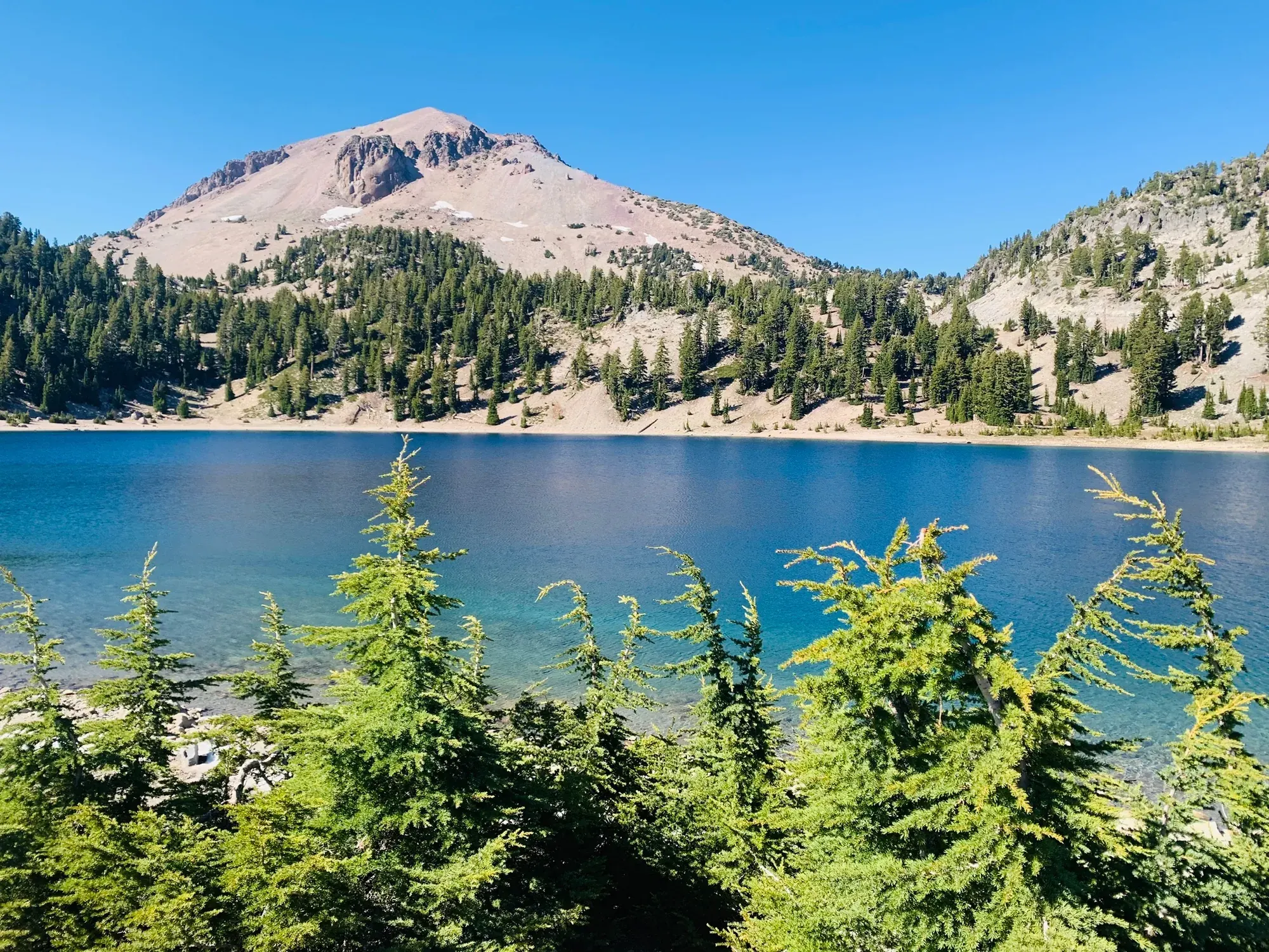
Lassen Peak Trail
Follow the maintained trail through its switchbacks to the first summit, where NPS says the maintained trail ends. Treat any further travel toward the true summit or crater interior as a separate decision.
Lassen Volcanic · Photo: David & Keri New
- 5 miDistance
- 1,957 ftElevation gain
- 4–5 hrTime
- StrenuousDifficulty
The numbers, with sources
Distance: 5 miles round trip Source
Gain: 1,957 feet of gain from a starting elevation of 8,500 feet Source
Time: 4-5 Hours Source
Difficulty: Hiking Source
Trailhead: Lassen Peak Trailhead at the Lassen Peak parking area. Source
Route type: out-and-back Source
Built from official sources (checked Nov 3, 2026). Confirm current conditions with the park.
Recreation.gov permits, entrances & campgrounds
Recreation.gov (RIDB). Booking records date not published. NPS guidance above takes precedence. A listing doesn’t mean you need a permit or that there’s space on your dates.
Nearby campground records
Within 10 straight-line miles of the trailhead. Distances are straight-line from map coordinates, not driving distances.
- Warner Valley Campground: approximately 6.2 miles straight line. RIDB coordinates · Mapped route source
- Manzanita Lake Camping Cabins (CA): approximately 4.8 miles straight line. RIDB coordinates · Mapped route source
- Southwest Campground - Winter/Spring: approximately 3 miles straight line. RIDB coordinates · Mapped route source
- MANZANITA LAKE: approximately 4.8 miles straight line. RIDB coordinates · Mapped route source
- MANZANITA LAKE GROUP CAMPGROUND: approximately 4.8 miles straight line. RIDB coordinates · Mapped route source
- SUMMIT LAKE NORTH: approximately 4.5 miles straight line. RIDB coordinates · Mapped route source
- SUMMIT LAKE STOCK CORRAL: approximately 4.8 miles straight line. RIDB coordinates · Mapped route source
- SUMMIT LAKE SOUTH: approximately 4.4 miles straight line. RIDB coordinates · Mapped route source
- LOST CREEK GROUP: approximately 6.1 miles straight line. RIDB coordinates · Mapped route source
Park campground options (15)
These records belong to the park’s NPS recreation area. We haven’t checked how close these are to the trail, when they open or whether sites are free; check the map and the booking page.
Warner Valley Campground — Campground; RIDB reservable: yes. Season: not published in structured RIDB data. Recreation.gov (RIDB) source · Booking details
NPS reservation guidance: Eight sites may be reserved via www.recreation.gov. The remaining nine sites are first come, first served. NPS source
Manzanita Lake Camping Cabins (CA) — Campground; RIDB reservable: yes. Season: not published in structured RIDB data. Recreation.gov (RIDB) source · Booking details
Southwest Campground — Campground; RIDB reservable: yes. Season: not published in structured RIDB data. Recreation.gov (RIDB) source · Booking details
Southwest Campground - Winter/Spring — Campground; RIDB reservable: no. Season: not published in structured RIDB data. Recreation.gov (RIDB) source
NPS reservation guidance: Southwest campsites are first-come, first-served only. Payment is made through Scan & Pay via recreation.gov’s mobile app. NPS source
MANZANITA LAKE — Campground; RIDB reservable: yes. Season: not published in structured RIDB data. Recreation.gov (RIDB) source · Booking details
NPS reservation guidance: Reservations are required for all sites in the 2024 season. Reservations can be made up to the day of arrival. It is best to reserve prior to arriving at the park due to limited connectivity. Reservations can be made 6 months in advance up to the day of arrival. Park staff does not handle reservations. Camping fee is reduced $15 when water is turned off, typically in mid-October. NPS source
JUNIPER LAKE GROUP — Campground; RIDB reservable: yes. Season: not published in structured RIDB data. Recreation.gov (RIDB) source · Booking details
NPS reservation guidance: All single sites are first-come, first-served only. Group sites and the stock corral are reservation-only. NPS source
MANZANITA LAKE GROUP CAMPGROUND — Campground; RIDB reservable: yes. Season: not published in structured RIDB data. Recreation.gov (RIDB) source · Booking details
SUMMIT LAKE NORTH — Campground; RIDB reservable: yes. Season: not published in structured RIDB data. Recreation.gov (RIDB) source · Booking details
NPS reservation guidance: Reservations are required for all sites in the 2024 season. Reservations can be made up to 6 months in advance of arrival date up to the day of arrival. It is best to reserve ahead of arrival, as there is limited to no connectivity in the park. Sites cannot be claimed without a reservation. NPS source
JUNIPER LAKE STOCK CORRAL — Campground; RIDB reservable: yes. Season: not published in structured RIDB data. Recreation.gov (RIDB) source · Booking details
BUTTE LAKE STOCK CORRAL — Campground; RIDB reservable: yes. Season: not published in structured RIDB data. Recreation.gov (RIDB) source · Booking details
BUTTE LAKE — Campground; RIDB reservable: yes. Season: not published in structured RIDB data. Recreation.gov (RIDB) source · Booking details
NPS reservation guidance: Reservations are required for all sites at Butte Lake Campground for the entire operating season. Reservations may be made a maximum of 6 months up to the time of arrival. It is best to reserve ahead of your arrival. Connection is limited to non-existent in the park. Park staff or campground hosts do not handle reservations. Between 9/3-10/14 only Loop B is open, and water is shut off for the season (no drinking water or flush toilets). There is no cellular service or Wi-Fi available at the campground, so please make reservations in advance. NPS source
BUTTE LAKE GROUP — Campground; RIDB reservable: yes. Season: not published in structured RIDB data. Recreation.gov (RIDB) source · Booking details
SUMMIT LAKE STOCK CORRAL — Campground; RIDB reservable: yes. Season: not published in structured RIDB data. Recreation.gov (RIDB) source · Booking details
SUMMIT LAKE SOUTH — Campground; RIDB reservable: yes. Season: not published in structured RIDB data. Recreation.gov (RIDB) source · Booking details
NPS reservation guidance: The campground is open 6/28/2024 - 9/23/2024. All sites are by reservation only throughout the duration of the operating season. Sites that are reservation only cannot be claimed without a reservation. Reservations can be made up to 6 months in advance up to the day of arrival. It is best to reserve ahead of arrival, as there is limited to no connectivity in the park. NPS source
LOST CREEK GROUP — Campground; RIDB reservable: yes. Season: not published in structured RIDB data. Recreation.gov (RIDB) source · Booking details
NPS reservation guidance: Reservations required for all sites. NPS source
Route, junction by junction
Selected start → Selected destination
Follow the maintained trail through its switchbacks to the first summit, where NPS says the maintained trail ends. Treat any further travel toward the true summit or crater interior as a separate decision. Source
No elevation profile: we only draw one from a mapped route we can verify. Route source
In-depth guide
Compiled from linked sources, checked Nov 2, 2026. Each paragraph links to its source.
Is this hike for you?
Lassen Peak is a strenuous 5-mile (8 km) round trip to the summit of one of the largest plug dome volcanoes in the world. You start at 8,500 ft (2591 m) and gain 1,957 ft (596 m). The NPS allows 4-5 hours and says it may take longer depending on your ability. The altitude can aggravate existing medical conditions, so know how it affects you. Source · Source 2
The trail
From the Lassen Peak parking area the trail climbs on sand-like cinders through mountain hemlock and whitebark pine. As the trees thin it steepens into switchbacks along a rocky ridge. The surface is packed dirt with some loose rock from erosion. The maintained trail ends at the first summit, which has interpretive signs and a big view. From there a steep route continues to the true summit, or you can descend into the crater. Source
Stay on the trail and don’t cut switchbacks; going off-trail pushes rocks onto the path and causes erosion. Step aside to let uphill hikers pass. Source
Snow, sun and storms
Snow can last through the summer, so wear proper footwear and consider trekking poles. There’s some tree shade in the first mile and little after that. Weather changes fast and snow is possible any month. Start early to avoid afternoon storms and lightning, and carry extra layers and plenty of water. Source
In winter the peak is under many feet of snow with avalanche danger, and climbing it takes special equipment and training. Source
Getting to the trailhead
The trailhead is at the Lassen Peak parking area. When we checked, a park alert said the park road (Hwy 89) was temporarily closed to through travel because of snow and fallen rock. From the northwest entrance you could drive 10 miles to the closure at Devastated Area, and from the southwest entrance 1 mile to the closure at Sulphur Works. Check current alerts before you go. Source · Source 2
Permits and fees
The NPS says this hike doesn’t need a reservation. The private-vehicle entrance fee is $30.00, good for 7 consecutive days. When the entrance station isn’t staffed you can buy a digital pass online at recreation.gov. Source · Source 2 · Source 3
Kids, dogs and wheelchairs
The trail isn’t wheelchair accessible. No pets are allowed; service animals are. Source · Source 2
Before you go
Decide where you’ll turn around before you start. The first summit is a fine place to stop, and it’s fine to turn back sooner if the weather builds or the group is slower than expected. Source
There’s no elevation profile yet. Source
Sources & planning limits
Reviewed 2026-11-03. Check current conditions for your trip dates.
- Distances and times are the NPS’s, for the trail as it describes it. Source
- NPS details are as of the date shown. Confirm access, services and reservations for your travel date. Source
- The NPS doesn’t say whether this trail suits kids. Source
- Check permit, reservation and fee rules for your travel date. Source
Getting there and back
Lassen Peak Trailhead at the Lassen Peak parking area. Source
Return: Complete the return arrangement described for this route. The first summit and the true summit are not interchangeable destinations. This hike ends where the maintained trail ends. You don’t need to scramble or explore the crater to reach the interpretive signs. Source
Water
Carry plenty of water, take breaks often, and do not exceed your abilities. Source
Your footsteps can push rocks onto the trail, create pathways for water erosion, and undermine the supporting slope. Source
Hazards
As the trees begin to thin and vistas of the park come into view, the trail steepens into series of switchbacks along a rocky ridge to the summit. Source
From there, hikers may continue up the steep route to the true summit or descend into the interior of the crater to explore the remnants of the dramatic eruptions that have rocked this volcano. Source
Get an early start to avoid afternoon storms and lightning. Source
Season
Lassen Peak is covered with many feet of snow in the winter. There is also avalanche danger. It takes special equipment and training to ascend the mountain in winter. Source
Lassen Peak is covered with many feet of snow in the winter. There is also avalanche danger. It takes special equipment and training to ascend the mountain in winter. Source
Gear & rules
Service animal allowed. No pets. Source
Filling a gap in your kit? Compare these packing essentials on Amazon. Choose gear for your route, conditions and the park’s guidance.
As an Amazon Associate we earn from qualifying purchases. How this works
Wear proper footwear and consider using trekking poles to help maintain balance. Source
Carry extra layers for warmth. Source
Carry plenty of water, take breaks often, and do not exceed your abilities. Source
Questions
Which hike is this?
Follow the maintained trail through its switchbacks to the first summit, where NPS says the maintained trail ends. Treat any further travel toward the true summit or crater interior as a separate decision. Source
Are the published figures fully consistent?
The first summit and the true summit are not interchangeable destinations. This hike ends where the maintained trail ends. You don’t need to scramble or explore the crater to reach the interpretive signs. Source
Is there an elevation profile?
Official NPS trail geometry sampled with USGS 3DEP. Distance comparison: Half of the NPS five-mile round trip, for the outward chart leg. NPS publishes 1,957 feet of gain; sampled terrain gives 2,028 feet (+3.63%). The difference is unresolved. Source
Alternatives
Camp near Lassen Peak Trail
Closest campgrounds by drive time to Lassen Peak Trailhead:
- 14 min Southwest Walk-in (7.1 mi, in the park)
- 16 min Summit Lake North (8.8 mi, in the park)
- 17 min Summit Lake South (8.9 mi, in the park)
- 41 min Manzanita Lake (21.5 mi, in the park)
- 57 min Hat Creek ↗ (34 mi, USDA Forest Service)
Driving time with no traffic (OSRM, OpenStreetMap roads). Some park roads are shuttle-only in season. All camping near Lassen Volcanic