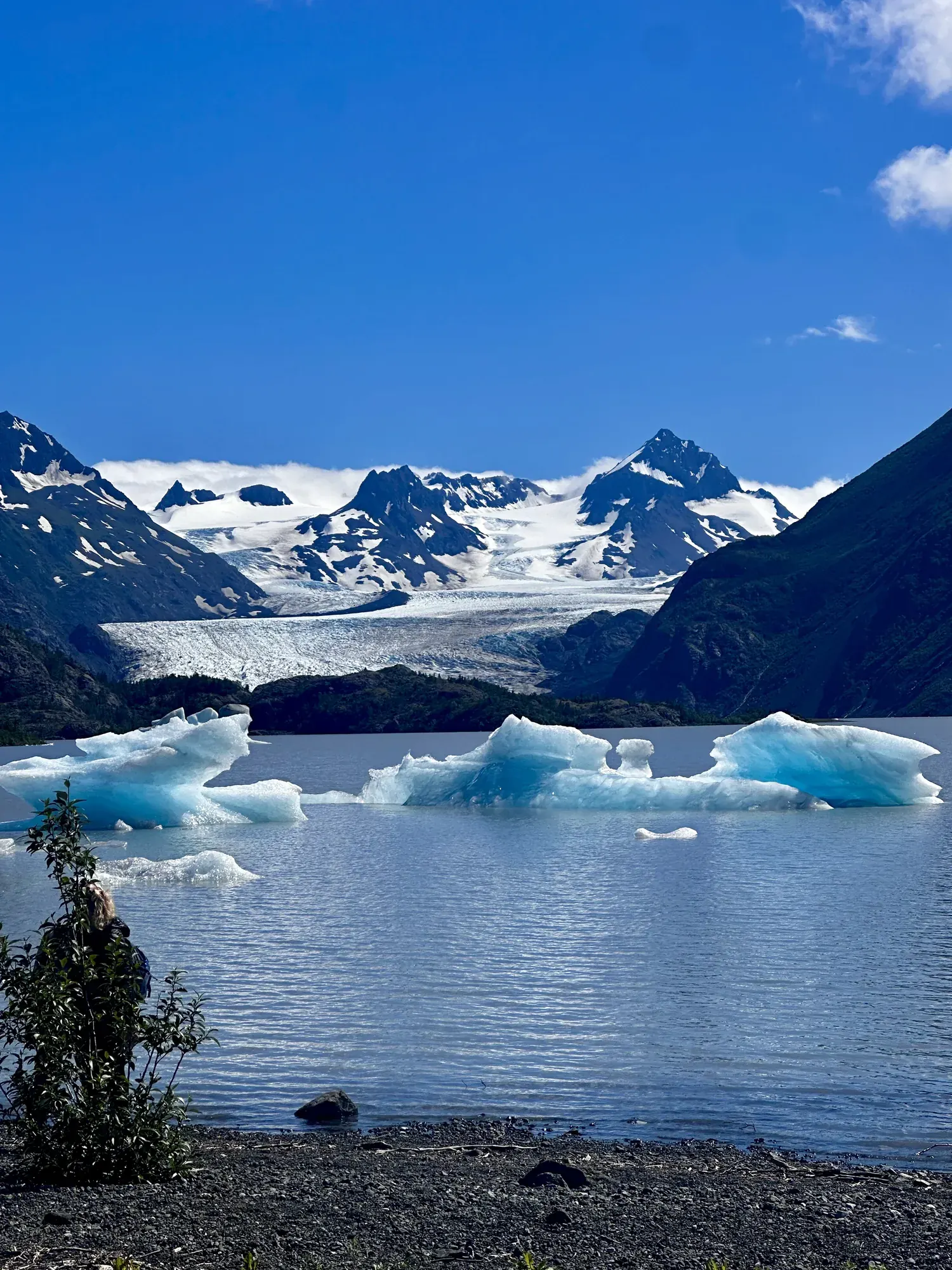
Harding Icefield Trail
A strenuous out-and-back climb from the Exit Glacier area through forest and alpine meadows to a view across the Harding Icefield.
Kenai Fjords · Photo: David & Keri New
- 7.8 miDistance
- 6–8 hrTime
- StrenuousDifficulty
The numbers, with sources
Distance: 7.8 mi round trip from the Harding Icefield trail register; the approach from the nature center is additional. Source
Gain: The NPS doesn’t publish the elevation gain. Source
Time: Allow at least 6–8 hours for the trail round trip. Source
Difficulty: Strenuous. Winter and snowy shoulder-season travel can require mountaineering skills. Source
Trailhead: Harding Icefield trail register, reached from the Exit Glacier trail network. Source
Route type: out-and-back Source
Built from official sources (checked Nov 3, 2026). Confirm current conditions with the park.
Recreation.gov permits, entrances & campgrounds
Recreation.gov (RIDB). Booking records date not published. NPS guidance above takes precedence. A listing doesn’t mean you need a permit or that there’s space on your dates.
Park campground options (1)
These records belong to the park’s NPS recreation area. We haven’t checked how close these are to the trail, when they open or whether sites are free; check the map and the booking page.
Kenai Fjords National Park Cabins — Campground; RIDB reservable: yes. Season: not published in structured RIDB data. Recreation.gov (RIDB) source · Booking details
Route, junction by junction
Exit Glacier Nature Center → Harding Icefield trail register
Use the official Exit Glacier map and signs to join the Harding Icefield route. The register is the origin for the distances below. Source
Trail register → Marmot Meadows
The lower climb passes through forest before reaching the meadows. A shorter turnaround is an alternative to continuing to the trail end. Source
Distance: 1.5 mi outbound from the register; the bridge is at 0.7 mi. Source
Elevation: Marmot Meadows: 1,685 ft elevation on the official map. Source
Marmot Meadows → Top of Cliffs
Stay on the trail. Don’t cut switchbacks or trample fragile alpine plants. Source
Distance: Top of Cliffs is 2.3 mi from the register, not an additional 2.3 mi beyond the meadows. Source
Elevation: Top of Cliffs: 2,454 ft elevation. Source
Top of Cliffs → End of trail
The upper route reaches a view across the Harding Icefield. Snow and avalanche conditions may prevent reaching this destination. The shelter is for emergencies, not recreational overnight accommodation. Source
Distance: Emergency shelter at 3.7 mi; trail end at 3.9 mi from the register. Source
Elevation: Trail end: 3,527 ft elevation. Source
No elevation profile: we only draw one from a mapped route we can verify. Route source
In-depth guide
Compiled from linked sources, checked Nov 2, 2026. Each paragraph links to its source.
Is this hike for you?
Harding Icefield is a strenuous mountain hike, not an extension of the easy walk to the lower glacier. The NPS says to allow at least six to eight hours for the round trip, and that’s trail time only: the drive from Seward, parking and the walk from the nature center come on top. You don’t have to go to the end. The park says shorter walks up the trail also give views over Exit Glacier and its valley. Marmot Meadows (1.5 miles) and Top of Cliffs (2.3 miles) make good turnarounds; you come back the same way. Source · Source 2
The trail
The park map measures everything from the Harding Icefield trail register, at mile zero and 426 feet. From there it’s 0.7 mile to the bridge, 1.5 miles to Marmot Meadows, 2.3 miles to Top of Cliffs, 3.7 miles to the emergency shelter and 3.9 miles to the end. Those are all distances from the register, not from the parking lot. The trail climbs from the valley floor through cottonwood and alder, then heather meadows, then open ground above the trees, ending at a view across the icefield. Stay on the trail rather than heading out onto the ice, and don’t cut switchbacks: trampling and summer rain erode the fragile alpine plants. Source · Source 2
The NPS elevation figures for this trail don’t agree, so we don’t give a total climb, and there’s no elevation profile yet. Source · Source 2 · Source 3
Getting to the trailhead
Exit Glacier is the only part of Kenai Fjords you can drive to. From mile three of the Seward Highway, turn onto Herman Leirer Road (also called Exit Glacier Road) and follow it 8.4 miles to the nature-center parking lot. Parking is limited, especially between 10:30 am and 3:30 pm, so the NPS suggests timing your arrival, carpooling, bicycling, or taking a shuttle or taxi. Source
The Exit Glacier area is open all year, but snow usually closes the road to cars from late October into mid-May. Check the road report before you book transport. There’s no cell service or public wifi in the area, so set up your ride back before you lose coverage. Source
Snow and weather
Snow and avalanche risk can affect the trail into July. Check the date on the current trail report, the forecast and with park staff. Where the park has put up orange route flags, follow them, not footprints. Source
In winter the NPS calls this a mountaineering route, and steep snow, hard route finding and avalanche danger can linger into the shoulder seasons. Then it takes self-arrest, steep snow travel, avalanche recognition and rescue skills and the gear to match. If your group doesn’t have them, pick a lower hike. Source
Expect high winds, storms, strong sun and sudden temperature changes above the trees. Cold, rainy summer weather can cause hypothermia here. Bring warm layers of wool or synthetic fabric, rain gear, sturdy footwear, sunglasses and sunscreen. Wet, icy and rocky footing makes the steep parts harder; trekking poles help with balance. Pack for a delay, and remember you still have to get back down. Source · Source 2
Water and restrooms
Carry at least two liters of water per person, or bring a water filter. Untreated stream water may carry Giardia. There are no toilets or garbage cans on the trail, so pack out litter and toilet paper and follow the park’s rules for human waste away from trails and water. Source
In summer there’s drinking water at the restroom building by the nature center, with fountains and a bottle-filling station. Flush toilets normally run from Memorial Day to Labor Day; pit toilets the rest of the year. Picnic tables and bear-resistant garbage and recycling bins are by the parking lot. Source
Bears
The trail passes dense brush and salmonberry thickets that black bears use. Make noise so you don’t surprise one, and watch for females with cubs: you may see the cubs before the mother. Never get between a mother and her cubs. Carry bear spray, use bear-resistant food storage, and don’t approach wildlife. Source · Source 2
Kids, strollers and wheelchairs
This trail isn’t rated for strollers or wheelchairs, and the NPS doesn’t give a minimum age. For an accessible walk, the Glacier View Loop is the park’s one-mile lower trail through cottonwood forest to a view of Exit Glacier. The Glacier Overlook continuation beyond it is moderately strenuous. Pets aren’t allowed on these trails. Source · Source 2
Permits, fees and safety
Kenai Fjords has no entrance fee and you don’t need a pass. If you want to camp, stay in a public-use cabin or run a special event, check the park’s permit and reservation rules. Source · Source 2 · Source 3
Carry a map and a paper navigation backup, hike with someone, and leave your route and return time with someone else. Rescue can take hours. Report emergencies to patrolling rangers or the nature-center staff, and don’t count on a phone connection on the trail. Source
Sources & planning limits
Reviewed 2026-11-03. Check current conditions for your trip dates.
- No elevation profile yet: we haven’t verified complete measurements for this route. Source
- The NPS elevation figures for this trail don’t agree, so we don’t give a total climb. Source
- We haven’t confirmed access, transport or services for any given date. Check with the NPS and your transport company before you rely on them. Source
Getting there and back
Exit Glacier Road ends at the nature-center parking area. Parking is limited, especially 10:30 am–3:30 pm. The road is normally inaccessible to cars from late October to mid-May. Source
Return: Return along the same trail to the register and then to the nature-center area. Arrange transport before leaving cell coverage. Source
Water
Carry at least two liters per person or a filter; untreated stream water may contain Giardia. There are no toilets or garbage cans along the trail. Source
Summer drinking water is available at the restroom building near the nature center. Flush toilets normally operate Memorial Day–Labor Day, with pit toilets available outside that period. Source
Hazards
Dense salmonberry vegetation is bear habitat. Make noise, stay alert, and never move between a mother bear and cubs. Source
Storms, wind, snow, avalanche exposure and sudden temperature changes require preparation. Do not enter avalanche terrain without appropriate training and equipment. Source
Carry navigation and communication equipment, leave a trip plan with someone else, and prepare for delayed rescue. Source
Season
Check snow and avalanche conditions even in summer. Winter conditions can also occur during October, November, May and June. Source
Snow and avalanche hazards may persist into July; read the dated current trail report before choosing the trip. Source
Gear & rules
Camping on this corridor must be at least one eighth mile from the trail on bare rock or snow, out of sight and without crushing vegetation. The emergency shelter is not a campsite. Source
Filling a gap in your kit? Compare these packing essentials on Amazon. Choose gear for your route, conditions and the park’s guidance.
As an Amazon Associate we earn from qualifying purchases. How this works
Bring warm layers, rain gear, sturdy shoes, sun protection and navigation equipment. Source
Protect alpine plants by staying on the trail. Pets are prohibited on park trails. Source
The park recommends bear spray and bear-resistant food storage. Source
Questions
Can the trip turn around before the icefield overlook?
Yes. NPS says shorter hikes also have views. The official map shows Marmot Meadows and Top of Cliffs on the climb, and you come back the same way. Source
Is this the accessible Exit Glacier walk?
No. NPS identifies Glacier View Loop as the accessible lower trail. Harding Icefield is a separate strenuous mountain route. Source
Why is there no elevation chart?
The NPS map supplies real milestone elevations, but a verified route line with USGS elevation sampling has not yet been assembled. We don’t draw a full profile from those few points. Source
Alternatives
For something lower, pick the accessible one-mile Glacier View Loop. Glacier Overlook is a separate, moderately strenuous continuation. Source
Camp near Harding Icefield Trail
Closest campgrounds by drive time to Harding Icefield Trailhead:
- 40 min Primrose Campground ↗ (23 mi, USDA Forest Service)
- 45 min Ptarmigan Creek ↗ (28 mi, USDA Forest Service)
- 50 min Trail River ↗ (30 mi, USDA Forest Service)
- 1 hr 16 min Quartz Creek Campground ↗ (50 mi, USDA Forest Service)
Driving time with no traffic (OSRM, OpenStreetMap roads). Some park roads are shuttle-only in season. All camping near Kenai Fjords
More Kenai Fjords trail guides
- Exit GlacierEasy