Guadalupe MountainsTrail guides
Guadalupe Peak Trail
Take the main Guadalupe Peak trail to the summit and come down the same way. The stock-trail variant adds a mile in each direction and is not the distance used here.
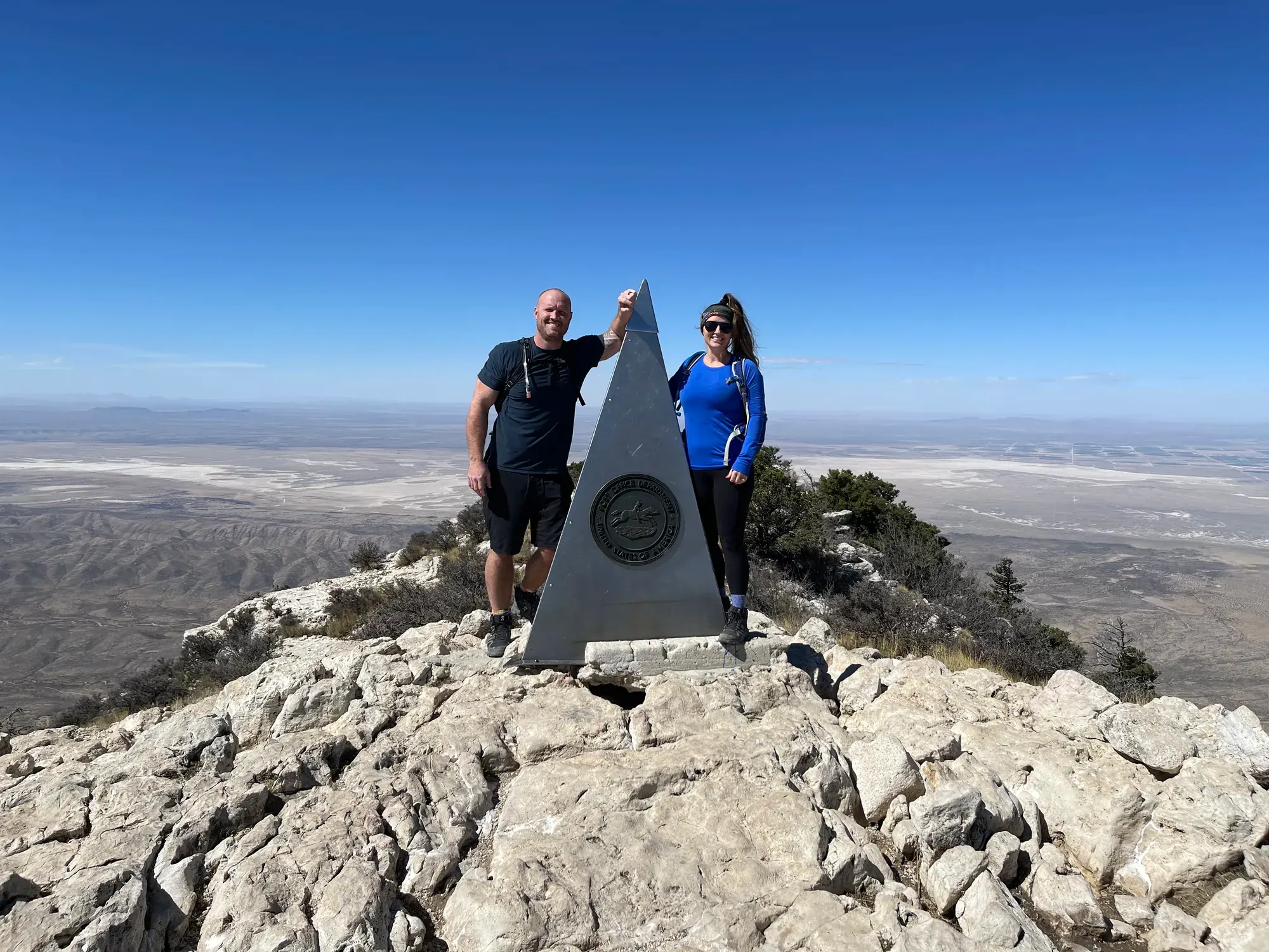
Guadalupe Mountains · Photo: David & Keri New
- 8.4 miDistance
- 3,000 ftElevation gain
- 6–8 hrTime
- StrenuousDifficulty
The numbers, with sources
Distance: 8.4 miles round trip Source
Gain: 3,000 feet of gain Source
Time: 6-8 Hours Source
Difficulty: Guadalupe Peak is a rewarding, although very strenuous, 8.4 mile round trip hike with a 3,000 foot elevation gain. This is the most popular hike in the park and is often crowded on the weekends. More effort is required to hike at higher elevations due to the reduced amount of oxygen available in the air. Remember that at 8,000 feet you are at risk of altitude illness , a potentially life-threatening condition. Search and Rescue Policy Search and rescue actions are conducted on a discretionary basis. The level and necessity of the response is determined through evaluation of the situation by field personnel. Rescuer safety is always our first priority. This park expects visitors to exhibit a high degree of self-reliance and responsibility for their own safety in line with the difficulty of their chosen activities. If you choose to carry a hand-held electronic signaling device, be familiar with its operation, limitations, and frequency of failure to transmit. Do not rely on it to summon rescue personnel or notify family that you are “OK”. The device only acts as a communication link. All decisions regarding rescue will fall to park field staff. If you do activate the emergency help function on the device, understand the consequences of what you may be asking of rescue personnel. If you find yourself in a true emergency and have exhausted all means of self-rescue/help, contact a ranger in the field or call Texas DPS Pecos Dispatch (432) 447-3533. There is little to no cell reception in most areas of the park. When you make contact, provide clear and concise information regarding the nature and exact location of the problem or injury, as well as the number of people involved. Be aware that help may be several hours to several days out. You must be prepared to help yourself. If you have any questions, please contact the Visitor Center at (915) 828-3251. Source
Trailhead: The trail starts at the Pine Springs Trailhead (1/2 mile from the Pine Springs Visitor Center – check in at the visitor center, then turn right out of the visitor center parking lot). Follow the signs for the Guadalupe Peak Trail. Follow the hiker trail; the horse trail will add about 1 extra mile to the trip (although it is less steep). You will encounter the steepest part of the hike in the first mile and a half, as the trail switchbacks up the first steep slope. Be sure not to cut across the switchbacks, as this causes accelerated erosion. The views will get better with every switchback you climb. After about a mile and a half, the trail will become less steep as it passes a cliff and then turns around to the north-facing slope. Here, hikers will discover a small forest of pinion pine, south-western white pine, and Douglas fir. The forest exists here since on a north-facing slope there is not as much sunlight. The slightly cooler, shadier climate allows these pines to survive. After nearly three miles the trail will top out at a false summit. It is still a little more than a mile to the actual summit. The trail will flatten out for a short distance as it passes through a sparse forest of ponderosa pine. The backcountry campsite for overnight backpackers is on this summit (backcountry permit required to camp). After passing the backcountry campsite, the trail descends slightly and crosses a wooden bridge. After the bridge, the trail begins the final climb to the summit. After only a few switchbacks, the top of El Capitan will dominate the view to the south. Eventually you will pass the horse hitching posts and arrive at the summit, where on a clear day you will be rewarded with a tremendous view of the surrounding mountains and desert. Source
Route type: out-and-back Source
Built from official sources (checked Nov 3, 2026). Confirm current conditions with the park.
Recreation.gov permits, entrances & campgrounds
Recreation.gov (RIDB). Booking records date not published. NPS guidance above takes precedence. A listing doesn’t mean you need a permit or that there’s space on your dates.
Nearby campground records
Within 10 straight-line miles of the trailhead. Distances are straight-line from map coordinates, not driving distances.
- Dog Canyon Campground: approximately 6.8 miles straight line. RIDB coordinates · Mapped route source
- Tejas Wilderness Campground: approximately 3.1 miles straight line. RIDB coordinates · Mapped route source
- Tejas Wilderness Campground: approximately 2.9 miles straight line. RIDB coordinates · Mapped route source
- Guadalupe Peak: approximately 1.4 miles straight line. RIDB coordinates · Mapped route source
- Frijole Horse Corral Campground: approximately 1.7 miles straight line. RIDB coordinates · Mapped route source
- Pine Springs Campground: approximately 0.2 miles straight line. RIDB coordinates · Mapped route source
Park campground options (6)
These records belong to the park’s NPS recreation area. We haven’t checked how close these are to the trail, when they open or whether sites are free; check the map and the booking page.
Dog Canyon Campground — Campground; RIDB reservable: yes. Season: not published in structured RIDB data. Recreation.gov (RIDB) source · Booking details
NPS reservation guidance: All campsites in the Dog Canyon Campground are reservable through recreation.gov. Individual campsite cost will be $20 per night, per site; $10.00 for Senior and Access passholders; there is no discount for Annual, Annual Military, Annual 4th grade, Volunteer or Guadalupe Mountains National Park passholders. There is one group site that can accommodate groups with 10-20 individuals, reservable up to six months in advance. NPS source
Tejas Wilderness Campground — Campground; RIDB reservable: no. Season: not published in structured RIDB data. Recreation.gov (RIDB) source · Booking details
NPS reservation guidance: A Wilderness Use Permit is required for use of any wilderness camping and can be obtained up to one day in advance of your trip. Advanced reservations for Wilderness Use Permits are available through the recreation.gov service. NPS source
Tejas Wilderness Campground — Campground; RIDB reservable: no. Season: not published in structured RIDB data. Recreation.gov (RIDB) source · Booking details
NPS reservation guidance: A Wilderness Use Permit is required for use of any wilderness camping and can be obtained up to one day in advance of your trip. Advanced reservations for Wilderness Use Permits are available through the recreation.gov service. NPS source
Guadalupe Peak — Campground; RIDB reservable: no. Season: not published in structured RIDB data. Recreation.gov (RIDB) source
Frijole Horse Corral Campground — Campground; RIDB reservable: yes. Season: not published in structured RIDB data. Recreation.gov (RIDB) source · Booking details
NPS reservation guidance: The visitor horse corral and campsite at Frijole Horse Corral Campground can be reserved up to two months in advance of the visit. NPS source
Pine Springs Campground — Campground; RIDB reservable: yes. Season: not published in structured RIDB data. Recreation.gov (RIDB) source · Booking details
NPS reservation guidance: All campsites in the Pine Springs Campground are reservable through recreation.gov. Individual campsite cost is $20 per night, per site; $10 for Senior and Access passholders; there is no discount for Annual, Annual Military, Military Veteran, Annual 4th grade, Volunteer or Guadalupe Mountains National Park passholders. There are two group sites that can accommodate groups with 10-20 individuals, reservable up to six months in advance. NPS source
Route, junction by junction
Selected start → Selected destination
Take the main Guadalupe Peak trail to the summit and come down the same way. The stock-trail variant adds a mile in each direction and is not the distance used here. Source
No elevation profile: we only draw one from a mapped route we can verify. Route source
In-depth guide
Compiled from linked sources, checked Nov 2, 2026. Each paragraph links to its source.
Is this hike for you?
Guadalupe Peak is the highest point in Texas at 8,751 feet (2,667 meters). The hike to the top is 8.4 miles round trip with 3,000 feet of elevation gain, and the NPS calls it very strenuous. Plan on six to eight hours (the NPS lists 6-8 Hours). It starts at a mile above sea level, so think about any medical condition that altitude or hard effort could make worse, like asthma or a heart condition. On the way up you pass through high desert and high elevation forest, and on a clear day you can see the surrounding mountains and desert. Source
The trail
The trail starts at the Pine Springs Trailhead, 1/2 mile from the Pine Springs Visitor Center. Check in at the visitor center, turn right out of its parking lot and follow the signs for the Guadalupe Peak Trail. Stay on the hiker trail. The horse (stock) trail adds about 1 extra mile each way, though it’s less steep and can be useful if you’re backpacking. Source
The steepest part is the first mile and a half, as the trail switchbacks up the first slope. Don’t cut the switchbacks; it causes erosion. After that the trail eases as it passes a cliff and turns onto a north-facing slope with a small forest of pinion pine, south-western white pine and Douglas fir. After nearly three miles you reach a false summit, with a little more than a mile still to go. Source
The trail flattens for a bit through ponderosa pine and passes the backcountry campsite (you need a backcountry permit to camp there). It then dips, crosses a wooden bridge and starts the final climb. After a few switchbacks El Capitan fills the view to the south, and you pass the horse hitching posts just before the summit. Source
Much of the trail is steep and rocky, and trail widths vary from two to six feet. The descent is often harder than the climb because of the rocky surface and tired legs. Wear broken-in boots with good traction; the NPS highly recommends hiking poles. Source
Weather, heat and wind
Expect the summit to be at least ten degrees cooler and at least ten miles per hour windier than Pine Springs. Winds over 40 miles per hour aren’t unusual on the peak, especially in winter, so be ready to turn around in high wind. Afternoon thunderstorms are common in summer, and lightning is especially dangerous on the exposed peak. If storms build, get to lower ground. Storms can also drop the temperature fast, so bring warm layers even in hot weather. Source
There’s little shade, and summer can be quite hot. Start early in the morning, especially in summer. If you’re going up for sunrise or sunset, bring a headlamp or flashlight. Source
Water, food and waste
Bring at least one gallon of water per person, per day, plus sunscreen, a hat and protective clothing. Turn around when you’ve drunk half your water. Carry the Ten Essentials (the NPS adds one more and calls them the Eleven Essential items). Source
Pack out all your trash. More than a quarter of a mile from a restroom, and everywhere inside the Wilderness boundary, you have to carry out all solid human waste, toilet paper and feminine hygiene products in a landfill-safe commercial toilet bag. Bring one. Source
Parking
Guadalupe Peak is the most popular trail in the park, and on weekends the trailhead lot fills early. Overflow parking is at the Pine Springs Visitor Center. Source
Permits and fees
You don’t need a reservation to hike Guadalupe Peak. Camping at the backcountry campsite needs a backcountry permit. Source
The entrance fee is $10 per person ($10.00), for ages 16 and older, and it covers 1-7 consecutive days. Annual, Senior, Military, 4th grade and Access Pass holders can bring in 3 adults free. Display your pass in your vehicle. Source
Since August 14th, 2025 the park store has been cashless; it takes credit cards, debit cards and mobile payments. Source
Kids, dogs and accessibility
The NPS doesn’t rate this trail for kids or wheelchairs. The surface is loose or hardened rock. All trailhead areas have accessible parking. Source
Pets aren’t allowed on trails here, and the NPS suggests leaving them at home. Only trained service animals are allowed in the park and on trails. Source
Before you go
Check the park’s current alerts and the forecast before you go, carry a map, and agree on a turnaround time. The NPS doesn’t publish an elevation profile we could verify for this trail, so there’s no chart here. Source · Source 2 · Source 3
Sources & planning limits
Reviewed 2026-11-03. Check current conditions for your trip dates.
- We haven’t confirmed current permit, reservation and fee terms. Check the NPS page for your travel date. Source
- Park information changes. Check access, services and reservations for your travel date. Source
- The NPS doesn’t say whether this hike suits kids or people with limited mobility. Read its accessibility notes before you pick it. Source
- We haven’t confirmed access, transport or services for your trip date. Check with the NPS and any transport provider. Source
- There’s no elevation profile yet: we haven’t verified complete measurements for this route. Source
Getting there and back
The trail starts at the Pine Springs Trailhead (1/2 mile from the Pine Springs Visitor Center – check in at the visitor center, then turn right out of the visitor center parking lot). Follow the signs for the Guadalupe Peak Trail. Follow the hiker trail; the horse trail will add about 1 extra mile to the trip (although it is less steep). You will encounter the steepest part of the hike in the first mile and a half, as the trail switchbacks up the first steep slope. Be sure not to cut across the switchbacks, as this causes accelerated erosion. The views will get better with every switchback you climb. After about a mile and a half, the trail will become less steep as it passes a cliff and then turns around to the north-facing slope. Here, hikers will discover a small forest of pinion pine, south-western white pine, and Douglas fir. The forest exists here since on a north-facing slope there is not as much sunlight. The slightly cooler, shadier climate allows these pines to survive. After nearly three miles the trail will top out at a false summit. It is still a little more than a mile to the actual summit. The trail will flatten out for a short distance as it passes through a sparse forest of ponderosa pine. The backcountry campsite for overnight backpackers is on this summit (backcountry permit required to camp). After passing the backcountry campsite, the trail descends slightly and crosses a wooden bridge. After the bridge, the trail begins the final climb to the summit. After only a few switchbacks, the top of El Capitan will dominate the view to the south. Eventually you will pass the horse hitching posts and arrive at the summit, where on a clear day you will be rewarded with a tremendous view of the surrounding mountains and desert. Source
Return: Complete the return arrangement described for this route. NPS calls this very strenuous and identifies the summit elevation as 8,751 feet. The summit elevation, the starting elevation and the total climb are three different numbers. The descent remains a substantial rocky walk and should not be left out of the time or water plan. Source
Water
When you consume half of the water you are carrying, turn around. Source
The top of Texas is not a toilet. Source
Make sure to bring a commercial toilet bag system with you to protect the environment you are hiking in. Source
In areas more than a quarter of a mile from restroom facilities, and all areas inside the Wilderness boundary, all solid human waste, feminine hygiene products, and toilet paper must be carried out in a landfill-safe commercial toilet bag . Source
Bring plenty of water, at least one gallon per person, per day. Source
Hazards
While the stock trail adds a mile to the hike each direction, it is significantly less steep than the main trail, and may be useful if backpacking. Source
Much of the trail is over steep, rocky terrain. Source
Afternoon thunderstorms are common through the summer months. Source
Lightning can be especially dangerous at high elevations on the exposed peak. Source
If storms develop, seek a lower elevation . Source
Plan to start the hike early in the morning, especially in the summer when high temperatures and afternoon thunderstorms are a concern. Source
Even in the hottest weather, thunderstorms can cause the temperature to drop significantly. Source
Season
Guadalupe Peak is the most popular trail in the park. If hiking on a weekend, expect trailhead parking to fill early in the day. Overflow parking for the trailhead is located at the Pine Springs Visitor Center. Source
Guadalupe Peak is the most popular trail in the park. If hiking on a weekend, expect trailhead parking to fill early in the day. Overflow parking for the trailhead is located at the Pine Springs Visitor Center. Source
Gear & rules
Pets disturb wildlife and are not allowed on trails. Your pets should remain at home as opportunities for pets are very limited in the park. Source
Filling a gap in your kit? Compare these packing essentials on Amazon. Choose gear for your route, conditions and the park’s guidance.
As an Amazon Associate we earn from qualifying purchases. How this works
Carrying the Ten Essentials (plus one) with you can help you be prepared for minor injuries, sudden weather changes, or unexpected delays. Source
When you consume half of the water you are carrying, turn around. Source
Hiking poles help! Source
Make sure to bring a commercial toilet bag system with you to protect the environment you are hiking in. Source
Layers and sunscreen are important to protect you from the elements. Source
Hikers should wear comfortable hiking boots with good traction , and that are well broken in. Source
Trekking poles aid in stability and can be a useful addition. Source
Bring plenty of water, at least one gallon per person, per day. Source
Bring enough warm clothing. Source
Questions
Which hike is this?
Take the main Guadalupe Peak trail to the summit and come down the same way. The stock-trail variant adds a mile in each direction and is not the distance used here. Source
Are the published figures fully consistent?
NPS calls this very strenuous and identifies the summit elevation as 8,751 feet. The summit elevation, the starting elevation and the total climb are three different numbers. The descent remains a substantial rocky walk and should not be left out of the time or water plan. Source
Is there an elevation profile?
Official NPS trail geometry sampled with USGS 3DEP. The chart follows the main Guadalupe Peak Trail, not the stock-trail variant. Distance comparison: Half of the NPS 8.4-mile round trip, for the outward chart leg. Source
Alternatives
More Guadalupe Mountains trail guides
- Devil’s Hall Trail4.2 mi · Strenuous