Glenwood Dunes Featured Loop
6.8-mile featured loop, within a network ranging from less than a mile to nearly 15 miles. Easy to moderate, with packed dirt, sand and boardwalk sections.
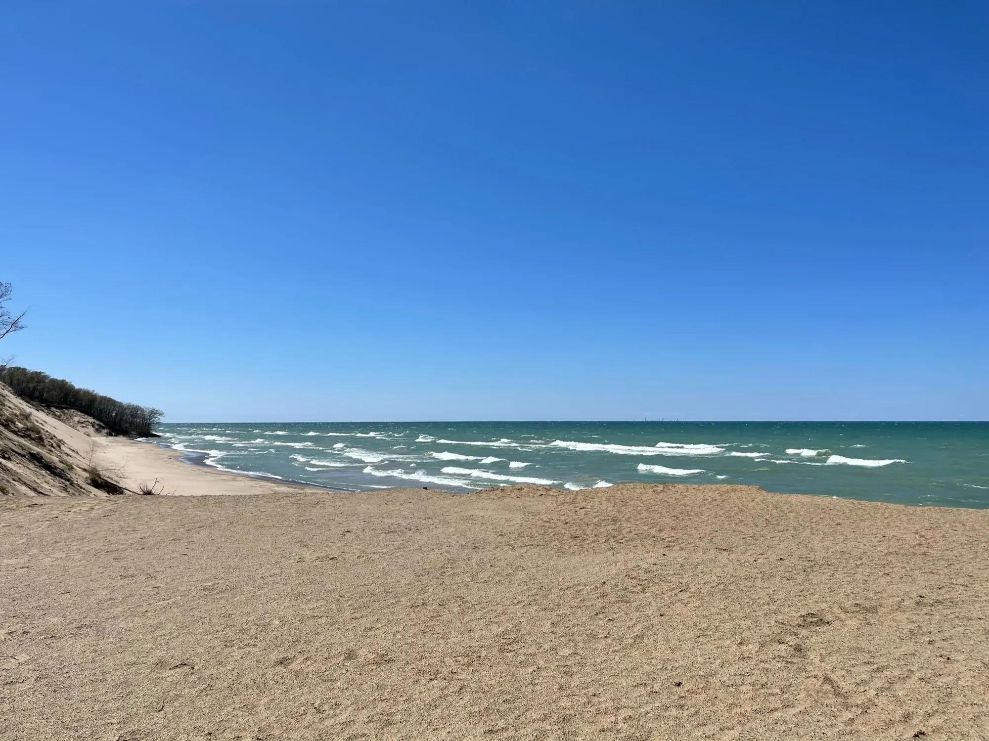
Indiana Dunes · Photo: David & Keri New
- 6.8 miDistance
- 129 ftElevation gain
- 4 hrTime
- ModerateDifficulty
The numbers, with sources
Distance: 6.8-mile featured loop, within a network ranging from less than a mile to nearly 15 miles. Source
Gain: 129 feet of elevation gain; 1% average and 4% maximum grade. Source
Time: 4 hours for the featured route. Source
Difficulty: Easy to moderate, with packed dirt, sand and boardwalk sections. Source
Trailhead: Glenwood Dunes lot at U.S. Highway 20 and Brummitt Road. Source
Route type: loop Source
Built from official sources (checked Nov 3, 2026). Confirm current conditions with the park.
Recreation.gov permits, entrances & campgrounds
Recreation.gov (RIDB). Booking records date not published. NPS guidance above takes precedence. A listing doesn’t mean you need a permit or that there’s space on your dates.
Park campground options (5)
These records belong to the park’s NPS recreation area. We haven’t checked how close these are to the trail, when they open or whether sites are free; check the map and the booking page.
Central Avenue Walk-in Sites — Campground; RIDB reservable: yes. Season: not published in structured RIDB data. Recreation.gov (RIDB) source · Booking details
NPS reservation guidance: Reservations can be made up to 6-months in advance. Reservations are made through recreation.gov. NPS source
Chellberg Farm Picnic Shelters — Campground; RIDB reservable: yes. Season: not published in structured RIDB data. Recreation.gov (RIDB) source · Booking details
Dunbar Group Site — Campground; RIDB reservable: yes. Season: not published in structured RIDB data. Recreation.gov (RIDB) source · Booking details
NPS reservation guidance: Reservations can be made up to 6-months in advance. Reservations are made through recreation.gov. NPS source
West Beach Picnic Shelters — Campground; RIDB reservable: yes. Season: not published in structured RIDB data. Recreation.gov (RIDB) source · Booking details
Dunewood Campground — Campground; RIDB reservable: yes. Season: not published in structured RIDB data. Recreation.gov (RIDB) source · Booking details
NPS reservation guidance: All campsites are reserved on Recreation.gov. Check-out time is noon. New “check-ins” cannot occupy your site until noon, unless the site is vacant. NPS source
Route, junction by junction
Glenwood Dunes lot → counter-clockwise loop
Start at US 20 and Brummitt Road. Bring the map: there are 13 junctions and the NPS doesn’t describe every turn. Source
East end → Calumet cut-off
Take the short cut-off to avoid the Calumet Dunes Paved Trail. The Calumet lot, with restrooms and water, is a short detour. Source
Western end → Glenwood Dunes lot
Follow the trail west along US 12, then south. Skip the Glenwood Dunes Extension and follow the loop north and east to the lot, 6.8 miles in all. Source
No elevation profile yet:
No elevation profile yet: we haven’t verified complete measurements for this route. Source
In-depth guide
Compiled from linked sources, checked Nov 3, 2026. Each paragraph links to its source.
Decisions & preparation
The NPS gives distances only for the points listed above, so we don’t split the total into legs. Source
Turnaround & return planning
Use a cut-off to shorten the loop if the group is running low on energy, water or daylight. Planning basis
Parking & transport timing
Glenwood Dunes lot at U.S. Highway 20 and Brummitt Road. The NPS doesn’t say when parking fills. Source
What to bring by season
Pack the Ten Essentials: navigation, sun protection, extra clothing, a light, first aid, fire supplies where allowed, repair tools, extra food, water and emergency shelter. Tell someone your plan. Source
In warm weather bring sun protection, plenty of water and extra food. In cold or wet weather add warm layers and rain gear. Source
Check current conditions, hours and seasonal horse and ski rules before you go. Source
Children & mobility
You can reach the trail system from the Glenwood Dunes Trail or Calumet Dunes Trail parking lots. Source
Is this hike for you?
Glenwood Dunes is a network of connected loops, from less than a mile to nearly 15 miles with extensions, used by hikers, runners, horseback riders and cross-country skiers. The featured loop is 6.8 miles with 129 feet of elevation gain, a 1% average grade and a 4% maximum grade. The NPS puts it at 4 hours and calls the system easy to moderate. The surface is packed dirt with some sand and boardwalk. Source
The featured loop
Bring a trail map. There are 13 trail junctions, and the NPS says there are too many junctions and cut-offs to describe every turn. Hike counter-clockwise from the trailhead and take care crossing roads. At the east end, take the short cut-off so you don’t end up on the Calumet Dunes Paved Trail. After the cut-off, follow the trail west along U.S. Highway 12, then south to the western-most point. Don’t take the Glenwood Dunes Extension Trail there; follow the loop back north and then east to the parking lot. Source
Detailed maps of the Glenwood Dunes Trail System, and of every trail in Indiana Dunes National Park, are on the NPS website or on paper at the trailhead kiosk and the Indiana Dunes Visitor Center. Source
Longer options
Dunewood Trace Campground Trail: 4.4 miles round trip, 30 feet of gain, 0% average and 1% maximum grade, about 2.5 hours. It runs out and back from the Calumet Dunes Paved Trail to Dunewood Campground. Park at the Calumet Dunes lot (there’s no non-camper parking at the campground), walk around the left (south) side of the main building, follow the paved trail to the right, and the Dunewood Trace trail breaks off to the left within a tenth of a mile. Near the campground, look for what’s left of an old golf course. The surface is packed dirt and loose sand. One section runs on county road 375E with no sidewalk, so be careful. The campground has restrooms and potable water, and leashed pets are allowed on this trail. Source
Glenwood Dunes Extension Trail: 2.6 miles round trip from its junction at the west end of the Glenwood Dunes loop, 26 feet of gain, 1% average and 2% maximum grade, about 2.5 hours. It heads out toward the South Shore Railroad’s Dune Park station, crosses Tremont Road and ends at county road 50E, where you turn around. There’s no parking at either end; the nearest lot is Glenwood Dunes. Surface is packed dirt and loose sand. Leashed pets are allowed on the extension but not on the Glenwood Dunes Trail, and horses aren’t allowed on it. Look for fall colors and wildlife. Source
Add the Calumet Dunes Paved Trail, Dunewood Trace and the Glenwood Dunes Extension to the loop and you get nearly 15 miles. Their distances overlap, so don’t simply add them up. Source
Getting to the trailhead
Park at the Glenwood Dunes lot (main), 1475 North Brummitt Road, Chesterton, IN 46304, at U.S. Highway 20 and Brummitt Road. GPS: 41.648245, -87.015382. You can also start from the Calumet Dunes lot. The paved lot is big enough for horse trailers, and there are covered picnic shelters there (first come, first served, no reservations). Source · Source 2
Before you go
The trail is open daily from 6:00 am to 11:00 pm. Hikes here run from less than 1 hour to 4 hours, from less than 1 mile up to 6.8 miles, or over 15 miles with extensions. Ticks are present year-round, poison ivy can grow along the edges, and mosquitoes and flies can be bad in summer. Weather changes, so come prepared. Stay on the trail and respect closed-area signs. For an emergency or to report a crime, call 1-800-PARK-TIP. Source
Water and restrooms
There are year-round restrooms and potable water at both the Glenwood Dunes and Calumet Dunes trailheads, and it’s a short walk from the east end of the loop to the Calumet Dunes lot if you need them. Source
Kids, strollers and wheelchairs
The trails and picnic shelters aren’t wheelchair accessible. The restrooms are. Source
Dogs, horses, skiing and other rules
Pets aren’t allowed on the equestrian part of the trail, for safety. Elsewhere they’re fine on a leash 6’ or shorter. No bicycles or motorized vehicles, no littering, hunting or removing plants. Source
Horseback riding is allowed on the Glenwood Dunes Trail only from March 16 - December 14. If there’s enough snow for cross-country skiing (3 inches or more) before December 15 or after March 15, the trail stays closed to horses, which are banned in winter to keep skiers safe. Horses aren’t allowed on any surrounding roads. Bring your own horse or skis. Skiers and riders should go counter-clockwise so traffic flows one way. Source
Cooking fires at the picnic shelters are allowed only in the provided grills or an approved carry-in grill: a non-combustible container with an enclosed bottom and sides at least 2 inches deep. Cool your charcoal and dispose of it in a non-combustible container, or take it with you. Source
Nearby hikes
Great Marsh, Dune Ridge, and Bailly Homestead / Chellberg Farm. Source
Sources & planning limits
Reviewed 2026-11-03. Check current conditions for your trip dates.
- We haven’t verified this point. Check the NPS page for current requirements. Source
- NPS details are as of the date shown. Confirm access, services and reservations for your travel date. Source
- The NPS publishes separate distances for each trail in the network, and we haven’t measured them ourselves. Source
- No elevation profile yet: we haven’t verified complete measurements for this route. Source
Getting there and back
Glenwood Dunes lot at U.S. Highway 20 and Brummitt Road. Source
Return: Counter-clockwise featured loop; take the east cut-off, avoid the Glenwood Dunes Extension at the western end, and return to the main lot. Source
Water
Year-round restrooms and potable water at Glenwood Dunes and Calumet Dunes trailheads in the NPS listing. Source
Year-round restrooms and potable water at Glenwood Dunes and Calumet Dunes trailheads in the NPS listing. Source
Hazards
13 trail junctions require a trail map; take care at road crossings. Source
Season
Check current conditions, hours and seasonal rules. NPS dates and schedules are as of the date shown. Source
Check current conditions, hours and seasonal rules. NPS dates and schedules are as of the date shown. Source
Gear & rules
Pets are prohibited on the equestrian portion; permitted elsewhere on a leash six feet or shorter. Source
Filling a gap in your kit? Compare these packing essentials on Amazon. Choose gear for your route, conditions and the park’s guidance.
As an Amazon Associate we earn from qualifying purchases. How this works
Pets are prohibited on the equestrian portion; permitted elsewhere on a leash six feet or shorter. Source
Questions
Which route do the displayed distance and time describe?
6.8-mile featured loop, within a network ranging from less than a mile to nearly 15 miles. 4 hours for the featured route. Source
Does accessible parking or a facility certify the trail?
No. The source distinguishes trail accessibility from facilities. Source
Alternatives
More Indiana Dunes trail guides
- Bailly–Chellberg and Mnoké Prairie Outer Loop3.4 mi · Moderate
- Cowles Bog Trail4.7 mi · Moderate
- Dune Ridge0.7 mi · Moderate
- Paul H. Douglas Trail through Miller Woods3.4 mi · Moderate
- West Beach Three-Loop Trail3.4 mi · Strenuous