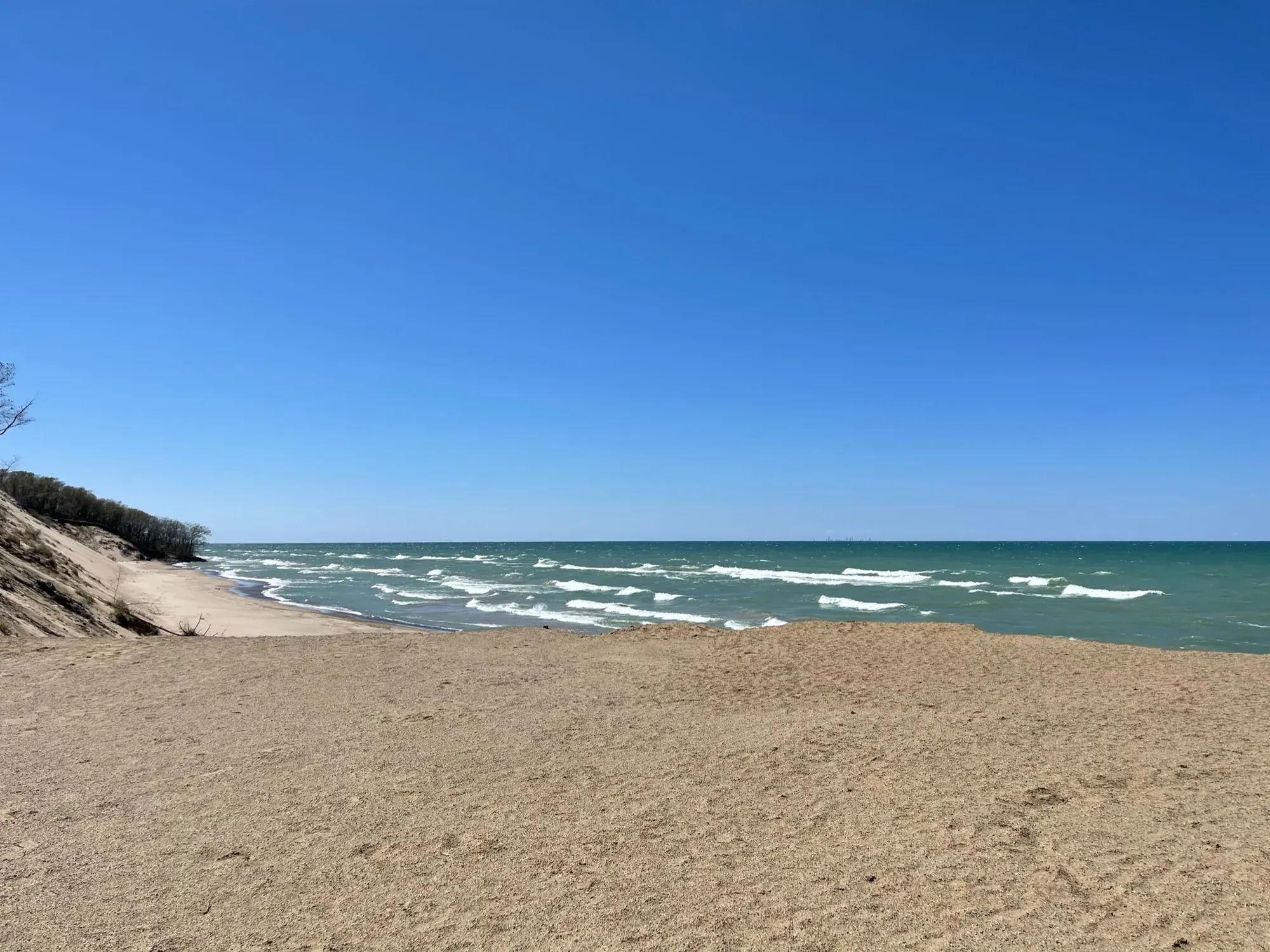
Dune Ridge
From Dune Ridge Trailhead in the Kemil Beach parking lot, follow the southbound approach to the loop. NPS recommends turning left for a clockwise circuit, leaving the old roadbed for single track, climbing to the Great Marsh view and descending loose sand before rejoining the approach.
Indiana Dunes · Photo: David & Keri New
- 0.7 miDistance
- 73 ftElevation gain
- 30 minTime
- ModerateDifficulty
The numbers, with sources
Distance: 0.7-mile lollipop route (NPS). Source
Gain: 73 feet elevation gain (NPS). Source
Time: NPS fields give 30 minutes and 30 minutes–1 hour. Source
Difficulty: Moderate; loose sand and steep slopes. Source
Trailhead: The NPS doesn’t publish this for the whole route. Consult the official route description and park map for the start. Source
Route type: Lollipop loop Source
Built from official sources (checked Nov 3, 2026). Confirm current conditions with the park.
Recreation.gov permits, entrances & campgrounds
Recreation.gov (RIDB). Booking records date not published. NPS guidance above takes precedence. A listing doesn’t mean you need a permit or that there’s space on your dates.
Park campground options (5)
These records belong to the park’s NPS recreation area. We haven’t checked how close these are to the trail, when they open or whether sites are free; check the map and the booking page.
Central Avenue Walk-in Sites — Campground; RIDB reservable: yes. Season: not published in structured RIDB data. Recreation.gov (RIDB) source · Booking details
NPS reservation guidance: Reservations can be made up to 6-months in advance. Reservations are made through recreation.gov. NPS source
Chellberg Farm Picnic Shelters — Campground; RIDB reservable: yes. Season: not published in structured RIDB data. Recreation.gov (RIDB) source · Booking details
Dunbar Group Site — Campground; RIDB reservable: yes. Season: not published in structured RIDB data. Recreation.gov (RIDB) source · Booking details
NPS reservation guidance: Reservations can be made up to 6-months in advance. Reservations are made through recreation.gov. NPS source
West Beach Picnic Shelters — Campground; RIDB reservable: yes. Season: not published in structured RIDB data. Recreation.gov (RIDB) source · Booking details
Dunewood Campground — Campground; RIDB reservable: yes. Season: not published in structured RIDB data. Recreation.gov (RIDB) source · Booking details
NPS reservation guidance: All campsites are reserved on Recreation.gov. Check-out time is noon. New “check-ins” cannot occupy your site until noon, unless the site is vacant. NPS source
Route, junction by junction
Route selection → Described destination
From Dune Ridge Trailhead in the Kemil Beach parking lot, follow the southbound approach to the loop. NPS recommends turning left for a clockwise circuit, leaving the old roadbed for single track, climbing to the Great Marsh view and descending loose sand before rejoining the approach. Source
No elevation profile yet:
No elevation profile yet: we haven’t verified a complete line for this route. No partial line, invented connector, scaled mileage or flat profile is substituted. Source
In-depth guide
Compiled from linked sources, checked Nov 3, 2026. Each paragraph links to its source.
Is this hike for you?
The Dune Ridge Trail is a 0.7-mile lollipop loop over a tall, forested dune, with views of the wetlands and forests to the south, including the Great Marsh. It has 73 feet of elevation gain, a 4% average grade and an 11% maximum grade. The NPS rates it moderate, with some steep slopes in loose sand, and gives 30 minutes to 1 hour. It’s a good one for birding, fall colors, wildflowers and wildlife, and no other short trail in Indiana Dunes National Park takes you through as many different habitats. Source
The trail
Start from the southeast corner of the parking lot and head south through the foredunes on sandy soil, among marram and little bluestem grasses and cottonwood trees. The footing gets firmer as you reach the oak savanna. At the loop junction, turn left to hike it clockwise. The loop starts on an old roadbed; turn right off the wide road onto single track. The trail climbs to the top of the dune and the view of the Great Marsh, follows the ridge line, then drops down a steep section of loose sand. It winds back to the loop junction, where you turn left and head north to the parking lot. The surface is a mix of loose sand and packed dirt. Source
Stay on the trail and respect closed-area signs. The dune grasses look tough but can die when stepped on. Source
Getting to the trailhead
The Dune Ridge Trailhead is at the Kemil Beach Parking Lot, north of U.S. Highway 12 on East State Park Road (300E), Beverly Shores, IN 46301. South of U.S. Highway 12 the same road is called Kemil Road. Trailhead GPS: 41.677357, -87.008950. It’s open daily from 6:00 am to 11:00 pm. The lot is paved and fills up quickly on summer weekends. Source
For swimming at Kemil Beach, see the NPS beach page; that’s separate from the hike. Trail maps are on the NPS website, at the trailhead kiosk and at the Indiana Dunes Visitor Center. Source
Ticks, poison ivy and emergencies
Ticks are around year-round, so take steps to avoid bites. Poison ivy can grow at the trail edges. For an emergency or to report a crime, call 1-800-PARK-TIP. Source
Dogs, strollers and wheelchairs
Dogs are allowed on a leash 6’ or shorter. The trail isn’t wheelchair accessible; the restrooms are. Source
What we couldn’t confirm
The NPS doesn’t say when the lot fills or list services beyond what’s above. Source
There’s no elevation profile yet: NPS trail maps list the Dune Ridge Trail among the park’s trails, but we haven’t verified a complete line for this loop. Source
OpenStreetMap also shows a Dune Ridge Trail here, but that’s a community map and doesn’t confirm the full route or current access. Source · Source 2 · Source 3
Getting there and back
The NPS doesn’t publish this for the whole route. Consult the official route description and park map for the start. Source
Return: Use the return described in the official route account. Don’t count on a shuttle, boat, flight or pickup unless you have confirmed it yourself. Source
Water
The NPS doesn’t publish a full list of water and restrooms along this route. Use only the facilities explicitly identified in the NPS account; confirm current operations. Source
Hazards
This is a habitat walk, with a beach visit separate from its mileage. Foredunes, oak savanna and forest have different footing. Stay on the trail to protect dune plants. The NPS lists accessible restrooms but says trails are not wheelchair accessible, so facility access and trail access remain separate. Source
Season
This page can’t tell you current access. Check NPS conditions before departure. Source
Check current conditions and seasonal access with the park before you go. Check the park before departure. Source
Gear & rules
Respect current closures, signs and barriers. A mapped path is not proof that travel is permitted. Source
Filling a gap in your kit? Compare these packing essentials on Amazon. Choose gear for your route, conditions and the park’s guidance.
As an Amazon Associate we earn from qualifying purchases. How this works
The NPS doesn’t publish a pet rule for this exact route; confirm with the park before bringing an animal. Source
Questions
Which hike is this?
From Dune Ridge Trailhead in the Kemil Beach parking lot, follow the southbound approach to the loop. NPS recommends turning left for a clockwise circuit, leaving the old roadbed for single track, climbing to the Great Marsh view and descending loose sand before rejoining the approach. 0.7-mile lollipop route (NPS). Source
Is a measured elevation profile available?
No elevation profile yet: we haven’t verified a complete line for this route. No partial line, invented connector, scaled mileage or flat profile is substituted. Source
Alternatives
Alternative-route distances and durations are unavailable unless separately described in the source. Side trails aren’t included. Source
More Indiana Dunes trail guides
- Bailly–Chellberg and Mnoké Prairie Outer Loop3.4 mi · Moderate
- Cowles Bog Trail4.7 mi · Moderate
- Glenwood Dunes Featured Loop6.8 mi · Moderate
- Paul H. Douglas Trail through Miller Woods3.4 mi · Moderate
- West Beach Three-Loop Trail3.4 mi · Strenuous