Bailly–Chellberg and Mnoké Prairie Outer Loop
3.4-mile outer loop. The separate inner loop is 1.1 miles. Easy to moderate with stairs; soil and wood chips can be wet, muddy and slippery.
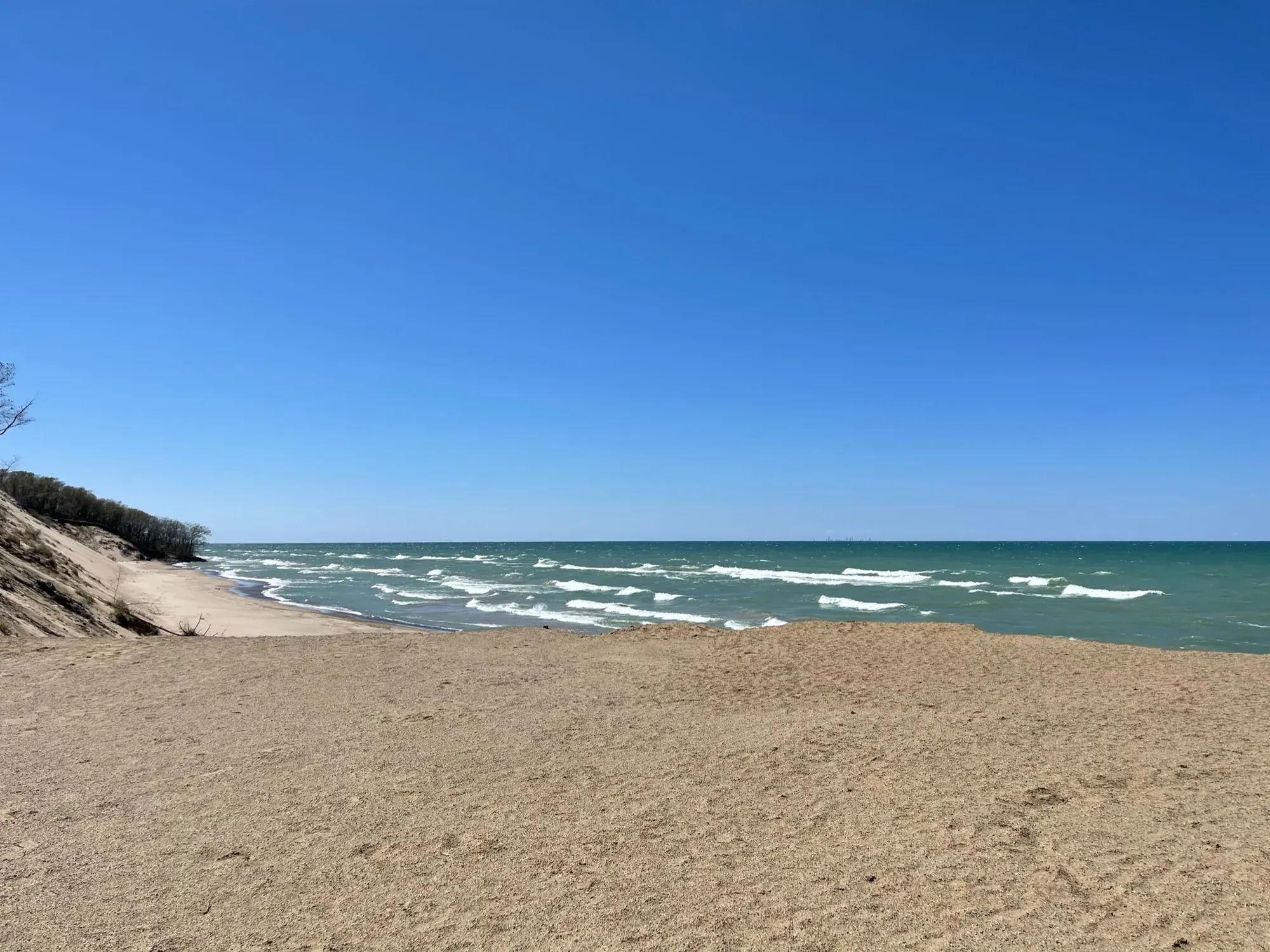
Indiana Dunes · Photo: David & Keri New
- 3.4 miDistance
- 120 ftElevation gain
- 2.5 hrTime
- ModerateDifficulty
The numbers, with sources
Distance: 3.4-mile outer loop. The separate inner loop is 1.1 miles. Source
Gain: 120 feet gain; 1% average and 9% maximum grade. Source
Time: 2.5 hours for the outer loop. Source
Difficulty: Easy to moderate with stairs; soil and wood chips can be wet, muddy and slippery. Source
Trailhead: Bailly/Chellberg parking lot. Source
Route type: loop Source
Built from official sources (checked Nov 3, 2026). Confirm current conditions with the park.
Recreation.gov permits, entrances & campgrounds
Recreation.gov (RIDB). Booking records date not published. NPS guidance above takes precedence. A listing doesn’t mean you need a permit or that there’s space on your dates.
Park campground options (5)
These records belong to the park’s NPS recreation area. We haven’t checked how close these are to the trail, when they open or whether sites are free; check the map and the booking page.
Central Avenue Walk-in Sites — Campground; RIDB reservable: yes. Season: not published in structured RIDB data. Recreation.gov (RIDB) source · Booking details
NPS reservation guidance: Reservations can be made up to 6-months in advance. Reservations are made through recreation.gov. NPS source
Chellberg Farm Picnic Shelters — Campground; RIDB reservable: yes. Season: not published in structured RIDB data. Recreation.gov (RIDB) source · Booking details
Dunbar Group Site — Campground; RIDB reservable: yes. Season: not published in structured RIDB data. Recreation.gov (RIDB) source · Booking details
NPS reservation guidance: Reservations can be made up to 6-months in advance. Reservations are made through recreation.gov. NPS source
West Beach Picnic Shelters — Campground; RIDB reservable: yes. Season: not published in structured RIDB data. Recreation.gov (RIDB) source · Booking details
Dunewood Campground — Campground; RIDB reservable: yes. Season: not published in structured RIDB data. Recreation.gov (RIDB) source · Booking details
NPS reservation guidance: All campsites are reserved on Recreation.gov. Check-out time is noon. New “check-ins” cannot occupy your site until noon, unless the site is vacant. NPS source
Route, junction by junction
Bailly/Chellberg lot → Little Calumet trail
Head north toward Chellberg Farm, go straight at the farm junction, then stay left at the Bailly Cemetery Trail after about a third of a mile. The cemetery is an optional 0.6-mile round trip. Source
Little Calumet trail → Mnoké Prairie
Stay right at the connector, go left on the paved Porter Brickyard Trail, then right onto the hiking trail. Cross Howe Road. Stay right at the unmarked junction around 1.3 miles, and again before the river to avoid the closed trail. Source
Mnoké Prairie → Bailly Homestead → lot
Cross the boardwalk and bridge, walk the prairie to the alternate lot, then take the entrance road and Howe Road back over the river. Go up the Bailly Homestead driveway and follow the northeast trail back to the lot to finish the 3.4-mile loop. Source
No elevation profile yet:
No elevation profile yet: we haven’t verified complete measurements for this route. Source
In-depth guide
Compiled from linked sources, checked Nov 3, 2026. Each paragraph links to its source.
Decisions & preparation
We only show distances for parts of the loop where the NPS gives them. Source
Turnaround & return planning
Turn back the way you came, or skip the cemetery spur, if the group is running low on energy, water or daylight. Planning basis
Parking & transport timing
Bailly/Chellberg parking lot. The NPS doesn’t say when it fills. Source
What to bring by season
The NPS Ten Essentials: navigation, sun protection, extra clothing, a light, first aid, fire supplies where allowed, repair tools, extra food, water and emergency shelter. Tell someone your plan. Source
In warm weather, bring sun protection, enough water and extra food. In cold or wet weather, bring warm layers and rain gear. Source
Check current conditions, hours and seasonal rules before you go. Source
Children & mobility
There are 3 covered picnic shelters near the parking lot that are wheelchair accessible. Source
Is this hike for you?
The Outer Loop is a 3.4-mile perimeter hike that strings together several trails around Bailly Homestead, Chellberg Farm, the Little Calumet River and Mnoké Prairie. The NPS gives 120 feet of elevation gain, a 1% average grade and a 9% maximum grade, and a hike time of 2.5 hours. It rates the trails easy to moderate, with some ravine stairs. There’s also a shorter Bailly/Chellberg Inner Loop of 1.1 miles; across the different options the NPS gives 45 minutes to 2.5 hours. Source
The trail
You pass through forest of maple, beech, basswood and oak, along the Little Calumet River and across the Mnoké Prairie. Start at the Bailly / Chellberg parking lot and head north on the Bailly Homestead / Chellberg Farm Trail. Just before the farm buildings, go straight (north) onto the Little Calumet River / Mnoké Prairie Trail, which winds through a small ravine with some stairs. After a third of a mile, stay left at the Bailly Cemetery Trail junction; you can add a 0.6 mile round trip out and back to the cemetery here. Stay right at the next connector, then go left on the paved Porter Brickyard Trail until the hiking path veers off to the right. Source
Cross Howe Road and continue through mature forest. At roughly the 1.3 mile mark, stay right at an unmarked junction, and stay right again just before the river to avoid a closed trail. Cross the boardwalk and bridge into the prairie. After nearly a mile, you pass another closed trail on the left and come out at an alternate parking lot. Walk down the entrance road, take Howe Road north to cross back over the river, go up the Bailly Homestead driveway, and pick up the trail to the northeast back to the lot. The junctions can be confusing, so carry the detailed map. Source
Bailly Homestead and Chellberg Farm
People have been drawn to this area for over 10,000 years. The Bailly Homestead, a National Historic Landmark since 1962, was home to Honore Gratien Joseph Bailly de Messein (1774 - 1835), one of the earliest settlers of northern Indiana, who set up his fur trading post here in 1822 where the Little Calumet River met several Indigenous trails. In the 1870s, Swedish immigrants Anders and Johanna “Kjellberg” bought 80 acres for a family farm, and three generations of Chellbergs lived here. In the 1930s they started tapping maple trees for syrup. Indiana Dunes National Park is the only national park that makes maple syrup, and the Maple Sugar Time event on the first two weekends in March shows how methods changed, from an early American Indian method to open iron kettles to modern commercial production. The NPS doesn’t say whether buildings are open on a given day. Source
Getting to the trailhead
The trailhead parking lot is north of U.S. Highway 20 on Mineral Springs Road, Porter, IN 46304 (GPS 41.624679, -87.089502). It’s paved and big enough for buses. The trails are open daily from 6:00 am to 11:00 pm. Maps are on the NPS website, at the trailhead kiosk, and at the Indiana Dunes Visitor Center. Source
Mud, ticks and safety
The trail is packed soil with wood chips in places and several sets of stairs, and it can be very wet, muddy and slippery, so wear good shoes. Morning dew can be heavy in the prairie. Ticks are around year-round, so take steps to avoid bites. Stay on the trail and respect closed-area signs. For an emergency or to report a crime, call 1-800-PARK-TIP. Source
Water, restrooms and picnic shelters
There are year-round restrooms and drinking water at the parking lot. Nearby are 3 covered picnic shelters you can reserve at www.recreation.gov up to six months ahead, for day use from 6:00 am to 11:00 pm. Cooking fires are allowed in the provided grills or an approved carry-in grill (a non-combustible container with an enclosed bottom and sides at least 2 inches deep). Cool your charcoal and dispose of it in a non-combustible container or take it with you. Source
Dogs, bikes and accessibility
Dogs are allowed on a leash 6′ or shorter. Bicycles and motorized vehicles aren’t allowed on these trails (you can bike the Porter Brickyard Trail), and littering, hunting and removing plants are prohibited. The trails aren’t wheelchair accessible; the restrooms and one picnic shelter are. Source
Sources & planning limits
Reviewed 2026-11-03. Check current conditions for your trip dates.
- We haven’t confirmed access or services for any particular date. Check with the NPS before you rely on them. Source
- NPS details are as of the date shown. Confirm access, services and reservations for your travel date. Source
- The NPS gives different times for different loops; we keep each one with the loop it belongs to. Source
- No elevation profile yet: we haven’t verified complete measurements for this route. Source
Getting there and back
Bailly/Chellberg parking lot. Source
Return: North from the main lot through the river and Mnoké Prairie connections, with the described Howe Road and homestead return. Source
Water
Year-round restrooms and potable water at the parking lot in the NPS listing. Source
Year-round restrooms and potable water at the parking lot in the NPS listing. Source
Hazards
Stairs, mud, slippery footing, road crossings, ticks and poison ivy. Source
Season
Check current conditions, hours and seasonal rules. NPS dates and schedules are as of the date shown. Source
Check current conditions, hours and seasonal rules. NPS dates and schedules are as of the date shown. Source
Gear & rules
Pets permitted on a leash six feet or shorter; bicycles and motorized vehicles prohibited. Source
Filling a gap in your kit? Compare these packing essentials on Amazon. Choose gear for your route, conditions and the park’s guidance.
As an Amazon Associate we earn from qualifying purchases. How this works
Pets permitted on a leash six feet or shorter; bicycles and motorized vehicles prohibited. Source
Questions
Which route do the displayed distance and time describe?
3.4-mile outer loop. The separate inner loop is 1.1 miles. 2.5 hours for the outer loop. Source
Does accessible parking or a facility certify the trail?
No. The source distinguishes trail accessibility from facilities. Source
Alternatives
More Indiana Dunes trail guides
- Cowles Bog Trail4.7 mi · Moderate
- Dune Ridge0.7 mi · Moderate
- Glenwood Dunes Featured Loop6.8 mi · Moderate
- Paul H. Douglas Trail through Miller Woods3.4 mi · Moderate
- West Beach Three-Loop Trail3.4 mi · Strenuous