Devils Garden
Choose your turnaround before you start. NPS describes three options from the Devils Garden trailhead: Landscape Arch (1.8 miles round trip, easy, its own guide), Double O Arch (4.0 miles round trip, strenuous) and the entire trail with Dark Angel and the primitive trail (7.9 miles round trip, strenuous). Past Landscape Arch the trail climbs sandstone slabs with narrow ledges, steep drop-offs and few trail markers.
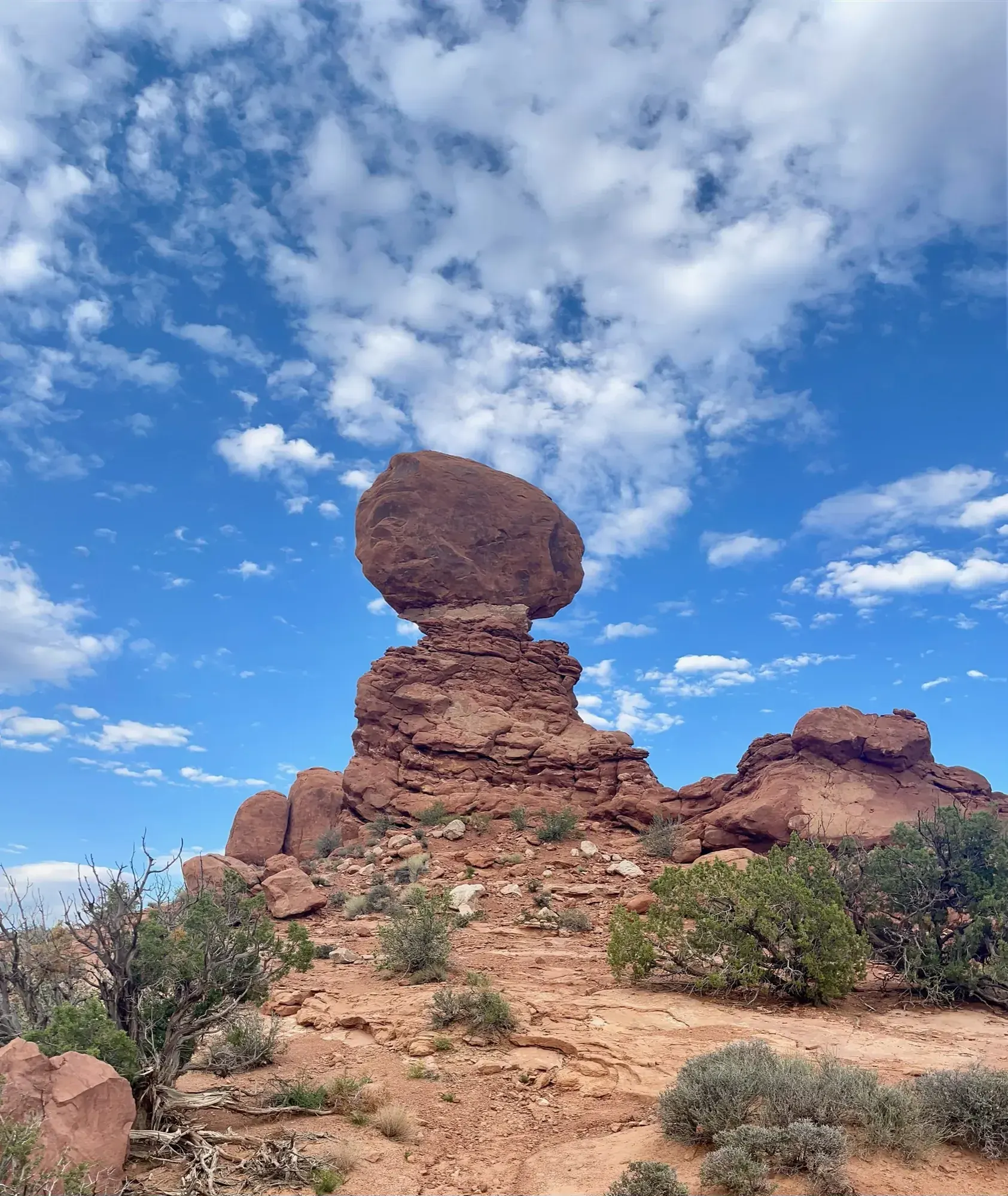
Arches · Photo: David & Keri New
- 7.9 miDistance
- 286 ftElevation gain
- 3–5 hrTime
- StrenuousDifficulty
The numbers, with sources
Distance: 7.9 miles round trip for the entire trail; 4.0 miles round trip to Double O Arch. Source
Gain: 286 feet of elevation change (entire trail); 275 feet to Double O Arch. Source
Time: 3–5 hours for the entire trail; 2–3 hours to Double O Arch. Source
Difficulty: Strenuous beyond Landscape Arch. Source
Trailhead: Devils Garden trailhead, at the northern end of the park, 18 miles (28 km) from the park entrance. Source
Route type: Out-and-back or loop with the primitive trail Source
Built from official sources (checked Nov 6, 2026). Confirm current conditions with the park.
Recreation.gov permits, entrances & campgrounds
Recreation.gov (RIDB). Booking records date not published. NPS guidance above takes precedence. A listing doesn’t mean you need a permit or that there’s space on your dates.
Park campground options (1)
These records belong to the park’s NPS recreation area. We haven’t checked how close these are to the trail, when they open or whether sites are free; check the map and the booking page.
DEVILS GARDEN CAMPGROUND — Campground; RIDB reservable: yes. Season: not published in structured RIDB data. Recreation.gov (RIDB) source · Booking details
NPS reservation guidance: You can reserve campsites for nights between March 1 and October 31. Between November 1 and February 28, all sites are first-come, first served. Reservations for both group and individual sites can be made below or by calling Recreation.gov at 1-877-444-6777. The earliest you can make reservations for standard sites is 10 am eastern time, six months in advance. The latest you can make reservations is four days in advance. You can reserve group sites up to 12 months in advance. The campground has two sites for groups of 11 or more people. Juniper Basin campsite accommodates up to 55 people and is available March 1 to October 31; Canyon Wren campsite accommodates up to 35 and may be reserved year-round. No RVs or trailers are permitted in the group sites. NPS source
Route, junction by junction
Route selection → Described destination
Choose your turnaround before you start. NPS describes three options from the Devils Garden trailhead: Landscape Arch (1.8 miles round trip, easy, its own guide), Double O Arch (4.0 miles round trip, strenuous) and the entire trail with Dark Angel and the primitive trail (7.9 miles round trip, strenuous). Past Landscape Arch the trail climbs sandstone slabs with narrow ledges, steep drop-offs and few trail markers. Source
No elevation profile yet:
No elevation profile yet: we haven’t verified a complete line for this route. No partial line, invented connector, scaled mileage or flat profile is substituted. Source
In-depth guide
Compiled from linked sources, checked Nov 6, 2026. Each paragraph links to its source.
Is this hike for you?
Pick your turnaround before you start. The NPS lists three hikes from the Devils Garden trailhead: Landscape Arch (1.8 miles round trip, easy, with its own guide on this site), Double O Arch (4.0 miles round trip, strenuous) and the entire trail, including Dark Angel and the primitive trail (7.9 miles round trip, strenuous). Past Landscape Arch the trail climbs sandstone slabs with narrow ledges, steep drop-offs and few trail markers. Source
Distance, elevation and time
Double O Arch: 4.0 miles round trip, 275 feet of elevation change, 2–3 hours. Entire trail: 7.9 miles round trip, 286 feet of elevation change, 3–5 hours. Source
The NPS doesn’t give times for the pieces in between. There’s no elevation profile yet, because we haven’t verified a complete line for any version of the hike. Source · Source 2
The trail
To Landscape Arch, a hard-packed trail leads through fins (narrow rock walls) and arches, with spur trails to Pine Tree Arch and Tunnel Arch. Landscape Arch is the longest arch in North America, with a light opening of 306 feet (93.3 meters), and it’s only 6 feet (1.8 meters) thick at its narrowest. Large pieces of it fell in the 1990s. Source
Past Landscape Arch the trail climbs steeply over sandstone slabs, with uneven surfaces and narrow ledges above steep drop-offs. Spur trails lead to more arches. Dark Angel is 0.4 miles (0.6 km) beyond Double O Arch. The full loop adds the primitive trail, with rock scrambling, steep exposure and few trail markers. Source
OpenStreetMap shows ways labeled “Devil’s Garden Trail” and “Devil’s Garden Primitive Trail Loop”, and the NPS trail map lists Devils Garden. Neither shows the whole hike as one verified route, so carry the park map. Source · Source 2 · Source 3 · Source 4
Before you go
Go only when the rock is dry. The NPS says to avoid the trail when it’s wet, snowy or icy. Skip shoes with open toes, high heels or slick soles. Source
Bring at least 2 quarts (2 L) of water per person to Double O Arch and at least 3 quarts (3 L) for the entire trail, plus a headlamp and light jacket for the full loop in case you’re back after sundown. Source
Getting to the trailhead
Devils Garden is at the northern end of the park, 18 miles (28 km) from the entrance. Toilets at the trailhead are open year-round. Drinking water is there spring through fall only. Source
Kids, strollers and wheelchairs
The trail to Landscape Arch is considered barrier free, but just before the arch there are steep slopes where you may need help. Beyond Landscape Arch the trail isn’t accessible to wheelchairs. Source
Dogs
Dogs aren’t allowed on this trail. Service animals are. Source
Sources & planning limits
Reviewed 2026-11-06. Check current conditions for your trip dates.
Getting there and back
Devils Garden trailhead, at the northern end of the park, 18 miles (28 km) from the park entrance. Source
Return: Use the return described in the official route account. Don’t count on a shuttle, boat, flight or pickup unless you have confirmed it yourself. Source
Water
The NPS doesn’t publish a full list of water and restrooms along this route. Use only the facilities explicitly identified in the NPS account; confirm current operations. Source
Hazards
Go only when the rock is dry. NPS says to avoid the trail when rock is wet, snowy or icy, to bring at least 2 quarts (2 L) of water per person to Double O Arch and 3 quarts (3 L) for the whole trail, and to carry a headlamp and light jacket for the full loop. Dogs are not allowed on this trail; service animals are. Drinking water at the trailhead runs only spring through fall. Source
Season
This page can’t tell you current access. Check NPS conditions before departure. Source
Check current conditions and seasonal access with the park before you go. Check the park before departure. Source
Gear & rules
Respect current closures, signs and barriers. A mapped path is not proof that travel is permitted. Source
Filling a gap in your kit? Compare these packing essentials on Amazon. Choose gear for your route, conditions and the park’s guidance.
As an Amazon Associate we earn from qualifying purchases. How this works
The NPS doesn’t publish a pet rule for this exact route; confirm with the park before bringing an animal. Source
Questions
Which hike is this?
Choose your turnaround before you start. NPS describes three options from the Devils Garden trailhead: Landscape Arch (1.8 miles round trip, easy, its own guide), Double O Arch (4.0 miles round trip, strenuous) and the entire trail with Dark Angel and the primitive trail (7.9 miles round trip, strenuous). Past Landscape Arch the trail climbs sandstone slabs with narrow ledges, steep drop-offs and few trail markers. 7.9 miles round trip for the entire trail; 4.0 miles round trip to Double O Arch. Source
Is a measured elevation profile available?
No elevation profile yet: we haven’t verified a complete line for this route. No partial line, invented connector, scaled mileage or flat profile is substituted. Source
Alternatives
Alternative-route distances and durations are unavailable unless separately described in the source. Side trails aren’t included. Source
Camp near Devils Garden
Closest campgrounds by drive time to Devils Garden Trailhead:
- 3 min Devils Garden (0.6 mi, in the park)
- 57 min Courthouse Rock Campground ↗ (29.9 mi, Bureau of Land Management)
- 1 hr 1 min Ken’s Lake Campground ↗ (33.9 mi, Bureau of Land Management)
- 1 hr 23 min North Klondike Campground ↗ (38.3 mi, Bureau of Land Management)
- 2 hr 52 min Hatch Point Campground ↗ (80.3 mi, Bureau of Land Management)
Driving time with no traffic (OSRM, OpenStreetMap roads). Some park roads are shuttle-only in season. All camping near Arches
More Arches trail guides
- Delicate Arch3 mi
- Double Arch Trail0.6 mi · Easy
- Fiery FurnaceStrenuous
- Landscape Arch Trail1.8 mi · Easy